Tuesday, December 31, 2013

Garcia Trail to Colby Trail Hike – December 31, 2013

Near Azusa Peak
camera Two weeks after this hike, the Colby Fire incinerated the environs of these trails. Visit my Garcia to Colby Farewell Tour photo album (12-31-13)

After a three-month hiatus from hiking, I needed to cap off the year with a hike. And my local Garcia Trial seemed ideal. In both 2012 and 2011 I hiked Garcia Trail on New Years Day, so this time I’ll end my year with it. My wife dropped me off at the trailhead five minutes from our house. There are a couple dozen people lingering around the trailhead. It’s a pleasant 66 degrees and forecasted to hit 73 today.

On Garcia Trail
10:20 AM - Begin hike (3 to 4 hours later than I would normally begin a hike). I’m immediately struck by the amount of foot traffic...tons of people on the trail today...hundreds! I steadily climb through mature chaparral under sunny skies. Haze mutes the view of the human sprawl below. I run into Francis, a gentleman I met last year at a hike presentation at Azusa City Library. Enjoy chatting. I meet three gals who are picking up plastic bottles with a long extension grabber. Bless them for helping keep the trail clean. There is nothing in bloom except for a few occurrences of wild cucumber and its tiny white flowers. At 11:10 I reach the upper ridge and Glendora Ridge Motorway with views into San Gabriel Canyon and the expansive San Gabriel Mountains. I turn east to make the final climb to the summit.

On Garcia Trail
11:17 - Azusa Peak (2081’). There are about 30 people and two dogs here with folks coming and going. Quite honestly, I can’t think of another peak in the San Gabriels that get so much traffic aside from Mt. Baldy and Echo Mountain. This is like a tourist attraction. No one is dressed like a hiker; lots of spandex, work-out cloths, and bright colors. The iconic cross seems to be the focal point of activity as various ones take turns posing for photos with it. To the east, Glendora Peak calls me higher and certainly will offer a reprieve from the crowds.

View east toward Glendora Peak
11:30 - Leave Azusa Peak and head east down the path and in a few minutes arrive at Glendora Ridge Motorway again. The walk along the wide dirt road is peaceful. The warm sun feels good. I’m always stuck by the visual dichotomy of this ridge: The southern panorama is dominated by vast human sprawl while the northern panorama features rugged mountains. A small white blossom of a cliff aster stands alone with virtually nothing else in bloom. But it is winter, and the red berries of toyon add a splash of color to the vegetation.

Over my shoulder to the west I get a view of the mountainside burned by the Madre Fire. The fire started on Sept. 23 and incinerated nearly 300 hundred acres at the month of San Gabriel Canyon. I had some tense hours as a spectator standing near the command center hoping they could contain the inferno quickly. Kudos to the firefighters and their gallant efforts in keeping the fire from consuming the mature chaparral that graces the rugged canyons and ridges above Azusa.

Madre Fire, Azusa – Sept. 24, 2013
View of Madre Fire burn area

Glendora Peak dominates the skyline in front of me. Soon I reach the off-road junction and I decide to veer right unto the narrow use path that climbs the west ridge. It’s a good choice as I enjoy expanding views and solitude (although, I encountered only three people since leaving Azusa Peak). The route gets quite steep as it approaches the summit.

View south from Glendora Peak
12:10 - Glendora Peak (2596’). The broad, rounded summit offers some great views. From east to north, the grand high country, crowned by Mt. Baldy, defines the horizon. Typically those lofty summits are covered with snow this time of year, but not today. I see many peaks fostering memories of splendid hikes. Have a bite to eat.

Leave the summit at 12:35 and head east. Within a few minutes I’m back on the dirt road and continue east. I’m loving the scenery and ever-changing views along this rollercoaster route. Soon the Colby Trail area comes into view way down at the base of the mountain to the east.

View northeast toward summit 2583
At a point where the road bends north, I scamper up to a high point (2400+) overlooking Englewild Canyon to the east. A gentle ridge descends south to the head of Harrow Canyon; the old topo map shows a firebreak on the ridge. I consider descending this ridge but it looks pretty brushy with no clear path. Looking across the chasm to the east, I see a long, gentle ridge with a clear path. This will be my route down. Looking back at the road, I see a guy walking with an umbrella…not a typical sight here. I head back down to the road and continue north and northeast. I consider climbing the west ridge to summit 2583’ but decide to skirt it to the north along the road. At 3.08 miles from Azusa Peak, I reach the junction to water tank TW8. I turn right (south) and climb 0.14 mile and 125 vertical feet to achieve the summit.

View north from summit 2583
2:01 - Summit 2583’. A concrete foundation is all that is left of what the topo map shows as a radio facility. Sections of Glendora Mountain Road (GMR) can be seen just down the hillside. Now for the fun part! The route, known as Upper Colby Trail, descends south down the ridge 1.1 miles to the upper terminus of Colby Trail at GMR. It’s popular with mountain bikers. I’ve not been on this upper trail before so this will be a chance to explore some new territory.

View south on Upper Colby Trail
2:06 - I begin my descent. It starts gently but within a couple minutes I reach a crazy steep drop. Gosh, I’ve got to climb down this?! After a few moments of building up courage, I take the plunge. Crabbing on all five helps negotiate the most perilous sections. It takes me six minutes to get down safely. In a few more minutes I reach another steep section, but this one is not as bad. I continue down the ridge enjoying varying views and warm sunshine. An occasional vehicle on GMR breaks the tranquility. I come across some cougar tracks. Mountain bikers have spent a lot of energy building finely formed dirt jumps along the route.

3:10 - I finally reach a hairpin bend of GMR. The route continues south down the slope. It’s crazy steep with loose footing, dropping about 140 vertical feet in just 0.07 mile. As I’m climbing down a young man tries coaxing a young woman to climb up, but to no avail. I don’t blame her for opting out of this crazy route. It takes me nine minutes to make the descent and arrive at GMR again. I text my wife with my ETA and linger here for a few minutes.

On Colby Trail
3:30 - Begin my descent on Colby Trail. I’m now back on familiar ground. My pace is relaxed. Others are enjoying the trail. I always appreciate the good folks of Glendora Community Conservancy for their efforts in maintaining this splendid trail and preserving natural space. I love the warm light of the “golden hour.” The golden leaves of western sycamore speak of changing seasons.

4:02 - Finish hike at the Colby Trail trailhead at the top of Loraine Avenue in Glendora. It’s 68 degrees.

Western sycamore on Colby Trail
Epilog - What a splendid outing in my local hills to end 2013! I covered 6.22 miles with great weather, rugged scenery, familiar trails and a new route, crowds and solitude, and good exercise. What a blessing to live at the base of the beautiful San Gabriel Mountains and being able to hike! icon

camera Two weeks after this hike, the Colby Fire incinerated the environs of these trails. Visit my Garcia to Colby Farewell Tour photo album (12-31-13)

See Trail Descriptions on Dan's Hiking Pages:
- Garcia Trail to Azusa Peak
      - Colby Trail

NEXT > Colby Trail Tree Planting and Hike - March 8, 2014
PREVIOUS > Colby Trail, Amgen Bike Race & a Solar Eclipse - May 20, 2012
 

Saturday, September 28, 2013

Peak Bagging: Winston, Buckhorn, Lewis - Sept. 28, 2013

View southwest toward Mt. Baden-Powell and Mt Burnham from Mt. Lewis
See Dan's Hiking Pages

I’ve always been drawn to climb peaks. While I’m not a peak bagging fanatic, I do keep track of the peaks I climb and have some modest goals. The Sierra Club’s Angeles Chapter, Hundred Peaks Section (HPS) has a list of 275 named summits in Southern California of at least 5,000 feet in elevation. The consuming task of completing the list has no draw for me, but I would like to complete 100, including all of those in the San Gabriels.

So today’s outing was specifically to bag three peaks along the Angeles Crest Highway in the San Gabriels high country: Winston Peak (7502’), Buckhorn Peak (aka Mount Akawie) (7283’), and Mount Lewis (8396’). All three are short hikes of 1.0 to 1.25 miles round trip with 400-500 feet in elevation gain each. The summits don’t compare to other peaks in the area offering grand views and requiring lengthy hikes to get there. I have, however, seen each of these peaks from various perspectives on various hikes and have been drawn to their summits.

Hikemasters group ready to hike
I connected with my friend Ray and he planned the outing with his Hikemasters hiking group. Nine of us rendezvous at 7:30 on Saturday morning at the Highway 2 meeting location in La Canada. We drive 32 miles up Angeles Crest Highway to Cloudburst Summit (7018’) in the Mt. Waterman/Buckhorn area. This is a location where the Pacific Crest Trail crosses the highway. Our trail to Winston Peak starts off as an abandoned dirt road to the left of 3N02.

Climbing north on the ridge to Winston Peak
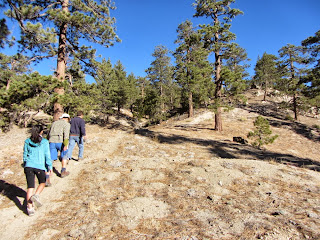
8:30 a.m. - Begin first hike. The weather is perfect; it’s a gorgeous day in the San Gabriel Mountains! Two minutes up the old dirt road brings us to a footpath veering off to the left to bypass a loop in the road. In another minute we cross the old road which heads west and we continue on the path up the broad ridge. The forest is open and dominated by Jeffery pine. There is nothing in bloom except some rabbit brush. Granite boulders from small to large dot the landscape. Our pace is relaxed and the rate of climb is quite comfortable. Views toward Mt. Williamson open up to our east while Waterman Mountain looms to our south.

View northwest toward the Mojave Desert from Winston Peak
9:06 - Winston Peak (7502’). The broad, tree-covered summit has several large outcroppings. We hang around a stand of rocks on the north edge and enjoy some views toward the vast Mojave Desert. A few of us wander north down the ridge to other outcroppings and are rewarded with some much better views. I eyeball Pleasant View Ridge, Will Thrall Peak, and Pallett Mt. as destinations for future trips. It’s peacefully quite here. Everyone seems to be enjoying themselves. I don’t see a peak register anywhere. I’m not sure if I’m not looking hard enough or if there is none.

I’m the last to leave the summit at 9:54. We retrace our steps back, enjoying the beautiful high country. Looking east across the canyon, I eyeball Buckhorn Peak 1.1 miles away as the crow flies...our next destination.

10:13 - End our first hike (1.25 miles r.t. / 500’ gain). What a fun excursion! After a quick snack, we pile into the cars and drive up the highway 0.5 mile to a wide turnout on the north side of the street just short of mile marker 57.72. Our trail to Buckhorn Peak starts off past a locked vehicle gate on an abandoned dirt road heading north.

Climbing north en route to Buckhorn Peak
10:25 - Begin second hike. The old road ascends at a pleasant grade and bends around northeast. I love the beauty of this forest. Pine, fir, and cedar rise into sky. Scrub oak and manzanita provide of some texture. The sun feels good. The weather is perfect. Our pace is relaxed. In 13 minutes we reach a well-beaten path that leaves the old road and cuts left (north) up a draw. The satellite images show that the road continues a little further then circles back to reconnect with the footpath at the ridge line. We opt for the path and turn north. We reach the broad ridge in few minutes and curve east and in another couple minutes reconnect with the old road at a gentle saddle. Glimpses of the desert open up through the trees.

We continue east up the path. Beautiful scenery! Waterman Mountain towers to our south while somewhere below us in the canyon lies Buckhorn Campground. The roar of motorcycles on the highway disrupts the serenity. Back behind us, Winston Peak emerges as a long bulge on the nearby horizon. I’m really enjoying this trail. And it’s good hiking with others; I’m enjoying their company. We approach the summit, which is a wide, flat open space surrounded by trees. Lots of footprints indicate many visitors. An outcropping on the southeast edge appears to be the high point, so that is where I head.

View southeast from Buckhorn Peak
11:08 – Buckhorn Peak (7283’). Ok, this is nice. Trees obscure the views, but there are glimpses of scenery beyond. A ring of epoxy on a boulder suggests that there used to be a survey marker here.

I have grown accustom to the name Buckhorn Peak because it’s the name used on the Tom Harrison Map and has such a natural connection to the local. However, the Sierra Club HPS renamed it Mount Akawie in 1990 after Dick Akawie (1925-89), one of their leaders. It’s great to celebrate and honor those to whom honor is due, and Mr. Akawie seems to be worthy of recognition. But it bugs me that the Sierra Club renames peaks. Just gets too confusing. I guess I’m more of a traditionalist and prefer that geographic names be left alone. I’d say to the HPS, find a peak that doesn’t have a name yet and give it one. By the way, a name for this peak does not appear on the USGS topo map nor is a name listed with the U.S. Board on Geographic Names. So perhaps that fact contributed to the HPS’s assumed liberty in changing the name. Peakbagger.com also uses the Mount Akawie name.

We leave Buckhorn Peak at 11:20 and retrace our steps down, continuing to enjoy the beautiful setting and great weather.

11:40 - End our second hike (1.2 miles r.t. / 400’ gain). That was fun too! We pile into our cars again and continue up the highway 11.5 miles to Dawson Saddle (7901’) (mile maker 69.48). The last time I was here was to climb Throop Peak and beyond. Climbing Lewis Peak will be the steepest of our hikes today, gaining 500 feet in a half mile. Our trail starts just to the left of the maintenance building and heads north.

Climbing the steep section to Mount Lewis
12:17 - Begin third hike. Wow, the trail is crazy steep! This is billy goat stuff! We slowly creep our way up the precipitous slope. One of our group decides to stay behind and skip this peak. The scenery is dramatic. Views open up through the trees toward Mt. Baden-Powell and Mt Burnham to our southeast and toward the desert to the northeast. We stop often on this steep mountainside to catch our breath. Soon the trail mellows some as it ascends the broad ridge.

View northwest from Mount Lewis
12:47 - Mount Lewis (8396’). This certainly has the feel of climbing a mountain. As with our other two peaks today, the broad summit covered with trees offers limited views. A pile of rocks and a log post would seem to be the logical place for a peak register, but there is none. We sit on some logs and have lunch. It’s warmer now but still quite nice. I stroll a little further to see if there is a better vantage point on the northern hip only to find more of the same.

I leave the summit at 1:10 to catch up with the group. Soon I tangent unto a less-traveled route that follows the top of the ridge and I get some views west. I love the magnificent scenery of the high country. As the trail gets crazy steep, I catch up with the group as they carefully negotiate the descent.

View northwest toward Mount Lewis from Dawson Saddle
1:30 - End our third hike (1.0 mile r.t / 500’ gain). That was a lot of fun! We say our goodbyes and head home. Ray and I take the east route through Wrightwood and the Cajon Pass and experience very different scenery.

Epilog - What an enjoyable day! Great company, perfect weather, magnificent scenery, splendid trails, three new peaks, and experiencing my beloved San Gabriels high country from a different perspective. I am always so thankful to live so close to these wonderful mountains and for the health and ability to enjoy the trails. icon

See Dan's Hiking Pages

Related Posts on Dan's Hiking Blog:

Thursday, September 19, 2013

Observatory to Mt. Hollywood & Bell in Griffith - Sept. 19, 2013

View west toward Mt. Lee
Griffith Icon In June I had the opportunity to host three out-of-town work colleagues on a hike to Mt. Lee and the Hollywood Sign. They had a great time. Two of them were back in town this week for a meeting and so once again they just had to go hiking in Griffith Park. The classic hike from Griffith Observatory to Mt. Hollywood seemed ideal. And adding Mt. Bell took it beyond the normal tourist mode to being a real hike. I had just hiked to Hollywood and Bell early this mouth, but today’s hike will be very different.

Their meeting ran a little long, so we weren’t able leave our office in Echo Park until 5:40. After driving the five miles to the observatory parking lot, the lot was full, but thankfully a space opened up down the road pretty close to the trailhead.

View north from Charlie Turner Trail toward Mt. Hollywood
6:10 p.m. - Begin hike at the Charlie Turner Trailhead. The temperature is quite pleasant, even a little cool. Lots people on the trail. The sun is low in the sky nearing its. 6:53 sunset and casts a warm, yellow glow. The marine layer from this morning leaves a haze in the air limiting our visibility. After the bridge we leave the main trail and take the narrow path up the ridge, as is always my preference. We’re really enjoying ourselves as we climb higher. When we reach the junction of Vermont Canyon Trial, we decide to keep climbing up the ridge. Arriving at Charlie Turner Trail and the six-point junction presents another option. The guys are good with skipping the road to continue straight up the ridge, which I’m happy about because the sun is dipping rapidly. Up we climb. It’s really steep but fun.

View south from Mt. Hollywood
6:37 - Mt. Hollywood (1625’). What a great destination! There about 15 people here. I would have loved treating my guests to a spectacular view but we can barely see the downtown skyline today. We take pics of the three of us to memorialize our ascent. We’re having a great time. I talk the guys into continuing onto Mt. Bell, a real peak. We leave the summit at 6:45 and head northeast on the wide dirt road.

Photographing the sunset from the north side of Mt. Hollywood
As we reach the four-point junction and head north along the backbone, we get our last views of sun setting behind the distant Santa Monica Mountains. We think about Mt. Lee where we were three months ago near sunset. The Bells call us north. We veer left onto the use path but skirt Baby Bell for time sake. We now enjoy twilight views of Burbank and Glendale. We arrive at the saddle east of Mt. Bell and proceed up the steep, narrow path to the summit.

View east from Mt. Bell toward Glendale
7:05 - Mt. Bell (1582’). My favorite peak! The guys agree that this summit is well worth the extra effort. Night is falling and Burbank and Glendale come alive as a blanket of twinkling lights. A full moon rises as an orange ball on the eastern horizon. The beauty of twilight here is stunning. Pictures don’t quite capture it. We savor the experience. We leave the summit at 7:14,carefully climb down the steep, slippery path lit with the last lumens of daylight, and put our feet on flat ground in 4 minutes.

We retrace our steps and enjoy a pleasant stroll down the road as darkness brings out a sea of lights in the valleys below. We reach the four-point junction at 7:30 and choose to turn left (east) and take the route past Dante’s View. Still lots of people on the trail. A stream of headlights are coming up the roads to the observatory. The full moon glows brighter as it rises higher. I often hike solo, but there is also something special about sharing the experience with good company. We follow Charlie Turner Trail all the way down.

View south from the roof of Griffith Observatory
8:10 - End hike. What a delightful two hours! This place is swarming with people. The guys are surprised how busy it is. We stroll over to the observatory for a brief visit. A telescope offers us a view of Neptune, some 2.8 billion miles away! That’s amazing!! We drive away at 8:35 and head down Western Canyon Drive. Cars are parked along both sides of the road for at least a half mile. We cap off the evening at In-N-Out. It doesn’t get better than this!

Epilog - What a great time! It never ceases to amazing me at the new and special experiences that this remarkable park continues to serve up. icon

Griffith Icon  See Hiking Griffith Park at Dan's Hiking Pages
  (includes links to my other blog posts for hiking in Griffith Park)

Related hikes in Griffith Park:
NEXT > Bee Rock and Mt. Bell via Old Zoo Park - March 13, 2014
PREVIOUS > Western Cyn to Mt. Hollywood & Mt. Bell - Sept. 12, 2013

Thursday, September 12, 2013

Western Cyn to Mt. Hollywood & Bell in Griffith - Sept. 12, 2013

Griffith Icon In the six years I’ve been hiking in Griffith Park, I’ve not repeated a hike. With the vast web of trails, I’ve been able to cobble together various trail sections and destinations to create a different hike each time. My first and only time to hike up Western Canyon was on May 14, 2010 to the observatory to celebrate its 75th anniversary. So today’s hike will be a first for me as I hike from Western Canyon all the way to Mt. Hollywood and beyond. The convergence of having the car for an early morning meeting at work, decent temperatures, and an itch to hike in Griffith Park occasioned this outing.

I leave my office in Echo Park at 3:17, jump on the 101 Freeway, and head north. I exit Hollywood Blvd. and navigate my way to Fern Dell Drive off Los Feliz Blvd. I decide to park in the residential area adjacent to the park so that if my timing is off, I won’t have to worry about hurrying back to my car to avoid the consequences of the park’s “no-parking after sunset” rule (today sunset is 7:03). It’s 86 degrees.

3:45 PM - Begin hike from trailhead across from The Trails Cafe on Fern Dell Drive. Cross a couple bridges and walk north through the Ferndell picnic area. I love the mature sycamores and their shade. Soon I reach a confluence of trails at the bend of Western Canyon Drive (across from the large parking lot). I stay right and continue north on Western Canyon East Trail. The sun is warm as I leave the shady canopy. Mt. Hollywood stands majestically at the north end of the canyon. There is virtually nothing in bloom and vegetation is parched…a huge difference from the lush greenness and life of spring. I always wonder why the early guardians of the park felt compelled to carve all these wide dirt roads though this rugged natural space.

Soon I reach the junction where the west route joins and I continue up. I eyeball narrow use paths and ponder future exploration. Over my shoulder the Pacific Ocean and Catalina Island begin to reveal themselves through the Canyon’s v-shaped month to the south. My road bends east and south as it makes its final ascent to Western Canyon Road. Just before the road, I veer right to visit the splendid lookout terrace. Its strategic location is ideal for spending a few minutes scanning the opposite canyon slopes and examining the use paths dropping into the canyon from the west ridge. One of these shall be my return route.

4:30 - Leave the lookout terrace and walk the couple hundred yards to Western Canyon Road. I cross the paved road to continue up the trail. Within a couple minutes the Hollywood sign on Mt. Lee to the west comes into view. A few more minutes brings me to Charlie Turner Trail where it crosses the Vermont Tunnel. Views to the east and southeast open up. I pick out a few landmarks, including my office building in Echo Park. A ribbon of bluish-gray haze defines the distant horizon.

I cross the bridge and veer right, departing from the wide dirt road, and begin to climb the narrow path up the south slope of Mt. Hollywood. I always prefer this route over the wide dirt road. The climb is steep and the sun is warm. I love the amazing views of the rugged parkland and sprawling metropolis. And in spite plenty of foot traffic in the park today, it’s easy to feel a degree of solitude and escape.

Arrive at junction of Vermont Canyon Trail coming up from Bird Sanctuary to the east. Choose to take the path straight up the ridge rather than baring left on the gentler route. It’s steep but I’m enjoying the workout. Six minutes more delivers me to the five-point junction south of Mt. Hollywood. I have three choices to get me to Mt. Hollywood, but I’m a hiker so I choose the middle one and continue up the steep ridge. This is the good life. The summit looms above.

5:07 - Mt. Hollywood (1625”). I love this peak. What an amazing panorama! Always people here. Visibility is pretty clear today. I chat with a young man and woman and point out various landmarks. I notice several small trees have been planted along the south edge of the summit. As these grow it will decimate the view. Gotta get that fixed!

5:35 - Leave the summit and head north. Pass the four-point junction and walk along the ridgeline toward the “Bells”—Baby Bell and Mt. Bell. I enjoy great views east while the view west is hazed by the late afternoon sun. I veer left on the use path and decide to skirt Baby Bell for this trip. I spot the old control tower for the long-gone Grand Central Air Terminal in Glendale and think about the early days of aviation in So Cal (see my Beacon Hill Hike description for more). I arrive at the saddle east of Mt. Bell and three minutes gets me to the summit.

5:52 - Mt. Bell (1582’). I love this peak too. I’ve climbed this summit more times than any other peak in Griffith Park, probably because of its central location. And I’ve encountered another person up here only once. Great panorama to the north and east. I take particular interest in photographing the Verdugo Mountains where I was two weeks ago. Zoomed in on Mt. Hollywood, there are 12 people there now, with one hanging upside down.


6:02 - Leave summit and head west I’ve got one hour till sunset. A five-minute scramble delivers me to the road about 70 yards from the saddle west of Mt. Bell. I continue down, take a shape left, and arrive at paved Mt. Hollywood Drive. My original plan was to descend via Brush Canyon Trail, climb the ridge past Bronson Caves and drop down into Western Canyon. But I’m running out of daylight so I proceed down the paved road. The golden hour provides wonderful warm light for pictures. With great interest, I gaze down into Brush Canyon since I recently spent many hours completing my Brush Canyon hike description. I spot some routes worthy of exploration.

6:42 – Reach the ridge that separates Brush Canyon and Western Canyon. Across the canyon Griffith Observatory basks in the glow of the setting sun. I turn right (southwest) on the dirt road that follows the ridge town to water tank 116. In a couple minutes I turn left onto a spur ridge to check it out. A use patch heads down into Western Canyon which I had considered as an option, but ruled it out for this hike. Back at the ridge road I continue down. I arrive at the water tank to watch the sun set behind the western hills.

Now time to descend a ridge. I first I have to climb a steep knob which I hadn’t ascertained from the aerial photo. Shortly beyond the knob the path drops precipitously down a rock face. This is my route!!?? Eeeek! I take a big breath of courage and begin to carefully pick my way down using feet, both hands, and butt. After a tense few minutes I safely reach a saddle. I spot a group of several others climbing down behind me. I turn left and take a brushy path 100 yards to Western Canyon Road. Feels good to have my feet on solid pavement. My plan had been to descend another use path from this road down to the canyon bottom, but as darkness settles in, I opt to head down the paved road instead. After a few minutes down the road, a path heads down the slope. It looks doable. I take it. Four minutes delivers me safely again at Western Canyon Road at the bend where the parking lot is. My pace is relaxed now as I stroll through the picnic area under the sycamores. It’s dark now and there is a peacefulness here.

7:37 - Trailhead. That was fun! There are several cars still here and I wonder about the timing of officials in enforcing the “closed-at-sunset” ordinance. I know that they do ticket and tow, so I wouldn’t gamble leaving my car here into the dark. I stroll back to my waiting car parked safely out of the park zone.

Epilog - What an enjoyable outing in my beloved Griffith Park! I love exploring new routes. I’m learning to never underestimate the park trails and that being diligent to plan off-trail routes is a good thing. And I love to experience day turn to night and to watch the human sprawl turn to a sea of twinkling lights. icon


Griffith Icon  See Hiking Griffith Park at Dan's Hiking Pages
  (includes links to my other blog posts for hiking in Griffith Park)

Related Hikes in Griffith Park:
NEXT > Mt. Hollywood and Mt. Bell via Griffith Observatory - Sept. 19, 2013
PREVIOUS > Mt. Lee Hike in Griffith Peak - June 25, 2013