Showing posts with label Griffith Park. Show all posts

Wednesday, June 22, 2016

Griffith Observatory to Mt. Hollywood & Baby Bell - June 22, 2016

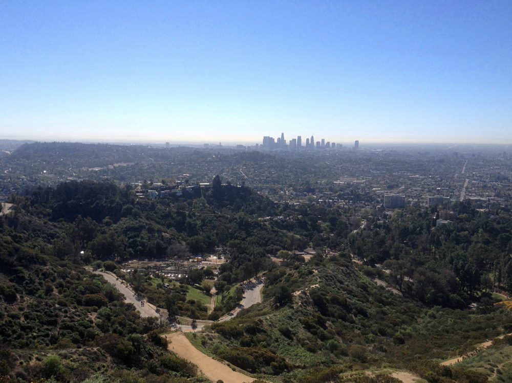
Southern panorama as seen from Mt. Hollywood, Griffith Park, Los Angeles, June 22, 2016

Griffith Icon I love it when by job intersects with hiking. This week at work I was responsible for helping facilitate meetings with leaders from around the country. Several of them enjoy hiking so it’s always on our radar to see if we can take a hike on one of the evenings. It worked out for Wednesday evening. The only one who is able to hike this time was Jeff. Griffith Park, as always, is our venue of choice, and we decide on the classic hike from the Observatory to Mt. Hollywood and beyond.

We leave the office in Echo Park at 6:21 and drive the five miles to Griffith Park. We are thankful to find a parking place on West Observatory Road just short of the Charlie Turner Trailhead. I’m pleased that a beautiful sign and map has been erected at the trailhead. Good job, parks people! Signage in Griffith Park has been horribly deficient for years. It’s labeled as Sign No. 19, so that suggests that there are more!

6:49 PM - Begin hike heading north on Mt. Hollywood Trail from the Charlie Turner Trailhead. The temperature is pleasant and haze mutes the views. There are lots of people on the trail. We stroll along and enjoy good conservation and the rugged scenery lit with the warm glow of the late afternoon sun. We cross the bridge spanning the Vermont Canyon Road tunnel and veer left following the main route. Soon I realize I neglected to turn onto the shortcut trail that climbs straight up the ridge. Oh well, I guess we’ll walk the long switchback. Views of the grand observatory open up.

As we approach the end of switchback leg, we hear wheels screeching below on Mt. Hollywood Drive. There is a strong smell of rubber. We go to the edge of the trail and notice it’s a yellow Hummer. It backs up and repeats the maneuver. We realize it’s a film shoot as we spot a camera truck. Griffith Park is used a lot for filming (and Mt. Hollywood Drive is normally closed to vehicular traffic).

At the switchback there are stone benches and a monument marker. It reads, “The Tiffany & Co. Foundation Overlook.” I’ve not been here since September 2013, so these are new to me (since I usually take the shortcut, the last time I was here was with Jeff and Loren coming back down in the dark; on that hike we hit Mt. Hollywood and Mt. Bell).

The Tiffany & Co. Foundation Overlook
With visionary support from The Tiffany & Co. Foundation
and contributions from people worldwide,
Cahuenga Peak, the backdrop of Hollywood,
is preserved for generations to come.
Enjoy the view!

We switchback heading east. It’s always sad to see rocks defaced with graffiti. The parks department works hard at covering it, but one tag—painted over at least two previous cover-overs—begs to be abated. The horrific scourge of graffiti in our population centers in “modern” society is compelling evidence that humankind is not evolving. Homo sapiens are de-evolving into Neanderthals and there is seemingly nothing that science and modernity can do to stop it (perhaps a theological explanation should be considered).

We are enjoying good conversation as our view over the vast L.A. sprawl to the south expands. Above us, Mt. Hollywood is accented with tiny figures.

We reach the six-point junction south of Mt. Hollywood at 7:20. A new sign has been posted here as well: Sign No. 13. It points left and right to either main route to Mt. Hollywood at .4 mi (to the left through Captain’s Roost [.1 mi.], and to the right through Dante’s View [.2 mi.]). And it points left (west), back to where we came up (.7 mi to Berlin Forest; 1 mi. to the Griffith Observatory). What the sign doesn’t mention is the two routes heading south down the ridge (the shortcut to the bridge and to Bird Sanctuary, although one is shown on the new map). And it doesn’t show the steep route that heads directly up the ridge to Mt. Hollywood. The small print at the bottom of the sign reads, “You are in an urban wilderness. For you safety and to protect the habitat, please stay on designated trails.” I guess that means they would prefer we don’t use the popular shortcut. We’ll, that’s going to be our route, so sorry, sign.

We turn north and begin to climb the well-worn path straight up. A guy is playing with a remote control car. Lots of California buckwheat is in bloom, about the only thing I’ve seen blooming today. The route is really steep, but always a fun way to go.

Atop Mt. Hollywood (1625’), Griffith Park, Los Angeles, June 22, 2016
7:34 - Mt. Hollywood (1625’). I love this place. There are always people here; 13 right now. The massive human sprawl to the south is muted by haze. The grand observatory sits impressively on the mountain below. The soon-setting sun silhouettes Mt. Lee and the Hollywood sign to the west. To the northeast the majestic San Gabriels span the horizon with their sun-draped peaks. To the north Baby Bell calls to us. We linger for a few minutes and soak in the splendid location.

We leave the summit at 7:45 and head northeast on the wide dirt road. I’m hoping to get sunset shots from Baby Bell. That is about as far as we’ll get today. At the Captain’s Roost junction another new sign has been erected: Sign No. 11. And at the four-point junction north of Mt. Hollywood is new Sign No. 10. These are nice! The sun is nearing its disappearing point behind the peaks to the west. We continue straight along the ridge-divide and head north toward the Bells. The sun casts a warm glow over Glendale to our northeast. We’ve lost the sun behind Mt. Chapel but I’m calculating we’ll see it again once on top of Baby Bell. Our pace is deliberate now. We transition left unto the rutted path that skirts Baby Bell, then turn left to follow the ridge to the summit.

View of sunset from atop Baby Bell, Griffith Park, Los Angeles, June 22, 2016
8:01 - Baby Bell (1570’). We’re just in time to photograph the setting sun as it dips below the distant horizon to the right of Mt. Chapel. There are two guys here and they snap our picture. Sometime I’d like to learn the story behind the hexagon-shaped foundation. This is Jeff’s first time on this peaklet (on our hike in September 2013 with Loren, we skirted Baby Bell so that we could have enough time to peak out at Mt. Bell with adequate light). We enjoy our 360-degree view over the rugged parkland and the vast megalopolis beyond. There is peacefulness as night falls on L.A. Looking north to the site of the long-gone Grand Central Airport in Glendale, and looking northeast to the zoo parking lot and the former of site of the Griffith Aviation Park, I share a little history with Jeff. Such aviation luminaries as Martin, Boeing, and Douglas had their roots here (see my Beacon Hill hike description for more).

We leave the summit at 8:13 and head down the northwest ridge route. At the dirt road we turn right and traverse along the north flank of Baby Bell. At the site of the short-lived Griffith Park Teahouse, I reminisce about its clandestine appearance on June 30, 2015. We continue around the peaklet then retrace our steps along the ridge-divide heading south. Lights twinkle in Glendale. Nightfall displays its beauty. I’m really enjoying Jeff’s enthralling story about a recent adventure he had on the Appalachian Trail…oh the lessons we learn while hiking!

At the four-point junction north of Mt. Hollywood (Sign No. 10), we opt to turn left (east). At Dante’s View there’s another new sign (Hogback Trail at Dante’s View, Sign No. 12). I encourage Jeff to drink from the fountain. He declines by saying he has water. I tell him he has to drink from the drinking fountain…because it’s here, and L.A. tap water is so robust. We take a short walk through Dante’s View before continuing on. It’s nearly dark now.

We reach the five-point junction at 8:52 and decide to go straight down the ridge shortcut. The ambient light is sufficient for our steps. I don’t recall if I have been down this route at night, but I failed to anticipate how tedious and precarious it is in the dark (I attempt to use my headlamp but I prefer the ambient light). A sea of lights covers our southern panorama. We safely negotiate the steep, slippery route and at the junction to Bird Sanctuary are rewarded with a reasonable path. Headlights stream up Western Canyon Drive. The observatory is bustling. Back at the bridge we retrace our steps past the Belin Forest and to the Charlie Turner Trailhead.

9:22 - End hike. The place is teeming with visitors. Back at the car we navigate to Sunset and Orange in Hollywood and cap off the evening at In-N-Out. It doesn’t get better than this!

Jeff and Dan atop Baby Bell, Griffith Park, Los Angeles, June 22, 2016
Epilog - What an enjoyable hike. I never get tired of this amazing urban wild place with its endless possibilities. In the nine years I’ve been hiking in Griffith Park, I’ve not repeated a hike. With the vast web of trails, I’ve been able to cobble together various trail sections and destinations to create a different hike each time. This hike was similar to previous hikes but distinctly different. Jeff was great company and it’s always a privilege to host our out-of-down guests. icon

Griffith Icon  See Hiking Griffith Park at Dan's Hiking Pages
 (includes links to my other blog posts for hiking in Griffith Park)

Boot IconRelevant trail descriptions for this hike at Dan's Hiking Pages:

PREVIOUS > Beacon Hill and Glendale Peak in Griffith Park - Feb. 15, 2016

Monday, February 15, 2016

Beacon Hill and Glendale Peak in Griffith Park - Feb. 15, 2016

Panorama northwest through east from Glendale Peak, Griffith Park, Los Angeles, February 15, 2016

Griffith Icon A day off from work to celebrate Presidents Day was an ideal time for a hike in Griffith Park…my first one for this year. I had to go into my office in L.A. for a few hours so I figured I would do a short hike to begin the morning. As I headed west on the 210 and 134, I pondered what trails I might cobble together. I decided that the two peaks at the east end of the park would be good.

I exit the I-5 at Los Feliz and take Crystal Springs drive to the large parking lot near the merry-go-round. Lots of cars in the lot and lots of walkers, hikers, and runners.

Beginning the hike on Lower Beacon Trail, Griffith Park, Los Angeles, February 15, 2016
9:10 a.m. - Begin hike. I head southeast on Lower Beacon Trail. The temperature is pleasant, the sky is blue, and the hillsides are green from winter rain. In a couple minutes I round a hip and reach my junction. A narrow use path cuts to the right up a steep bank. Up I climb the informal route which ascends a broad ridge due south. It’s mostly shaded and I have the path to myself. The din of traffic on the I-5 is ever-present. I enjoy expanding views of Glendale to the east with the San Gabriels as the backdrop. I can see my car in the lot below to the northwest. View northwest from the north ridge of Beacon Hill, Griffith Park, Los Angeles, February 15, 2016 Across the canyon to the west, Glendale Peak, Baby Bell, and Mount Bell define the skyline. It’s disheartening to see that someone has torn out all the young wild cucumber vines along the way. Why would someone destroy native plants? After a few minutes the steep path mellows out Climbing the north ridge of Beacon Hill, Griffith Park, Los Angeles, February 15, 2016 and I can see the summit of Beacon Hill. Soon the route gets steep again and at 9:27 I reach Upper Beacon Trail, a wide dirt road. I turn left (east) and climb the final steep pitch to the summit.

View north from Beacon Hill (1001’), Griffith Park, Los Angeles, February 15, 2016
9:29 - Beacon Hill (1001’). This broad-top summit stands as the easternmost point of the 40-mile-long Santa Monica Mountains. Clear skies provide good visibility today. It’s simply a beautiful day in L.A.! Burbank and Glendale basking in the morning sun sprawl to the north and east. The downtown L.A. skyline stands silhouetted to the south. Distant Palos Verdes Peninsula floats as a slender line above the marine layer. Glendale Peak and Hogback Ridge outline the parkland to the west. I look north toward Glendale beyond the 134 to spot the old control tower of the long-gone Grand Central Air Terminal. The airport got its start in 1923 and was the Southland’s main air terminal. The beacon light that stood on this summit guided those early aviators.

View west from Beacon Hill toward Upper Beacon Trail, Griffith Park, Los Angeles, February 15, 2016
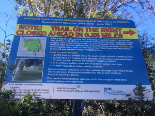
9:35 - Leave Beacon Hill heading west on Upper Beacon Trail. I’m really enjoying the sunshine, fresh air, and surrounding park as a wildland island amidst a vast metropolis. Six minutes delivers me to 5-Points junction. View west arriving at 5-Points junction from Upper Beacon Trail, Griffith Park, Los Angeles, February 15, 2016 I encounter my first humans of the hike. Of the two routes that head west toward Vista Del Valle Drive, the one on the right has a sign that notes that the trail is closed 0.25 mile ahead for a construction project to expend the water recycling system. Construction closure sign at 5-Points junction, Griffith Park, Los Angeles, February 15, 2016 It will be closed through June 2017. Two gals head up that road, so maybe they know of a way to skirt the construction.
View west approaching Joe Klass Water Stop, Griffith Park, Los Angeles, February 15, 2016
I take the road on the left which climbs west. A lady and her dog off leash are coming down the road. The dog jumps up on me. I tell her the dog needs to be on a leash according to park regulations. She laughs and says, “Yeah, your right.” But she continues down road while occupied with her smart phone. What’s with these people?! I continue along the eucalyptus-lined dirt road and in five minutes reach the Joe Klass Water Stop. Joe Klass Water Stop at Vista Del Valle Drive, Griffith Park, Los Angeles, February 15, 2016 I top off my water bottle and continue west, now on paved Vista Del Valle Drive. A couple minutes delivers me to the construction project, which occupies a large area on the knoll adjacent to the Vista View Point (helipad). I have views west now toward the grand observatory View west toward Griffith Observatory from Vista View Point (helipad) at Vista Del Valle Drive, Griffith Park, Los Angeles, February 15, 2016 and Mt. Hollywood. The L.A. basin sprawls out on the southern panorama. Lots of people on the trails today.

View north toward Bridle Trail junction and Glendale Peak from Vista Del Valle Drive near Vista View Point (helipad), Griffith Park, Los Angeles, February 15, 2016
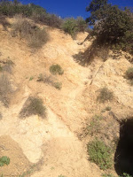
I round the bend north to see Glendale Peak inviting me up. At the junction for Hogback Trail (aka Bridal Trail), behind the green pump house, I ponder the treacherously steep route climbing about 15 feet up the shire granite road-cut. Short cut to Glendale Peak from the junction of Bridle Trail, Riverside Trail, and Vista Del Valle Drive, Griffith Park, Los Angeles, February 15, 2016 The first time I encountered this obstacle was in August 2010 on my six peaks hike. I had left Glendale Peak heading east thinking it was a short-cut, only to be stopped by this cliff. So I turned back. But today I stand here looking at the obstacle and think, you know, I can climb that thing. So up I climb, carefully negotiating each step, each handhold, summoning the nerve to keep climbing. At about half way I look down and realize that one slip would have horrible consequences. I dislike hospitals, so I will myself safely up. Wow, that was exhilarating! What a relief. The narrow path now leads me comfortably up the ridge five minutes to the peak. Heading west on short cut to Glendale Peak from the junction of Bridle Trail, Riverside Trail, and Vista Del Valle Drive, Griffith Park, Los Angeles, February 15, 2016
View south from Glendale Peak (1184’) in Griffith Park toward downtown Los Angeles, February 15, 2016
10:08 - Glendale Peak (1184’). This is a splendid little summit. Great views today. I love how green everything is. And there is such a contrast between the surrounding ruggedness and the massive human sprawl beyond. And as always, I have the peak all to myself. Ant-like figures crawl along the roads webbing throughout the park around me. It’s getting warm now. Thankfully it’s all downhill from here.

View north from Glendale Peak toward Henry’s Trail and Hogback ridge, Griffith Park, Los Angeles, February 15, 2016
10:15 - Leave Glendale Peak heading east on Henry’s Trail. I’m thoroughly enjoying the scenery. I stop to photograph wild Canterbury bells. Wild Canterbury bells (Phacelia minor) along Henry’s Trail, Griffith Park, Los Angeles, February 15, 2016 There has been very little in bloom today: some wild cucumber, everlasting, deerweed, ceanothus, tree tobacco, and the typical weeds of mustard and filaree. I ponder my return route and think I’ll climb down from the bridge to Vista Del Valle Drive. When I reach the junction it appears to be awfully steep and perilous. But I’ve done it up and down before, so I know it is safely doable. So down I go (starting at the point directly behind the Henry’s Trail sign). Beginning of short cut from Henry’s Trail to Vista Del Valle Drive, Griffith Park, Los Angeles, February 15, 2016 It is somewhat precarious, but I negotiate it safely. It’s certainly not for the faint of heart. View from Vista Del Valle Drive toward short cut coming from the bridge at Henry’s Trail and Hogback ridge, Griffith Park, Los Angeles, February 15, 2016
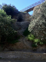
View north from the use trail connecting Vista Del Valle Drive and Fern Canyon Trail, Griffith Park, Los Angeles, February 15, 2016
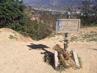
I turn right (south) on Vista Del Valle and stroll along. Looking east down into the canyon, I see a well-worn path along the canyon bottom heading down to Fern Canyon Trail. Oh, that’s going to be my return route. I walk past the junction of Hogback and Riverside trails and find my route adjacent to the Vista View Point (helipad) just to the left of the lower trail heading back to 5-Points (blocked right now by a construction fence). I head down the trail. It’s a splendid path and I enjoy being off the wide fire roads. But, as with most narrow trails in Griffith Park, it doesn’t last for long before it deliverers me to a wide dirt road.

View north on Fern Canyon Trail, Griffith Park, Los Angeles, February 15, 2016
10:51 - Fern Canyon Trail. I turn left and mosey down the dirt road. Lots of foot traffic today. A ranger drives up the road and I give to him a set of keys I found on Glendale Peak. I also reported to him the destruction of the wild cucumber vines. It’s quite warm now and I’m glad I’m heading down. Several families with young kids trudge up road under the warm sun. The kids don’t look like they are enjoying themselves. I don’t blame them. Dragging kids up a steep road under ponding sun is not a good way to endear them to hiking. At 11:08 I leave the road and transition onto Fern Canyon Nature Trail, a most pleasant route for my final stretch. View northeast from Fern Canyon Amphitheater to Fern Canyon Trail, Griffith Park, Los Angeles, February 15, 2016 The area is rebounding nicely after the devastating fire of May 2007, but some dead trees still stand as a reminder of the raging inferno.

11:17 - End hike. It’s about 87 degrees. Good for 8,539 steps on my Fitbit.

Dan Simpson on Beacon Hill (1001’), Griffith Park, Los Angeles, February 15, 2016
Epilog - What a pleasant outing! Warm sun, fresh air, blue sky, green hillsides, splendid views, some adventure, and good exercise. In all my hikes in Griffith Park over the years, I’ve never repeated a hike. I’ve used many of the same trail sections, but combined them for different hikes. So on today’s hike it was fun to visit two familiar peaks yet cobble together different routes for a unique hike. I never get tired of the amazing Griffith Park. icon

Griffith Icon  See Hiking Griffith Park at Dan's Hiking Pages
 (includes links to my other blog posts for hiking in Griffith Park)

Boot IconRelevant trail descriptions for this hike at Dan’s Hiking Pages:

PREVIOUS > Griffith Park Teahouse, Mt. Bell, Mt. Hollywood - July 24, 2015