 See Garcia Trail Description on Dan's Hiking Pages
Rarely do I hike twice in one weekend, but Sunday was another gorgeous day. I couldn’t resist. Yesterday’s hike to Monrovia Canyon Falls was enjoyable, but weather like this calls for climbing a peak. So I arose early and headed to Garcia Trail, my de facto scrappy hike, five minutes from my home in Azusa.
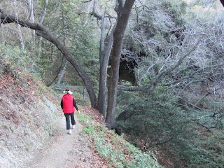
7:05 - Begin hike. The thermometer says 47 degrees, but it seems warmer than that. The sun is barely above the eastern horizon and casting a warm light. I soon take off my long sleeves. Lots of people on the trail today. I run into my friend Art, a fellow Azusian. There is not much in bloom. The Santa Ana winds have cleaned up the air making good visibility. I climb steadily and enjoy the beauty of the day. I reach the ridge and Glendora Ridge Motorway at 7:43, turn east, and head to the summit. Six guys in sleeping bags are camped out on the water collection slab.
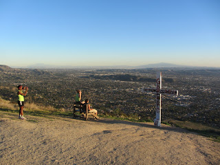
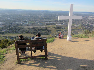 7:50 - Azusa Peak (2081’). Three young ladies are sitting separately and quietly reading. A man, a young girl, and a dog sit on the bench. It’s peaceful here. The wooden cross has been repainted white sometime since January 1. I snap a few pics and leave the summit at 7:54 heading east.
I have no specific plan for the hike, but I have to be home by 10:00. I figured I’d wander up the road a bit. There is a slight breeze. There is virtually no snow visible on the high country to the north and east. At 8:07 I decide to veer right onto the use path that climbs the broad ridge east toward Glendora Peak. It starts gently but then gets steep as it approaches the summit. The weedy grasses are low and green and pose no problems.
 8:24 - Glendora Peak (2596’). The large round summit provides commanding views, but they are partially obscured by vegetation on the north and south. I’ve hiked here numerous times over the years. It offers a nice five-mile round trip with 1,800 in elevation gain starting from Garcia Trail trailhead. It’s a convenient conditioning hike for me. There are two primary routes to this peak. The other climbs a short distance (3 minutes) from the east from Glendora Ridge Motorway.
 I post a photo to FB and leave the peak at 8:46, retracing my steps. I meet a man named George. He says he has seen mountain lions eight times in this area. I reach the road at 9:04 just as George catches me. We walk together and talk hiking. He completed the Sierra Club Hundred Peaks Section list last year. Quite commendable! We transition to Garcia Trail at 9:15. Lot of people lingering about (for many, this is their destination, without making the final climb to Azusa Peak). After a few minutes I say goodbye to George and slow down a little. The warm sun feels good. Excellent visibility today. Lots of people on the trail: young, old, large, small, couples, solos, groups, families, dog walkers, runners, and out-of-shape folks who are barely dragging themselves up the trail. At “Razor Ridge” a Boy Scout troop from West Covina stands resting. I hear the leader polling the boys to see if they want to abort the hike. That seems odd to me...quitting with less then a quarter mile into the hike. Run into Barbara, an old friend from our CFC days.
 9:53 - End hike. The thermometer reads 67 degrees, but it feels warmer.
 Epilog - What a blessing to have such a splendid trail so close to home! Gorgeous weather! I get satisfaction out of seeing so many people enjoying the outdoors. And as is typical, heading east from Azusa Peak almost always offers a degree of solitude and serenity.
 See Garcia Trail Description on Dan's Hiking Pages

