 See San Gabriel Peak Hike Report January 6, 2006 at Dan’s Hiking Pages
An extraordinarily beautiful day following Thanksgiving and a day off work was the perfect occasion to hit the trail. And my hike to Mt. Wilson last week piqued my interesting in returning to the area. I had several goals in mind. One was to bag Mt. Deception, a peak that is not labeled on the USGS topo map or Tom Harrison map, but is on the Sierra Club Hundred Peaks list. I also wanted to hike the JPL trail, which I’ve not done before. And I wanted to get a feel for the extent of the Station Fire damage. Finally if I had time left over, I’d drive up the road and bag Occidental Peak.
Leave my house in Azusa at about 8:35 and head east on the 210. My eyes are drawn to Mt. Wilson and its neighboring peaks. As I wind along Angeles Crest Highway I stop several times to take some pictures. Turn right on Mt. Wilson Road and drive the half mile to the junction (2N52). Up the road about 80 yards on the left is the where the trail starts. A yellow sign warns of potential hazards in the burned area. It’s a brisk 51 degrees and I’m eager to hit the trail.
 9:45 AM - Begin hike (4750’). The trail zigzags up a draw and begins to meander south up the broad ridge under a canopy of mature oaks. I’m delighted that this area was not destroyed by the fire. The trial is beautifully built with a comfortable grade. My pace is moderate as I enjoy the splendid setting. Views toward the eastern high country open up. Manzanita is thick and green. The trial passes near the road in several spots. Patches of snow linger in the deep shade.
 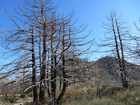 10:34 - Road (5750’) (1.3 miles from the start). A signpost marks the trail. A metal plaque indicates JPL 88. Now for a stroll up the road traversing the east flank of Mt. Disappointment. The warm sun feels good. As I approach the junction, blackened trees announce the entry into the fire zone. Reach a junction and am rewarded with striking views into Bear Canyon. Take a hard right to proceed up the steep road to the summit.
 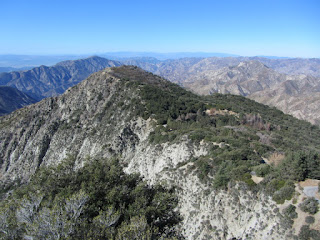 10:52 - Mt. Disappointment (5994’) (1.9 miles from the start). The array of structures makes for a less then ideal peak experience, but a fine rock out cropping on the southwest edge of the summit provides a nice place to sit and take in the views. Mt. Deception stands prominent below to the west and invites me to conquer it. Massive fire damage dominates the landscape, for miles. I’m grieved by the senseless destruction of one third of the Angeles National Forest which could have been avoided if not for the politics, bureaucracy, and misguided policies.
 I sit on the rocks, have some food, upload a photo to FB, and attempt to call home. The weather is fantastic. The solitude is an amazing contrast to the crowds swarming the stores on this Black Friday. The downtown L.A. skyline pokes above the haze blanketing the human sprawl. Closer south, Mt. Markham and Mt. Lowe bring memories of my most excellent adventure in January 2006. Well, I’d like to linger longer but San Gabriel Peak calls me higher. I leave the summit at 11:30 and take a cross-country shortcut southeast down the ravine to the road. Works well.
 11:37 - Junction - Meet a gentleman named Dennis. Chat for a few minutes. He is heading to San Gabriel Peak too so we walk together. Leave the road and transition onto a trail dropping to a saddle where it passes the trail coming up from Markham Saddle. We begin our ascent. The fire damage is heartbreaking. What used to be a mature forest blanketing these slopes is now nothing but black sticks and the invasive poodle-dog bush (Turricula parryi).
  12:13 - San Gabriel Peak (6161’). The summit offers an amazing 360-degree panorama. It’s easy to see why this peak was a strategic location for a fire lookout tower, which stood here from 1928 to 1937. The last time I was here the views were partially obscured by dense vegetation. Not any more. Dennis and I linger on the summit and enjoy good conversation and the beauty of the day. I upload a photo to FB. There’s not a peak register to be found. We leave the summit at 1:01.
 We pass a hiker heading to the top. I’m still numb over the horrific fire damage. This used to be such a magnificent forest. We pass another hiker. He has some clippers and is trimming poodle-dog bush along the way. Arrive back at the road at 1:26. It’s cool in the shade. We reach the trail junction and say our good-byes as Dennis heads down the trail and I head west down the road. Careful steps safely get me past a shaded stretch of road covered by ice. At a hairpin turn, I take a shortcut by descending off trail and hit the road again in a few minutes. It worked well. At 1:50 I reach a saddle where the road turns north and a climbers’ path heads west up the ridge toward Mt. Deception. The route looks steep and brushy, but Hundred Peakers do it, so we’ll see. Begin the climb. The route is actually pretty decent and free of brush, and untouched by the fire. It is steep but not unreasonable. After 8 minutes I reach the ridge and the route mellows out. Shortly I transition into the land of the incinerated with blackened vegetation and abundant poodle-dog bush. After passing a “false” summit the ridge bends northwest and in a few more minutes I pass through some brush and arrive at the summit.
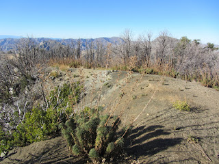 2:13 - Mt. Deception (5796’) - My biggest thought is why is this peak on the Hundred Peaks list? It’s really not a summit I’d write home about. There is a good view west into Bear Canyon
 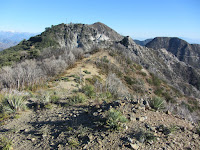 I leave the summit at 2:44 and begin to realize that maybe I’ve not left enough time in my day to drive over and climb Occidental Peak. We’ll see. I retrace my steps. When I get to the section that drops steeply east, I decide to turn left (north) and descend via another ridge. In studying the aerials before hand, I observed a clear route that looks like it may work well. Down I go. It gets pretty steep but the soil is soft and easy to descend. I would not want to climb this way. The route works fine and I reach the road at 2:56.
  My pace now is relaxed. It’s nice to be back in unburned territory with living trees and green vegetation. The shade is cool. I’m pretty much resigned that Occidental is out. At 3:12 I leave the road and get back on the trail and enjoy a pleasant stroll through dense manzanita and oak. A man passes me heading up—only the forth person I’ve seen all day. As I approach the trailhead, I’m a little surprised that I’m here already.
3:31 - End hike. It’s a brisk 47 degrees.
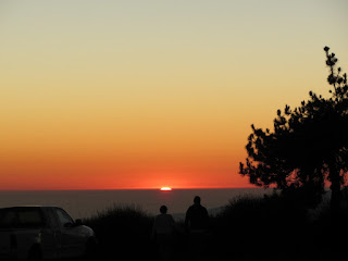
 I jump into the car and head to Mt. Wilson. When I get to the trailhead for Occidental Peak, I impulsively decide to give it a try. It’s supposed to be one mile to the peak, and I figure I can do that in a half hour and be back to the car by sunset at 5:00. I make it past the communications installation and helipad, but the route becomes rough and somewhat indistinct. I hack through it for awhile but finally I realize that there is no way I can safely make it to the summit and back before dark. As Kenny Rodgers says, “You gotta know when to hold ‘em, know when fold ‘em.” And it’s definitely time to fold ‘em. The peak will always be here for another day...but there is no guarantee that the beautiful mature forest will still be blanketing its slopes.
 Epilog - Splendid day of hiking! The weather was absolutely perfect. Enjoyed good company with Dennis for a bit. Had lots of solitude and appreciated going my pace and soaking in the experience. The horrific damage from the Station Fire was somewhat depressing. I don’t know if it would be better to have not experienced the wonderful forest before that fire so that I don’t have a frame of reference to compare it to, or to have experienced the pre-fire forest and have good memories of its beauty. Maybe it’s a moot point since I did experience the forest before it was destroyed and value the memories. However, as I sit here looking at photos from my hike to San Gabriel Peak in 2006, I find myself getting angered that the bureaucrats didn’t allow for the firefighters to hit the fire hard enough and fast enough in its infancy. Oh well, if you enjoy black sticks and poodle-dog bush, head to the Station Fire burn area...there are millions of them!
 See San Gabriel Peak Hike Report January 6, 2006 at Dan’s Hiking Pages
Wasn't it a beautiful day here? I took my dog up to Vasquez Rocks and took a lot of photos.
ReplyDeleteKay
Hey Dan, I think my daughter and I met you on the trail that day coming back from Occidental Peak. We had done Disappointment and Deception and were trying to finish Occidental as well when we turned back half way becuase the trail was unclear and it was getting late as well. We went back out the day before christmas and got Occidental, that was the right trail, mt Lowe and Markham. Thanks for your page, I use it often with my girl scouts as they are working their way towards 100 peaks and backpacking. You can keep track of our progress at: http://www.calzim.com/gs151/
ReplyDeleteHi, Dan... I might have mentioned that I was married on San Gabriel Peak on 11-27-1987! That day the view was astounding! We could see waves breaking at Huntington Beach to the south; Mt. Langley, Whitney and the west ridge of Mt. Russell (13,900+) to the north (!). I did Occidental when I was in high school--from Altadena via Henninger, Eaton Canyon and then up Occidental's south ridge! It was a bitch! Not only was the hike steep, long and brushy, but the temperature was 90 degrees and it was smoggy when we were on the ridge. When we reached the summit, though, it was clear to the north. On the way home from Eaton Saddle, I had the worst charlie-horse cramps I've ever had--and I was in great shape!
ReplyDelete