Sunday, August 28, 2011

Bighorn Peak Hike - August 28, 2011

Bighorn PeakSee Icehouse Canyon to Icehouse Saddle hike description at Dan's Hiking Pages

The San Gabriels’ eastern high country called to me again, this time to a summit I’ve not yet conquered: Bighorn Peak (8441’). It does not get as much attention as its taller neighbors, Cucamonga Peak (8859’) to the southeast and Ontario Peak (8693’) to the west. But I’ve had my eye on it for years.

I’ve long pondered attacking Bighorn by climbing straight up the ridge from Icehouse Saddle. And after last week’s climb up Register Ridge, I was feeling ambitious to do another rigorous, unconventional climb. Last year when I was at Icehouse Saddle I did some exploring around the slope but did not find any clear route. I’ve not found any write-ups for it, but the Sierra Club Hundred Peaks Section did mention that it is doable and one of the climbing archive reports mentioned climbing it, but with little detail, and 10 years ago. The topography does not appear to be unreasonably steep, but my main concern was the thick blanket of manzanita. And with an elevation gain of 860 feet, I had to realize that it was like climbing from the Baldy/Hardwood saddle to Baldy’s summit, only with 160 feet more and no trail. But I was ready for the challenge.

With the blazing temperatures for this weekend, I knew I would need an early start to beat the heat. My alarm woke me at 4:00 and off I headed to Icehouse Canyon. There were only a few cars in the parking lot (in the daytime it’s usually packed). The car thermometer read 74 degrees...not cool.

5:30 AM - Start hike at Icehouse Canyon (4900’). It’s still dark and the constellation Orion shines brightly above. A flashlight is necessary to guide my steps. This first mile is one of my favorite sections of the trail with its streamside charm, but this morning I can only imagine it in the dark. Reach Chapman Trail junction (1.0 mi.) at 5:59. I don’t need the flashlight any longer, but it’s still too dark for decent pictures. Shortly I cross the creek and arrive at the boundary to Cucamonga Wilderness (1.8 mi.) at 6:20. I keep pressing on.

View west from Icehouse CanyonAt 6:24 I see the first rays of sun landing on West Baldy’s south ridge to the west. I love watching a new day emerge. I am aware that I’m the only one on the trail, a rarity in Icehouse Canyon. I contemplate the possibility of arriving at Icehouse Saddle without encountering a single person. Cross Telegraph Wash, hit the 2-mile post at 6:39, and begin the steep section climbing the north slope. The trail condition is much better here. Pass Columbine Spring at 6:48 and start the switchbacks. Shortly a lone hiker catches and passes me. My solitude streak is broken, but oh well, it’s still quite peaceful. At 7:13 I pass the upper junction to Chapman Trail (3.0 mi.). Only 0.6 mile to go. Views toward Baldy open up and I reflect on last week’s adventure sitting on the rim of Baldy Bowl. I press the pace with hopes of reaching the saddle by the two-hour mark.
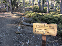
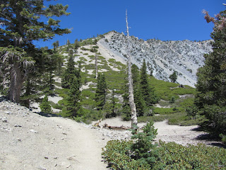
Icehouse Saddle7:30 - Icehouse Saddle (7580’) (3.6 mi.). I step into my first sun of the morning. It’s not breezy yet. The lone hiker sits resting. We chat briefly. He leaves as two more hikers arrive. After I look around the saddle, one of the hikers asks if I’m Dan. They are big fans of Dan’s Hiking Pages. James and Bob are hiking the Three Tees today. It’s good they got an early start. Other hikers arrive. I think I’m procrastinating my adventure climb. Leave the saddle at 8:10.

Climbing the ridge from Icehouse Saddle to Bighorn PeakI walk up Ontario Peak Trail about 100 yards and find a spot to begin my climb. It’s steep with loose footing and I am picking my route though thick patches of manzanita. I’m hoping it gets better because 860 feet of this would be quite taxing. I see no human-made paths, but evidence of bighorn sheep is abundant. I follow a bighorn path as it leaves the ridge taking a tangent to the right on the slope of a wash. I soon realize that this route is not going where I need to go. I turn east and start a steep, rugged climb back to the ridge. At 8:46 I achieve the ridge again. This is certainly the better route and the brush has thinned out. I sit on a log and enjoy some food. As I continue, views open up east to Etiwanda and Cucamonga peaks. The route is somewhat steep but quite decent, although I’m negotiating some deadfalls from the fire years ago. I get excited as I see the ridge mellowing out as it gets closer to the top.

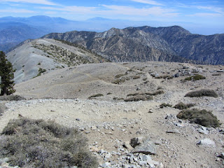
View south from the ridge east of Bighorn Peak9:21 - Ridge junction intersecting the ridge coming up the Cucamonga/Bighorn saddle. Wow, this is great! Views open south to the human sprawl. Cucamonga Peak looms to the southeast. The route bends west and follows the rocky ridge. The rugged landscape is stunning. I enjoy soaking it in. This is bighorn sheep country, so I tread gently and slowly and hope to encounter the herd.

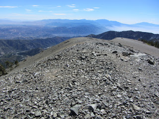
View southwest from Bighorn Peak9:38 - Bighorn Peak (8441’). What a splendid peak! Sweeping views in all directions from the nearly treeless summit are amazing. It’s warm now. Haze murkies up the vast human sprawl to the south with Saddleback poking up on the distant horizon. This is a great vantage point to view Mt. Baldy and its surrounds. I sit in the warm sun on a comfortable log and sign the peak register. As I enjoy the quite solitude I think about the multitudes who will assault Old Baldy today. I have cell reception so I call my wife and upload a photo to Facebook. I decide for my return to head west and descend through Kelly Camp.

View north toward Mt. Baldy from below Bighorn Peak10:20 - Leave Bighorn Peak. Shortly I stray off trail to explore an impressive outcropping of rocks hanging on the steep southern mountainside. Continue on but can’t find the trail. Found it but lost it again. As the trails drops into a saddle choked with brush, the route disappears. I ponder a shortcut down Delker Canyon but decide to stick with the plan. The ridge steeply climbs to a high bump (8210’) but I follow what I think is the trail around the northern flank. Trail disappears again. This is turning out to be more of an adventure than my cross-country climb to Bighorn Peak. I climb the steep slope and finally find the trail which descends to the ridge. The scenery is amazing. Fluffy white clouds begin to gather to the north.

View east toward Bighorn Peak11:17 - Junction with Ontario Peak Trail. I’m back on familiar territory as I was here a year ago en route to Ontario Peak. Turn hard right and take the descending trail. Views are open as the trail meanders through an area that was incinerated years ago. Soon I arrive in welcome shade.

11:38 - Kelly Camp. No one here. I wander over to the spring and sit and eat. Leave Kelly at 12:12 for the 1.0 mile descent to Icehouse Saddle. Scenery is still wonderful. Thunder clouds gathering over Baldy cast interesting shadows on the mountain. I pass a ravine (Delker Canyon) that appears that would have made a good shortcut from the ridge coming down from Bighorn. I explore a spur ridge on the left.

View west in Icehouse Canyon12:57 - Icehouse Saddle. A couple large groups are leaving. The breeze is warm. I mosey north up Three Tees Trail for a couple hundred yards to get a view of my route up Bighorn Peak. Leave the saddle at 1:05 at an earnest pace taking advantage of the good trail here. It’s hot now and I’m glad it’s downhill. Stop at Columbine Spring and get some more water. Pass the 2-mile post at 1:55, cross Telegraph Wash, photograph some metamorphic rock, and arrive at the wilderness boundary at 2:11. Sit and enjoy the shade while having a snack. I’m amazed to see several hikers dragging themselves up the trail en route to the saddle. Why would anybody punish themselves like that in the blistering heat? Continue on and am glad to reach the streamside section with shade and the refreshing sounds of the creek. A Boy Scout troop comes plodding up the trail. I ask where they are heading and an adult leader says the saddle. Not to meddle, but it seems to me that it is a regrettable lack of judgment to inflict such punishment on these boys. Scouting is supposed help boys fall in love with hiking. None of these kids or adults look like they are enjoying themselves in the sweltering heat.

Lower IcehouseMy 4GB memory card reaches capacity. So the section I walked in the dark this morning won’t get photographed today. Oh well. I pass Chapman Trial junction at 3:53. My pace is slow on the rocky trail. Even though I love the incredible beauty of Icehouse Canyon, I always dread the descent because of the poor trail surface for much of way. For me, it makes footing tedious and laborious. The streamside stroll is pleasant. Various ones are enjoying playing in the cool stream. I’m dreaming of a cool shower and cold Coke.

3:24 - Done. Parking lot is still quite full. My car thermometer reads 93 degrees.

Bighorn trackEpilog - Another amazing day of hiking in the San Gabriels’ high country! Incredible scenery! Conquering a new peak and doing it the “hard way” is most satisfying. I thoroughly enjoyed the surprising amount of solitude. I didn’t encounter one person in my 5-hour loop from the Icehouse Saddle to the peak and back to the saddle. And there were very few people on my descent from the saddle. I climbed more than 3,600 feet covering 9.5 miles...a most respectable workout. I am so thankful for the ability to hike these wonderful mountains. icon

Blogspot See my blog post: Ontario Peak Hike - August 21-22, 2010

See Icehouse Canyon to Icehouse Saddle hike description at Dan's Hiking Pages
 

Sunday, August 21, 2011

Register Ridge to Harwood, Baldy & W. Baldy - Aug. 21, 2011

View from southeast from West BaldySee Introducing Mt. Baldy and Mt. Baldy hike description at Dan's Hiking Pages

Unequivocally, this was one of my very best hike experiences in the San Gabriels. An amazing day of hiking! I’ve been hearing about the Register Ridge route for years, but its purported difficulty has had me avoiding it. But two weeks ago while hiking to Mt. Baldy, I met a man who had just hiked it that morning. So based on his first-hand report, I decided it was time to tackle the notorious Register Ridge. The route begins on Ski Hut Trail just past the sign-in register, climbs 2,600 in about 1.6 miles, and intersects Devils Backbone Trail on the south face of Mt. Harwood. My plan was to hike the ridge and continue onto Harwood. Then if I felt up to it, I could continue on to Baldy or descend via the Backbone.

I psyched myself up the whole week, read some hike descriptions, studied maps and aerials, and got my gear together. And the weather forecast was for mild temps. I arose at 5:00 Sunday morning and headed off to Manker Flats.

Falls Road, San Antonio Canyon6:25 AM - Begin hike (6160') on Falls Road. I was here two weeks ago but this morning there is an excitement in my step. The ragged ramparts of Baldy Bowl catch the morning’s first rays of sun 3,900 feet above. I transition onto Ski Hut Trail, sign the register, round the bend and arrive at the junction for the Register Ridge route. I take 5 minutes and do some stretching exercises.

Register Ridge6:55 - Begin climbing Register Ridge. The well-worn path zigzags up the steep slope. The footing is loose and I’m thankful I brought a walking poll. At 7:07 I step into the sun. It’s bright. Shortly the trail gets less steep. A gentle breeze feels good. I’m loving the expanding views in all directions. Baldy Bowl in all its glory rises high above while a marine layer blankets the valleys below. I’m seeing the area from a perspective I’ve not experienced before. I love the smell of pine. Sugar pine, Jeffery pine, and white fir decorate the ridge. The path is easy to follow for the most part. At one point I find my own route scampering over some rocks. There are great views down both sides of the ridge. The climb is steep but I’m really enjoying the trail. There is a real sense of climbing a mountain. And I have it all to myself! The grand scenery is breathtaking while the micro features such as pine cones, stumps, dead branches, and delicate flowers add a unique beauty. At times the ridge gets narrow with steep drop-offs.

view west from Register Ridge toward Baldy Bowl8:36 - Reach a high spot on the ridge which drops slightly to a small saddle. The ridge broadens out and the climb gets steeper. A huge outcropping greets me and I pass easily to its left. Scrambling up scree now. Stopping to catch my breath affords me ample time to soak in the majestic vistas. I am thoroughly enjoying an exhilarating climb. Gentle breezes and pleasant temps are so welcome.

View south from Register Ridge9:29 - Arrive at a splendid outcropping which provides an ideal place to sit, rest, eat, and savor the awesome scenery. I don’t feel guilty for lingering a half hour since this setting rivals just about any peak in the San Gabriels. I call my wife, upload a photo to Facebook (technology...gotta love it!) and enjoy perfect solitude...until I hear the clicking of trekking poles. A woman and man pass me climbing to the top. Finally I leave this delightful spot at l0:05. Manzanita and gnarled pines dominate the landscape of the now-broad mountainside. Suddenly I’m caught by surprise as I see a runner moving laterally just ahead. Wow, I’m almost there!

Devils Backbone Trail10:12 - Arrive at Devils Backbone Trail. Maybe I was over psyched for climb, but it was not nearly as tough as I thought it would be. Perhaps the shire beauty of the route outweighed its difficulty. Or maybe 5 weeks of noteworthy conditioning helped. I’m reluctant to even mention Register Ridge for concern of increasing its traffic. But it is indeed a serious climb and its demand for experienced hikers in good hiking condition will always weed out the multitudes. Word to the wise: Don’t even consider this route unless you can handily climb Ski Hut Trail to Baldy.

10:18 - I feel great so I fix my gaze to the north and begin ascending Mt. Harwood. There is no established route--I just climb straight up the crushed-rock-covered barren mass. The scenery is breathtakingly expansive. I’m having such an enjoyable hike!

View east from Mt. Harwood10:29 - Mt. Harwood (9552’). Wow, this is an awesome summit! The vistas are simply stunning. It’s curious to me that peaks often have their identity based on the relationship to other peaks. If Old Baldy wasn’t looming above it by 500 feet, this would certainly be one of the most popular peaks in the San Gabriels. The wind is blowing briskly and I strap on my hat. The view northwest toward Dawson Peak and Pine Mt. reinforces my desire to hike them this season. I leave the summit at 10:44 and head west toward Baldy. In 100 yards I pass a spacecraft-looking device that seems at home on this moonscape (It’s actually an EarthScope GPS monitoring station). I pass a couple outcroppings and descend to the saddle as I eyeball the steep pitch to Baldy with hikers looking like ants sprinkled along the route.

View west toward Mt. Baldy from Baldy/Harwood saddle11:02 - Badly/Harwood saddle (9360’). With the solitude behind me, I now join the masses in scaling the 700 vertical feet to Baldy’s summit. The scenery is still stunning and the temps still pleasant. A stiff wind to my back at times helps propel me uphill. After 18 minutes I reach a junction where the route splits. To the right the trial is less steep as it passes through a draw. I veer left on the steeper trail with the intent to explore the rim of Baldy Bowl. I wander off the trail in several spots to view the spectacular scene. Massive scree slopes, topped by jagged rocks, drop a 1,000 feet.

View east toward Mt. Harwood and Register Ridge from the rim of Baldy Bowl11:33 - I reach a recessed area. I continue to bear left staying close to the rim. I climb a knoll and am drawn downward toward a small outcropping and then down to a large one. What an incredible vantage point as I sit perched on the very rim of Baldy Bowl. I’d love to be sitting at the ski hut and see me sitting up here! I’ve long been one who strays off the path to find interesting things, and this ranks as a real treasure. I linger, snack, soak in the beauty, and feel no need to rush off to a crowded, bald summit. At 12:02 I leave my sweet spot and head toward the peak. It’s fun creating my own route. I reach the main trail at 12:27 and take the final steps to the top.

View west toward West Badly from the summit of Mt. Baldy12:29 - Mt. Baldy summit (10,064’)! It’s a great peak but I’m not as wowed today after having experienced the amazing scenery on Register Ridge, Mt. Harwood, and Baldy Bowl rim. I count 14 people here. I still feel great so decide to make it a triple crown day! I manage to accomplish what I wasn’t able to two weeks ago: I stay briefly! At 12:39 I leave the summit and head toward West Baldy. I follow the path that traverses directly down the board, gentle ridge. Wispy white clouds in the deep blue sky add beauty to the day. I reach the saddle in 10 minutes and begin the climb to my third summit for the day.

View West from West Baldy12:56 - West Baldy (9988') - I meet Cindy, Lindella, and Tony, who climbed here via the long route on Bear Flat Trail from the village. We chat and I’m amazed and inspired by their hiking exploits. There is a lot less haze today than two weeks ago when I made my first visit to this peak. Leave the summit at 1:42 and retrace my steps to Baldy.

2:02 - Mt. Baldy summit, the second time. Count 18 people. Linger for a while, have a snack, chat with few people, and enjoy the beauty of this grand, bald summit.

View east toward Mt. Harwood from the side of Mt. BaldyLeave the peak at 2:25 to begin my 3.2 mile trek to Baldy Notch. I’m glad the sun is to my back. Hikers are still coming up the trail. My pace is casual as I enjoy the scenery and take pictures. Reach the Baldy/Harwood saddle at 3:01. It’s nice to finally be on a decent trail. At 3:13 I pass the junction of Register Ridge route. I smile with satisfaction. I continue along Devils Backbone Trail. I’m surprised to run into my friend Dave Dorman, who’s coming up the trail. I chuckle because over the years we have crossed paths while hiking on 5 or 6 occasions. I guess we’re on the same wavelength in trial selection. A few minutes later I meet a young man named Drew who recognized me from my hiking website. He’s working on a personal best time up Baldy. I take a short snack break sitting on a log. I still have ice in my Gatorade...so refreshing!

Devils Backbone4:06 - Reach the backbone section. It’s pretty short in contrast to its notoriety. I walk it in 10 minutes. Always breathtaking scenery. My pace is casual as I walk along the ski lift service road. My body is starting to feel the effects of a long day of hiking. I resist the temptation to drop down one of the ski runs, although, they do make good shortcuts.

4:51 - Baldy Notch (7800’). I’m so done. Ten bucks for a one-way ski lift ticket is a good value right now. I’ve never ridden the lift going up but I can justify going down after a long hike. I enjoy the 15-minute ride down the 1,500 vertical feet and arrive at the bottom at 5:22. Now walk the half mile back to the car.

Riding the ski lift down5:40 - Done, indeed!

Epilog - What an amazing day of hiking! The weather was perfect. The Baldy high country is stunning. Connecting with other hikers, experiencing a new route, exploring Baldy Bowl rim, and hitting all three peaks was greatly rewarding. I am always eternally grateful for these wonderful mountains in my back yard and for the gift of being able to hike. icon

See Introducing Mt. Baldy and Mt. Baldy hike description at Dan's Hiking Pages

CameraSee Mt. Baldy Hike photo album (8-21-11)
 

Sunday, August 14, 2011

Mt. Bliss Hike - August 14, 2011

View south from the summit of Mount Bliss (3720') See Mt. Bliss hike description at Dan's Hiking Pages

I wanted to get a moderately strenuous hike under my feet this weekend, but did not want to give a whole day to it. So I choose one of my local scrappy hikes: Mt. Bliss. The trailhead is only 10 minutes from my house in Azusa, and with a distance of 8.5 miles round trip and 2880 feet in elevation gain, it would be an ideal hike to keep my legs and feet in condition.

Mount Bliss is not usually a summer hike: Heat, obscured visibility, withering chaparral. But if I go early I can at least mitigate the heat, to a degree.

Full moon setting5:50 AM - Start hike. Leaving the equestrian center, I begin my steep climb up Van Tassel Fire Road. It’s cool and nighttime dampness brings out the aromas of the chaparral, particularly the white sage. A full noon is setting. A marine layer thinly blankets the valley. Soon I encounter a sign: “ESA (Environmentally Sensitive Area) No Entrance Permitted, TRTP Segments 4-11.” It’s branded by the Edison Company of Southern California. I’m not a defiant person, but I don’t recognize the Edison Company’s authority to tell me I can’t hike on a public right-of-way in the national forest. I keep walking. I love the beauty of the pre-sunrise morning. An orange glow outlines the majestic peaks crowing the eastern end of the San Gabriels.

Sunrise from Van Tassel Fire Road
6:30 - Sunrise over Ontario Peak. Moments later I pass under the power transmission towers and in a couple minutes pass by the locked gate. Not much in bloom right now except an abundance of California buckwheat and a few occurrences of sunflower, lupine, scarlet penstemon, scarlet larkspur, cliff aster, bush monkeyflower, and mustard. I’m trying to maintain a workout pace. The early sun adds a warm glow to the hillsides. Just past the power tower retaining wall is another ESA sign. In fact, they occur often throughout the rest of the hike creating a visual blight.

Looking north on Van Tassel Fire RoadThere is a beauty to the rugged, chaparral-covered foothills. It’s so much better in spring, and it certainly doesn’t have the “wow” factor as last week’s hike to Mt. Baldy, but it’s my backyard and I value it. Views open up to the west. The city is waking up. Flies and gnats pester me. See a male deer disappear into brush. The road is less steep in places but not for long. I daydream about wonderful single-track trails with moderate grades. Views open up to Spanish Canyon, Sawpit Canyon, Monrovia Peak, and Mt. Wilson.

8:13 - Cross under the power lines and take an immediate right on a side road (sometimes hikers miss this turn and end up descending toward White Saddle). In another 50 yards, I turn left on a less-used spur road and pass a power tower. Buckwheat menaces my bare legs as I traverse along the ridge toward my destination.

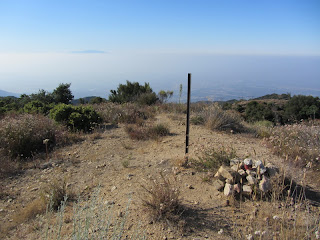
View north toward Monrovia Peak from the summit of Mount Bliss8:29 - Mount Bliss (3720’). Aside from Azusa Peak via Garcia Trail, this is my most visited summit. It doesn’t get much traffic so I’ve always had solitude here. It offers a splendid 360 panorama, which is somewhat muted today by a marine haze. The peak lives up to its name “Bliss,” except for the flies and muffled drone of the 210 Freeway far below. The sun is getting warm now. I sign the peak register. Looks like frequent visitor Gary Meza is addicted to this peak. Forty-five minutes on the summit pass quickly.

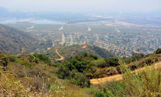
View south9:15 - Leave peak. Sun is warm so I’m glad its downhill all the way. Wildlife encounters for the day include rabbit, deer, lizards, butterflies, squirrel, quail, Steller’s jay, and various other birds. Animal tracks on the road include several snakes and mountain lion. Mountain lion track My pace is fast but I stop frequently to take pictures and soak in the scenery. I appreciate brief sections of shade. Pass the power tower retaining wall and views south to the human sprawl emerge. When I arrive at the locked gate, a mountain biker passes me going down. Pass the power towers and begin a jogging pace—seems easier than walking down the steep road. Occasional breezes are welcome.

View south from Van Tassel Fire RoadI look east across Van Tassel Canyon toward Van Tassel Ridge and wonder how that scene will look once Vulcan Materials begins mining it. It will have an impact but I think it will be better than if they had advanced on Fish Ridge. When I get to the spur trail coming up from Mel Canyon, I take a jaunt to check it out. It’s used a lot by equestrians to access a flat spot on the ridge, but the brushy route coming up from Mel Canon looks less than inviting. Back to the main road at 11:35.

Sunflower11:43 - Done. Car thermometer reads 84 degrees. Seems warmer.

Epilog - Good outing. Solid workout for my body. Watched a new day emerge. Experienced nature. Enjoyed solitude on a trail that has become an old friend. icon

See Mt. Bliss hike description at Dan's Hiking Pages

CameraSee Mt. Bliss hike photo album
 

Sunday, August 7, 2011

Mt. Baldy Hike - August 7, 2011

Looking west from Mt. Baldy to East BaldySee Introducing Mt. Baldy and Mt. Baldy hike descriptions at Dan's Hiking Pages

Mt. Baldy! Time for some high country hiking at its best. When I went to bed on Saturday night I had not picked out a hike for Sunday yet. But somewhere in that netherworld between sleep and consciousness, I chose Old Baldy. It’s been three years since my last ascent, so I figured it was time to pay the grand summit a visit. And I had good hikes under my feet in recent weeks, so I felt I was in condition enough.

Rising 10,064 feet into the sky, massive Mt. San Antonio stands as the crown of the San Gabriels. There are several routes ascending its lofty heights. I decided on Ski Hut Trail, my favorite approach. And if I have time and energy, I’d like to wander over to West Baldy, a summit I’ve not yet conquered.

I arise early Sunday morning, gather my stuff, and make the 40-minute drive to Manker Flats below the Mt. Baldy Ski Lifts. Dozens and dozen of cars are parked at the trailhead. My car thermometer reads 60 degrees. I reach for my sunglasses and they bust in my hand. I reach into the glove box and my other ones aren’t there. Now what? Typical of this hike, there is lots of bright sun reflecting off rock; there is no way to ascend Baldy without eye protection. So I throw the pieces of my sunglasses into my pack and figure if I can repair them with tape from my first aid kit at the ski hut, I’d continue my ascent. If not, I’d turn back and try another day.

View north up San Antonio Canyon toward Baldy Bowl8:00 AM - Begin hike (6160'). The walk along the paved road is a nice way to get warmed up. The canyon is still mostly in shadows. After rounding the bend I can see my destination high up San Antonio Canyon. The green ski hut looks no bigger than a Monopoly house perched on the mountainside. I pass San Antonio Falls, which is still flowing but not as showy as when fed by snow melt. Road is dirt now.

8:22 - Reach subtle junction to Mt. Baldy Bowl Trail, popularly called Ski Hut Trail. It amazes me that such a popular trail to a significant peak doesn’t even warrant a sign. I begin climbing the steep, single track footpath and at 8:27 I sign the register. My pace is deliberately slow and in low gear; I want to give my body the best opportunity to perform well today. flowersThe narrow trail bends north and cuts across the steep canyon slope. The sun is now shining on the shire walls across the canyon. Other hikers, the first of many, pass me heading up. A line of haze obscures the distant valleys to the south. My destination appears far away. I climb higher and higher. The scenery is magnificent. As I cross the stream the ski hut is imminent. Stop to photograph some Indian paint brush and Bigelow's sneezeweed.

San Antonio Ski Hut9:58 - Sierra Club San Antonio Ski Hut. This is always a nice place to rest. I’d like to stay here some time. The views are absolutely amazing. Sitting on a splendid log bench, I go to work with surgical precision to repair my sun classes. After about 25 minutes and several feet of first aid tape, the repair is complete, howbeit, really ugly.

10:40 - Leave the ski hut, cross the stream, and begin my westward traverse along the jumble of fractured boulders at the base of Baldy Bowl. Photos can’t capture the stunning scale of my surrounds. I chat with a man and women from Orange County who are making their first ascent of Old Baldy. Reach the section of trees at 10:56 and begin climbing the canyon’s west wall. The trail degenerates into a web of use paths carving up the steep mountainside. It’s ridiculously steep. It amazes me, given the huge popularity of this route, that a real trail isn’t built here. Trees provide welcome shade. Stop to chat some more.

Looking north on Baldy's South ridge11:35 - Ridge (8800') - Take a planned break and have a snack. Talk with a gentleman who is a member of a search and rescue team. He has a handsome service dog getting a workout on the trail. Begin the ridge climb at 12:05. The route starts moderately but soon begins to climb like a home-sick angel. Manzanita carpets the slopes accented by tall pine and fir. The scenery is spectacular and the sky a deep blue. The air temperature is not bad but the sun is warm. My pace is turtle-slow as I chug up the crazy steep ridge. Hikers coming and going. The massive south ridge of West Baldy dominates the west skyline.

Badly Bowl12:40 - Reach a spur trail and wander 100 feet over to the edge of Baldy Bowl. Looking over the edge makes my feet tingle. In some ways the views from here are far more breathtaking than from the summit. I get out my iPhone and am amazed I have reception. Call my wife and upload a photo to Facebook. Almost feel guilty for being so high-tech in such a ruggedly beautiful setting. Resume at 1:05. Trail mellows out briefly before starting to be crazy steep again. At 1:22 I take another side jaunt for more stunning views into the bowl. The hut is a tiny green dot far below. In another 5 minutes I pass a mini-bowl, a recessed section which would make a good campsite. The route now transitions to the broad apron skirting Baldy’s summit. I continue at a turtle’s pace meandering through patches of manzanita. My excitement builds as I inch closer to the summit.

Mt. Baldy summit 10,0641:57 - Mt. Baldy summit (10,064')! Wow, I’m always impressed with the grandeur of this mountain! About 30 people here. Haze rests on the 360-degree horizon. Weather is perfect. Slight breeze. I chat with the man and women from O.C.--Randy and Kathy. A seven-year-old boy is there with his father. What an accomplishment for such a little guy. My original intent was to stay briefly then hike over to West Baldy, but I linger, soaking in the extraordinary panorama. Hikers come and go. I wander around the bald summit and take pics from different perspectives. As the time approaches 3:00, I debate if I should hike to West Baldy or not. You know, it’s never going to get any easier or more convenient!


View west through north from Mt. Baldy.
West Baldy (9988') is on the left, Mt. Baden-Powell (9399') is in the middle, and Pine Mt. (9648') is on the right.


3:00 - Leave Baldy summit and head west. The trail skirts along the south side of the ridge en route to the saddle between Baldy and West Baldy. I scout the terrain looking for a way to bypass climbing Baldy’s summit on my return. I feel a little excitement as I’m on ground I’ve never covered before. At 3:12 I reach the saddle and begin my summit climb. It’s not bad. I survey the views in all directs to appreciate the varied landscape.

View east toward Mt. Baldy from West Baldy3:20 - West Baldy (9988') - Wow! Great views, better than Baldy in some respects. A rock cluster makes a perfect place to sit. I snack, study the map, and soak in the panorama. One of the grandest summits in the San Gabriels, and I have it all to myself! Hikers on Baldy look like ants. I stroll over to the west edge to get striking views into the East Fork San Gabriel River. The mountains to the west form a picturesque array of textured blue silhouettes in the late afternoon sun. Note to self: Spend the night up here in clear weather!

View west from West Baldy
3:50 - Leave West Baldy and arrive at the saddle in 6 minutes. Along the way I’ve been eyeballing a tangent that would cut across Baldy’s south apron to descend directly to the trail. I see no establish path but an off-trail route looks quite doable. I weave through patches of manzanita and am careful not to descend too steeply so that I don’t undershoot the trail. The plan works nicely and I intersect the trail just above the mini-bowl. Minutes later I reach the mini-bowl and stroll over to the edge of Baldy Bowl for another view. Spectacular scenery! Continue down the ridge, navigating the steep, rough web of paths with care. Hardly anyone now on the trail and I’m feeling some solitude.

Dusk in San Antonio Canyon5:02 - Reach the ridge junction (8800'). Sit and have a snack. Leave at 5:15 and begin the steep descent east into the canyon, now mostly in shade. Cross the base of Baldy Bowl and arrive at the ski hut at 5:45. A group of hikers ask if I heard someone calling for help. I hadn’t. Soon a helicopter appears overhead and for the next 30 minutes the chopper noise provides the soundtrack for the hike. My legs are weary now and I’m ready to be done. My steps are slow. The lighting is very different. Only 11 people signed the register for the day. Arrive at road at 7:12, finally. Enjoy a casual stroll down. The setting sun creates a picturesque scene toward the valley below.

7:35 - Done. Yahooo! What an amazing 11 ½ hours. It’s 74 degrees. There’s only about 8 cars left. I’m so ready to be home in the shower.

Epilog - Spectacular day of hiking! Magnificent scenery, wonderful weather, a challenging trail, some adventure, and two grand summits. Mt. Baldy lives up to its place as the crown of the San Gabriels. And adding West Baldy to the day was an added bonus. icon

See Introducing Mt. Baldy and Mt. Baldy hike descriptions at Dan's Hiking Pages