Friday, December 31, 2010

Echo Mt. and Rubio Canyon Hike - December 27, 2010

Echo MountainSee Echo Mountain Hike Description and Rubio Canyon Hike Description on Dan’s Hiking Pages

A rain storm that started on Christmas evening and carried over to the next day cleared up for an absolutely gorgeous day for hiking. Thankful for a week off from work between Christmas and New Years, I was eager to hit the trail for a final hike to conclude 2010. With all the rain we have had, this is certainly a great time to visit a waterfall. But the exceptional visibility drew me to a high place instead—Echo Mountain above Altadena.

On my drive from Azusa to Pasadena, the beauty of the mountains after the rains is striking. I find a place to park on Lake Avenue near the Cobb Estate trailhead.

On Sam Merrill Trail to Echo Mt. 12:31 - Begin my hike. The weather is perfect...sunny, clear, low 70s. I love the greenness of everything! On the Sam Merrill Trail, I begin my 2.5 mile ascent. Lot of people on the trail. My pace is brisk. I am captivated by the beauty of the surrounding mountains and the ever expanding view of the human sprawl below. Virtually nothing in bloom. Red toyon berries add a splash of color. I am peeved by the thoughtless dog owners who believe that they are exempt from leash laws and common courtesy.

12:55 - One-mile marker. Really enjoying the hike. Sun feels good. Sky is so blue. Views are great. Chaparral is fragrant. Pass the two-mile marker at 1:23. Further up in Las Flores Canyon now as the city views narrow. Can hear water flowing deep in the canyon below. Can see all the way to Catalina Island.

Foundations of Echo Mountain House hotel1:41 - Arrive at the old rail bed junction. My thinking is to head north to the Cape of Good Hope, but first I’ll take a quick look around the Echo Mt. ruins. Snap pictures of the various signs, machinery, and foundations. Others are enjoying the site as well. As I stand on the grand steps of the historic Echo Mountain House, I imagine ladies with parasols and men in derbies...100 years ago. I’ve been here four times before, so I’m not sure why my inclination to again explore this historic site trumps a “quick” visit. I yell through the echo phone, and yup, there’s still an echo.

Leontine Falls
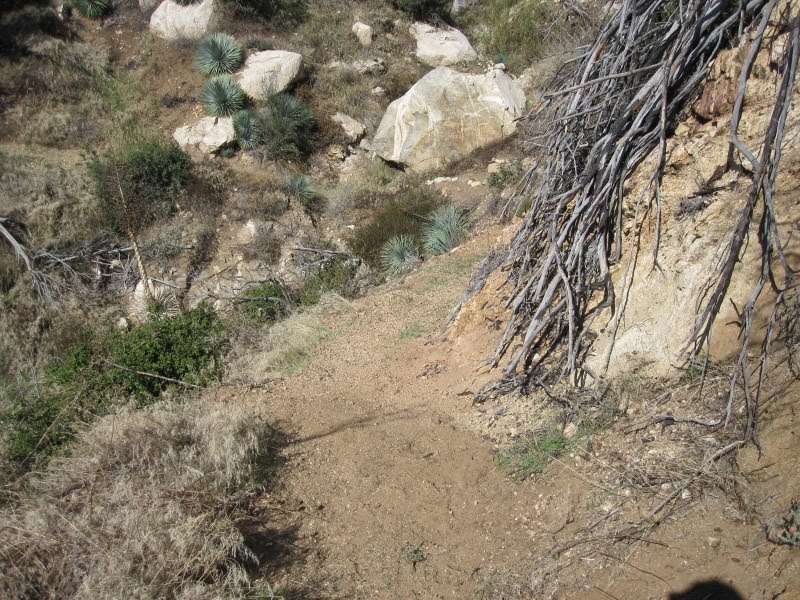
I wander over to the site of the chalet and continue following the trial east toward Rubio Canyon to get a pic of Leontine Falls. I’ve explored some of these trials before, but I don’t recall where this one leads. A ways down the trail, I sit on a rock and have some lunch while enjoying an excellent view of the old incline tram bed and the southland beyond. I relish the solitude (I’m sure that the vast number of Echo Mt. guests don’t venture over here). At 2:37 I continue down the trail, thinking that it probably bends north up canyon, if my recollections are correct. But it continues to zigzag east into Rubio Canyon. I finally decide that I’m not going to climb back up to Echo Mt., so I sure hope this trail ends someplace favorable! It bends south and shortly I see in the distance that the trail intersects the incline tram rail bed.

Incline Tram rail bed3:00 - Arrive at the incline tram rail bed. I’ve been here before, only that time I had climbed from the bottom. A route clearly heads down, but I don’t readily discern a route heading up. I begin my steep descent. The path zigzags down the old tram bed. My steps are guarded. I take pics of railroad remnants. Bypass the chasm which had been spanned by “Macpherson Trestle.” Descend the tram bed through “Granit Gorge.”

3:33 - Arrive at Rubio Canyon Trail. Of course, before I turn south to head home, I’m compelled to boulder hop upstream the quarter mile to visit the waterfalls. The creek is flowing briskly. My pace is slowed by finding the route, fording the creek numerous times, and negotiating the foliage that has grown since the creek bottom was laid bare in the October 2004 storm. At several points I pondered if it is even wise to proceed. But I pressed on. A father and son pass me as they head down.

Ribbon Rock and Moss Grotto Falls3:52 - Arrive at Ribbon Rock and Moss Grotto Falls. What a beautiful site! Direct sunlight still lands on the upper falls. I know I can’t linger long because sunset is in less than an hour. I explore the area and take lots of pics. Been here four times before...twice before the falls were covered with rocks, and twice after the October 2004 storm restored the falls.

View toward L.A. on Rubio Canyon Trail4:04 - Leave the falls. I’m more confident now negotiating the boulder-strewn creek bed. I arrive back the old pavilion site at the lower end of the incline tram at 4:20. Beyond the ruins I pick up the main trial and am relieved to be on nice path. The sun still alights on sections of the canyon. The trail is newly washed out in several spots making for some dicey moments. The creek is far below. My pace is casual as I soak in the beauty of the canyon at day’s end. The distant downtown L.A. skyline silhouetted in an orange sea of haze emerges through the V-shaped canyon mouth.

4:42 - Arrive at the Rubio Canyon Trail trailhead at the corner of Rubio Vista Road and Pleasant Ridge Drive in the middle of a residential neighborhood. The warm glow of the setting sun is beautiful. Now for the task of navigating a walk back to my car on Lake Avenue. The map I have with me is virtually useless. I walk down the street and once on Rubio Canyon Road, I discover Altadena Crest Trail running alongside the drainage wash. Looks like it’s heading in the right direction, so I give it a try. Shortly I meet a couple walkers who confirm that this route will take me where I want to go. In a few minutes it transitions into a creek bed and in a few more minutes I am pleased that it delivered me to the beginning of Sam Merrill Trail.

5:13 - End hike, back at car. What a thoroughly enjoying outing! Fantastic weather, dramatic scenery, green hillsides, historic ruins, a gushing waterfall, and a serendipitous adventure with a favorable ending!

Rubio Canyon Trail MapMap Note: At the Rubio Canyon trailhead, a white box sitting against a sign post contained copies of a line map (provided by Paul Ayers). One side showed Rubio Canyon Trials, and the other side showed Mt. Lowe Railway Trails. From it I learned that the trial I took from the chalet is Chalet Trail, then turns south and becomes Old Echo Mountain Trail, and the final piece is Incline Trail. icon

See blog posts from other hikes in Rubio Canyon:

See Echo Mountain Hike Description and Rubio Canyon Hike Description on Dan’s Hiking Pages
 :

Wednesday, December 1, 2010

Summit 2843 Hike - November 26, 2010

Looking south toward Azusa from Summit 2843See my Summit 2843 Hike Description on Dan’s Hiking Pages

Great weather, a day off from work, and the need to work off a Thanksgiving meal create the perfect recipe for a Black Friday hike. I decided on Summit 2843, a conspicuous peak standing guard at the month of San Gabriel Canyon in Azusa. I’ve hiked it a few times but it’s been five years since my last visit. I’ve never seen it written up anywhere, so it was one of those hikes that I just forged. The last time I hiked it the route suffered from mud slides, downed trees, overgrowth, and poison oak obstructions. I figured it was time to check the trail conditions and update my webpage.

An eight minute drive from my home in Azusa gets me to the trailhead near Morris Reservoir on Hwy 39. The temps are pleasant enough to stash my long-sleeved shirt in my pack.

Toyon (Heteromeles arbutifolia) aka Christmas berry, California holly, holly wood10:15 AM - Begin hike up 2N28, Silver Fish Road, an abandoned fire road. The grasses are lush green from the good rains we’ve had this season, a big contrast to the brown deadness of the dry months. The air is pleasant in the sun and brisk in the shade. Frost is in patches. Autumn leaves and the bright red berries of the native Toyon bush (aka holly wood) add a dash of color to the scenery. Virtually no flowers are in bloom except for a few occurrences of fuchsia and mustard. It’s quiet here except for the sounds of vehicle traffic on Hwy 39 below. The water in Morris Reservoir is green.

View east toward Glendora Mt. and Mt. Baldy11:30 - Arrive at the descending/ascending ridge which will be my return route. For now I continue on the fire road as it bends northwest into Water Canyon. The large landslide that had covered the trail a few years back is not an issue now as hikers have beaten a path over it. There is no water in the small waterfall, even after some rain earlier in the week. As I reach the location high in the canyon where the trail cuts back to the east, I am pleased that the jungle of poky trees that had previously impeded progress has been thinned out by helpful humans. And I am relieved that the barricade of leafless poison oak has a clear path through it. Further up the trail the deadfalls have been removed. The views open up east and I get my first glimpse of snow-covered Mt. Baldy. I’m soaking in the beauty of the autumn chaparral. Across the canyon toward Glendora Mountain, barren hillsides left by last year’s Morris Fire are a stark reminder of how devastating fire is. The chaparral grows back, but it takes many years to become mature. I am thankful that my present trek takes me through rich landscape.

Climbing the buckwheat-covered firebreak11:29 - Arrive again at the descending/ascending ridge. A left (east) would take me down (my return trip), but I shall turn right and climb the old firebreak. The path is not terribly steep as its snakes through a sea of California buckwheat. I break out my pruners and trim a scrub oak that is intruding into the path. The sky is blue and the sun feels good. Soon Pine Mountain comes into view to the north and the panorama of Mt. Baldy and its neighbors to the east.

12:05 - Arrive at the upper and final intersection of 2N28. Before I continue up the firebreak, I decide to turn right (north) and follow the road to the saddle. It is quite brushy in spots. I stop several times and do some trimming.

12:35 - Arrive at Saddle south of Silver Mountain. Great views down into the upper reaches of Roberts Canyon and across to Mt. Bliss and Monrovia Peak. I can see the remains of the old Silver Fish Road (2N28) as it meanders northwest toward White Saddle. Have snack and change my camera battery. I decide to press on past the knob on the saddle to the base of the Silver Mountain route. It’s quite brushy and I do some trimming. An old washout poses some risk to negotiate. Glad I brought along my trusty old ski pole to aid me.

Silver Fish Road heading into Robert's Canyon1:15 - Arrive at the base of the Silver Mountain route where 2N28 crosses over to the Roberts Canyon watershed. On a previous expedition, dense brush blocked the route after about 200 yards or so. I press further to see how it is now. Someone had trimmed some brush and the route is now passable. I venture on wondering how far I can go, trimming brush along the way. At 1:42 I reach a washout that requires climbing along a rock face with a steep drop off. Looks pretty dicey and I decide not to take the risk. One essential rule in hiking solo is to “know when to hold ‘em and know when to fold ‘em.” I turn back and retrace my steps to the Silver Mt. junction. I veer right, deciding to walk along ridge over the knob only to find it drops off sharply making a very precarious climb down—a moment of déjà vu from a previous hike. I pass through the saddle and then on to the descending/ascending ridge route and arrive there at 2:40 (that side jaunt took 2 hours and 35 minutes). The sun is over the ridge now and the deep shade and cools temps are a very different feel from earlier. To reach the summit and return, I will be flirting with a 4:45 sunset and freezing nighttime temps. But this time I “hold ‘em” and turn west to climb the old firebreak.

 View south along the ridge toward the crescent2:50 - Arrive at the ridge divide. Sun feels good. To the north, I ponder if the route climbing from the saddle is still doable. It looked pretty brushy from the saddle. I turn left (south) and start my climb following a web of use paths up the ridge. Soon the ocean to the southwest comes into view appearing as a shiny gold band reflecting the late afternoon sun. In another three minutes the summit guarding the north approach to Summit 2845 comes into view. I press along the buckwheat-covered ridge and descend into the meadow-like crescent with soft green grass. I spot a deer on the distant ridge. She is aware of my presence as she bounds down the other side. I curve around the crescent, climb a steep, grassy pitch, and come again into the sun as I spot my destination up ahead, marked by a lone eucalyptus tree.

View east toward Mt. Bliss and Monrovia Peak3:19 - Arrive at Summit 2843. There’s no geological survey marker or summit log on this unnamed peak, but it has become a friend. The 360 degree panorama is rewarding. A number of familiar peaks are in view. That vast expanse of the San Gabriel Valley sprawls before me to the south. There is a slight breeze but the temps are still pleasant enough to be in short sleeves. I sit near the eucalyptus tree and have a snack. No cell reception. The new Target store a few blocks from my house in Azusa appears as a big white square dominating the tree covered neighborhoods.

Morris Dam3:45 - Leave Summit 2843. My pace is earnest. The afternoon sun casts a warm light on the mountains to the north and south. The crescent meadow is now in shade but I soon emerge into more sunlight. Takes 15 minutes to reach the descending/ascending ridge junction heading east. I leave the sunshine and begin my descent. Much cooler in the shade. Only 45 minutes until sunset but I should be fine as long as I keep making good time. I pass over 2N28 at 4:09 and again at 4:24. Now I’m on the section which I have not done yet today. Shortly the last vestiges of the sun alight upon Glendora Mountain and Mt. Baldy. At 4:38 I begin the incredibly steep section. It’s not as bad as I had feared from my recollections and I reach 2N28 at 4:47 as the sun disappears from the distant peaks. I never did stop to put on my long-sleeved shirt. The evening air and my walking pace are brisk now. The path is gentle and the aromas pleasant. I savor the last minutes of a splendid outing.

5:02 - Finish. The car thermometer reads 42 degrees but it quickly increased to 51. What a thoroughly enjoyable hike! On this Black Friday where hordes of humanity invade the shopping malls, I experienced the solitude and beauty of our amazing San Gabriel Mountains just minutes from my home. I am truly thankful to an awesome Creator for such a rich treasure and the health to partake of its rewards. icon

See my Summit 2843 Hike Description on Dan’s Hiking Pages
:

Monday, November 8, 2010

Upper Bear Creek Trail Maintenance - November 6, 2010

On Upper Bear Creek Trail See Smith Mountain Via Upper Bear Creek Trail Description on Dan's Hiking Pages

In June 2003 I discovered the San Gabriel Mountains Trailbuilders. What a great find that was. I had gone to the Forest Service office in Glendora to find out when the Crystal Lake area would be reopened (it had been incinerated by the Curve Fire a year earlier). The gal told me that it was still closed and that they had no idea when it would be reopened (it's still closed at this time, Nov. 2010!!). She told me that there was a group called the San Gabriel Mountains Trailbuilders who are working on the trials at Crystal Lake. Hmmm, the back door in! So I showed to work with the SGMTBs on Saturday, June 21, 2003. My ulterior motive was to see the Crystal Lake area. But I so thoroughly enjoyed the trailbuilding experience that I became a regular volunteer with organization. They are a great group of men and women who volunteer their time to work on trails, primarily in the San Gabriel River watershed. The regular work days are the first, third and fifth Saturday of each month.

Fast forward to November 2010, it had been awhile since I had been out with the Trailbuilders, so I decided to hit the trail with them. Our project for the day is routine trail maintenance on Upper Bear Creek Trail, which climbs three gentle miles from Hwy 39 in the San Gabriel Canyon to Smith Saddle (4260' est.). Joining us would be some scouts and adults from Troop 501 in La Canada.

Gathering at the Upper Bear Creak TrailheadI arrive at the San Gabriel Canyon Gateway Center in Azusa a little before 8:00 a.m., the regular meeting location. We pile into cars and head up into San Gabriel Canyon on Hwy 39. At 8:20 we arrive at the Rincon Fire Station to load the equipment. Trailbuilder Bron Draganov gives a brief overview of the day. We load up and continue up Hwy. 39 and arrive at the trailhead at 8:50. Bron presents a safety briefing and explains some fundamentals of trailbuilding. We split up into two groups. One would hike up the trail about 2.5 miles and work their way back. The other would start near the lower end and work their way up.

View southwest toward Smith Mt. from Upper Bear Creek TrailArmed with McLeods, mattocks, loppers, and leather gloves, we begin hiking up the trail at 9:03. I am with the first group, which consists of three trailbuilders, three scouts, the scoutmaster, and scout grand mother. The weather is nice and everything is greening up nicely from our recent rains. This area was incinerated in the 2002 Curve Fire, but it has rebounded well. The storms the following year significantly damaged the trail, completely washing out some sections. In late 2005 the Forest Service hired a trail contractor to repair the trail. And the San Gabriel Mountain Trailbuilders has worked a lot on this trail over the years. Today, the trail is in good condition except for some plants intruding into the path in places and the need for some general tread work.

Preparing to workOur pace is little slow. Pass the one-mile maker at 9:37. Not much in bloom. The sycamore and poison oak are beginning to display fall colors. Clouds are drifting in overhead with some chance of rain late afternoon or evening. Pass the two-mile marker at 10:16. The pointed summit of Smith Mountain looms to our southwest. At 10:22 we arrive at our destination, a rock face which had required some dynamite work a couple years ago to restore the trail. I proceeded onto Smith Saddle while the others began trial work heading down. I do some light work as I hike.

Restored section of trailAt 10:49 I come to section of trial which is worthy of concerted effort. I go to work removing dead branches which were hanging into the trail. Next I removed some rocks and debris, flatten the birm on the outside edge, remove some plants in the trail, and regrade the dread. An hour of work makes big difference...feels good. I continue up the trail and shortly encounter a deer hunter. He is waiting for his three friends who are coming down the trail. They've not bagged anything yet and tomorrow is the last day of hunting season. I continue up the trail, pass the three hunters, and at arrive at Smith Saddle at 12:11.

view from Smith Saddle northeast toward South Hawkins and the winding Upper Bear Creek TrailIt's cool and breezy now. I was here on July 18, and like at that time, the summit of Smith Mountain calls to me but I must stay on task. Take some pics, have lunch, and leave the saddle at 12:38. Aside from snapping some pics of a few plants, I proceed directly down the trail and meet with the rest of the group at 1:25. We continue to remove plants from the trail and rework tread. The cool weather is welcome. At 2:00 we stop work and begin our homeward decent. We traverse sections of trial that have been nicely worked by the other group. We arrive at the trailhead at 2:44, 15 minutes before the designated rendezvous time. We stash our tools back in the truck, say our good-byes and hit road.

A good day on the trail. It's always hard work but very rewarding. And it's always good to have Boy Scouts working us. Why not come out some Saturday and experience trial work for yourself? icon

Visit the San Gabriel Mountains Trailbuilders website

Read my Smith Saddle Blog - July 18, 2010

See Smith Mountain Via Upper Bear Creek Trail Description on Dan's Hiking Pages
 :

Friday, October 22, 2010

Henninger Flats Hike - October 22, 2010

Eddie and John at the entrance to Henninger Flats See Henninger Flats Hike Description on Dan's Hiking Pages

Got an email from my friend, John, inviting some of his friends to celebrate his birthday with him on a night hike to Henninger Flats. Sounded fun. I’ve not done much hiking at night so welcomed the new experience. We’ve been having rain throughout the week, so that was my main concern. But what hay, if we get stuck in a rain storm, we’ll have a memorable story. I have hiked to Henninger Flats several times, so I look forward to climbing it at night.

Leave my office in Los Angeles and ride the Metro Gold Line train to Sierra Madre Villa Station where John picks me up a little after 7:00 p.m. We park at the intersection of Altadena Drive, Roosevelt Avenue and Midwick Drive in Altadena. His friend, Eddie, meets us here. We get acquainted and find that we share similarities in our life journeys and passions. We linger at the trailhead for a few minutes to see if any others of the invitees would show up. Turns out we will be a threesome.

7:43 - Begin hike. We descend the narrow "Midway" trail, as I call it, into the Eaton Canyon wash. A full moon is slatted for this evening but it is hiding behind the clouds at this point. I love the aromas of the chaparral after a rain. The air is cool and there is a slight breeze. We cross the wash and have no problems fording the stream...except for me...I step on a rock without realizing it is underwater! Things look differently at night!

Arriving at the north side of the wash at the main Eaton Canyon Trail, we decide to turn right (east) to ascend the Walnut Canyon trail to reach Mt. Wilson Toll Road (rather than walking the 0.4 mile west to the bridge at beginning of the road). Our only concern with this route is that it might be muddy and slippery from the rain today. Start our ascent at 7:51 and find the trail to be fine. We enjoy good conversation as we navigate the 12 switchbacks. The full moon reveals itself through the patchy clouds. There is quite a bit of light but we continue to use our lights on this section of the hike to avoid footing mishaps. At 8:15 we arrive at the Toll Road. It's interesting how one can work up a sweat on a cool evening. I shed my long-sleeved shirt.

View south toward the San Gabriel ValleyWe amble along the wide dirt road with a southern panorama of twinkly lights of human sprawl. The moon fades in and out but the light is sufficient to guide our steps. Stop at one of the conveniently placed benches while John fixes his sock. Our conversation bounces around a range of topics from hiking, politics, spiritual life, wildlife, and life experiences. Time seems to fly and I'm a little surprised when we arrive at the Henninger Flats sign, about 2.5 miles and 1,300 feet in elevation gain.

9:19 - Henninger Flats (2550). We turn right (east) and climb the trail to the upper campsites to get a good vantage point. We are hoping to be able to see the Disneyland fireworks, which happen about 9:30. We greet some campers who are spending the night. Find a good spot on the road and sure enough, the visibility is sufficient to see the pyrotechnic display many miles south in Orange County. We linger quite awhile enjoying each other's company and the special atmosphere of nighttime in the forest.

Dan, Eddie and John the birthday boyAt 10:30 we finally leave, following the road back down through the flats. As we stroll along we reflect on Psalm 19: "The heavens declare the glory of God; the skies proclaim the work of his hands. Day after day they pour forth speech; night after night they display knowledge. There is no speech or language where their voice is not heard." And we appreciate that God not only reveals his existence through his creation, but also he reveals himself personally through his Word: "The law of the Lord is perfect, reviving the soul. The statues of the Lord are trustworthy, making wise the simple…sweeter than honey from the comb."

We arrive at the top of the Walnut Canyon trail at 11:30. Linger for a while then begin our descent, headlamps lighting the way. Reach the main trail at 12:28 a.m. Hmmm, this may be the first time in my life that a single hike (besides backpacking) has spanned two calendar days. Wander back across the wash, up the final pitch, and arrive at the trailhead at 12:44.

Epilog - What a thoroughly enjoyable way to spend a Friday night! Great company, beautiful nighttime surroundings, pleasant temperatures, full moon, freshness of recent rains, fireworks, a new friend, and the celebration of a birthday. Happy birthday, John! Thanks for including me on this special day! icon

See my Henninger Flats Hike Description on Dan's Hiking Pages
 

Sunday, October 10, 2010

Mt. Hollywood, Mt. Bell Hike - 10-10-10

View south from Mt. Hollywood
Griffith Icon It’s 10-10-10, how cool! I had to do something to commemorate the date...so a hike was it. My plan was to drive into my office on Saturday in LA to get some work done in preparation for a full week, then do a late afternoon hike in Griffith Park. As I drove the 210 and 134, the beauty of the day grabbed me. Instead of transitioning to the 2, I couldn’t resist the gravitational pull of Griffith Park. I ended up at the observatory and got a great parking place on the road just a few steps below the Charlie Turner Trailhead.

11:00 - Start hike at the Charlie Turner Trailhead on Mt. Hollywood Trail heading north. The weather is warm and sunny but not too hot. I am vitally aware of the fact that I have never hiked in Griffith Park in the morning. All my hikes have been in the late afternoon after work. So my pace is brisk with the intent of standing on Mt. Hollywood in the morning. I’ve hiked this trail a number of times but I’m busy snapping pictures because I have never experienced it in this light.

Looking north toward Mt. Hollywood
11:04 - Transition to the ridge trail just past the bridge. I figure I’ll take the most direct route. The trail is somewhat steep but certainly more like real hiking than a stroll on a wide dirt road. The views are quite striking today.

11:11 - Reach the junction south of Mt. Hollywood. Veering left would take me past Captain’s Roost; veering right would take me past Dante’s View. But I head straight up the ridge, continuing on the most direct route. The sun is warm.

View west toward Mt. Lee from Mt. Hollywood
11:16 - Mt. Hollywood (1625'). That was fast! To my surprise there are only two people here. On every previous visit, there has always been a small crowd. Great views today. I look north and see Mt. Bell and figure I can reach it while it is still morning.

11:20 - Leave Mt. Hollywood and head northeast. I love the scenery in Griffith Park and the panoramas beyond. In minutes I reach the major junction and continue straight along the ridge. I am aware that this is the first time I have hiked this section of trail going this direction.

11:28 - Transition to the narrow trail climbing the north ridge of “Baby Bell” (the unnamed summit to the southeast of Mt. Bell). I am really enjoying the midday light…I can take pictures in all directions without the deep, late afternoon shadows that I am used to. Virtually nothing in bloom right now. Curve around the east hip of Baby Bell and now enjoy the views north with Mt. Bell in my sights to the west.

11:33 - Saddle east of Mt. Bell. I start ascending the east ridge, the shortest route to the top. I notice that someone has cleared a lot of brush from along the trail, making the climb easier.

View south from Mt. Bell toward Mt. Hollywood, Griffith Park
11:37 - Mt. Bell (1582')…my fifth time here this year, and each time has been from a different route. I really enjoy the views from this summit. I especially like being able to look west toward Mt. Lee (Hollywood Sign) and Cahuenga Peak without squinting from the setting sun. View west from Mt. Bell toward Mt. Lee and Cahuenga Peak The brush trimming efforts came all the way to the summit and several prominent bushes have been removed. I don’t know what the purpose was; it decreases some of the shade, but does increase the views. See a line of equestrians on the dirt road below.

11:50 - Leave Mt. Bell heading southwest. The brush clearing makes this route easier, but it’s still steep in places with loose footing. I take careful steps.

Horseback riders on Mt. Hollywood Drive
11:55 - Arrive at main trail. Count 109 paces from there west to the saddle junction. I continue west, then cut left down to paved Mt. Hollywood Drive heading south. Lots of people using the main trails today. Some on horses. Some with dogs. I pass by Mulholland Trail junction (#43) and continue south. I’m now on a portion of trail (paved road) which I’ve never been on.

12:14 - 3 Mile Trail junction (#37). This will be my route, but I continue on another 100 yards to check out the large rock outcropping that predominately sits high on the eastern slopes of Brush Canyon. It’s quite impressive. I scamper around and explore it. There is still water pooled in some of the recesses left over from the rains earlier in the week.

12:34 - Back at 3-Mile Trail junction. Begin my ascent. I’ve not been on this trail before so I’m enjoying some different perspective on the scenery. I’m loving the clear skies and great views of the surrounding hills and human sprawl beyond. Soon reach a hairpin turn that cuts back east and now briefly have views south. Pass below water tank 151.

Dante's View, Griffith Park
12:49 - Junction north of Mt. Hollywood. I continue straight (east) and arrive at Dante’s View in about three minutes. Refresh my water bottle at the water fountain. Wander around Dante’s View—a sprawling hillside garden—and enjoy snapping some pics in the midday light. The benches, picnic tables, and serenity of the garden are most inviting, but no one is here but me. After 10 minutes, I continue southwest.

1:06 - Junction south of Mt. Hollywood (my 11:11 location). I retrace my steps south along the path that drops to the west of the ridge and soon meet another multi-route junction. I continue down to find myself in a web of trails that end up dropping steeply to the road below. I think I took a wrong turn! I climb back to the multi-route junction and realize I should have turned right (west) rather than going straight south. Chat with a family visiting from Germany. Follow them down the correct path.

1:29 - Arrive at the bridge. Those last few steps are really dicey. Continue south across the bridge. At the Berlin Forest I note the sign that the points in the direction of Berlin—5,795 miles away. Wow, that German family is far from home! Soon my car comes into view parked along the road below.

Griffith Observatory
1:35 - End of hike, back at the Charlie Turner Trailhead. I wash up at the restroom and pay a short visit to the observatory. I love this amazing landmark. The air conditioning inside feels good. Lots of people. As I head back to the car I see a helicopter approaching the summit of Mt. Hollywood. It looks like it's going to land. It does land, kicking up a huge plumb of dust. Wonder what that’s about. View north toward Mt. Hollywood

Epilog - Really an enjoyable hike on 10-10-10. Warm and sunny, but not unbearable. Great views. This year has been the year of hiking Griffith Park for me. This special place has really become a dear friend. With the seasons changing and daylight getting less, it may not be until next spring before I do another after-work hike in Griffith Park, so I will have to savor this one. icon

Griffith Icon  See Hiking Griffith Park at Dan's Hiking Pages
 (includes links to my other blog posts for hiking in Griffith Park)

Boot IconSee Mt. Hollywood via Griffith Observatory hike description at Dan's Hiking Pages (Detailed trail guide with options to Mt. Bell, Mt. Chapel, Mt. Lee, and more)

NEXT > Mt. Lee and More in Griffith Park Hike - March 9, 2011 (Mt. Hollywood, Mt. Chapel, Mt. Lee, Cahuenga Peak via Griffith Observatory)
PREVIOUS > Griffith Park Six Peaks Hike - August 5, 2010 (Bee Rock, Mt. Chapel, Mt. Bell, Mt. Hollywood, Glendale Peak, Beacon Hill via Old Zoo Park)

Saturday, September 25, 2010

Fish Canyon Falls Hike - September 25, 2010

Fish Canyon Falls with no water
See Fish Canyon Falls Hike Description at Dan’s Hiking Pages

The 80-foot, three-tier Fish Canyon Falls is one of the finest in the San Gabriels and the two-mile trail to get there is a treat. I’ve hiked it many times since it is practically in my backyard in Azusa. Most of my hikes in Fish Canyon over the years have been when Vulcan Materials offers one of its access days where they provide free shuttle service through the query to the start of the trail. In looking at my hike log, I noticed that all my hikes in Fish Canyon have been in January through July except for one in November. So I decided to see what Fish Canyon is like in early fall.

Vulcan Materials Fish Canyon access day
7:07 a.m. - Sign the log at Vulcan Materials office. There are five other parties with a total of 18 hikers who have already signed in. Take the short van ride with Peter, Anna, and Rima. They have used my website. We chat as the van takes us to the start of the trail.

7:10 - Start the hike. It’s not hot yet but it’s not cool either with the weather forecast to hit 100 today. There is water in the creek at this point but it is not flowing. I take a fast pace. Fall colors are beginning to accent the scenery. Brown leaves crunch beneath my feet. I often wonder what our local plant communities would have looked like prior to the introduction of various non-native grasses and weedy plants that turn brown shortly after the rains stop in the spring.

Heading north on Fish Canyon Trail
Many of the trees are much leafier now than in the spring when I usually hike Fish Canyon, giving a different feel to some of the sections of the trail. The red fruit of the holly-leaf cherry (Prunus ilicifolia) is in abundance along the trail. I don’t recall having seen this ripe fruit on hikes early in the season.

Just past the “spiral staircase” several young branches of poison oak span the trail. I wonder if the hikers before me navigated it safely or if they’ll be itching like crazy in a couple days. I don’t have my clippers with me so weigh the branches down with rocks.

The tributary at Darlin’ Donna Falls is flowing but I keep going without taking the side jaunt. I arrive at the main creek crossing and find it to be completely dry. I suspect that this is a harbinger of what I’ll find at the falls. Climbing now on the east canyon wall and my final pitch. As I get closer I can hear the noisy voices of hikers at the base of the falls but hear no water.

Fish Canyon Falls with no water
7:55 - Fish Canon Falls, 2.0 miles from the start. No water falling today. There is water in the lower pool but the main pool is virtually dry except for a little puddle at the rock face. There are 10 people here, and they are quite noisy. Perhaps the absence of the roaring sound of water is why the people’s voices are notably loud. I visit with Peter, Anna, and Rima, who arrived after me.

8:35 - Leave the falls, right after Peter and company. Cross the creek and step into the first direct sun of the morning. Arrive at the Darlin’ Donna tributary and invite the others to join me to see if the falls are flowing. We scramble up the ravine a stone’s throw and find Darlin’ Donna Falls flowing nicely! I run face first into some poison oak. Cleanse it well with mugwort and water; I’ll know if that does the trick in a few days [it worked]. Take a pic of a butterfly. Back on the trail I stroll along. Sun is now warm. Pace is slow as I take time to photograph some plants. I pass periodic parties of hikers coming up the trail. .

Looking south in Fish Canyon
As I approach the quarry and its massive rock walls, I wonder about the disposition of Vulcan’s plan to mine of the west slopes, still pending the signature count for a referendum.

9:44 - Finish hike. Wait at the footbridge for a few minutes for the van to arrive. Back at the Vulcan office I sign out at 9:51. There are 74 hikers who have signed in at this point.

Fish Canyon Trail
Epilog - An enjoyable outing. I can always expect a hike to Fish Canyon Falls to offer varied experiences. Met some nice people, enjoyed some fall colors, and experienced the unique setting of a dry waterfall (had seen Fish Canyon Falls dry only once before: July 7, 2007). Always appreciate Vulcan Materials providing these access days. icon

See Fish Canyon Falls Hike Description at Dan’s Hiking Pages (including links to my other Fish Canyon blog posts)

NEXT > Fish Canyon Falls Hike - January 29, 2011
PREVIOUS > Fish Canyon Falls Hike - March 27, 2010