Thursday, March 13, 2014

Old Zoo Park to Bee Rock and Mt. Bell - March 13, 2014

View west toward Bee Rock from Old Zoo Park
Griffith Icon It’s almost spring and a great time to hike in Griffith Park. Part of my job at work is to facilitate meetings, and this week we have meeting participants from all over the country in town. As the week unfolded it turned out that the meeting would end a half day early today. During weeks of previous meetings, I’ve had the pleasure of hosting Jeff (Kentucky) and Loren (Kansas) to hikes in Griffith Park. They were both up for a hike today and after mentioning it to Dave (Washington), he was in too.

So we pile into my car and head to Griffith Park. As we arrive at the Old Zoo parking lot, we found that the area is being used for filming a sitcom and the lot is closed off to cars. Thankfully there is a close-by parking place available.

Walking west through Old Zoo Park
2:35 p.m. - We begin our hike by walking west along the closed-off parking area. The production crew is up ahead so I decide to bear left and take the guys through the old zoo. It’s a worthwhile side jaunt as we enjoy walking past the zoo enclosures which housed the small assortment of animals from 1912 to 1965. Up on the mountainside 600 vertical feet above us, Bee Rock stands as an imposing mass. The warm sun, pleasant temps, and gentle breeze provide perfect hiking weather. Stately sycamores are now in full leaf after their winter hiatus. We enjoy good conversation as we stroll along.

We pass through the pedestrian opening in the chain link fence and transition unto Bee Rock Trail, a wide dirt road climbing west. I point out some of the plants along the way. This is Dave’s first time hiking in Griffith Park and he is impressed by the rugged beauty and remote feel right in the heart of Los Angeles.

On Bee Rock Trail from Old Zoo Park
The heavy rains we had two weeks ago have brought a freshness to the plants. There is nothing in bloom yet except for a lone eupatory. Soon the wide road ends and our route cuts left turning into a narrow path. Now this feels like hiking. We enjoy the views opening up to sprawling Glendale and beyond. I point out some of the landmarks. The marine layer from this morning has left hazy skies. Lemonade berry joins my blooming list. High above us, a couple ladies stand atop bee rock. We’re having a great time. We reach the ridgeline and turn left (east) for our final steps.

View east toward Glendale from Bee Rock in Griffith Park
3:19 - Bee Rock (1056’). I’m always impressed with the amazing views from this protruding pinnacle, aside from the horrid, rusty chain link fence. The abundance of graffiti is a stark reminder of how blighted mankind is. A cool breeze feels good. We take some pics and enjoy the scenery. I point out Mt. Bell to our west, our next destination.

We leave the summit at 3:29. A four-minute walk along the fenced ridge brings us to the paved Vista Del Valle Drive. It still makes me sad that the early guardians of the park felt the need to carve up this beautiful island of natural space with wide roads. We veer right and saunter west on the paved road. Shortly we arrive at trail junction 16, one of the very few navigation posts left in the park. We turn left (south) and begin our climb up the steep dirt road. I point out the tender young leaves of poison oak as it emerges from its winter siesta. We enjoy the warm sun and expanding views.

Climbing a use path on the east flank of Mount Bell
At junction 39 (yes, another sign post!), we turn right for a short descent. Within a minute we notice a steep use path heading west up the slope toward the summit of Mt. Bell. It looks like the path gets a fair amount of foot traffic, suggesting that it may be a doable route to the top. From my observations from Mt. Bell on previous trips, I’ve noted that there is a network of paths heading in various directions. I toss out the idea of an adventure and the guys are eager to give it try. So up we climb. It is quite steep and is still damp from the recent rains, making it slippery. Soon we reach a junction and veer right. Shortly the trail vanishes and we’re left on the brushy mountainside. I’m always amazed that so much foot traffic goes nowhere! We retrace our steps to the previous junction and try the route that heads south. Shortly it splits. I have the guys wait while I veer right to see if it’s a good route. It looks good, but Loren yells over announcing he’s found a doable path. I figure his route will join the east approach to Bell from the Bell/Baby Bell saddle. So I yell across and give him my blessing (and hope he realizes he’s not in Kansas anymore). Dave follows him and Jeff follows me. Soon our route gets crazy steep, slippery, and brushy. Not a good choice! After a few minutes of thrashing we finally reach a decent trail (the route coming up from the northwest). That was an adventure! Another couple minutes delivers us to the summit.

View east from Mount Bell
4:21 - Mount Bell (1582’). Loren and Dave are sitting here waiting for us and give us a hard time for our poor route choice. But they both have wounds on their shins, so their route wasn’t a walk in the park either! I love this peak. The views aren’t great today because of the haze, but it still provides a most satisfying panorama. I point out various sights—the ocean, mountains, peaks, cities, studios, buildings, and so on. We are having a great time. The weather is wonderful. I’m always amazed by the solitude on this peak. As I look south across the canyon, there are at least a dozen people over on Mt. Hollywood.

We leave the peak at 4:53 and head down the southwest approach and six minutes get us to the dirt road. A lady passes by...only our second human encounter since leaving Zoo Park (we passed three gals on Bee Rock Trail)…surrounded by a metropolis of 13 million people, and we have this splendid hike virtually to ourselves! Go figure.

Heading northeast on Bill Eckert Trail in Griffith Park
We turn right (west) then another right at the saddle heading northeast. This is the route we would have been on if we hadn’t taken our “shortcut” up the mountainside. At the next junction we take a left and in five minutes arrive at Vista Del Valle Drive. We turn right and saunter along the paved road in the late afternoon shade enjoying good conversation. We pass junction 16 (where we turned earlier) and shortly reach the junction with Bill Eckert Trail (jct. 14). I decide to lead the group down this route to provide a loop with some different scenery. Soon we are enjoying the direct sun. I love the “golden hour” for photography. After a half-hour walk down Eckert Trail, we arrive at its lower terminus near Old Zoo Park. We turn right, then left, then pass through the chain link fence. They are still shooting the TV show as we walk by the production trucks along the paved road.

6:05 - End hike.

Dave, Loren, Jeff, and Dan on Mount Bell
Epilog – What an enjoyable outing! Great company, near-perfect weather, beautiful scenery, good exercise, splendid trails, two fun peaks, solitude, adventure. And topped off with dinner at In-N-Out! Life is good! icon

camera  View photo album for this hike

Griffith Icon  See Hiking Griffith Park at Dan's Hiking Pages
  (includes links to my other blog posts for hiking in Griffith Park)

Boot Icon See Bee Rock and Old Zoo Park hike description at Dan's Hiking Pages

Boot Icon See Brush Canyon to Mt. Bell hike description at Dan's Hiking Pages
(includes more detailed description for the approaches to Mt. Bell)

NEXT > Mt. Hollywood and Mt. Bell via Travel Town - April 9, 2015
PREVIOUS > Mt. Hollywood and Mt. Bell via Observatory - Sept. 19, 2013

Saturday, March 8, 2014

Colby Trail Tree Planting and Hike – March 8, 2014

View west from Children’s Forest near Colby Trail in Glendora
I love nearby Colby Trail. Most people hadn’t heard of Colby Trail in the foothills above Glendora. That all changed on January 16, 2014 when an illegal campfire irrupted into a wildfire which destroyed more than 1,700 hundred acres of mountainside above Glendora and Azusa. Officials dubbed it the Colby Fire and “Colby” was in the lead story in the news for days.

Colby Trail is on property owned by the Glendora Community Conservancy, which has held, managed, and stewarded the open space for more than two decades. I was heartbroken when I learned that much of the environs around Colby Trail were incinerated by the fire.

When I saw the announcement by the Glendora Conservancy about the tree planting event—Children's Forest ~ Phase II—I was eager to lend a hand and get a firsthand look at the fire damage along Colby Trail.

Colby Trail trailhead in Glendora
9:00 AM - I arrive at the Colby Trail trailhead at the top of Lorain Avenue in Glendora. Others are arriving for the event. I meet Doug and his wife and daughter. I’ve enjoyed interacting with Doug online. We begin walking up the trail. Soon the fire damage abounds. Doug and family catch a ride on an electric cart. Signs handcrafted by children point the way. A walk of about 0.3 mile delivers me to the entrance of the Children’s Forest.

While volunteers look on, Dr. Ann Croissant, president of the conservancy, demonstrates the steps in planting the trees and shrubs. It’s great to see lots of kids here. I walk around and take picture of the activities. I find Bob Bennett, who is on the conservancy board and is an ISA certified arborist. He is shoveling mulch into a wheel barrel and mulching newly planted plants. I join up with Bob and soon we have a system going where he uses a small tractor to load the wheel barrel and I deliver the load to the plants. It takes nearly a full wheel barrel to mulch a single plant. Bob explains that the mush is critical in helping retain moisture to give the young plant a chance to survive. This is hard work but very satisfying. The sun is warm.

View southwest from Children’s Forest near Colby Trail in Glendora
After a couple hours the volunteers began to dissipate as all the plants that were intended to be planted today are now in the ground. I wander out to the south edge and have a bite to eat sitting on the stone bench memorializing Joseph Patrick Malowski (1989-2008). Soon a conservancy volunteer begins to work on mulching nearby trees so I lend a hand. Bob shows up with the tractor which greatly helps in delivering mulch to the trees. As we are finishing up, Dr. Ann Croissant and her husband Dr. Jerry Croissant drive over to survey the work that has been done. We enjoy good conversation. Ann gives me permission to hike up the closed Colby Trail to view the damage. They are hoping to reopen the trail by May.

View north at Colby Fire damage on Colby Trail in Glendora
1:00 - Begin my walk back. I take pictures of the newly planted trees. Back at the trail I turn left (west) and retrace my steps back to the junction. At the junction I turn right, pass the brodiaea reserve entrance, and continue up Colby Trail. The beautiful riparian woodlands I enjoyed on December 31 have been reduced to dead sticks and ash. It’s heartbreaking. A tender wild cumber vine crawls along the blackened ground.

View west at Colby Fire damage on Colby Trail in Glendora
As the trail climbs east out of the canyon, views south open up. The fresh green grass of the brodiaea reserve far below stands in stark contrast to the dead plants on surrounding hillsides. Green leaves of castor bean sprout along the trail...a most hardy weed. Grasses and other newly sprouting ground plants add a touch of fresh green life amidst a sea scorched earth. It’s so depressing to see the charred mountainsides to the west. I stop and talk with a man and his son who say they didn’t realize the trail is closed (hmmm…the sign is pretty clear).

View south from Glendora Mountain Road at Colby Fire damage on Colby Trail in Glendora
1:28 - Glendora Mountain Road. Wow, this view south is so different. It’s remarkable how a fire changes everything. I have to be done today by 2:30 so a figure I have enough time to climb the first leg of Upper Colby Trail 0.07 mile to the next occurrence of GMR. Up I climb the steep path with careful steps.

1:41 - GMR Second hair pin. There is a clear demarcation between the burned and unburned as I stand on the eastern edge of the burn area. It’s encouraging to look east and see the rich chaparral covering the mountainsides, particularly knowing that it was all incinerated by the 2002 Williams Fire. Life comes back. I sit on a nice rock and have a snack.

I leave at 1:53 and head down the ravine being drawn by a pretty white flower that I don’t recognize. Atop blackened sticks, five-pedal blossoms flutter in breeze. I’m intrigued. As I get close to take a picture I discover that the flowers are artificial! Someone stuck several dozen silk flowers on top of the deed sticks. I soon rejoined the trail and began my descent. Careful, deliberate footsteps delivery me safely down the step section.

Back on Colby Trail I retrace my steps through the blackened scenery. I meet a young man who also says he is not aware that the trail is closed. I try to recall some of the pictures I took on December 31 so I can do some before-and-after shots.

Colby Trail 12-31-13
12-31-13 - Colby Trail before the fire
Colby Trail
3-8-14 - Colby Trail after the fire
I find some orange slime mold. Ann had told me about it. Slime molds are common after a fire and are part of the natural processes. Nearing the beginning of the trail, my spirit lifts as I enter the land of the living.

2:30 – End Hike.

Sign at Colby Trail trailhead in Glendora
Epilog - It’s been a good a day. Planting trees gives a sense of being able to give back to nature and do something to balance the destruction of the fire. Hiking Colby Trail was both sad and encouraging. Last week’s rain has brought some new growth. Nature comes back but it will take years for its beauty to be fully restored. And I’m always thankful for the dedicated people of Glendora Conservancy and their amazing work in stewarding hundreds of acres of open space. icon


See Colby Trail hike description at Dan's Hiking Pages

See Colby Fire at Dan's Hiking Blog

Visit Glendora Community Conservancy

NEXT > Colby Trail Hike - May 3, 2015
PREVIOUS > Garcia Trail to Colby Trail Hike - December 31, 2013

Saturday, February 15, 2014

Van Tassel Ridge Hike - February 15, 2014

View east from the trail to Van Tassel Ridge
See Van Tassel Ridge via Fish Canyon Trailhead Hike Description on Dan's Hiking Pages

Big changes are coming to Fish Canyon and Van Tassel Ridge. Since 1999, this “goat trail” up and over Van Tassel Ridge into the Fish Canyon to bypass the quarry operation has provided a grueling access to Fish Canyon Falls. Now hikes to the falls are entering a new era as Vulcan Materials is diligently working on the new access trail that runs directly through the quarry. And when Vulcan begins to quarry rock from Van Tassel Ridge, this trail over Van Tassel will no longer provide access to Fish Canyon.

View east from the trail to Van Tassel Ridge toward the new Fish Canyon trailhead
As an outspoken stakeholder for the future of Fish Canyon, I was invited by Vulcan representatives to tour the construction of the new access trail through the quarry this morning. And I have to say that I am pleased with how it’s shaping up. The photo on the right (taken from the hike to follow) shows the new one-acre parking lot dedicated to Fish Canyon Trail (square area on the right). It will hold more than 50 cars. Vulcan will be planting some trees around the parking area. The access trail proceeds to the left from the top corner of the lot and follows the shoulder of the creek to begin. At about two thirds through the quarry the trail transitions to a riparian corridor for the final approach to the National Forest boundary, 0.6 mile from the start. It will be open seven days a week! The conditions of Vulcan’s permit require that the access trail be completed by August 2014, but they are optimistic that it will be sooner. I am eager to post an announcement of a ribbon cutting ceremony! After the tour of the new access trail, I decided it would be an opportune time to revisit Van Tassel Ridge.

View north from the trailhead for the trail to Van Tassel Ridge
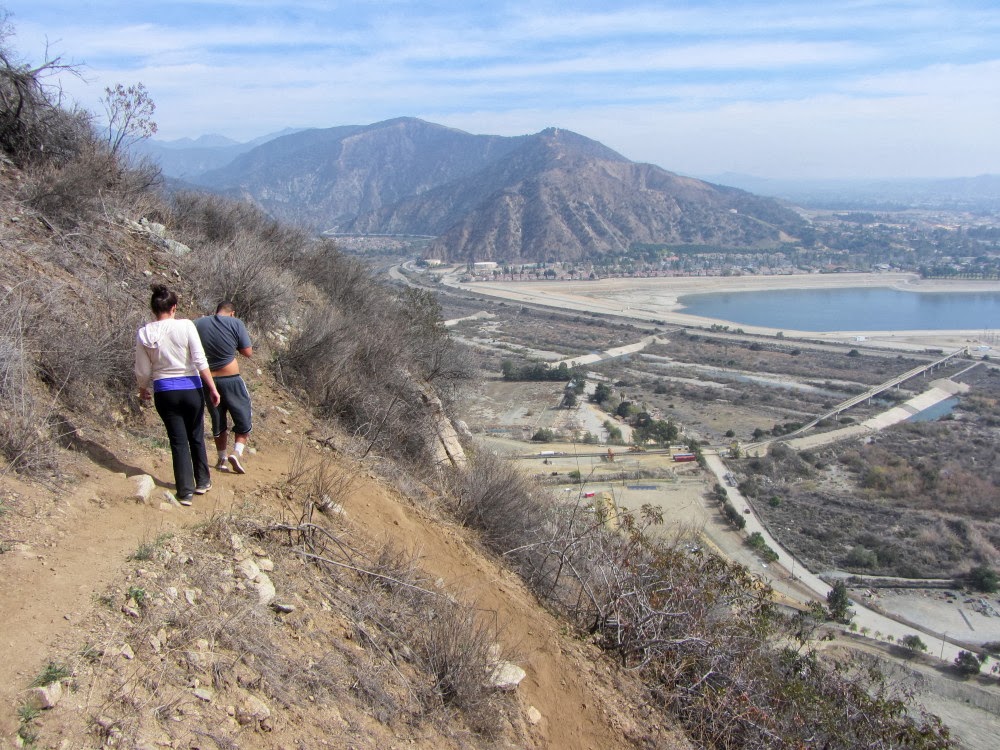
11:30 AM - Begin hike from the trailhead on Encanto Parkway in Azusa (often mistaken for Duarte since it is west of the river). It’s somewhat warm and I’m not really in a hiking mood. Maybe I’ll just walk up the trail a few minutes. With our record-low rainfall, everything looks parched. I encounter a group of about eight with some younger kids coming down. They didn’t go far. Soon I’m past the equestrian area and begin my climb up the steep mountainside. The dry and thirsty vegetation makes it feel more like August than February. There is nothing in bloom. Feels desolate. Pleasant breezes feel good.

View south from the trail to Van Tassel Ridge
I meet a lady who is resting. She asks how far to the falls. I tell her 4 ½ miles and lot of elevation gain on a really steep trail. I don’t think she quite understands. Shortly I encounter a young man and women coming down; they didn’t go far either. I meet another young man and women and they went all the way to the forest boundary (3.8 miles round trip with 1,400 feet gain). They wanted to go to the falls but they had enough. It’s interesting that there are so few people on this trail compared to the throngs that used to be on nearby Garcia Trail before being closed by the recent Colby Fire. I wonder where they are all hiking now.

I’m pleasantly surprised that the trail is in reasonably good condition. Plants are not intruding into the trail and I am quite comfortable in shorts. But it’s steep and narrow and eroded in some places. And there spots that require climbing up rocks. Certainly a good portion of those who climb Garcia Trail would not be comfortable at all on this trail.

View wast from the trail to Van Tassel Ridge
Thick haze mutes the views and joins the parched vegetation to give this hike a depressing feel. This hike today is not scoring high on the enjoyment scale, but I’m not wired to stop without achieving a destination. So I trudge on. There are not even flowers to photograph. As I round the south-facing slope, Van Tassel Road comes into view to the west. Nearing the top, I encounter a man and women who are coming down. They didn’t go far. (These would be my last encounter for the day.)

12:50 - Diamond Head ridge (1.3 miles from the start). I decide to continue over the ridge into the jungle area. It’s a little greener than the west and south slopes, but still pretty parched. The poison oak is mostly dormant and does not hinder my advance. I have a short descent and climb.

View east from Van Tassel Ridge across Fish Canyon toward Vulcan activity
1:00 - Vulcan Fence. - What pressed me to reach this point is a desire to get a view across Fish Canyon to toward the reclamation work Vulcan is doing on the mountainside. The mining plan that was approved by Azusa voters requires that Vulcan turn the 40-foot “Mayan” benches into 12-inch micro benches. Most of the work at this point has been to carve into the sheer rock face to create an angle of repose to hold the soil and plant growth. A section at the very top has been micro-benched and hydroseeded. From this vantage point I can also see a section of the mountainside burned by the September 2013 Madre Fire.

View north from the jungle area on Van Tassel Ridge
1:17 - Start back. As I traverse the jungle I am aware that many acres of this mature chaparral will be removed as “overburden” when Vulcan prepares to quarry the high-grade aggregate rock, which will be used in construction throughout the L.A. basin. Thankfully, much of this mining will be out of view from the human sprawl to the south.

Back at the ridge I follow the path east toward Diamond Head, but as I’ve observed before, the path ends in about 100 yards. I am hopeful that once the trail is cut off from proceeding over Vulcan property and into Fish Canyon, the trail to this point can be improved and maintain to provide a hike to Diamond Head. We’ll see.

View south from the trail to Van Tassel Ridge
Hiking down the steep, slippery trial is tedious as careful steps are required to keep my feet under me. Over on Van Tassel Road, I can see and hear heavy equipment being used by Edison for their project to construct new power towers. I can’t comprehend why trail users toss their plastic bottle down the slope. What pigs! I have solitude the entire way down. Some wild cucumber, a few tiny mustard flowers, and a single occurrence of wishbone bush provide some flowers after all, but far overshadowed by the parched vegetation of an extremely dry winter. And almost to the trailhead, some Douglas nightshade, tree tobacco, elderberry, mule fat, and golden currant provide some flowers to end the hike.

2:32 - End hike. There are four cars in the parking lot (there were eight when I started). Perhaps these belong to folks who have taken the long slog to Fish Canyon Falls.

Epilog - Not the greatest hike but good to revisit the trail and to update my hike description. And it was good to get a perspective on the progress Vulcan is making. I was thankful that the route was mostly brush free and that my feet stayed under me on the tedious downhill. I encountered only about 15 people in five parties; that’s pretty sparse. And three miles round trip with 900 feet in evaluation gain; that’s good exercise. icon

blogspot See my blog post Van Tassel Ridge Hike - March 31, 2012

See Van Tassel Ridge via Fish Canyon Trailhead Hike Description on Dan's Hiking Pages

See Fish Canyon Falls Hike Description on Dan's Hiking Pages