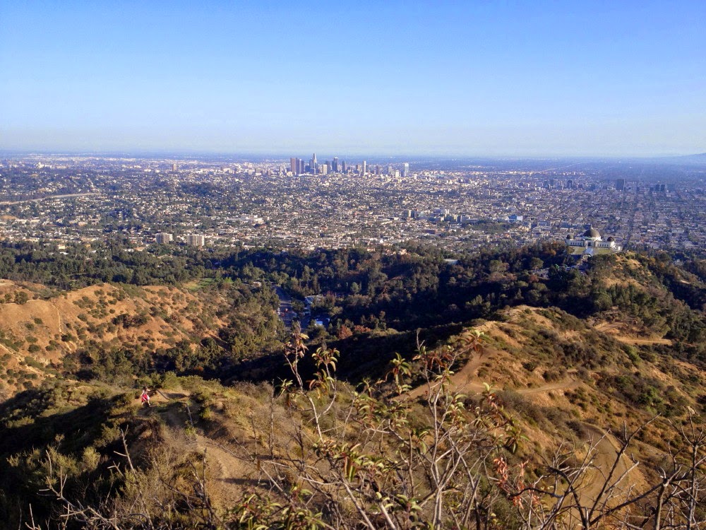
It’s spring and a great time to hike in Griffith Park. Most of my hikes in Griffith over the years have been on Thursday afternoons. Once a month I have an early Thursday morning meeting at work in Los Angeles, so I drive the car rather than taking the bus on those days. So with the availably of the car and an early-out day at work, I was eager to hit the trail for my first hike in Griffith Park this year. I’ve hiked virtually every trail in the park except for some on the north side. So I settled on starting at Travel Town and using Oak Canyon Trail, Toyon Trail, and Mt. Hollywood Trail and climbing a peak or two. In comparing the official
Map and Guide of Griffith Park (AKA “The LaBonge map”) and aerials from Google Earth, it was clear to me that the map itself would be shy on adequate details for navigation, so I printed some screen captures of Google Earth to fill in the gaps.
From my office in Echo Park, I navigate to the small dirt parking lot on Griffith Park Drive (next to the large Travel Town parking lot) about 200 feet south of the intersection with Zoo Drive (exit Forest Lawn Drive from the 134). There are four cars in the lot and it’s a pleasant 74 degrees.
3:48 PM - Begin hike. I walk across the street, turn left, and walk along the street for about 200 feet to where the trail crosses the road. Across the street, Skyline Trail heads east up the mountainside. I turn right then veer left unto Oak Canyon Trail, a wide dirt road heading south. This is a main thoroughfare for horseback riders coming from the large equestrian center across the river/freeway and into the park. The wide trail parallels Griffith Park Drive under a canopy of oak and sycamore. The ascent is gentle. I’m greeted by some wildflowers: Botta's Clarkia, phacelia,

and mustard (of course…the ubiquitous weed). Elderberry

and tree tobacco are also in bloom. With the scant rain this year, the weedy grasses are already turning yellow and giving the feel of early summer rather than early spring. Equine deposits add aroma to the walk. Car traffic on the nearby road detracts somewhat from the natural feel of the setting. As the dirt road bends left (east), I ignore a route that splits right (not shown on the map and barely visible on the aerial), and in another couple minutes ignore another right-hand split. That’s thing about hiking in Griffith Park: There are so many roads, trails, and use paths webbing all over the place, navigational alertness is a must.

4:09 - Junction with Hollywood Drive (0.65 miles from the start). The map totally fails to render this junction accurately and poses confusion to anyone who is relying on it for navigation (I give the cartographers at Cartifact, Inc. a C- in map making. This LaBonge map looks attractive but is riddled with bad errors.). I cross the gated Mt. Hollywood Drive and continue east on the dirt road, now climbing steeply. In a couple minutes I reach another junction and have to consult the aerials for guidance. I take a sharp right and begin my ascent south on Toyon Trail. There are virtually no trail signs in the park, so without a map and navigational skills, a hiker would have no idea what trail is what.

The dirt road climbs steeply now as views open up to the west, east, and north. Some machinery noise coming from above spoils the serenity of the setting. Soon the trail reaches the northern edge of the Toyon Canyon Restoration Project. That’s a euphemistic way of saying they are trying to mitigate the effects of 16 million tons of trash dumped here between 1957 and 1985 covering 90 acres of our beloved park. I’m sure Col. Griffith would have had some choice words about this if had still been around.
I get my first peek at Mt. Bell, Mt. Chapel, and Mt. Lee poking up in the distance. I stop to photograph some mustard.

As the trail reaches a hip, there is a nice bench, drinking fountains for people and horses, and hitching rails. The trail bends south and provides an excellent but hazy view northwest toward the San Fernando Valley and its various entertainment studios. Signs along the road indicate, “Nevins’s Barberry (
Berberis nevinii) / Endanger California Native Plant Species.” I’m guessing the signs are referring to the large shrubs on the hillside below the trail.
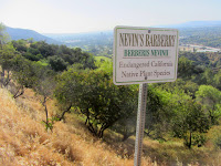

I’m glad for the signs since I would have just passed the bushes off as toyon.
Soon I reach a split in the trail and veer left and descend about a 100 yards to a paved road. Again I confer with the aerials because the LaBonge map is useless here. This appears to be an access road connecting Mt. Hollywood Drive (right) to the restoration facility (left). The bridal path (not show on the map) continues across the road. The path climbs briefly to the edge of the landfill and follows a rail fence south. A yellow sign is on the fence facing the other direction. I climb the fence to read it. It says, “Watch out for rattlesnakes.” That’s odd. Why is it facing toward the landfill and not the trail?

I continue along the wide clearing on this side of the fence and shortly I’m glad since the narrow path next to the fence becomes overgrown with dead weedy grass.
4:46 - Junction. The trail arrives at Mt. Hollywood Drive and an entrance to a sanitation facility. I again consult the map and aerials. I cross the driveway and continue on the narrow path alongside a fence and building. After the building, the trail turns left (east), still paralleling the paved road. Soon the road hairpins but the trail continues east as it becomes steep and rocky.

I stop at several points to photograph blooms of California buckwheat, sticky monkey flower, California everlasting, black sage, and elderberry.
5:01 - Three-way junction with North Trail and Mt. Hollywood Trail (dirt roads). Now I am on familiar ground. I previously hiked North Trail from Mineral Wells Picnic Area to Mt. Bell. Four guys are coming down the road, the first persons I have encountered on this hike. I turn right (south) and proceed on Mt. Hollywood Trail. I’m enjoying the exercise, sunshine, pleasant breezes, and expanding views. I stop to photograph lance-leaf dudleya with its orange blossoms

and some more Botta’s clarkia, AKA “farewell to spring.” Seems early to say good bye to spring but the abundant dead weeds say it’s summertime.
5:14 - Junction Vista Del Valle Drive (paved road). My original plan is to climb Mt. Bell, but as I look west, Mt. Chapel looks appealing. I decide to stick with the plan, turn left, and walk about 50 years to continue up the trail which ascends the north flank of Mt. Bell. The dense chaparral is rich and mature on these north-facing slopes. Glendale and eastern Burbank sprawl out before me in the afternoon sun. I reach the junction which provides the option to circle around Mt. Bell from the east or west. I choose east and continue straight. In another minute I reach the junction (#39) with the trail coming up from the east. I continue straight. Five equestrians ride past.
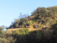
I reach the hip at 5:31 and enjoy the vistas of familiar trails and peaks. Across the canyon, a lone hiker stands on Hogback Peak. The 25-floor MTA headquarters building at Union Station pokes up over the ridgeline. I now traverse the southeast flank of Baby Bell.
When I arrive at the north/south ridgeline between Mt. Hollywood and Baby Bell, I get impulsive. Rather than turning right and going to Mt. Bell, I veer left and head to Mt. Hollywood. Just being spontaneous. Fare amount of foot traffic. Breeze is cool. At the four-way junction, a sign has been erected memorializing LAPD Officer Jeffrey B. Lindenberg, killed in the line of duty on June 11, 1976.

Later I Googled it and found that Officer Lindenberg was killed when the helicopter he was training in lost power and crashed while attempting to land on a helipad “on top of a small mountain” here in the park. The
the official online tribute lists Mount Bell as the location, but I wonder if it is actually Baby Bell and the octagonal pad on top.

I continue up the wide dirt road and take the southern road of the two parallel routes to the summit. The southern panorama toward Downtown Los Angeles opens up. Down at Griffith Observatory, some kind of large tent has been set up in the parking lot.
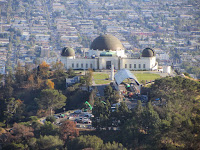
The grand summit of Mt. Hollywood stands in silhouette and invites me to it.
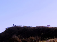 5:43 - Mt. Hollywood (1625’).
 I always enjoy this peak. On a clear day, the grand view south toward the Los Angeles sprawl is spectacular. Today it is somewhat muted by haze, but not bad. There are a few people here and some coming and going. To the west, Mt. Lee and the Hollywood sign stand in blurred silhouette against dipping sun. I don’t linger long. I leave at 5:50.
I return to the four-way junction via the north route and retrace my steps along the ridgeline. I reach the south junction for Baby Bell at 6:01 and climb straight up.

It’s pretty steep and requires both hands in places, but it’s the fun way.
6:04 - Baby Bell (1560+). This is great little peak with a commanding vista of the park’s interior and beyond. It’s not formally named but has been dubbed Baby Bell because of its close proximity to the taller Mt. Bell to its northwest. I leave the summit at 6:06 descending north. It’s quite slippery and careful steps are required. I’m thankful to reach the dirt road safely. There is a man sitting on the bolder atop Mt. Bell.

At the saddle, I take the east approach by veering right unto the narrow use path that disappears into brush. As I am nearly to the top, the young man who was sitting on the rock passes me as he heads down.
6:15 - Mt. Bell (1582’). This is my most-visited peak in Griffith Park, probably because its central location makes it accessible from any approach around the park. Lots of good memories of hikes to here. And I almost always have it to myself. I enjoy the views in all directions. Tiny figures stroll along the various trails far below me. There is a cool breeze. The sunset is in about hour, so I don’t linger long here today.

6:23 - Leave Mt. Bell and descend the southwest approach. The narrow use path is slippery in places and requires careful steps. Eight minutes delivers me to the road. I turn right and head west to make this hike a loop.
I turn right on paved Mt. Hollywood Drive and in about 200 feet turn right on Vista Del Valle Drive.

I love the warm glow of the golden hour for taking pictures. Others are on road. A pair of young ladies behind me spoils the tranquility with obnoxiously loud voices. The eucalyptus trees beg the question as to why early guardians of the park felt the need to plant alien species rather than appreciating the indigenous beauty of native plant communities. The landfill sprawls out below me.

6:42 - Junction with Mt. Hollywood Trail. I turn left and now retrace my steps. The noisy girls follow and soon I decide to let them pass. I reach the junction of Toyon Trail at 6:49 and turn left (west) It’s somewhat steep and rocky, so I guard my steps. The setting sun illuminates the waves of tall yellow grass. I photograph the blossoms of mule fat, which I didn’t notice earlier. When I reach the junction to the sanitation facility, I transition onto the paved road for the short segment before getting back on the trail. At the bench and water fountains, some guy has taken up residence for the night. A small herd of five does graze on the grassy hillside of the landfill.

I snap my last shots of the sun dropping below the ridgeline, 7 minutes before sunset. I love the beauty of dusk.
7:20 - Junction with Oak Canyon Trail (exactly at today’s sunset time). I turn left and saunter along dirt road enjoying the transition from day to night. Equestrians and a dog walker are also enjoying the trail.
7:39 - End hike. It’s 69 degrees and there are three cars in the lot aside from mine.
Epilog - What a nice hike! The lower portion was as I suspected with various trail segments cobbled together amidst man-made trappings. But it’s fun to navigate and explore new portions of my beloved park. I always enjoy visiting Mt. Hollywood, Baby Bell, and Mt. Bell. Scant rain has made for parched conditions. But pleasant temperatures, cool breezes, flowers, wildlife, sweeping visits, splendid peaks, a lovely sunset, and good exercise made for a rewarding outing.
 See Hiking Griffith Park at Dan's Hiking Pages
 (includes links to my other blog posts for hiking in Griffith Park)
 See Brush Canyon to Mt. Bell hike description at Dan's Hiking Pages
(includes more detailed description for the approaches to Mt. Bell)
NEXT > Burbank Peak, Cahuenga Peak, and Mt. Lee - June 24, 2015
PREVIOUS > Bee Rock and Mt. Bell via Old Zoo Park - March 13, 2014


 Across the canyon to the west, Glendale Peak, Baby Bell, and Mount Bell define the skyline. It’s disheartening to see that someone has torn out all the young wild cucumber vines along the way. Why would someone destroy native plants? After a few minutes the steep path mellows out
 and I can see the summit of Beacon Hill. Soon the route gets steep again and at 9:27 I reach Upper Beacon Trail, a wide dirt road. I turn left (east) and climb the final steep pitch to the summit.

 I encounter my first humans of the hike. Of the two routes that head west toward Vista Del Valle Drive, the one on the right has a sign that notes that the trail is closed 0.25 mile ahead for a construction project to expend the water recycling system.
 It will be closed through June 2017. Two gals head up that road, so maybe they know of a way to skirt the construction.
 I top off my water bottle and continue west, now on paved Vista Del Valle Drive. A couple minutes delivers me to the construction project, which occupies a large area on the knoll adjacent to the Vista View Point (helipad). I have views west now toward the grand observatory
 and Mt. Hollywood. The L.A. basin sprawls out on the southern panorama. Lots of people on the trails today.
 The first time I encountered this obstacle was in August 2010 on my six peaks hike. I had left Glendale Peak heading east thinking it was a short-cut, only to be stopped by this cliff. So I turned back. But today I stand here looking at the obstacle and think, you know, I can climb that thing. So up I climb, carefully negotiating each step, each handhold, summoning the nerve to keep climbing. At about half way I look down and realize that one slip would have horrible consequences. I dislike hospitals, so I will myself safely up. Wow, that was exhilarating! What a relief. The narrow path now leads me comfortably up the ridge five minutes to the peak.

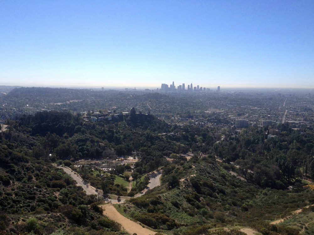

 There has been very little in bloom today: some wild cucumber, everlasting, deerweed, ceanothus, tree tobacco, and the typical weeds of mustard and filaree. I ponder my return route and think I’ll climb down from the bridge to Vista Del Valle Drive. When I reach the junction it appears to be awfully steep and perilous. But I’ve done it up and down before, so I know it is safely doable. So down I go (starting at the point directly behind the Henry’s Trail sign).
 It is somewhat precarious, but I negotiate it safely. It’s certainly not for the faint of heart.


 The area is rebounding nicely after the devastating fire of May 2007, but some dead trees still stand as a reminder of the raging inferno.