See Van Tassel Ridge via Fish Canyon Trailhead Hike Description on Dan's Hiking Pages
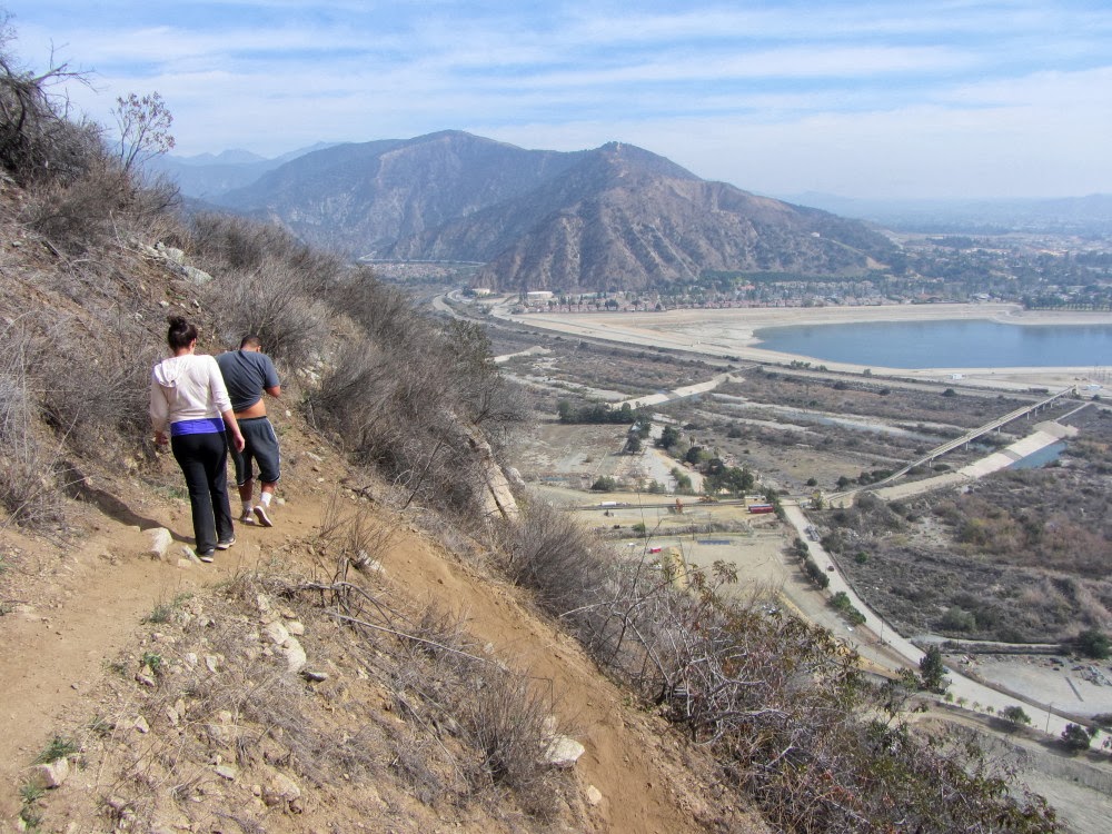
 March is one of my favor months of the year to hike. But for some reason, I was only on the trail once this month. Compelled by a calendar showing it to be the last day of the month, I had to get another hike in. With my wife’s need for the car and a forecast of gloom and drizzle, I figured I’d do a scrappy hike nearby. Van Tassel Ridge seemed ideal, just a few minutes from my house.

The trail was dedicated in 1999 as an attempt to provide an alternative route to Fish Canyon Falls since access is restricted by the quarry operation in the month of the canyon. I’ve never used this route to access the falls (a ridiculous 8.5-mile round trip with 3,200 in elevation gain), but it makes a good hike up Van Tassel Ridge when I need something short and close.
6:55 - Begin Hike. It’s 55 degrees and there are three cars in the parking lot. The thick gloom shrouds my designation on the ridge top. Within a couple minutes I pass the trailhead signboard. I’m intrigued by the sign: “Fish Canyon Trail is maintained and operated by the City of Duarte.” I would suggest more accurate language, such as, “...is poorly maintained by the City of Duarte...” or “...is occasionally maintained...”! By the way, the trail is entirely within the city limits of Azusa!
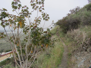
As I wander along the path I enjoy the rich aroma of damp chaparral. For a moment it brings back childhood memories of horseback riding along the Santa Ana River. Soon the trail begins winding and zigzagging up the steep mountainside. The trail condition is not bad. There are a few places where the trial has slid away, but it is still quite passable. Occasionally I have to climb rocks. It’s a little brushy in places, particularly with mustard. My pant legs are getting wet. Ticks like to perch on the tips of twigs and transfer themselves unto passing creatures. One of the reasons I wear light-colored pants is that it makes it easy to spot ticks. In the course of today’s outing I flick off a couple dozen or so.

Views are obscured by a thick marine layer. It’s cool, but with the steep climb and high humidity, I’m sweating pretty well. In spite of the muffled drone of the 210 freeway a mile and a half away, it’s really quite peaceful here. It’s disappointed to see all the graffiti along the trail. Come on, Duarte, live up to your maintenance claim!!
Spring wildflowers add a splash of color. In bloom this morning are mule fat (white), sunflower (yellow), mustard (yellow), elderberry (white), everlasting (pearly white), deerweed (yellow/orange), brittlebush (yellow), wishbone bush (purple), showy penstemon (purple), blue dicks (blue), wild Canterbury bells (purple), thistle (purple), chia (blue), buckwheat (cream), morning glory (white), poison oak (white), black sage (lavender), mountain lilac (purple/lavender), bush monkeyflower (orange), Douglas nightshade (white), virgin bower/clematis (white), golden yarrow (yellow), chemise (white), and tree tobacco (yellow). See
Plants of the San Gabriels at Dan's Hiking Pages.

7:43 - Diamond Head ridge. According to the map and trail description that I picked up at the trailhead signboard, I have climbed 890 feet in 1.3 miles to this point. A trail cuts to the right (east) toward Diamond Head summit, but in the past I have found that it dead ends before getting there. I continue straight (north) as the trail begins to gently descend into what I call “the jungle” on the north-facing slope. I immediately encounter the shinny green leaves of poison oak, coming back to life after its winter dormancy. There is a lot of it along this stretch of trail, some of which is blocking the route. In the car on the way over I realized I forgot my gloves and pruners...now I’m regretting it. Using a stick, I carefully weave my way threw the poison oak. I’m tempted to turn back but keep pressing through. I’m unsuccessful in keeping the poison oak from touching my paints and shirt sleeves, so I will need to carefully avoiding touching or spreading the toxic oil.
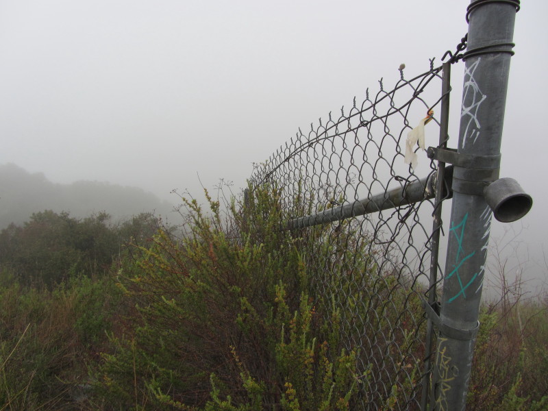
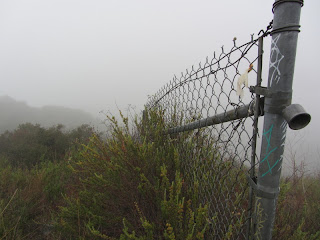
Past the jungle, I now walk along the fence that separates the trail from the quarry operation. In a few minutes the fence ends and the route veers left (northwest) and begins its climb up the dozer cut. At about 100 yards a trails cuts left and looks passable, but I continue up the road. It gets crazy steep...butt steep! I just take my time and slowly climb. The fog is thicker up here.
 8:28 - National Forest boundary (2080’)
. This is my destination, high up on Van Tassel Ridge, two miles from the start and 1,400 feet in elevation gain. The trail passes through an opening in the chain link fence that separates the quarry property from Angeles National Forest. I linger for a few minutes on the forest side. No cell reception, so can’t upload a pic to FB.
8:41 - Start back down. I arrive at a flat spot just before a really steep descent and decide to bear right to see if the old trail is passable. It is and makes a nice route to circumvent the crazy steep dozer cut. Back at the fence I take an alternate route to climb up and over the summit of Diamond Head to avoid the poison oak.
 9:05 - Diamond Head (1603’)
 - This is my first time on top of this summit, which from the east, looks similar to the iconic Diamond Head crater at Waikiki, Oahu. The view from here would be great on a clear day. I upload a pic to FB. When Vulcan begins to mine Van Tassel Ridge, the trail beyond here will be closed. So this summit would make a nice destination. Overhaul the trail and stick a bench up here, and it could be an alternative hike to Garcia Trial for locals.
As I continue west from the Diamond Head summit I can’t find a passable route. I thrash through thick brush.

Finally, after about 15 minutes of arduous bushwhacking, I find a path and walk the final minute to join the main trail. The roughness of this trail is more apparent going down as I climb over rocks in steep sections. It’s still foggy and cool and I’m still flicking ticks.

The solitude of this hike is a striking contrast to the hoards of people on Garcia Trail last week. I really should consider coming over here more often...just need long pants and sturdy boots.

As I near the bottom of the mountain I finally encounter another person...an older gentleman heading up. A minute later a group of about six young adults pass me. They’re heading all the way to Fish Canyon Falls. They don’t really look dressed for hiking and I wonder if they’re up to the whole enchilada. I mention the poison oak to them and they don’t seem phased. But with bear legs, unless they have a secret weapon, they’re going to get poisoned oaked for sure, not to mention the ticks.
10:07 - End hike.
Epilog - This has been a fun outing. Peaceful. Solitude. Some adventure. Cool is certainly better than hot. I’ll know in a couple days if the poison oak got me.
 See Van Tassel Ridge via Fish Canyon Trailhead Hike Description on Dan's Hiking Pages (Archive Page)
The trail up Van Tassel Ridge was closed upon the opening of the new Fish Canyon access trail on June 21, 2014. Read about it here: Fish Canyon Falls - A New Era - June 21, 2014
See Van Tassel Ridge via Fish Canyon Trailhead Hike Description on Dan's Hiking Pages (Archive Page)
The trail up Van Tassel Ridge was closed upon the opening of the new Fish Canyon access trail on June 21, 2014. Read about it here: Fish Canyon Falls - A New Era - June 21, 2014