Thursday, June 30, 2016

Van Tassel Fire Road Post-Burn Hike - June 30, 2016

View west over Duarte toward the Fish Fire shortly after it started on Monday, June 21, 2016 – Photo NWS Los Angeles
Monday morning, June 20, a huge plume of smoke began to billow into the sky above Duarte and Azusa. By day’s end, the fast-moving wildfire consumed nearly 3,400 acres of Fish and Van Tassel canyons all the way to Fish Canyon Falls, Mount Bliss, and beyond. I was staying in L.A. for four days of meetings and began to see pictures of the inferno pop up on my smart phone. Heart wrenching! But with the consuming demands of my job that week, I had hardly a moment to think about the fire or look at the news.

Road closure in Duarte neighbor due to the Fish Fire June 23, 2016
When I got home on Thursday evening, June 23 and saw the mountains and began to see the fire reports and news stories, I was numb. At about 7 p.m. I drove over to nearby Duarte to see what I could see. Encanto Parkway was blocked off so I meandered through the residential streets a little further west and north, but sheriff deputies had the streets near the mountainside closed off. I headed east on Royal Oaks then north on Melcanyon Road and arrived at the intersection of Brookridge at the base of the mountainside. The burn area loomed above me. I was surprised that there were no deputies or signs restricting access.

Fish Fire damage along the access drive adjacent to Opal Canyon Road, Duarte, June 23, 2016 Fish Fire damage along the access drive adjacent to Opal Canyon Road, Duarte, June 23, 2016
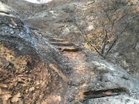
Fish Fire damage along the access trail to Van Tassel Fire Road, Duarte, June 23, 2016 Fish Fire damage at the junction of the access trail and Van Tassel Fire Road, June 23, 2016
View southeast toward Duarte from Van Tassel Fire Road, June 23, 2016 View southeast toward Duarte from Van Tassel Fire Road, June 23, 2016
So I got out of my car and began to walk north up the access drive adjacent to Opal Canyon Road. The driveway leads to a water tank and an access trail to Van Tassel Fire Road. The charred scene was heartbreaking. At the water tank I transitioned to the path and began walking through what days earlier was thick, mature chaparral. Acrid smell filled the air. There was nothing but ash and blackened sticks. It was a strange and eerie scene. I was too numb to cry. I had no intent to hike that evening, and as I climbed the ashy path I had no idea how far I’d go. But curiosity drew me upward. I was snapping pictures but was mindful of a low battery. When I reached Van Tassel Fire Road I decided to continue climbing. Occasionally a firefighting helicopter flew overhead. I was surrounded by lifeless moonscape. I monitored the time and daylight because I didn’t want to be coming down in the dark. At 8:21 I reached a hairpin curve with good views south and decided this would be my turn around point. I retraced my steps down the road as dusk turned to night. Ambient light was sufficient as I carefully negotiated my way down the access trail and arrived back at the car at 9:00. I knew I needed to return soon.


Closure sign at Fish Canyon Trail trailhead after the Fish Fire, Azusa, June 30, 2016
A week later, on Thursday evening, June 30, I decided an after-work hike up Van Tassel Fire Road would be good. This time I would be more equipped to hike. I took the 10-minute drive to the Vulcan entrance on Fish Canyon Road to see the new banner they posted on Wednesday announcing that Fish Canyon Trail is temporarily closed. Then I drove over to the stables at the head of Van Tassel Fire Road. There were no closure notices so I was free to walk up the road. Fish Fire damage at the beginning of Van Tassel Fire Road in Van Tassel Canyon, Azusa, June 30, 2016

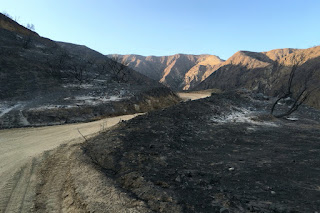
Fish Fire damage along Van Tassel Fire Road with Van Tassel Ridge in the background, Azusa, June 30, 2016
6:48 PM - Begin hike. The sun still rests on the Van Tassel Ridge high above me on the west. It’s amazing that the equestrian center was spared in the mouth of the canyon with scoured earth on three sides. I walk up the steep road surrounded by blackened scenery. The smell of burnt vegetation is still strong. I look north up narrow Van Tassel Canyon and ponder the possibility of exploring it now that it’s vegetation free. Soon the east end of the San Gabriel Valley lies before me illuminated by the late-day sun. View southeast toward the San Gabriel River from Van Tassel Fire Road surrounded by damage from the Fish Fire, Azusa, June 30, 2016 The barren, ashy landscape is surreal. There is almost a beauty to it in a Tim Burton kind of way. The only life is a fresh anthill.

Fish Fire damage along Van Tassel Fire Road with Van Tassel Ridge in the background, Azusa, June 30, 2016
The road has had a lot of traffic since I was here a week ago…no doubt firefighting vehicles. There is a fresh set of small tennis shoe prints. I leave a trail of footprints in the soft dirt. Higher and higher I climb surrounded by moonscape with blackened sticks. Fish Fire damage along Van Tassel Fire Road with Van Tassel Ridge in the background, Azusa, June 30, 2016 A lone blossom stalk of a yucca juts into the sky, strangely untouched by the fire. View southeast toward the San Gabriel River from Van Tassel Fire Road surrounded by damage from the Fish Fire, Azusa, June 30, 2016 As I round the outward bend by the first water tank, the pinkish-red Phos-Chek fire retardant covers the ground. Tons of it was dropped by aircraft during the first day of the fire. DC-10 Supertanker drops Flos-Chek to fight the Fish Fire, June 20, 2016, Los Angeles Times, Photo by Tim Berger The top of the water tank is now Phos-Chek red. View southeast from Van Tassel Fire Road toward a water tank covered with pinkish-red Phos-Chek fire retardant dropped fighting the Fish Fire on June 20, 2016 Typically much of my attention while hiking is on the plant life and photographing flowers. It’s so bizarre to walk through a lifeless moonscape. The last of the day’s sun lingers on distant Mount Baldy and neighboring peaks to the east. Huge power towers stand gangly against the azure sky. Power tower along Van Tassel Fire Road above Duarte, June 30, 2016

View west at dusk toward Monrovia from Van Tassel Fire Road above Duarte, June 30, 2016
7:43 - Heading west I pass through the open vehicle gate (it’s usually locked). I’m hoping to get line-of-sight to the 8:08 sunset, but soon see that the sun has dipped behind Mount Harvard. The line of Phos-Chek around me didn’t keep the fire from consuming the foothills to my west. The road cuts back east and I continue up. Dusk settles over my view east and the blackened landscape. View southeast toward Azusa from Van Tassel Fire Road above Duarte surrounded by damage from the Fish Fire, June 30, 2016 The scene is haunting. I should be overwhelmed with sadness over the loss of the rich chaparral that blanketed these slopes. But I feel at peace…kind of a melancholy contentment.

Heading north on Van Tassel Fire Road above Duarte surrounded by damage from the Fish Fire, June 30, 2016
For my destination I had in mind going to at least the power tower retaining wall up ahead. Since I was here last in August 2011, Edison has been working on the towers. I had assumed they were building additional ones, but I don’t see any new ones. I reflect on the many times I’ve climbed this road. It’s so familiar, yet now so different.

7:57 - Power towers, but there is no more retaining wall. View south along Van Tassel Fire Road above Duarte from the site of the now-gone retaining wall, June 30, 2016 The last sunlight sits upon Mount Baldy. I decide to continue up a little more. Deep in the canyons below some trees may have survived the inferno. I pass through a section of road that was previously lined with beautiful pines. Heading northwest along Van Tassel Fire Road above Duarte surrounded by damage from the Fish Fire, June 30, 2016 They are dead now.

View southwest toward Monrovia from Van Tassel Fire Road near water tank 14 (about half way to Mount Bliss), June 30, 2016
8:11 - Water tank 14 (about half way to Mount Bliss). View northwest toward water tank 14 (about half way to Mount Bliss) on Van Tassel Fire Road surrounded by damage from the Fish Fire, June 30, 2016 I now have a view southwest over the San Gabriel Valley as dusk falls and lights begin to twinkle. An orange band of haze outlines the horizon. It’s peaceful here. I linger for a few minutes and soak in the beauty of nightfall. At 8:15 I head down. View southeast toward Azusa on Van Tassel Fire Road surrounded by damage from the Fish Fire, June 30, 2016 I’m tempted to tangent up a slope to achieve a summit, but I decide to not trample bare earth by going off trail. As I reach the power towers, I scramble up to the tower on the high point to enjoy the vistas. It’s almost dark now and the human sprawl is a blanket of lights. The ambient light is sufficient for my steps. The temperature is quite pleasant.

View southeast along Van Tassel Fire Road toward Azusa and the east end of the San Gabriel Valley, June 30, 2016
8:58 - Pass through the open vehicle gate. The power towers have a strange beauty to them. I text a photo to my wife letting her know where I am. The dampness of evening intensifies the smell of charred landscape. I finally get out a light at 9:10 to aid my steps and at 9:15 I reach the bend where I ended my walk last week. It’s peaceful here. Occasionally the stillness is broken by rocks tumbling down the bare slopes. Crickets are chirping in the canyon below…the sounds of life amidst scoured earth. The bray of horses signals that I’m nearing the end. A tarantula crosses the road.

9:56 - End hike. My feet are filthy from miles of dusty road. Good for 4.4 miles round trip, 1,540 feet in elevation gain, and 13,969 steps on my Fitbit (normally it’s about 2,000 steps per miles walking; this turned out to be 3,174 steps per mile…so really short steps!).

Burnt shrub along Van Tassel Fire Road as night falls on the east end of the San Gabriel Valley, June 30, 2016
Epilog - What an interesting and fulfilling hike. Sad, serene, stirring, surreal. It’s sobering to experience the devastating results of a ferocious inferno. More than 4,200 acres of scorched earth. I’ve hiked this road many times since it is one of my nearby scrappy hikes. So sad to see it gone. The 2014 Colby Fire incinerated more than 1,700 acres of mountainside above Glendora and Azusa, laying waste the scenery around Colby Trail and Garcia Trail (which is still closed). Now the Fish Fire has destroyed the hikes to nearby Fish Canyon Falls and Mount Bliss. My four favorite scrappy hikes…reduced to moonscape. But I shall continue to hike and find beauty wherever I tread. icon

See Mt. Bliss hike description at Dan's Hiking Pages
 
CameraSee Mt. Bliss hike photo album - 8-14-11
 

Wednesday, June 22, 2016

Griffith Observatory to Mt. Hollywood & Baby Bell - June 22, 2016

Southern panorama as seen from Mt. Hollywood, Griffith Park, Los Angeles, June 22, 2016

Griffith Icon I love it when by job intersects with hiking. This week at work I was responsible for helping facilitate meetings with leaders from around the country. Several of them enjoy hiking so it’s always on our radar to see if we can take a hike on one of the evenings. It worked out for Wednesday evening. The only one who is able to hike this time was Jeff. Griffith Park, as always, is our venue of choice, and we decide on the classic hike from the Observatory to Mt. Hollywood and beyond.

We leave the office in Echo Park at 6:21 and drive the five miles to Griffith Park. We are thankful to find a parking place on West Observatory Road just short of the Charlie Turner Trailhead. I’m pleased that a beautiful sign and map has been erected at the trailhead. Good job, parks people! Signage in Griffith Park has been horribly deficient for years. It’s labeled as Sign No. 19, so that suggests that there are more!

6:49 PM - Begin hike heading north on Mt. Hollywood Trail from the Charlie Turner Trailhead. The temperature is pleasant and haze mutes the views. There are lots of people on the trail. We stroll along and enjoy good conservation and the rugged scenery lit with the warm glow of the late afternoon sun. We cross the bridge spanning the Vermont Canyon Road tunnel and veer left following the main route. Soon I realize I neglected to turn onto the shortcut trail that climbs straight up the ridge. Oh well, I guess we’ll walk the long switchback. Views of the grand observatory open up.

As we approach the end of switchback leg, we hear wheels screeching below on Mt. Hollywood Drive. There is a strong smell of rubber. We go to the edge of the trail and notice it’s a yellow Hummer. It backs up and repeats the maneuver. We realize it’s a film shoot as we spot a camera truck. Griffith Park is used a lot for filming (and Mt. Hollywood Drive is normally closed to vehicular traffic).

At the switchback there are stone benches and a monument marker. It reads, “The Tiffany & Co. Foundation Overlook.” I’ve not been here since September 2013, so these are new to me (since I usually take the shortcut, the last time I was here was with Jeff and Loren coming back down in the dark; on that hike we hit Mt. Hollywood and Mt. Bell).

The Tiffany & Co. Foundation Overlook
With visionary support from The Tiffany & Co. Foundation
and contributions from people worldwide,
Cahuenga Peak, the backdrop of Hollywood,
is preserved for generations to come.
Enjoy the view!

We switchback heading east. It’s always sad to see rocks defaced with graffiti. The parks department works hard at covering it, but one tag—painted over at least two previous cover-overs—begs to be abated. The horrific scourge of graffiti in our population centers in “modern” society is compelling evidence that humankind is not evolving. Homo sapiens are de-evolving into Neanderthals and there is seemingly nothing that science and modernity can do to stop it (perhaps a theological explanation should be considered).

We are enjoying good conversation as our view over the vast L.A. sprawl to the south expands. Above us, Mt. Hollywood is accented with tiny figures.

We reach the six-point junction south of Mt. Hollywood at 7:20. A new sign has been posted here as well: Sign No. 13. It points left and right to either main route to Mt. Hollywood at .4 mi (to the left through Captain’s Roost [.1 mi.], and to the right through Dante’s View [.2 mi.]). And it points left (west), back to where we came up (.7 mi to Berlin Forest; 1 mi. to the Griffith Observatory). What the sign doesn’t mention is the two routes heading south down the ridge (the shortcut to the bridge and to Bird Sanctuary, although one is shown on the new map). And it doesn’t show the steep route that heads directly up the ridge to Mt. Hollywood. The small print at the bottom of the sign reads, “You are in an urban wilderness. For you safety and to protect the habitat, please stay on designated trails.” I guess that means they would prefer we don’t use the popular shortcut. We’ll, that’s going to be our route, so sorry, sign.

We turn north and begin to climb the well-worn path straight up. A guy is playing with a remote control car. Lots of California buckwheat is in bloom, about the only thing I’ve seen blooming today. The route is really steep, but always a fun way to go.

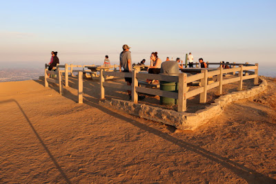
Atop Mt. Hollywood (1625’), Griffith Park, Los Angeles, June 22, 2016
7:34 - Mt. Hollywood (1625’). I love this place. There are always people here; 13 right now. The massive human sprawl to the south is muted by haze. The grand observatory sits impressively on the mountain below. The soon-setting sun silhouettes Mt. Lee and the Hollywood sign to the west. To the northeast the majestic San Gabriels span the horizon with their sun-draped peaks. To the north Baby Bell calls to us. We linger for a few minutes and soak in the splendid location.

We leave the summit at 7:45 and head northeast on the wide dirt road. I’m hoping to get sunset shots from Baby Bell. That is about as far as we’ll get today. At the Captain’s Roost junction another new sign has been erected: Sign No. 11. And at the four-point junction north of Mt. Hollywood is new Sign No. 10. These are nice! The sun is nearing its disappearing point behind the peaks to the west. We continue straight along the ridge-divide and head north toward the Bells. The sun casts a warm glow over Glendale to our northeast. We’ve lost the sun behind Mt. Chapel but I’m calculating we’ll see it again once on top of Baby Bell. Our pace is deliberate now. We transition left unto the rutted path that skirts Baby Bell, then turn left to follow the ridge to the summit.

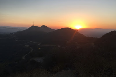
View of sunset from atop Baby Bell, Griffith Park, Los Angeles, June 22, 2016
8:01 - Baby Bell (1570’). We’re just in time to photograph the setting sun as it dips below the distant horizon to the right of Mt. Chapel. There are two guys here and they snap our picture. Sometime I’d like to learn the story behind the hexagon-shaped foundation. This is Jeff’s first time on this peaklet (on our hike in September 2013 with Loren, we skirted Baby Bell so that we could have enough time to peak out at Mt. Bell with adequate light). We enjoy our 360-degree view over the rugged parkland and the vast megalopolis beyond. There is peacefulness as night falls on L.A. Looking north to the site of the long-gone Grand Central Airport in Glendale, and looking northeast to the zoo parking lot and the former of site of the Griffith Aviation Park, I share a little history with Jeff. Such aviation luminaries as Martin, Boeing, and Douglas had their roots here (see my Beacon Hill hike description for more).

We leave the summit at 8:13 and head down the northwest ridge route. At the dirt road we turn right and traverse along the north flank of Baby Bell. At the site of the short-lived Griffith Park Teahouse, I reminisce about its clandestine appearance on June 30, 2015. We continue around the peaklet then retrace our steps along the ridge-divide heading south. Lights twinkle in Glendale. Nightfall displays its beauty. I’m really enjoying Jeff’s enthralling story about a recent adventure he had on the Appalachian Trail…oh the lessons we learn while hiking!

At the four-point junction north of Mt. Hollywood (Sign No. 10), we opt to turn left (east). At Dante’s View there’s another new sign (Hogback Trail at Dante’s View, Sign No. 12). I encourage Jeff to drink from the fountain. He declines by saying he has water. I tell him he has to drink from the drinking fountain…because it’s here, and L.A. tap water is so robust. We take a short walk through Dante’s View before continuing on. It’s nearly dark now.

We reach the five-point junction at 8:52 and decide to go straight down the ridge shortcut. The ambient light is sufficient for our steps. I don’t recall if I have been down this route at night, but I failed to anticipate how tedious and precarious it is in the dark (I attempt to use my headlamp but I prefer the ambient light). A sea of lights covers our southern panorama. We safely negotiate the steep, slippery route and at the junction to Bird Sanctuary are rewarded with a reasonable path. Headlights stream up Western Canyon Drive. The observatory is bustling. Back at the bridge we retrace our steps past the Belin Forest and to the Charlie Turner Trailhead.

9:22 - End hike. The place is teeming with visitors. Back at the car we navigate to Sunset and Orange in Hollywood and cap off the evening at In-N-Out. It doesn’t get better than this!

Jeff and Dan atop Baby Bell, Griffith Park, Los Angeles, June 22, 2016
Epilog - What an enjoyable hike. I never get tired of this amazing urban wild place with its endless possibilities. In the nine years I’ve been hiking in Griffith Park, I’ve not repeated a hike. With the vast web of trails, I’ve been able to cobble together various trail sections and destinations to create a different hike each time. This hike was similar to previous hikes but distinctly different. Jeff was great company and it’s always a privilege to host our out-of-down guests. icon

Griffith Icon  See Hiking Griffith Park at Dan's Hiking Pages
 (includes links to my other blog posts for hiking in Griffith Park)

Boot IconRelevant trail descriptions for this hike at Dan's Hiking Pages:

PREVIOUS > Beacon Hill and Glendale Peak in Griffith Park - Feb. 15, 2016