Showing posts with label Van Tassel Fire Road. Show all posts

Thursday, June 30, 2016

Van Tassel Fire Road Post-Burn Hike - June 30, 2016

View west over Duarte toward the Fish Fire shortly after it started on Monday, June 21, 2016 – Photo NWS Los Angeles
Monday morning, June 20, a huge plume of smoke began to billow into the sky above Duarte and Azusa. By day’s end, the fast-moving wildfire consumed nearly 3,400 acres of Fish and Van Tassel canyons all the way to Fish Canyon Falls, Mount Bliss, and beyond. I was staying in L.A. for four days of meetings and began to see pictures of the inferno pop up on my smart phone. Heart wrenching! But with the consuming demands of my job that week, I had hardly a moment to think about the fire or look at the news.

Road closure in Duarte neighbor due to the Fish Fire June 23, 2016
When I got home on Thursday evening, June 23 and saw the mountains and began to see the fire reports and news stories, I was numb. At about 7 p.m. I drove over to nearby Duarte to see what I could see. Encanto Parkway was blocked off so I meandered through the residential streets a little further west and north, but sheriff deputies had the streets near the mountainside closed off. I headed east on Royal Oaks then north on Melcanyon Road and arrived at the intersection of Brookridge at the base of the mountainside. The burn area loomed above me. I was surprised that there were no deputies or signs restricting access.

Fish Fire damage along the access drive adjacent to Opal Canyon Road, Duarte, June 23, 2016 Fish Fire damage along the access drive adjacent to Opal Canyon Road, Duarte, June 23, 2016
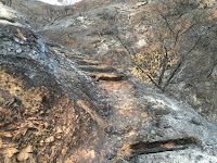
Fish Fire damage along the access trail to Van Tassel Fire Road, Duarte, June 23, 2016 Fish Fire damage at the junction of the access trail and Van Tassel Fire Road, June 23, 2016
View southeast toward Duarte from Van Tassel Fire Road, June 23, 2016 View southeast toward Duarte from Van Tassel Fire Road, June 23, 2016
So I got out of my car and began to walk north up the access drive adjacent to Opal Canyon Road. The driveway leads to a water tank and an access trail to Van Tassel Fire Road. The charred scene was heartbreaking. At the water tank I transitioned to the path and began walking through what days earlier was thick, mature chaparral. Acrid smell filled the air. There was nothing but ash and blackened sticks. It was a strange and eerie scene. I was too numb to cry. I had no intent to hike that evening, and as I climbed the ashy path I had no idea how far I’d go. But curiosity drew me upward. I was snapping pictures but was mindful of a low battery. When I reached Van Tassel Fire Road I decided to continue climbing. Occasionally a firefighting helicopter flew overhead. I was surrounded by lifeless moonscape. I monitored the time and daylight because I didn’t want to be coming down in the dark. At 8:21 I reached a hairpin curve with good views south and decided this would be my turn around point. I retraced my steps down the road as dusk turned to night. Ambient light was sufficient as I carefully negotiated my way down the access trail and arrived back at the car at 9:00. I knew I needed to return soon.


Closure sign at Fish Canyon Trail trailhead after the Fish Fire, Azusa, June 30, 2016
A week later, on Thursday evening, June 30, I decided an after-work hike up Van Tassel Fire Road would be good. This time I would be more equipped to hike. I took the 10-minute drive to the Vulcan entrance on Fish Canyon Road to see the new banner they posted on Wednesday announcing that Fish Canyon Trail is temporarily closed. Then I drove over to the stables at the head of Van Tassel Fire Road. There were no closure notices so I was free to walk up the road. Fish Fire damage at the beginning of Van Tassel Fire Road in Van Tassel Canyon, Azusa, June 30, 2016

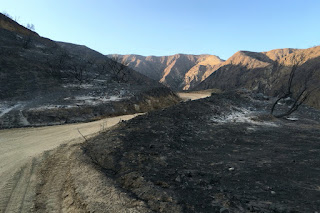
Fish Fire damage along Van Tassel Fire Road with Van Tassel Ridge in the background, Azusa, June 30, 2016
6:48 PM - Begin hike. The sun still rests on the Van Tassel Ridge high above me on the west. It’s amazing that the equestrian center was spared in the mouth of the canyon with scoured earth on three sides. I walk up the steep road surrounded by blackened scenery. The smell of burnt vegetation is still strong. I look north up narrow Van Tassel Canyon and ponder the possibility of exploring it now that it’s vegetation free. Soon the east end of the San Gabriel Valley lies before me illuminated by the late-day sun. View southeast toward the San Gabriel River from Van Tassel Fire Road surrounded by damage from the Fish Fire, Azusa, June 30, 2016 The barren, ashy landscape is surreal. There is almost a beauty to it in a Tim Burton kind of way. The only life is a fresh anthill.

Fish Fire damage along Van Tassel Fire Road with Van Tassel Ridge in the background, Azusa, June 30, 2016
The road has had a lot of traffic since I was here a week ago…no doubt firefighting vehicles. There is a fresh set of small tennis shoe prints. I leave a trail of footprints in the soft dirt. Higher and higher I climb surrounded by moonscape with blackened sticks. Fish Fire damage along Van Tassel Fire Road with Van Tassel Ridge in the background, Azusa, June 30, 2016 A lone blossom stalk of a yucca juts into the sky, strangely untouched by the fire. View southeast toward the San Gabriel River from Van Tassel Fire Road surrounded by damage from the Fish Fire, Azusa, June 30, 2016 As I round the outward bend by the first water tank, the pinkish-red Phos-Chek fire retardant covers the ground. Tons of it was dropped by aircraft during the first day of the fire. DC-10 Supertanker drops Flos-Chek to fight the Fish Fire, June 20, 2016, Los Angeles Times, Photo by Tim Berger The top of the water tank is now Phos-Chek red. View southeast from Van Tassel Fire Road toward a water tank covered with pinkish-red Phos-Chek fire retardant dropped fighting the Fish Fire on June 20, 2016 Typically much of my attention while hiking is on the plant life and photographing flowers. It’s so bizarre to walk through a lifeless moonscape. The last of the day’s sun lingers on distant Mount Baldy and neighboring peaks to the east. Huge power towers stand gangly against the azure sky. Power tower along Van Tassel Fire Road above Duarte, June 30, 2016

View west at dusk toward Monrovia from Van Tassel Fire Road above Duarte, June 30, 2016
7:43 - Heading west I pass through the open vehicle gate (it’s usually locked). I’m hoping to get line-of-sight to the 8:08 sunset, but soon see that the sun has dipped behind Mount Harvard. The line of Phos-Chek around me didn’t keep the fire from consuming the foothills to my west. The road cuts back east and I continue up. Dusk settles over my view east and the blackened landscape. View southeast toward Azusa from Van Tassel Fire Road above Duarte surrounded by damage from the Fish Fire, June 30, 2016 The scene is haunting. I should be overwhelmed with sadness over the loss of the rich chaparral that blanketed these slopes. But I feel at peace…kind of a melancholy contentment.

Heading north on Van Tassel Fire Road above Duarte surrounded by damage from the Fish Fire, June 30, 2016
For my destination I had in mind going to at least the power tower retaining wall up ahead. Since I was here last in August 2011, Edison has been working on the towers. I had assumed they were building additional ones, but I don’t see any new ones. I reflect on the many times I’ve climbed this road. It’s so familiar, yet now so different.

7:57 - Power towers, but there is no more retaining wall. View south along Van Tassel Fire Road above Duarte from the site of the now-gone retaining wall, June 30, 2016 The last sunlight sits upon Mount Baldy. I decide to continue up a little more. Deep in the canyons below some trees may have survived the inferno. I pass through a section of road that was previously lined with beautiful pines. Heading northwest along Van Tassel Fire Road above Duarte surrounded by damage from the Fish Fire, June 30, 2016 They are dead now.

View southwest toward Monrovia from Van Tassel Fire Road near water tank 14 (about half way to Mount Bliss), June 30, 2016
8:11 - Water tank 14 (about half way to Mount Bliss). View northwest toward water tank 14 (about half way to Mount Bliss) on Van Tassel Fire Road surrounded by damage from the Fish Fire, June 30, 2016 I now have a view southwest over the San Gabriel Valley as dusk falls and lights begin to twinkle. An orange band of haze outlines the horizon. It’s peaceful here. I linger for a few minutes and soak in the beauty of nightfall. At 8:15 I head down. View southeast toward Azusa on Van Tassel Fire Road surrounded by damage from the Fish Fire, June 30, 2016 I’m tempted to tangent up a slope to achieve a summit, but I decide to not trample bare earth by going off trail. As I reach the power towers, I scramble up to the tower on the high point to enjoy the vistas. It’s almost dark now and the human sprawl is a blanket of lights. The ambient light is sufficient for my steps. The temperature is quite pleasant.

View southeast along Van Tassel Fire Road toward Azusa and the east end of the San Gabriel Valley, June 30, 2016
8:58 - Pass through the open vehicle gate. The power towers have a strange beauty to them. I text a photo to my wife letting her know where I am. The dampness of evening intensifies the smell of charred landscape. I finally get out a light at 9:10 to aid my steps and at 9:15 I reach the bend where I ended my walk last week. It’s peaceful here. Occasionally the stillness is broken by rocks tumbling down the bare slopes. Crickets are chirping in the canyon below…the sounds of life amidst scoured earth. The bray of horses signals that I’m nearing the end. A tarantula crosses the road.

9:56 - End hike. My feet are filthy from miles of dusty road. Good for 4.4 miles round trip, 1,540 feet in elevation gain, and 13,969 steps on my Fitbit (normally it’s about 2,000 steps per miles walking; this turned out to be 3,174 steps per mile…so really short steps!).

Burnt shrub along Van Tassel Fire Road as night falls on the east end of the San Gabriel Valley, June 30, 2016
Epilog - What an interesting and fulfilling hike. Sad, serene, stirring, surreal. It’s sobering to experience the devastating results of a ferocious inferno. More than 4,200 acres of scorched earth. I’ve hiked this road many times since it is one of my nearby scrappy hikes. So sad to see it gone. The 2014 Colby Fire incinerated more than 1,700 acres of mountainside above Glendora and Azusa, laying waste the scenery around Colby Trail and Garcia Trail (which is still closed). Now the Fish Fire has destroyed the hikes to nearby Fish Canyon Falls and Mount Bliss. My four favorite scrappy hikes…reduced to moonscape. But I shall continue to hike and find beauty wherever I tread. icon

See Mt. Bliss hike description at Dan's Hiking Pages
 
CameraSee Mt. Bliss hike photo album - 8-14-11
 

Sunday, August 14, 2011

Mt. Bliss Hike - August 14, 2011

View south from the summit of Mount Bliss (3720') See Mt. Bliss hike description at Dan's Hiking Pages

I wanted to get a moderately strenuous hike under my feet this weekend, but did not want to give a whole day to it. So I choose one of my local scrappy hikes: Mt. Bliss. The trailhead is only 10 minutes from my house in Azusa, and with a distance of 8.5 miles round trip and 2880 feet in elevation gain, it would be an ideal hike to keep my legs and feet in condition.

Mount Bliss is not usually a summer hike: Heat, obscured visibility, withering chaparral. But if I go early I can at least mitigate the heat, to a degree.

Full moon setting5:50 AM - Start hike. Leaving the equestrian center, I begin my steep climb up Van Tassel Fire Road. It’s cool and nighttime dampness brings out the aromas of the chaparral, particularly the white sage. A full noon is setting. A marine layer thinly blankets the valley. Soon I encounter a sign: “ESA (Environmentally Sensitive Area) No Entrance Permitted, TRTP Segments 4-11.” It’s branded by the Edison Company of Southern California. I’m not a defiant person, but I don’t recognize the Edison Company’s authority to tell me I can’t hike on a public right-of-way in the national forest. I keep walking. I love the beauty of the pre-sunrise morning. An orange glow outlines the majestic peaks crowing the eastern end of the San Gabriels.

Sunrise from Van Tassel Fire Road
6:30 - Sunrise over Ontario Peak. Moments later I pass under the power transmission towers and in a couple minutes pass by the locked gate. Not much in bloom right now except an abundance of California buckwheat and a few occurrences of sunflower, lupine, scarlet penstemon, scarlet larkspur, cliff aster, bush monkeyflower, and mustard. I’m trying to maintain a workout pace. The early sun adds a warm glow to the hillsides. Just past the power tower retaining wall is another ESA sign. In fact, they occur often throughout the rest of the hike creating a visual blight.

Looking north on Van Tassel Fire RoadThere is a beauty to the rugged, chaparral-covered foothills. It’s so much better in spring, and it certainly doesn’t have the “wow” factor as last week’s hike to Mt. Baldy, but it’s my backyard and I value it. Views open up to the west. The city is waking up. Flies and gnats pester me. See a male deer disappear into brush. The road is less steep in places but not for long. I daydream about wonderful single-track trails with moderate grades. Views open up to Spanish Canyon, Sawpit Canyon, Monrovia Peak, and Mt. Wilson.

8:13 - Cross under the power lines and take an immediate right on a side road (sometimes hikers miss this turn and end up descending toward White Saddle). In another 50 yards, I turn left on a less-used spur road and pass a power tower. Buckwheat menaces my bare legs as I traverse along the ridge toward my destination.

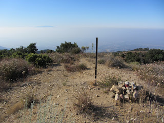
View north toward Monrovia Peak from the summit of Mount Bliss8:29 - Mount Bliss (3720’). Aside from Azusa Peak via Garcia Trail, this is my most visited summit. It doesn’t get much traffic so I’ve always had solitude here. It offers a splendid 360 panorama, which is somewhat muted today by a marine haze. The peak lives up to its name “Bliss,” except for the flies and muffled drone of the 210 Freeway far below. The sun is getting warm now. I sign the peak register. Looks like frequent visitor Gary Meza is addicted to this peak. Forty-five minutes on the summit pass quickly.

View south9:15 - Leave peak. Sun is warm so I’m glad its downhill all the way. Wildlife encounters for the day include rabbit, deer, lizards, butterflies, squirrel, quail, Steller’s jay, and various other birds. Animal tracks on the road include several snakes and mountain lion. Mountain lion track My pace is fast but I stop frequently to take pictures and soak in the scenery. I appreciate brief sections of shade. Pass the power tower retaining wall and views south to the human sprawl emerge. When I arrive at the locked gate, a mountain biker passes me going down. Pass the power towers and begin a jogging pace—seems easier than walking down the steep road. Occasional breezes are welcome.

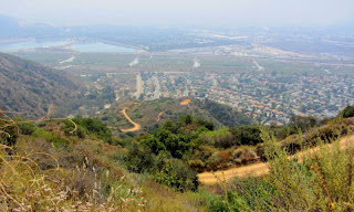
View south from Van Tassel Fire RoadI look east across Van Tassel Canyon toward Van Tassel Ridge and wonder how that scene will look once Vulcan Materials begins mining it. It will have an impact but I think it will be better than if they had advanced on Fish Ridge. When I get to the spur trail coming up from Mel Canyon, I take a jaunt to check it out. It’s used a lot by equestrians to access a flat spot on the ridge, but the brushy route coming up from Mel Canon looks less than inviting. Back to the main road at 11:35.

Sunflower11:43 - Done. Car thermometer reads 84 degrees. Seems warmer.

Epilog - Good outing. Solid workout for my body. Watched a new day emerge. Experienced nature. Enjoyed solitude on a trail that has become an old friend. icon

See Mt. Bliss hike description at Dan's Hiking Pages

CameraSee Mt. Bliss hike photo album