Thursday, September 12, 2013

Western Cyn to Mt. Hollywood & Bell in Griffith - Sept. 12, 2013

Griffith Icon In the six years I’ve been hiking in Griffith Park, I’ve not repeated a hike. With the vast web of trails, I’ve been able to cobble together various trail sections and destinations to create a different hike each time. My first and only time to hike up Western Canyon was on May 14, 2010 to the observatory to celebrate its 75th anniversary. So today’s hike will be a first for me as I hike from Western Canyon all the way to Mt. Hollywood and beyond. The convergence of having the car for an early morning meeting at work, decent temperatures, and an itch to hike in Griffith Park occasioned this outing.

I leave my office in Echo Park at 3:17, jump on the 101 Freeway, and head north. I exit Hollywood Blvd. and navigate my way to Fern Dell Drive off Los Feliz Blvd. I decide to park in the residential area adjacent to the park so that if my timing is off, I won’t have to worry about hurrying back to my car to avoid the consequences of the park’s “no-parking after sunset” rule (today sunset is 7:03). It’s 86 degrees.

3:45 PM - Begin hike from trailhead across from The Trails Cafe on Fern Dell Drive. Cross a couple bridges and walk north through the Ferndell picnic area. I love the mature sycamores and their shade. Soon I reach a confluence of trails at the bend of Western Canyon Drive (across from the large parking lot). I stay right and continue north on Western Canyon East Trail. The sun is warm as I leave the shady canopy. Mt. Hollywood stands majestically at the north end of the canyon. There is virtually nothing in bloom and vegetation is parched…a huge difference from the lush greenness and life of spring. I always wonder why the early guardians of the park felt compelled to carve all these wide dirt roads though this rugged natural space.

Soon I reach the junction where the west route joins and I continue up. I eyeball narrow use paths and ponder future exploration. Over my shoulder the Pacific Ocean and Catalina Island begin to reveal themselves through the Canyon’s v-shaped month to the south. My road bends east and south as it makes its final ascent to Western Canyon Road. Just before the road, I veer right to visit the splendid lookout terrace. Its strategic location is ideal for spending a few minutes scanning the opposite canyon slopes and examining the use paths dropping into the canyon from the west ridge. One of these shall be my return route.

4:30 - Leave the lookout terrace and walk the couple hundred yards to Western Canyon Road. I cross the paved road to continue up the trail. Within a couple minutes the Hollywood sign on Mt. Lee to the west comes into view. A few more minutes brings me to Charlie Turner Trail where it crosses the Vermont Tunnel. Views to the east and southeast open up. I pick out a few landmarks, including my office building in Echo Park. A ribbon of bluish-gray haze defines the distant horizon.

I cross the bridge and veer right, departing from the wide dirt road, and begin to climb the narrow path up the south slope of Mt. Hollywood. I always prefer this route over the wide dirt road. The climb is steep and the sun is warm. I love the amazing views of the rugged parkland and sprawling metropolis. And in spite plenty of foot traffic in the park today, it’s easy to feel a degree of solitude and escape.

Arrive at junction of Vermont Canyon Trail coming up from Bird Sanctuary to the east. Choose to take the path straight up the ridge rather than baring left on the gentler route. It’s steep but I’m enjoying the workout. Six minutes more delivers me to the five-point junction south of Mt. Hollywood. I have three choices to get me to Mt. Hollywood, but I’m a hiker so I choose the middle one and continue up the steep ridge. This is the good life. The summit looms above.

5:07 - Mt. Hollywood (1625”). I love this peak. What an amazing panorama! Always people here. Visibility is pretty clear today. I chat with a young man and woman and point out various landmarks. I notice several small trees have been planted along the south edge of the summit. As these grow it will decimate the view. Gotta get that fixed!

5:35 - Leave the summit and head north. Pass the four-point junction and walk along the ridgeline toward the “Bells”—Baby Bell and Mt. Bell. I enjoy great views east while the view west is hazed by the late afternoon sun. I veer left on the use path and decide to skirt Baby Bell for this trip. I spot the old control tower for the long-gone Grand Central Air Terminal in Glendale and think about the early days of aviation in So Cal (see my Beacon Hill Hike description for more). I arrive at the saddle east of Mt. Bell and three minutes gets me to the summit.

5:52 - Mt. Bell (1582’). I love this peak too. I’ve climbed this summit more times than any other peak in Griffith Park, probably because of its central location. And I’ve encountered another person up here only once. Great panorama to the north and east. I take particular interest in photographing the Verdugo Mountains where I was two weeks ago. Zoomed in on Mt. Hollywood, there are 12 people there now, with one hanging upside down.


6:02 - Leave summit and head west I’ve got one hour till sunset. A five-minute scramble delivers me to the road about 70 yards from the saddle west of Mt. Bell. I continue down, take a shape left, and arrive at paved Mt. Hollywood Drive. My original plan was to descend via Brush Canyon Trail, climb the ridge past Bronson Caves and drop down into Western Canyon. But I’m running out of daylight so I proceed down the paved road. The golden hour provides wonderful warm light for pictures. With great interest, I gaze down into Brush Canyon since I recently spent many hours completing my Brush Canyon hike description. I spot some routes worthy of exploration.

6:42 – Reach the ridge that separates Brush Canyon and Western Canyon. Across the canyon Griffith Observatory basks in the glow of the setting sun. I turn right (southwest) on the dirt road that follows the ridge town to water tank 116. In a couple minutes I turn left onto a spur ridge to check it out. A use patch heads down into Western Canyon which I had considered as an option, but ruled it out for this hike. Back at the ridge road I continue down. I arrive at the water tank to watch the sun set behind the western hills.

Now time to descend a ridge. I first I have to climb a steep knob which I hadn’t ascertained from the aerial photo. Shortly beyond the knob the path drops precipitously down a rock face. This is my route!!?? Eeeek! I take a big breath of courage and begin to carefully pick my way down using feet, both hands, and butt. After a tense few minutes I safely reach a saddle. I spot a group of several others climbing down behind me. I turn left and take a brushy path 100 yards to Western Canyon Road. Feels good to have my feet on solid pavement. My plan had been to descend another use path from this road down to the canyon bottom, but as darkness settles in, I opt to head down the paved road instead. After a few minutes down the road, a path heads down the slope. It looks doable. I take it. Four minutes delivers me safely again at Western Canyon Road at the bend where the parking lot is. My pace is relaxed now as I stroll through the picnic area under the sycamores. It’s dark now and there is a peacefulness here.

7:37 - Trailhead. That was fun! There are several cars still here and I wonder about the timing of officials in enforcing the “closed-at-sunset” ordinance. I know that they do ticket and tow, so I wouldn’t gamble leaving my car here into the dark. I stroll back to my waiting car parked safely out of the park zone.

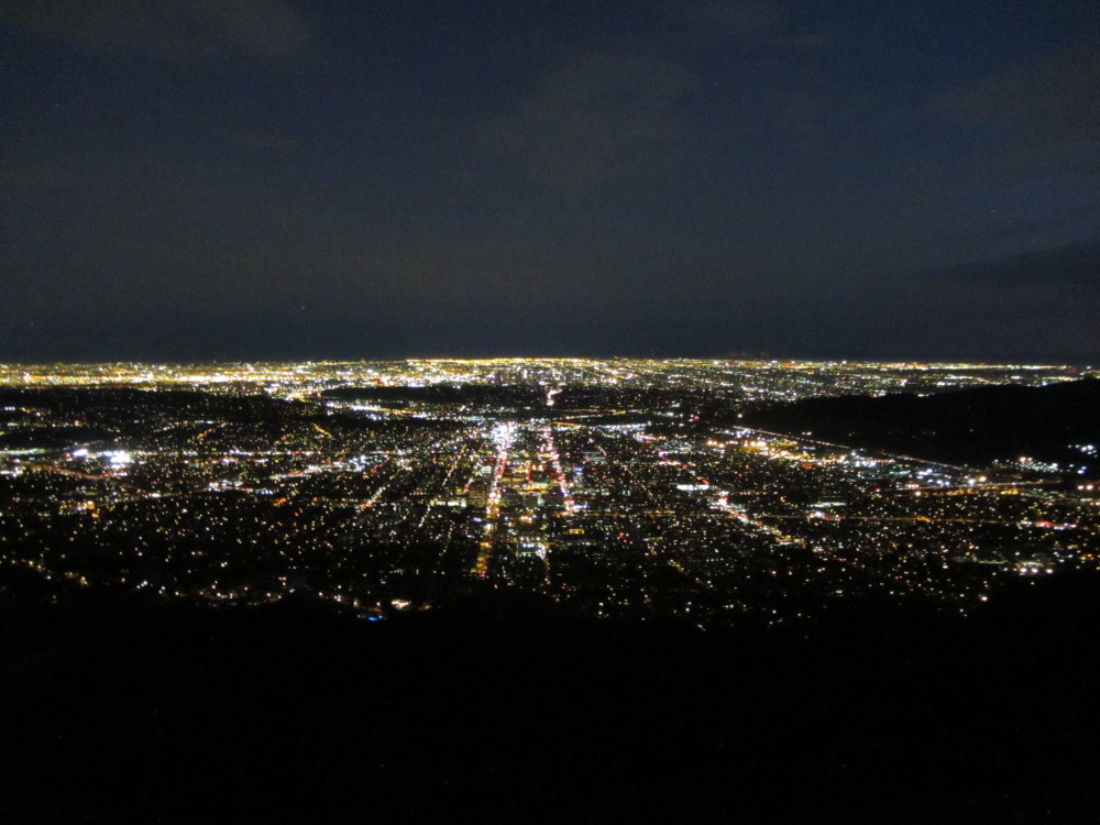
Epilog - What an enjoyable outing in my beloved Griffith Park! I love exploring new routes. I’m learning to never underestimate the park trails and that being diligent to plan off-trail routes is a good thing. And I love to experience day turn to night and to watch the human sprawl turn to a sea of twinkling lights. icon


Griffith Icon  See Hiking Griffith Park at Dan's Hiking Pages
  (includes links to my other blog posts for hiking in Griffith Park)

Related Hikes in Griffith Park:
NEXT > Mt. Hollywood and Mt. Bell via Griffith Observatory - Sept. 19, 2013
PREVIOUS > Mt. Lee Hike in Griffith Peak - June 25, 2013

Thursday, August 29, 2013

Verdugo Mountains South Hike - August 29, 2013

View west toward Burbank and the San Fernando Valley from Mt. Thom
The need for a conditioning hike occasioned this foray up the southern slopes of the Verdugo Mountains. My first adventure into the Verdugos was last December, and I so thoroughly enjoyed my hike, I knew I needed to come back. This small range, which lies between Crescenta Valley and Burbank, is best hiked in the winter or early spring when the rains have cleaned the air and brought green growth, flowers are blooming, and temps are pleasant. The time NOT to hike the Verdugos is in the middle of the summer on a hot day. I knew that, but I had to hike someplace nearby with substantial elevation gain, so this punishment was as good as any. And I’d cover some new territory to boot.

View north toward Mt. Thom and Tongua Peak from Freeway 2
Along with my Verdugo Mountains Trail Map by Tom Harrison, I leaned on the ever-dependable Jerry Schad and decided that his South End Loop (5.5 miles, 1,500’ gain) would be the ideal core for this hike, with the option to add some additional mileage and elevation at the top. And approaching from the east should provide some shade and help mitigate the heat.

I leave my office in Echo Park at 3:10 p.m. and take Freeway 2 north to Glendale. I exit on Mountain and navigate my way to the trailhead at the intersection of Beaudry Blvd and Beaudry Terrance. It’s a brisk 96 degrees!

3:35 p.m. - Begin hike on Beaudry Motorway (1,200’). The paved route starts to the right of a flood control wash and in a couple minutes passes by a locked vehicle gate and proceeds up the canyon on a wide dirt road. It’s been freshly graded...looks like today. It’s hot but oaks and sycamores provide a good amount of shade. At 0.4 mile I reach the junction of Beaudry North and Beaudry South motorways. Schad suggests going right on the North route since it will provide more shade for the ascent.

I turn right on Beaudry North and follow the wide, dirt road that ascends the steep mountain slopes through rich chaparral. Shade from both the trees and the steep road cut provides sections of welcome relief from the intense sun. An occasional breeze feels good. Soon I am treated with expanding views of Crescenta Valley and the rugged San Gabriels rising steeply behind. As I climb higher I round a bend and get a good view toward Tongue Peak, my destination, high on the backbone ridge.


There is hardly anything in bloom. The weedy non-native grasses are brown, and some of the native chaparral plants, like sticky monkey flower and black sage look parched. Poison oak is beginning to turn its fall colors. A row of cypress trees along the road makes me wonder why man thinks he can improve on nature.

4:50 - Junction (2500’, 2.3 miles). To the left (south) is my return route, which will visit Tongua Peak and Mt. Thom, two of the three named peaks (along with Verdugo Peak) in the Verdugos. But I will go right for at least another 0.6 mile to a saddle which should afford me views west. I sit on a nice rock, have a snack, study the map, and upload a pic to Facebook. After a 20-minute break I head north. The road runs below the ridge on the east. I’m still enjoying great views toward Crescent Valley and the San Gabriels. Soon Verdugo Peak comes into view a mile and a half north.

View south from junction
5:30 - Junction / Saddle (2660’). Wow, this is nice! There are great views south and southwest. I can see all the way to the Channel Islands. A pair of wooden benches provide a comfortable place to sit. Brand Motorway arrives here from the southwest. I linger for a few minutes, enjoy the breeze, and capture the scene with my camera. A noteworthy summit rises to the immediate northwest, which looks like it might be a good highpoint to hit before turning back. A steep use path heads straight up the ridge to the pointed summit. But I suspect that there will be a milder route up the road at the next saddle. So I continue along the road.

5:47 - Saddle. More great views. This is the location where the abandoned Skyline Motorway arrives from the west. Indeed a gentle path leads to the fore-mention summit to the southeast. But to the northwest an even greater summit juts into the sky. A steep path climbs to the top. I can’t resist. Up I climb. It’s crazy steep with slippery footing. I stop often to catch my breath. My primary worry is climbing back down this way. It will be treacherous! I’m hoping the top will yield a safer route down. Ten minutes delivers to the backbone ridge. Wow, the great view is worth the climb! The highpoint is still 100 yards north, so I continue up.

View southeast toward whence I cameView southeast toward whence I came View south toward Tongua Peak and Mt. Thom
View south toward Tongua Peak and Mt. Thom
View north toward Verdugo Peak from Summit 2960+
6:05 - Summit 2960’+. Now this is the sweat spot...360 degree panorama! It’s the highest point along the backbone until the cluster of summits around Verdugo Peak (3,126’), 0.75 mile north. I cast my eyes toward familiar landmarks amidst the vast human sprawl below me. I can see my office in Echo Park to the south. I’d like to linger here but it’s late. Not wanting to return on the treacherous route, I decide to continue along the ridge north. It appears that there is a doable route to meet the road in about 0.3 mile. Leave north at 6:17.
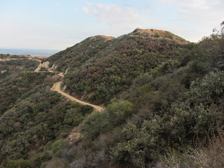
View south toward Summit 2960+
The ridge route is quite decent aside from some pesky brush on my bare legs. I descend to a saddle and up a steep path to another knob. Now it’s downhill the rest of the way. Just before another rise, I veer right on an old firebreak and follow a ridge northeast toward the road. The brush is thicker and I’m getting debris in my boots and on my sweaty clothes and skin. There’s not much foot traffic here and I’m concerned that this route will dead end at a steep road cut with no easy way down. Thankfully, a couple hairpins at the bottom of the ridge deliver me to the road at 6:43.

Now a nice dirt road the rest of the way! Soon a mountain biker passes…my first human encounter for the whole hike! I reach the saddle/junction with the abandoned Skyline Motorway and chuckle at my adventure up that steep route to Summit 2960+. Now I take the use path east to the summit I skipped earlier. Three minutes gets me to the top (2800+). I continue down the use path to the saddle.

7:06 - Junction / Saddle (2660’) (with Brand Motorway). To the south, Tongua Peak, basks orange in the nearly setting sun. I was hoping to get a good view of the sunset (7:24) but my summits to the west block line of sight. I’ll see if I can reach Tongue Peak in time. But first I sit on the bench and clean the debris from my boots. Two mountain bikers arrive. The setting sun colorfully illuminates the sky and clouds. An orange glow rests on the San Gabriels. I leave the junction at 7:14 and climb the use path veering east and in a minute I arrive at a round reservoir covered with corrugated steel. I ponder continuing down the ridge but it’s getting late and I’ve had enough wandering through brush today. I return to the junction and continue down the road. There is a beauty to dusk. More mountain bikers pass.

7:29 - Junction (2500’). I briefly ponder heading down the way I came up, but I haven’t come all this way to not bag the two named peaks at the south end of this range. Just past the junction a view opens to the west to reveal a gorgeous orange sky and the San Fernando Valley beginning to twinkle with lights. The route bends left (east) and winds its way to the summit. A large group of hikers are coming down.

7:37 - Tongua Peak (2656’). A barbed-wire topped chain-link fence surrounds a large communication array on the peak’s flattened top. I continue down the road with my eyes on Mt. Thom, about 0.7 mile away. It’s nearly dark now.

7:54 - Junction (2420’). To the right is Las Flores Motorway heading 2.4 miles south to Sunshine Drive. To the left is Beaudry Motorway South, my return route. Straight ahead is Mt. Thom. Several hikers are here and several more are coming down from Mt. Thom. I continue straight.

View south toward Glendale and Los Angeles Mt. Thom
7:57 - Mt. Thom (2440’+). The flattened summit hosts another communication array. I circumnavigate the fenced facilities enjoying nighttime views over the immense human sprawl. I leave the summit at about 8:03 and return to the junction. I move my flashlight from my pack to my pocket. I turn right and start my 2.3-mile descent. The ambient city light reflecting off the clouds is sufficient for my walk. I’m tired and ready to be home. I stop and fix my left boot which is beginning to hurt my foot. It’s still quite warm. I’m enjoying the views. Hiking at night is very different. My pace is slow. The road is really steep in sections. I finally reach the last junction at 9:13, turn right, and retrace my steps to the trailhead.

9:26 p.m. - End hike. It’s 84 degrees!

Epilog - What a fun adventure which exceeded my expectations! I hiked 8.4 miles with 2,230 in elevation gain. I conquered two of the three named peak of the Verdugos and the 2960-plus-foot summit that towers over the south end of the range. I survived the heat. I enjoyed lots of solitude, good exercise, expansive views on a relatively clear day, and the beauty of day turning to night. I look forward to my next expedition into the Verdugo Mountains. icon

Trail Notes:
Books: Jerry Schad presents three hikes in the Verdugos. His “South End Loop” describes hiking up Beaudry North and returning on Beaudry South, 5.5 miles with 1,500 feet in elevation gain (which is the core of the hike I describe above; I added another 2.9 miles on the top). John McKinney presents five hikes in the Verdugos; he briefly covers the same hike as Schad does as an option in his Beaudry Canyon hike.
Peaks: Both Tongua Peak and Mt. Thom are labeled on the Tom Harrison Map but with no elevations. Neither Tongua Peak nor Mt. Thom are labeled on the USGS topo map, (but Tongua is listed as 2656’), nor are they listed with the USGS Board on Geographical Names. Both peaks are listed on Peckbagger.com: Tongva Peak (2656’) (note spelling “Tongva” rather than ”Tongua”) | Mount Thom (2440+’).

See my blog for Verdugo Peak Hike – Dec. 20, 2012

Visit Dan's Hiking Pages
 

Saturday, August 17, 2013

Islip Ridge Trail Work with the Trailbuilders - August 17, 2013

View Northeast Islip Ridge toward Mt. Islip
I’ve not been out on the trail much this summer as I’ve been focused on a project at the house. So when the email came announcing this Saturday’s projects with the San Gabriel Mountains Trailbuilders, I decided to take a break from the house renovation and head for the high country. There is to be two crews for today. A chainsaw crew would leave early and head up to remove deadfalls above Little Jimmy Trail Camp and on Big Cienega Trail. The other crew would meet at the regular 8 a.m. time and do some tasks at Rincon and then up to Crystal Lake. I opted for the early group.

Since I live a few blocks from Hwy 39 in Azusa, I made arrangements to be picked up at the corner of Hwy 39 and Ninth Street. At 6:25 a.m. I climb into Jonathan’s big red pickup truck and we head up San Gabriel Canyon to Rincon Ranger Station to pick up equipment. We rendezvous with Fred, Brian, Bob, Alan, and George. Alan decides to drive up to Crystal Lake to work on Big Cienega Trail from the lower end. The other six of us pile into the crew cab and head up the highway. A key and permission from the Forest Service allows us to drive on the closed section of Hwy 39 to reach Hwy 2 at Islip Saddle (6670’), saving a long drive up the Angeles Crest from La Canada. A few minutes east on Hwy 2 brings us to a locked gate and forest service road leading to Little Jimmy Trail Camp. A key and permission save us a bunch of extra hiking to get to our work site.

Trailbuilders at Little Jimmy Trail Camp
8:15 a.m. - Arrive at Little Jimmy Trial Camp (7450’). There is only one group here today: a Boy Scout troop from Corona. I’m always amazed that such a splendid campground can be so sparely used on a fare-weather weekend. After we gear up, Fred drives the truck back to Crystal Lake as we five hit the trail.

8:35 - Leave little Jimmy on the Pacific Crest Trail heading southeast 0.3 mile to Windy Gap. It’s a beautiful day with clear skies, mild temps, pleasant breezes, and the sweet aromas of the forest. I love this high country and am thankful that the gallant fire-fighting efforts kept the 2002 Curve Fire from coming over the ridge from the Crystal Lake Basin and destroying this forest too. Majestic pine, cedar, and fir reach into the deep blue sky.

Windy Gap
8:49 - Windy Gap (7588’). It’s windy here, as always. Jonathan and Brian admire their handiwork, having carved some fine log benches last year. I reflect on being here on September 3, 2012 on the tenth anniversary of the Curve Fire. On that day I was surrounded by thick, acrid smoke from the Williams Fire 2012, which started the day before (read about my adventure here: Hawkins Ridge Hike - September 2-3, 2012). Today, however, the air is clear and the vistas are superb. We linger about 10 minutes then proceed about 200 yards up the trail heading west to Mt. Islip to tackle our first project for the day.

Trailbuilders removing a deadfall on Mt. Islip Trail
9:00 - Deadfall. Our task is to remove a large white fir which was fallen across the trail. Jonathan, Brian, and Bob are certified with the U.S. Forest Service as chainsaw operators. George and I are along to help carry equipment, swamping (clearing branches and debris as the crew saws), and general trail repair. After assessing the task, the sawyers make quick work of cutting off limbs, cutting through the trunk, and clearing the trail. We complete the task in 45 minutes and proceed up the trial toward Mt. Islp.

I am thoroughly enjoying the beauty of this high country. Wildflowers grace the landscape while towering ridges rut into the sky. It’s quiet and peaceful here. I look across the vast heart of the rugged San Gabriels and familiar mountain peaks elicit memories of many adventures. The distant Los Angeles basin filling the southern panorama is muted by marine haze.

Junction to Islip Ridge Trail
10:38 - Junction on the southern flank of Mt. Islip (8080’) To the right the trial proceeds 0.1 mile to the summit of Mt. Islip. To the left (southwest), Islip Ridge Trail descends the ridge 0.8 mile to Big Cienega Trail junction and then another 3.9 miles to Crystal Lake. We rest here for a few minutes. A party of several hikers passes by on their way to the summit. These are the only ones we’ve encountered on the trail so far. Again, I am amazed at how few people are partaking of these fine trails and specular scenery on this gorgeous Saturday. It’s a striking contrast to the many hundreds who will be swarming the trails of Mt. Baldy and Icehouse Canyon today.

View southeast into Crystal Lake Basin from Islip Ridge Trail
Our sawyers head down Islip Ridge Trail as George and I linger for a while and enjoy good conversation and the beauty of the setting. As we descend I reflect on the great hike I had coming up this ridge a year ago July and my encounter with a herd of bighorn sheep. No sheep today…just hoof prints and scat. I look northwest toward Will Thrall Peak and Pallett Mt. and think about my plans to climb them before the season turns. I love the beauty of this breathtaking scenery. I stop occasionally and my use my McLeod (half rake/half hoe) to do light trial work.

Big Cienega Trail junctiton
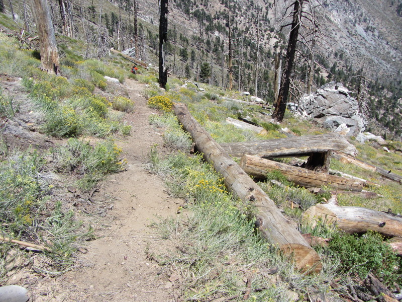
12:10 - Big Cienega Trail junction. From here we turn northeast to follow the trail as it descends into the upper reaches of the Crystal Lake Basin. Devastation from the 2002 Curve Fire abounds. Most of the forest around us here is dominate by dead tree trunks rutting into sky and laying on the ground.

12:16 - Work site. A jumble of several large tree trunks blocks the path. The chainsaw gang has already begun work. It takes some training and experience in assessing the best plan of attack in dismantling this tangle of timber. Piece by piece we cut and clear and are able to complete the chainsaw work by 1 p.m. (the time set by the Forest Service to cease use of chainsaws). We finish muscling the remaining logs off the path then break for lunch. Fred arrives and appreciates our work.
Trailbuilders removing deadfalls on Big Cienega TrailBefore Big Cienega Trail restored by Trailbuilders
After
1:45 - Leave the site and head down the trail. Soon we reach Alan, who has done an amazing job working a substantial section of trail. We continue down the trail through varied landscape and surround by towering ridges and rugged beauty.

San Gabriel Mountains Trailbuilders after a day of work
2:52 - Arrive at the truck that Fred parked on the South Mt. Hawkins Road. We are hot, tired, and dirty, but the satisfaction of a job well done makes it worth it. We are eager to pile into the truck and leave. Soon we rendezvous with our leader, Ben White, and others who came up later. An ice chest of cold drinks is so welcome!

Epilog - What a productive and fulfilling day! Beautiful weather, meaningful work, hearty exercise, spectacular scenery, rewarding four-mile hike, and great camaraderie swapping stories and just enjoying the companionship of good folks who love the outdoors. If you’d like to get in on the fun, come out and spend a day with the San Gabriel Mountains Trailbuilders. Everyone is welcome. Workdays are on the first, third, and fifth Saturdays of each month. Visit the San Gabriel Mountains Trailbuilders website to learn more. icon