|
View south from Hawkins Ridge toward So. Mount
Hawkins with the Williams Fire gaining in intensity |
 View Photo Album of Hike
 - 130 photos
I had an extraordinary hiking experience this weekend as I climbed Hawkins Ridge to commemorate the 10-year anniversary of the Curve Fire which destroyed the historic South Mount Hawkins Fire Lookout. And yesterday, Labor Day Sunday, as I stood on the ruins of the fire lookout, I could hardly believe my eyes. At 2:32 I spotted a column of spoke due south rising from East Fork San Gabriel River. This was nearly the exact same time 10 years ago to the day when a fire lookout looking south would have spotted the start of the Curve Fire. The timing was extraordinary. The hike was surreal.
Ten years ago on Labor Day Weekend 2002, I had planned an overnighter on Hawkins Ridge above Crystal Lake from Sunday to Monday. Those plans were preempted when the Curve Fire erupted at about 12:35 on Sunday afternoon, September 1. By the time the fire was out weeks later, it had consumed 20,857 acres of our Angeles National Forest, including most of the Crystal Lake Basin, much of the Sheep Mountain Wilderness, and the historic South Hawkins Fire Lookout.
So on this Labor Day weekend 2012, I planned a Hawkins Ridge hike to visit the ruins of the historic fire lookout, hike up Hawkins Ridge, spend the night on Mt. Hawkins, and return via PCT and Windy Gap Trail.
 |
Gate across from the Crystal
Lake visitor center
|
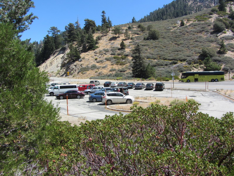
I leave my house in Azusa at 8:04 a.m. on Sunday morning for the 45-minute drive to Crystal Lake. I am excited. The forecast is for good weather with the possibility of afternoon thunderstorms in the deserts and mountains. So I would watch the weather carefully. As I drive past the West Fork and beyond, gazillions of cars are parked in the parking lots and along the highway. What a crowd on Labor Day weekend! The Crystal Lake Campground is jammed packed and overflowing too. The aroma of campfires fills the air. I find a parking place next to the gate across from the visitor center. After a brief visit in the visitor center I’m ready to begin.
I walk past the locked vehicle gate and up the paved road through the closed section of the campground. I’m surprised that even this area is filled with holiday campers. A half-mile walk brings me to Windy Gap Trial trailhead. Now I’m ready to hike.
 |
View north toward Windy Gap
from near the beginning
of Windy Gap Trail |
9:10 AM - Begin hike. I meander along the rock-lined Windy Gap Trail through stands of oak and pine. I get glimpses of the towering ridges surrounding the basin. I look to Hawkins Ridge on the east and imagine myself up there in a few hours. At 0.4 miles, I cross the first occurrence of South Hawkins Fire Road. I transition from the living forest that was spared by the Curve Fire into a stark toothpick forest. I’m adjusting to the pack on back, which is quite different from my regular day pack. My pace is slow as I conserve energy for a long hike. A large group of children led by several adults heads down the trial. The bright yellow blossoms of rabbit brush are abundant.
 |
View southwest from South Mount Hawkins Road
with damage from the 2002 Curve Fire in the foreground |
9:53 - Second occurrence of South Hawkins Fire Road, 1.1 miles from the start. I think about the bear I saw last year at this location. I also reflect on the workdays I’ve spent with the
San Gabriel Mountain Trailbuilders. We park our vehicles here to work on Windy Gap and Big Cienega trails. After a break, I turn right (south) to start the 3.7-mile climb to South Mount Hawkins. I’m now on a route that I’ve not hiked before, which is always special to me. The road had been abandoned by the Forest Service after torrential rains following the Curve Fire damaged sections of the road. Rocks and debris litter the route in places. Towering rock walls and massive scree slides make me feel small. The visibility is good and I’m enjoying the picturesque scenery. I see my route far ahead as it cuts across the mountainside. The temperature is pleasant as I stroll through intermittence patches of open space, living trees, and dead trees. I look across to Islip Ridge and reflect on my splendid hike there in July.
 |
| View south on South Mount Hawkins Road |
Normally hiking on a fire road is not my preferred choice, but the rugged beauty and sweeping vistas of this breathtaking topography makes it worthwhile. The grade is pleasant, climbing at a rate of only 294 vertical feet per mile. I cross two sections where the road is washed out, which would take some engineering and heavy equipment to repair. Crossing the washouts is not difficult. There are also some downed trees laying across the road.
11:08 - Soldier Creek. There’s no water visible but lush vegetation. I sit on a comfortable rock in the shade and enjoy a 15-minute break. It’s quite and peaceful. Sugar pine, Jeffery pine, and white fir grace the mountainsides. All along the way I’ve been scanning the landscape to scout out potential off-trail routes up to this road. I indentify a couple ridges but they are awfully steep.
 |
View southeast on South Mount Hawkins Road
toward South Mount Hawkins |
11:35 - I round a bend and have my first view south toward the reservoirs in San Gabriel Canyon. In five more minutes I round another bend and have my first view of South Mount Hawkins jutting prominently into the sky. This area was burned pretty badly. It’s always intrigued me how a fire can ravage an area but yet still leave some trees untouched. As the topography mellows out, the road twists and turns as it climbs higher.
12:01 - Camera battery pack dies. It should have been good for the entire day, so I think this battery is ready to be retired. I put in the backup. I have some angst that for the rest of the trip I have to be conservative in my shooting.
It’s starting to get warm now in the full sun. A breeze feels good. Three hikers come down the trail. I take a short energy break. Encounter a couple more hikers coming down.
 |
View south on South Mount Hawkins Road
toward South Mount saddle |
1:03 - Saddle Junction (7470’). I had hoped to have stunning views east toward Mt. Baldy but trees obscure the view. But thankful for living trees! One sign points north to Hawkins Ridge Trail 0.1 and south to So. Mt. Hawkins Lookout 0.5. The Harrison map shows it as 0.6, which might be referring to the road rather than the ridge route. I opt for the road and so up I climb as it traverses south along the western flank of the South Mount Hawkins. The scenery is grand. As the road curves around the south slope, I’m treated with a breathtaking panorama. It’s no wonder this location was selected for a fire lookout. A haze mutes the human sprawl in the valleys below, however, I can see all the way to Catalina Island. The road continues to curve around the mountain to head north. A dense forest of trees survived the rampage of 2002 Curve Fire. The road, like a corkscrew, curves around the north slope and ascends south for the final pitch to the summit.
 |
| Ruins of South Mount Hawkins
Fire Lookout |
1:30 - South Mount Hawkins (7783’). Wow, I’m finally here after many years of waiting. The historic fire lookout lies in ruins. Burned timbers cut into short lengths lie in a large heap. There’s a pile of scrap metal that had a former life serving a fire lookout. Other debris is scattered about. Four concrete pilings mark the location of tower legs which lifted the 14 x14 lookout cab 30 feet into the sky. On the south edge of the summit, a foundation is all that is left of the resident structure. This almost feels like sacred ground. I resist taking anything as a souvenir. A small slab in the shade of a Jeffrey pine makes an ideal place to sit and enjoy lunch.
 |
2:32 p.m. - View south toward the Williams Fire
2012
from the ruins of South Mount Hawkins Fire Lookout |
After lunch I begin to look around the ruins and take more pictures. And then it happens. At 2:32, as I stand on the ruins of the fire lookout, I spot a column of smoke due south. I gasp and cry out, “Oh no!” I immediately realized that this would have been what the fire spotters would have experienced 10 years ago nearly to the movement when the Curve Fire erupted. Is this some kind of reenactment!? Although I’ve never been a fire spotter serving at a lookout tower, I have visited a few lookouts over the years and have a feel for the responsibilities. At that moment I felt the adrenaline rush that a spotter would have experienced in jumping into action to report a fire. But I have no means of communication (I had already found that I had no cell reception here). All I can do is watch and pray. I recognize that the smoke is coming from the East Fork and I am aware that this is the area where the Williams Fire started 10 years ago this month.
 |
| Williams Fire 2012 |
I walk to the south edge of the summit area and sit for a long time watching the blaze. The fire is small and so the optimist in me thinks this should be ok. Just put it out now and it will barely make the evening news. I am expecting to see aircraft hitting the fire, but the only thing I see is a single helicopter apparently just doing observation. The smoke grows. It’s disconcerting to me. Please let this not be another Station Fire—which, as a result from bureaucracy, misguided policies, and poor judgment—was allowed to consume one third of the Angeles National Forest. Surely we won’t repeat that, will we?
As I watch the fire grow, I eagerly wait to see a jumbo jet swoop down and drop its load of orange foscheck. Or at least let’s see a super scooper or even some helicopters. I figure there is a herculean effort on the ground to scramble resources and evacuate those in danger, but why aren’t they fighting this thing from the air!?
 |
3:16 p.m. - View south toward the Williams Fire 2012
from South Mount Hawkins one hour after it begin |
I take my last picture of the fire from this location at 3:16 (one hour after it began) and decide to continue my hike up Hawkins Ridge away from the fire.
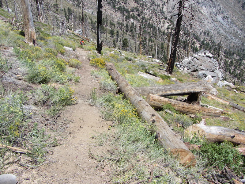
3:16 - Leave the South Mount Hawkins. I take the ridge route north. The location where ridge meets the road gets rocky and steep and a little tricky to negotiate. I cross the road and continue down the ridge. It’s somewhat steep but not bad. There’s no path but there are indications that others have taken this route. After about 10 minute I arrive at a trail. I didn’t realize a formal trail climbed this ridge. I followed it down.
 |
| View east toward Mt. Baldy |
3:32 - Saddle Junction (7470’). A sign indicates 2.3 miles to Pacific Crest Trail (PCT). A dirt road heads up the east side of the ridge heading north. In 0.1 mile the road reaches a flat area and turns into a faint footpath continuing up the broad ridge. Looking back over my shoulder I see smoke filling the sky. The wind is blowing from the west so it’s pushing the smoke toward Mt. Baldy. The canyons are beginning to be choked by smoke.

I reach a large meadow-like area and the trail disappears. I stay to the left edge since there seems to be a hint that there may be a trail here and I see footprints probably from the hikers I met earlier. The trail doesn’t materialize and so I cut left and climb a steep slope to the ridge. It seems the Curve Fire was capricious in selecting what trees to kill and what to let live. I continue up the board ridge carefully picking a route over undulating terrain through dead grass, hardy vegetation, and fallen trees. Huge billows of smoke fill the southern and eastern sky. I wonder what fire officials have launched as an aerial attack.
 |
View northwest toward Windy
Gap and Mt. Islip (left)
from Sadie Hawkins |
4:29 - Sadie Hawkins (8047'). This is a nice summit. There are a lot of trees obscuring the panorama but I have a commanding view west and northwest into the Crystal Lake Basin. I sit on a rock and take a 30-minute refreshment break. I’ve not done as much long hikes this summer so I’m feeling the effects of not being in top condition.
I leave the summit heading north on the semblance of a path. Middle Hawkins stands as an imposing mass on the ridge to the north. I had not anticipated on it being so big. Within a few minutes the slope begins to drop steeply. It’s strange to see what appear to be bike tracks in the loose dirt. As I near the saddle I meet the actual trail coming in from the east flank Sadie Hawkins.
 |
View north on Hawkins Ridge en route to
Middle
Hawkins |
I’m on a nice trail now as I begin to ascend the ridge. It hits a couple spots on the ridge with dramatic views west before it begins to traverse around the east flank of Middle Hawkins. I admire the fine rockwork of the San Gabriel Mountains Trailbuilders. Smoke continues to fill the southern and eastern skies. I don’t see a route to the summit of Middle Hawkins but figure there is one from the north ridge. The hike descriptions from both Robinson and Schad are void of any details in hitting Sadie and Middle. I round the hip and in a few minutes reach the ridge on the north of Middle Hawkins. A path heads south up the ridge. I’m looking at the time (6:03) and contemplate skipping Middle Hawkins to ensure I reach Mount Hawkins to set up camp before nightfall. But who knows when I’ll be back here again? I decide to hit the summit. I turn left and begin the steep, rocky climb. It reminds me of the trial climbing Baldy’s east ridge as it snakes up the mountain.
 |
| View south from Middle Hawkins |
6:13 - Middle Hawkins (8505'). Wow, this is an impressive peak. Large rocks crown the summit. I don’t see a peak register. I look around and take in the views. The smoke shrouds the horizon to the south and east. I’d like to linger longer but I must keep going. I leave the summit at 6:30 and retrace my steps down north ridge and reach the main trail in eight minutes. The trail ascends and traverse along the east flank of a final large knob along the ridge. Past the knob I achieve a board saddle and in another minute hit...
6:50 - Junction Pacific Crest Trail (8390’). The sign is gone and only a post lies on the ground. A left turn (west) would take me to Windy Gap (1.4 miles) and if I kept going, to Canada. I turn right (east). The trail soon veers northeast to skirt a large knob on the ridge. The setting sun casts an orange hue on the scenery. A toothpick forest is a stark reminder of the destructive Curve Fire.
 |
| View of sunset from Mount Hawkins |
As the trail emerges on the east side of the knob, Mount Hawkins looms in front of me draped in bright orange. With the sun ready to set, I decide to climb the more difficult west approach to the summit so that I don’t miss photographing the setting sun. I would like to have already been comfortably camped on the summit but that extra hour on South Hawkins watching the fire put me at a time deficit. I don’t see any path heading over to the west ridge so pick a spot to go off trail and weave my way through the low brush. On the ridge now, a use path climbs steeply up the rocky slope. As the sun sets behind the peaks of the western San Gabriels, I busily snap pictures to capture that perfect sunset photograph. The sun disappears at 7:19. And in an instant, like the flip of a switch, everything went from warm orange to muted gray. Now for the final push to the top.
 |
| View south from Mount Hawkins
menaced with smoke |
7:27 - Mount Hawkins (8850’). I’ve arrived! For the first time since I spotted the fire at 2:32, the air around me is smoky and the visibility is muted. It’s eerie and I’m hit with a very uncomfortable feeling being here. The acrid smoke is irritating my eyes and making it hard to breath. Has the fire advanced more quickly than I had thought? Am I in danger? I really don’t want to be here and certainly don’t feel at ease spending the night here.
[As I’m writing this portion of the blog post days later, I debate whether I should admit what happens next. Part of me is embarrassed and would rather gloss over it. But part of me feels that perhaps being transparent may help others learn from my mistakes. Ok, here it goes, true confessions...]
As I stand on Mt. Hawkins surrounded by smoke, I find myself feeling some fear. My logic says the fire is many miles away and has no possibility of reaching here tonight. But my senses are impacted by the smoke and lack of visibility. I decide not to spend the night here on the summit. It seems like a good plan to follow the path east 0.2 mile to PTC then consider my options. Plan A is to head west to Windy Gap (2.0 miles) where I could spend the night or head down the ravine 0.2 mile to the highway if needed. Plan B is to head east past Throop Peak and down to the highway at Dawson Saddle (2.7 miles). This of course would put me many miles from my car at Crystal Lake.
 |
| Descending from Mount Hawkins
after sunset |
I put on a long sleeve shirt, get out my flashlight (my preference over a headlamp, which I also have with me), and eat a power bar. At 7:35 I leave the summit and begin down the rustic path descending the ridge. It’s not as steep as the west approach but I thought the path would be better. Soon the darkness forces me to turn on my flashlight. I’m anxious to hit PCT. Shortly I figure that the trail must be close below me so I start down the embankment as a shortcut. There’s no sign of the trail and this steep, loose mountainside is no place to be. So I tangent back to the ridge and continue down. I’m starting to get puzzled because surely I should have arrived at PCT by now. I’d like to get a visual of Throop Peak but the darkness and smoke prevent me from seeing the topography beyond my immediate area. Maybe I missed a faint spur trail and now PCT is well below me. I figure I’d stay on the ridge and eventually it will hit the saddle between Hawkins and Throop and must cross PCT before ascending.
Down and down I go, climbing through brush, over logs, and around rocks. Sometimes there is a faint use path. This is crazy. Something’s not right. I’m starting to feel a little fear and bewilderment. In the back of my mind I began to entertain the thought that maybe I went the wrong way from the summit. Surely I didn’t go south down Copter Ridge? No, that’s impossible! Only ignorant people make those kinds of navigation errors. These are my mountains; I don’t get lost. As the visibility gets better, it’s disconcerting to me that Throop Peak is not looming in front of me. This ridge seems like it drops forever into an abyss, like Copter Ridge does. Oh my. It’s time to face reality. And this large, flat area is an ideal place to spend the night.
 |
| View southeast toward Pomona Valley
from Copter Ridge |
I sit on a comfortable log, get out my map and compass, and sure enough, I’m on Copter Ridge! I am now out of the smoke, the sky is clear, and I see no indication that the fire is advancing north. It would be much better to spend the night here than to climb back up the ridge in the dark. So here’s where I’ll bivouac. I feel at peace now. I lay out my sleeping gear, clean up some, have a bite to eat, and settle in for sleeping under the stars. There is no cell reception so my family will have to just feel my good-night wishes. The massive clouds of smoke have lain down. To the distant southeast, Pomona Valley lays as a blanket of twinkling lights. A bright red moon rises in the east. I fall asleep on Copter Ridge.
Monday, September 3
 |
Pre-sunrise view southeast toward Pomona Valley
from Copter Ridge |
5:57 a.m. - I wake up and am glad to see dawn arrive. There’s an orange glow over the eastern horizon as the sun prepares to rise. Lights still twinkle in the valleys below. Smoke hangs in the southern sky. The canyons are choked with smoky haze. I lay in bed for while. The temperature is cool but not bad. I’m startled by the chime from my smartphone announcing an incoming text message. It’s my daughter asking if I’m ok. I text back but the message is not able to be sent. I finally get up, get dressed, get my gear together, get breakfast, and get going.
 |
| View southeast from Copter Ridge |
7:50 - Leave my campsite on Copter Ridge and begin my climb up the ridge. Hiking in the daylight is great! Up and up I go, climbing through brush, over logs, and around rocks. I chuckle to myself as I think how I ended up here. Last night was crazy. This morning is fun. There is a cool breeze from the south. The forest around me is mostly living trees. The views are great and the scenery is dramatic. It’s very peaceful here. To the east, Mt. Baldy and neighbors poke above the haze. To the north, Throop Peak stands majestically, almost mocking me for my stupid navigation blunder. I look southwest across the canyon and admire Hawkins Ridge from a different perspective. The lower end fades away into smoke.
 |
View south from Copter Ridge toward
South Mount Hawkins |
8:30 - Mount Hawkins (8850’)! Wow, I’m here already! That went faster than I was expecting. I guess I can count this as a second ascent to this peak. I’m happy to have finally bagged this peak as my final peak in the top 10 highest peaks in the San Gabriels. There’s not the smell of smoke like last night and the sun feels good. I look around the summit and evaluate how I took the wrong route last night. One mistake I made was to think that the trail left the peak heading east. I had that in mind because this crest generally runs east and west from Baden-Powell to Vincent Saddle. But at this point, the ridge heads northeast and the trail actually heads almost due north! If I would have looked at the map more carefully and scouted around the summit for the route options, I could have avoided a 165-degree mistake. On the upside, that spot on Copter Ridge was a great place to camp and enjoy some splendid scenery coming back. I find the peak registry off to the side of the rock pile. It was placed here in August 2010 but has only one entry.
 |
View west from PCT amidst smoke from the Williams
Fire 2012 and damage from the Curve Fire 2002 |
8:50 - Leave summit and head north. This is a really nice trail! Gosh, how could I have missed it last night!? It takes only six minutes to reach PCT!! I make a sharp left (southwest) and head down the trail. By now the whole mountain range is smoky creating a very unpleasant atmosphere. After the Hawkins Ridge Trail junction, the trail descends generally west traversing around several large high points along the ridge crest. The topography is grand but horribly obscured by the smoke. I have an eerie feeling as I pass through sections of toothpick forest amidst acrid smoke; it’s almost apocalyptic. There is no one else on the trial and I hear no vehicles on the Angeles Crest Highway. What normally I would appreciate as solitude has a creepy feel today. I’ve never been on this section of trail and will definitely have to return when I can enjoy what would normally be a spectacular setting.
 |
| View southeast from Windy Gap down Windy Gap Trail |
10:30 - Windy Gap (7588’) (2.2 miles from Mt. Hawkins). The wind is blowing as usual, coming from the south and carrying nasty smoke. There is no view at all into the Crystal Lake Basin as it is shrouded in smoke. This is surreal. I take a break, inventory my liquid supply, and leave Windy Gap at 10:55 for the 2.5-mile descent to the trailhead.
I’ve been on Windy Gap trial lots of times and normally enjoy it. But today it is unpleasant hiking into a smoke bowl. The thousands of trees left dead by the Curve Fire are accentuated by the smoke and smell of this current inferno. As I approach the campground it seems deserted.
12:22 - Windy Gap Trail trailhead (5830’). I wander down the road. The campground is a ghost town. Obviously it’s been evacuated. I’m so eager to be home for a nice shower, refreshing Coke, and long nap. As I approach the visitor center, two gentlemen from the forest service walk to meet me and inquire about my presence. They are relieved to know that one of the two cars left was mine.
The drive down Highway 39 is also very strange being completely deserted. As I near the East Fork I can see flames, smoke, and helicopters. San Gabriel Dam is being used as a staging area for the helicopter air attack. I do my best to snap pictures from my privileged vantage point. As I pass the barricade at the month of San Gabriel Canyon, I think about other times I’ve stood here behind the closure line and watched my forest burn.
Epilog - What a strange and extraordinary experience. It started as a great hike memorializing the Curve Fire on its 10th anniversary, a fire that forever changed the landscape of our mountains. I felt the honor of standing at the historical fire lookout ruins and the horror of watching a new Williams Fire start. I felt the frustration of what seemed to be an incredibly slow response to attack the fire when it was small. I climbed four peaks I’ve not previously conquered while watching the sky fill with smoke. I experienced a smoky mountaintop and the angst of being temporarily misplaced in a dark and strangely eerie place. I enjoyed the relief of a comfortable night under the stars and hiked through a desolate forest of dead trees with the acrid smoke of a forest-destroying blaze. This is one hike am not likely to forget!

Trail Stats
The standard loop route comes out as follows with 3,333 feet in elevation gain:
|
| Windy Gap trailhead (5830') to So. Mt. Hawkins (7783') |
4.7 |
|
| South Mount Hawkins (7783') to PCT junction (8390') |
2.8 |
|
| PCT junction (8390') to Mt. Hawkins (8850') |
0.8 |
|
| Mount Hawkins (8850') to Windy Gap (7588') |
2.2 |
|
| Windy Gap (7588') to Windy Gap trailhead (5830') |
2.5 |
|
| |
13.0 |
|
The full distance of my hike was 15.4 miles with 4,180 in elevation gain. That includes side jaunts to Sadie Hawkins (200’ gain) and Middle Hawkins (150’gain) of about 0.5 mile each, a detour down Copter Ridge (500’ feet lose/gain) of about a mile, and a mile of waking through the campground to and from the trailhead.
Mileages based on the Tom Harrison map.
See my Windy Gap Trail hike description for driving directions, season, and other notes.
|
View Photo Album of Hike - 130 photos
Links on Dan’s Hiking Pages and Blog:
Other Links:


 Before