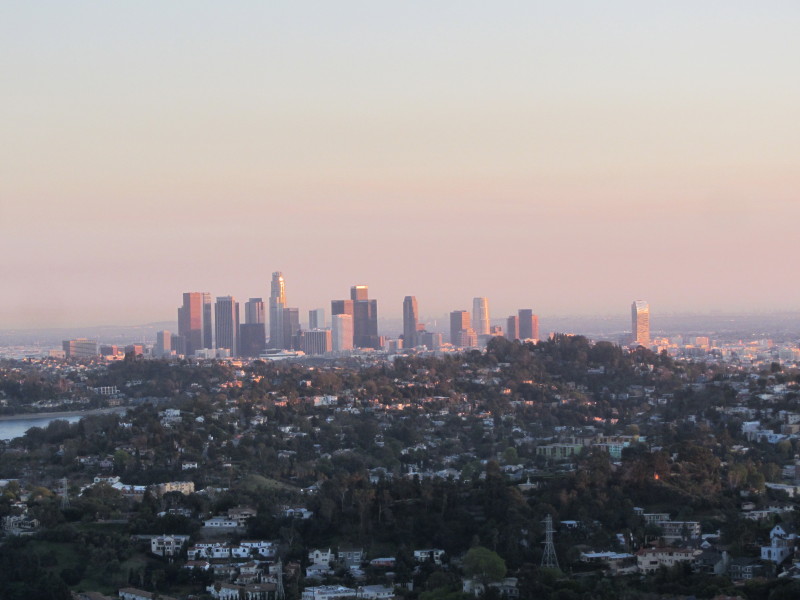
A day off from work to celebrate Presidents Day was an ideal time for a hike in Griffith Park…my first one for this year. I had to go into my office in L.A. for a few hours so I figured I would do a short hike to begin the morning. As I headed west on the 210 and 134, I pondered what trails I might cobble together. I decided that the two peaks at the east end of the park would be good.
I exit the I-5 at Los Feliz and take Crystal Springs drive to the large parking lot near the merry-go-round. Lots of cars in the lot and lots of walkers, hikers, and runners.
9:10 a.m. - Begin hike. I head southeast on Lower Beacon Trail. The temperature is pleasant, the sky is blue, and the hillsides are green from winter rain. In a couple minutes I round a hip and reach my junction. A narrow use path cuts to the right up a steep bank. Up I climb the informal route which ascends a broad ridge due south. It’s mostly shaded and I have the path to myself. The din of traffic on the I-5 is ever-present. I enjoy expanding views of Glendale to the east with the San Gabriels as the backdrop. I can see my car in the lot below to the northwest.

Across the canyon to the west, Glendale Peak, Baby Bell, and Mount Bell define the skyline. It’s disheartening to see that someone has torn out all the young wild cucumber vines along the way. Why would someone destroy native plants? After a few minutes the steep path mellows out

and I can see the summit of Beacon Hill. Soon the route gets steep again and at 9:27 I reach Upper Beacon Trail, a wide dirt road. I turn left (east) and climb the final steep pitch to the summit.
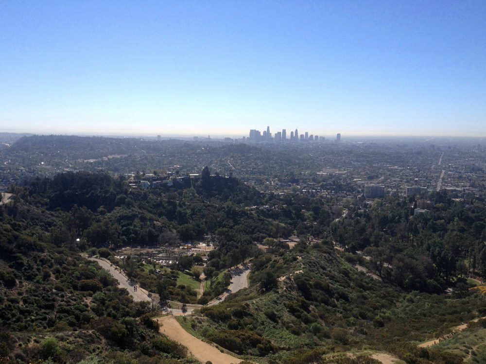
9:29 - Beacon Hill (1001’). This broad-top summit stands as the easternmost point of the 40-mile-long Santa Monica Mountains. Clear skies provide good visibility today. It’s simply a beautiful day in L.A.! Burbank and Glendale basking in the morning sun sprawl to the north and east. The downtown L.A. skyline stands silhouetted to the south. Distant Palos Verdes Peninsula floats as a slender line above the marine layer. Glendale Peak and Hogback Ridge outline the parkland to the west. I look north toward Glendale beyond the 134 to spot the old control tower of the long-gone Grand Central Air Terminal. The airport got its start in 1923 and was the Southland’s main air terminal. The beacon light that stood on this summit guided those early aviators.
9:35 - Leave Beacon Hill heading west on Upper Beacon Trail. I’m really enjoying the sunshine, fresh air, and surrounding park as a wildland island amidst a vast metropolis. Six minutes delivers me to 5-Points junction.

I encounter my first humans of the hike. Of the two routes that head west toward Vista Del Valle Drive, the one on the right has a sign that notes that the trail is closed 0.25 mile ahead for a construction project to expend the water recycling system.
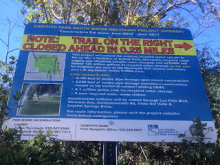
It will be closed through June 2017. Two gals head up that road, so maybe they know of a way to skirt the construction.
I take the road on the left which climbs west. A lady and her dog off leash are coming down the road. The dog jumps up on me. I tell her the dog needs to be on a leash according to park regulations. She laughs and says, “Yeah, your right.” But she continues down road while occupied with her smart phone. What’s with these people?! I continue along the eucalyptus-lined dirt road and in five minutes reach the Joe Klass Water Stop.

I top off my water bottle and continue west, now on paved Vista Del Valle Drive. A couple minutes delivers me to the construction project, which occupies a large area on the knoll adjacent to the Vista View Point (helipad). I have views west now toward the grand observatory

and Mt. Hollywood. The L.A. basin sprawls out on the southern panorama. Lots of people on the trails today.
I round the bend north to see Glendale Peak inviting me up. At the junction for Hogback Trail (aka Bridal Trail), behind the green pump house, I ponder the treacherously steep route climbing about 15 feet up the shire granite road-cut.
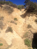
The first time I encountered this obstacle was in August 2010 on my
six peaks hike. I had left Glendale Peak heading east thinking it was a short-cut, only to be stopped by this cliff. So I turned back. But today I stand here looking at the obstacle and think, you know, I can climb that thing. So up I climb, carefully negotiating each step, each handhold, summoning the nerve to keep climbing. At about half way I look down and realize that one slip would have horrible consequences. I dislike hospitals, so I will myself safely up. Wow, that was exhilarating! What a relief. The narrow path now leads me comfortably up the ridge five minutes to the peak.
 10:08 - Glendale Peak (1184’).
 This is a splendid little summit. Great views today. I love how green everything is. And there is such a contrast between the surrounding ruggedness and the massive human sprawl beyond. And as always, I have the peak all to myself. Ant-like figures crawl along the roads webbing throughout the park around me. It’s getting warm now. Thankfully it’s all downhill from here.
10:15 - Leave Glendale Peak heading east on Henry’s Trail. I’m thoroughly enjoying the scenery. I stop to photograph wild Canterbury bells.

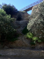
There has been very little in bloom today: some wild cucumber, everlasting, deerweed, ceanothus, tree tobacco, and the typical weeds of mustard and filaree. I ponder my return route and think I’ll climb down from the bridge to Vista Del Valle Drive. When I reach the junction it appears to be awfully steep and perilous. But I’ve done it up and down before, so I know it is safely doable. So down I go (starting at the point directly behind the Henry’s Trail sign).
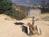
It is somewhat precarious, but I negotiate it safely. It’s certainly not for the faint of heart.
I turn right (south) on Vista Del Valle and stroll along. Looking east down into the canyon, I see a well-worn path along the canyon bottom heading down to Fern Canyon Trail. Oh, that’s going to be my return route. I walk past the junction of Hogback and Riverside trails and find my route adjacent to the Vista View Point (helipad) just to the left of the lower trail heading back to 5-Points (blocked right now by a construction fence). I head down the trail. It’s a splendid path and I enjoy being off the wide fire roads. But, as with most narrow trails in Griffith Park, it doesn’t last for long before it deliverers me to a wide dirt road.

10:51 - Fern Canyon Trail. I turn left and mosey down the dirt road. Lots of foot traffic today. A ranger drives up the road and I give to him a set of keys I found on Glendale Peak. I also reported to him the destruction of the wild cucumber vines. It’s quite warm now and I’m glad I’m heading down. Several families with young kids trudge up road under the warm sun. The kids don’t look like they are enjoying themselves. I don’t blame them. Dragging kids up a steep road under ponding sun is not a good way to endear them to hiking. At 11:08 I leave the road and transition onto Fern Canyon Nature Trail, a most pleasant route for my final stretch.

The area is rebounding nicely after the devastating fire of May 2007, but some dead trees still stand as a reminder of the raging inferno.
11:17 - End hike. It’s about 87 degrees. Good for 8,539 steps on my Fitbit.
Epilog - What a pleasant outing! Warm sun, fresh air, blue sky, green hillsides, splendid views, some adventure, and good exercise. In all my hikes in Griffith Park over the years, I’ve never repeated a hike. I’ve used many of the same trail sections, but combined them for different hikes. So on today’s hike it was fun to visit two familiar peaks yet cobble together different routes for a unique hike. I never get tired of the amazing Griffith Park.
 See Hiking Griffith Park at Dan's Hiking Pages
 (includes links to my other blog posts for hiking in Griffith Park)
 Relevant trail descriptions for this hike at Dan’s Hiking Pages:
PREVIOUS > Griffith Park Teahouse, Mt. Bell, Mt. Hollywood - July 24, 2015
Relevant trail descriptions for this hike at Dan’s Hiking Pages:
PREVIOUS > Griffith Park Teahouse, Mt. Bell, Mt. Hollywood - July 24, 2015


 Across the canyon to the west, Glendale Peak, Baby Bell, and Mount Bell define the skyline. It’s disheartening to see that someone has torn out all the young wild cucumber vines along the way. Why would someone destroy native plants? After a few minutes the steep path mellows out
 and I can see the summit of Beacon Hill. Soon the route gets steep again and at 9:27 I reach Upper Beacon Trail, a wide dirt road. I turn left (east) and climb the final steep pitch to the summit.

 I encounter my first humans of the hike. Of the two routes that head west toward Vista Del Valle Drive, the one on the right has a sign that notes that the trail is closed 0.25 mile ahead for a construction project to expend the water recycling system.
 It will be closed through June 2017. Two gals head up that road, so maybe they know of a way to skirt the construction.
 I top off my water bottle and continue west, now on paved Vista Del Valle Drive. A couple minutes delivers me to the construction project, which occupies a large area on the knoll adjacent to the Vista View Point (helipad). I have views west now toward the grand observatory
 and Mt. Hollywood. The L.A. basin sprawls out on the southern panorama. Lots of people on the trails today.
 The first time I encountered this obstacle was in August 2010 on my six peaks hike. I had left Glendale Peak heading east thinking it was a short-cut, only to be stopped by this cliff. So I turned back. But today I stand here looking at the obstacle and think, you know, I can climb that thing. So up I climb, carefully negotiating each step, each handhold, summoning the nerve to keep climbing. At about half way I look down and realize that one slip would have horrible consequences. I dislike hospitals, so I will myself safely up. Wow, that was exhilarating! What a relief. The narrow path now leads me comfortably up the ridge five minutes to the peak.


 There has been very little in bloom today: some wild cucumber, everlasting, deerweed, ceanothus, tree tobacco, and the typical weeds of mustard and filaree. I ponder my return route and think I’ll climb down from the bridge to Vista Del Valle Drive. When I reach the junction it appears to be awfully steep and perilous. But I’ve done it up and down before, so I know it is safely doable. So down I go (starting at the point directly behind the Henry’s Trail sign).
 It is somewhat precarious, but I negotiate it safely. It’s certainly not for the faint of heart.


 The area is rebounding nicely after the devastating fire of May 2007, but some dead trees still stand as a reminder of the raging inferno.