I wanted to get a moderately strenuous hike under my feet this weekend, but did not want to give a whole day to it. So I choose one of my local scrappy hikes: Mt. Bliss. The trailhead is only 10 minutes from my house in Azusa, and with a distance of 8.5 miles round trip and 2880 feet in elevation gain, it would be an ideal hike to keep my legs and feet in condition.
Mount Bliss is not usually a summer hike: Heat, obscured visibility, withering chaparral. But if I go early I can at least mitigate the heat, to a degree.
 5:50 AM - Start hike. Leaving the equestrian center, I begin my steep climb up Van Tassel Fire Road. It’s cool and nighttime dampness brings out the aromas of the chaparral, particularly the white sage. A full noon is setting. A marine layer thinly blankets the valley. Soon I encounter a sign: “ESA (Environmentally Sensitive Area) No Entrance Permitted, TRTP Segments 4-11.” It’s branded by the Edison Company of Southern California. I’m not a defiant person, but I don’t recognize the Edison Company’s authority to tell me I can’t hike on a public right-of-way in the national forest. I keep walking. I love the beauty of the pre-sunrise morning. An orange glow outlines the majestic peaks crowing the eastern end of the San Gabriels.

6:30 - Sunrise over Ontario Peak. Moments later I pass under the power transmission towers and in a couple minutes pass by the locked gate. Not much in bloom right now except an abundance of California buckwheat and a few occurrences of sunflower, lupine, scarlet penstemon, scarlet larkspur, cliff aster, bush monkeyflower, and mustard. I’m trying to maintain a workout pace. The early sun adds a warm glow to the hillsides. Just past the power tower retaining wall is another ESA sign. In fact, they occur often throughout the rest of the hike creating a visual blight.
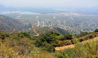
 There is a beauty to the rugged, chaparral-covered foothills. It’s so much better in spring, and it certainly doesn’t have the “wow” factor as last week’s hike to Mt. Baldy, but it’s my backyard and I value it. Views open up to the west. The city is waking up. Flies and gnats pester me. See a male deer disappear into brush. The road is less steep in places but not for long. I daydream about wonderful single-track trails with moderate grades. Views open up to Spanish Canyon, Sawpit Canyon, Monrovia Peak, and Mt. Wilson.
8:13 - Cross under the power lines and take an immediate right on a side road (sometimes hikers miss this turn and end up descending toward White Saddle). In another 50 yards, I turn left on a less-used spur road and pass a power tower. Buckwheat menaces my bare legs as I traverse along the ridge toward my destination.
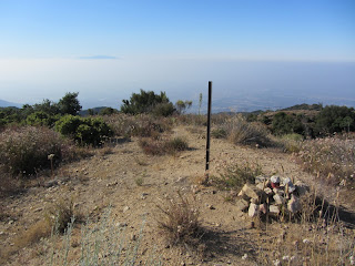
 8:29 - Mount Bliss (3720’). Aside from Azusa Peak via Garcia Trail, this is my most visited summit. It doesn’t get much traffic so I’ve always had solitude here. It offers a splendid 360 panorama, which is somewhat muted today by a marine haze. The peak lives up to its name “Bliss,” except for the flies and muffled drone of the 210 Freeway far below. The sun is getting warm now. I sign the peak register. Looks like frequent visitor Gary Meza is addicted to this peak. Forty-five minutes on the summit pass quickly.
 9:15 - Leave peak. Sun is warm so I’m glad its downhill all the way. Wildlife encounters for the day include rabbit, deer, lizards, butterflies, squirrel, quail, Steller’s jay, and various other birds. Animal tracks on the road include several snakes and mountain lion.
 I look east across Van Tassel Canyon toward Van Tassel Ridge and wonder how that scene will look once Vulcan Materials begins mining it. It will have an impact but I think it will be better than if they had advanced on Fish Ridge. When I get to the spur trail coming up from Mel Canyon, I take a jaunt to check it out. It’s used a lot by equestrians to access a flat spot on the ridge, but the brushy route coming up from Mel Canon looks less than inviting. Back to the main road at 11:35.
 11:43 - Done. Car thermometer reads 84 degrees. Seems warmer.
Epilog - Good outing. Solid workout for my body. Watched a new day emerge. Experienced nature. Enjoyed solitude on a trail that has become an old friend.
Hi Dan, I enjoy your blogs and have done many of your hikes. Thank you for all the info! Have you done this hike recently? We would like to take the trail from equestrian center to white saddle or mt bliss.
ReplyDeleteHi Sheri! I’ve not hiked Mt. Bliss recently. But eager to. I understand there’s been a new firebreak cut on the final ridge to the summit (within the last couple years). I’d hit Mt. Bliss first then down the backside (north) to pick up the road to White Saddle. And this is the best season while temps are still moderate and everything is green. Most of the route is fully exposed.
Delete