For years Cooper Canyon Falls has been on my must-hike list. Finally all the factors came together to make the long drive up Angeles Crest Highway for a splendid day of hiking in the San Gabriels high country. My friend, Ray, and his group visited the falls last weekend, and he reported that the falls were flowing well. And he gave me some tips for the hike. The forecast was for perfect weather.
As I drive up Angeles Crest Highway, I am again saddened by the horrific damage from the 2009 Station Fire. What used to be thousands of acres of majestic pine, fir, and cedar are now blackened sticks. Soon my spirit is lifted as I enter mature forest that was not burned.
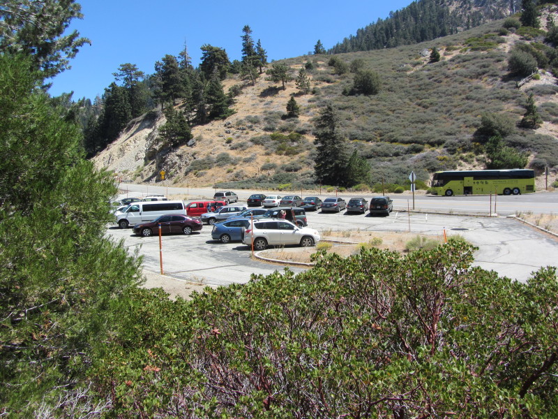
My plan is to hike via Buckhorn Campground down Burkhart Trail and return via Cooper Canyon Trail to Cloudburst Summit. Since the campground is still closed for its winter hiatus, I have to park along the highway and hike through the campground to the trailhead. The Forest Service has done a great job in making the campground beautiful and ready for the camping season. Signs point the way toward Burkhart Trail. Some patches of snow linger. The sound of the creek provides a pleasant soundtrack. After a walk of about 0.8 mile I reach the trailhead to Burkhart Trail. A brand new sign announces the entrance to Pleasant View Ridge Wilderness. This will be my first time in this new wilderness, which was newly designated by Congress in 2009 and encompasses 26,752 acres.

10:26 - Begin my hike down Burkhart Trail. The trail heads north, high on the canyon wall, descending at a pleasant grade through a rich green forest. The water is far below me on the right. I’m really loving this trail. Birds are singing and the temperature is perfect. I keep my eyes open for a spur trail which Ray says leads to a small waterfall. At about 10 minutes in I find the trail and climb down to the small falls. Very nice and worth the side trip.
For me, this trail is nearly quintessential, with the only thing keeping it from perfection is the Sutter walls (wooden retaining barriers). To me they look ugly and mar the landscape. I much prefer stone retaining walls, which blend into the natural surroundings.
Soon views open up to the north toward Will Thrall Peak and Pallet Mountain. Another spur trail heads down the open slope to what appears on the map to be another waterfall far below. I’ll skip this one. A couple hikers pass me coming out and in a few more minutes more another couple. I chat with a gentlemen hiking solo. I love the beautiful scenery, from pine needles beneath to the forest-covered mountainsides, to craggy rock formations. This is certainly among the finest trails in San Gabriels. So far I’ve seen nothing in bloom except a lone wallflower in the campground.

11:18 - One mile maker. It doesn’t take a mathematician to see that my pace is quite slow. But I’m sure enjoying it! As I approach Cooper Canyon, which this canyon meets, the trail bends west and in a few minutes switches back east, a stone’s through above Cooper Canyon creek. Somewhere over there on the other bank is Cooper Canyon Trail, but I can’t see it through the trees. Majestic cedars rise into the sky. White alder and other deciduous plants are beginning to come back to life. Soon the trail drops down and crosses the tributary creek flowing from the south. I carefully pick the best place to cross to avoid getting wet. I fail and my boot gets partially baptized. In another three minutes I reach a junction.

11:45 - Junction with Cooper Canyon Trail/Pacific Crest Trail. Cooper Canyon Trail cuts hard right (west) and Burkhart Trail continues east. This trail is also part of Silver Moccasin Trail, a 53-mile route established by the Boy Scouts. In two minutes past the junction, I look down to my left and see torrents of water spilling over the rocks. Could this be the falls? Since I had seen pictures only from the front of the falls, I really didn’t know what to expect to see when I reached them.
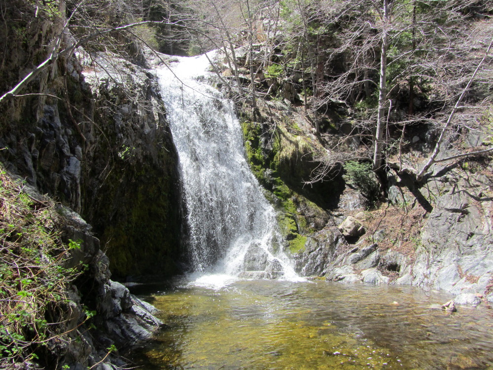
11:52 - Cooper Canyon Falls. Most waterfalls in the San Gabriels are approached from downstream...you round a bend and come face to face with a cascade. But here, as with Hermit Falls, I’m looking down on the falls from the trail. I pull out the note from Ray and he describes two routes down; the first uses a rope to negotiate the steep canyon side, which he does not recommend. The second is a little further and approaches the falls via some boulder hopping. I ignore the route that starts at the Sutter wall, thinking it is the rope route, and take the second, about 20 feet further. I follow the path down and soon discover that this is the rope route. It doesn’t look too bad so I continue. But it gets slimy and slippery and is dicier than it appeared. Once at the bottom I gingerly cross the creek to the other side.
A wall of white water tumbles into a sparkling green pool. With the alders still leafless from the winter, the falls are in full sun. I’m the only one here and I think about the crowds at Fish Canyon Falls today. I find a comfortable spot on the smooth, marble-looking bedrock and enjoy my lunch serenaded by the roar of the falls. At about 25 feet, it’s not one of the taller falls in the San Gabriels, but the sheer mass of water is impressive. I do a little exploring.
After nearly an hour, a group of four arrives. Their descending the rope route reminds me of a scene from the Keystone Cops. I decide it’s time to go. I leave by boulder hopping downstream about 30 yards then climb up the steep rocky slope to the trail. A normal person would head back at this point, but I must explore further.
1:00 - Continue east down the trail. My primary objective is the check out the trail junction. A short walk of six minutes delivers me to the steam crossing. Trout swim in the sparking water. Across the creak, the route cuts left and climbs about 30 yards to the signed junction. Burkhart Trail continues climbing to the left (north). Rattlesnake Trail heads southeast and meanders its way to Eagles Roost Picnic Area on Angeles Crest Highway. It is also the Pacific Crest Trail and Silver Moccasin Trail. This section of trail is closed because of protecting the habitat for the Mountain Yellow-legged Frog (
Rana Mucosa). There is no sign here indicating the closure (but there is one at Cloudburst Summit).
I decide to continue north on Burkhart Trial for a little more to see what I can see (kind of like the bear that went over the mountain). Feels good to be going uphill. About 10 minutes into it I achieve a crest with sweeping views of breathtaking topography. Wow, this is really worth the extra effort. Will Thrall Peak and Pallett Mountain dominate the near horizon and call me to climb them. They’ll have to wait for another day. Sheer cliffs drop steeply into the canyon of Little Rock Creek. This is splendid high country and about as pristine as anything in the San Gabriels. There are not even any Sutter walls in sight.
1:30 - Turn around and head back. I reach Cooper Canyon Falls again at 1:46. More people are here now. I take some notes and pictures and do some more exploring.
2:06 - Leave Cooper Canyon Falls heading west. At the junction I veer right, departing from Burkhart Trail (which I descended this morning) to take Cooper Canyon Trail as my return route. As I cross the creek a couple arrives with a dog off leash.

It’s sad how many dog owners either don’t grasp or don’t care how many important reasons there are for restraining their animal in the wilderness (if nothing else, it’s the law, on multiple levels: county, national forest, federal wilderness).
The trail now follows the north bank of the stream and heads west. It’s warm now and I’m in the open sun more than shade. The trail is quite wide and obviously was some type of dirt road in the past. For the most part the trail stays close to the creek. I am so enjoying the mature forest of oak, alder, pine, fir, and cedar. I encounter my second flower for the day, another lone wallflower standing proudly in the warm sun.
3:00 - Cooper Canyon Trail Camp. There is a restroom (pit toilet) on this side of the creek, and a spacious campground with tables and stoves on a large clearing across the creek. I wonder about the wilderness boundaries, since under federal rules, these kinds of amenities would not be allowed in a wilderness. Later I found that there is a narrow corridor from the highway to here that is excluded from Pleasant View Ridge Wilderness. A large group of a few adults and a bunch of kids occupy the campground. They had cut a lot of live tree branches and are using them to make various pieces of rustic camp furniture and shelters...another clear violation of forest-use rules. I speak with the leader and encourage him to set a good example for the kids. As I am leaving, a group of young adults passes with two dogs off leash…again, just ignorance or disregard for law.
The trail now climbs northwest and circles a large bowl offering varied scenery of splendid high country. This climb in the warm sun is a strong reminder of why I don’t particularly like upside-down hikes. I’d much rather do the climb when I’m fresh and it’s cool, then do the downhill to end the hike. I find another flower in bloom, the delicate little Davidson’s phacelia. I achieve a ridgeline and enjoy the northern panorama.
Upon reaching a nice outcropping, I discover my reading glasses are missing! Oh man! I’m thinking I may have dropped them while changing my camera batter a quarter mile back. I retrace my steps and after 10 minutes, eureka, there sitting on a tree stump are my glasses! Yahooo! Now for some déjà vu as I rehike up the hill. Thankfully it is wonderful scenery and worth a second look.
After I pass the outcropping the trail bends southwest and traverses along the southeast flank of summit 6903’. It would be fun to climb it on another trip. The trail is wide again. Shortly I reach a saddle with views to the west and the sun dipping low in the sky. The trail now bends southeast. It’s a little disconcerting that I’m now descending...I’d rather keep climbing to my destination.
4:56 - Cross the dirt road as the trail continues to descend. I’m loving the beautiful scenery, varied topography, melodic creek, vanilla scent of Jeffrey pine, fresh air, and a splendid trail. Soon I begin to climb as the trail meanders through the forest. It’s cool now. My legs are tired. I’m thinking about the one-mile walk down the highway back to my car.
5:41 - Cloudburst Summit (7018’) at Hwy 2. I sit on the curb and remove a rock from my boot. Up the road comes Tom and Todd, two gentlemen I met earlier hiking the loop in the opposite direction. They graciously offer me a ride back to my car, and I eagerly accept.
Once back at the car I scout out the various places to park along the highway, do some exploring, play in the snow, and take some notes. At 7:00, I finally point my car west and start the long drive down Angeles Crest Highway into the setting sun.
Epilogue - What a rewarding day! Fantastic weather, fresh air, magnificent high country, splendid trails, mature forest, solitude, interesting people, and a roaring waterfall. I’m always so thankful for the health and wherewithal to enjoy these wonderful mountains. 
See Waterfalls of the San Gabriels at Dan's Hiking Pages