Visit my photo album for this hike
Visit Dan’s Hiking Pages
After climbing Mt. Baldy from the south, east, and west this summer, I figured it was time to climb it from the north approach over Pine and Dawson from Blue Ridge. I hooked up with my new friend Don and off we went. We had planned to leave my house in Azusa at 5:30 AM but that got delayed until 7:30. We headed east then north through the Cajon Pass, west through Wrightwood, then started our drive on Blue Ridge Road (3N26). It was recommended that high-clearance vehicles be used on the rough road, so Don’s big four-wheel-drive pick-up served us well. After 7.2 miles of back-roading we arrived at the trailhead for the North Backbone Trail, aka The Other Devils Backbone. The pointed summit of Pine Mt. loomed high above us to the south.
10:03 AM – Begin hike under beautiful sunny skies with a chilly breeze. A sign indicates that we are entering Sheep Mountain Wilderness, in which we will spend the entire hike. A trio of young backpackers are a few minutes ahead of us. The trial begins at an elevation of 8240’ and steeply drops 130 vertical feet to a saddle then begins a climb of 1,500 vertical feet to Pine Mountain. This rugged high country is stunningly beautiful. Massive Mt. Baden-Powell looms to our west. Looking back toward the trailhead, we notice a large group of hikers beginning down the trail. Razor-like sections of the trail that drop steeply to both sides bear resemblance to Devils Backbone Trail. Mature pine and fir dominate the landscape. We catch up with the three backpackers and I am recognized by Eric, who emailed me awhile back with questions about this trail. They are heading to Baldy Ski Lifts.
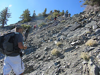
We climb up and over a bump in the ridge (8555’) and face a really steep section with jagged rocks and loose footing. We are sharing the trail now with the large group as we negotiate this dicey section requiring hands and feet. Cross another razor section and meet the leader of the group. They are from OC Hiking Club. The topography widens out some as the trail climbs the northwest face of Pine Mt.
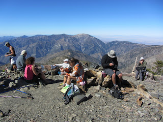
11:38 - Pine Mountain (9648’)—second highest peak in the San Gabriels. I’m a little puzzled in that the topo map shows the trail skirting along the west flank 200 vertical feet below the summit. I did not see any trail bearing to the right, rather, the trail led us directly to the top. The group from OC Hiking Club are enjoying lunch. There are great views south, west and north while views toward the northeast and east are obscured by trees—perhaps the reason for the name, Pine Mt. The huge mass of Mt. Baldy dominates the view south. Tiny figures can be seen on its summit and climbing its east ridge. We notice that the portion of our summit to the east is a little higher so we wander over there and find the summit register among the rocks of the horseshoe-shaped wind barrier. We sign the register and soon the others join us in signing in. They leave and we explore the summit some more. Meet up with Eric and company.
Leave the summit at 12:27 heading due south. The trail soon gets steep and it drops straight down the ridge. I never did detect any route coming in from the west as shown on the maps (USGS topo and Harrison map). As we descend I ponder having to climb this steep route back. The large, broad summit of Dawson Peak to the southeast invites us to climb it. As we approach the saddle, low brush nearly envelops the trail and nastily scratches the legs. Trail maintenance anyone?
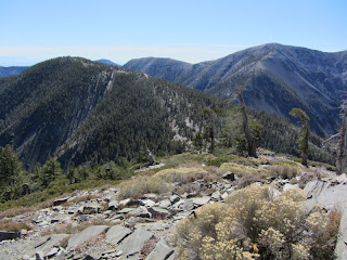
12:41 - Pine/Dawson saddle (9151’). Now we start a climb of 424 vertical feet. In a few minutes we pass the junction (9200’) of Dawson Peak Trail heading west to Fish Fork. Soon the trail mellows out as it begins to climb the arm extending northwest from the summit. The scenery is stunning. Trees are gnarled from the harsh winters. Dark gray flagstone covers the ground.
The ridge descending from Dawson to the Dawson/Baldy saddle is in full view now. The climb to Baldy looks intimidating. Our trail passes along the west flank 80 vertical feet below Dawson’s summit. We almost miss the faint path that veers left toward the summit approaching from the south.
1:17 - Dawson Peak (9575’)—third highest peak in the San Gabriels. I think about my friend Keith Dawson—his grandfather, Ernest Dawson (1882-1947), was the one who this peak was named after. Mr. Dawson founded Dawson's Bookstore (1905) and was an influential early member of the Sierra Club. The broad, rounded summit is mostly bald with views in all directions except east. A remnant of the group from OC Hiking Club linger about but soon leave. As we have a bite to eat we evaluate our options. Our goal for the day was to climb Mt. Baldy, but we decide that it’s too late in the day now to continue. We don’t want to risk of running out of daylight and particularly navigating the precipitous rocky section in the dark. And the night-time temps will drop toward the 30s. Good judgment wins out. I console myself that in spite of not reaching Baldy, we conquered the second and third highest peaks in the San Gabriels today. That’s a respectable accomplishment. A gentleman from Australia arrives and we visit. I explore around the summit.
Leave the summit at 2:20 continuing south. We figured we would at least head down toward the Dawson/Baldy saddle before turning back. I’m loving the breathtaking scenery of this grand high country. At 2:47 we decide we have descended far enough, maybe 250 vertical feet above the saddle. We pause for a few minutes and then begin our climb back. At 3:17 we pass the junction to Dawson summit and begin the mild descent traversing Dawson's southwest flank. At 3:37 we reach the Dawson/Pine saddle and take a refreshment break before the last steep climb of the day. We pass through the nasty brush getting our legs scratched up again. The climb is steep and the cool breeze feels good. The Mt. Wilson country to the distant west stands as hazy blue silhouettes. We keep pressing on. We still don’t see any trail skirting the peak’s west flank as shown on the maps. Our route leads straight to the summit.
4:18 - Pine Mt., again. The vast Mojave Desert spans the north horizon. We linger for a few minutes soaking in our final moments on this splendid peak then begin our descent. It’s quite cool now. The lighting is very different than this morning.
The steep, rocky section is more difficult to climb down than up. Reach the saddle and begin our final ascent of 130 vertical feet to the trailhead.
5:43 - Finish Hike. We’re done, 20 minutes before sunset. It was a good decision to not continue to Baldy.
Epilog - What a thoroughly enjoyable day of hiking—Sunshine, blue skies, fall temperatures, amazing scenery, two commanding peaks, a splendid route, about 6 miles round trip, 3,000 feet in total elevation gain, and great company!
Visit my photo album for this hike on Google+ - featuring 82 photos with captions
Visit Dan’s Hiking Pages
Saturday, October 29, 2011
Monday, October 24, 2011
Garcia Trail Hike – October 23, 2011
See Garcia Trail Description on Dan’s Hiking Pages
After a few weeks off from hiking, it was time to hit the trail. And local Garcia Trail above Azusa was just the venue for a late afternoon scrappy hike to exercise my legs.
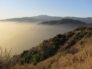
4:20 PM - Begin hike. The trail sign is missing. It is a warm day but the temps aren’t bad now. In spite of the one-day rain from the other week that started some grass growing in the shade, everything seems dry and dusty. Hardly anything in bloom (just a few occurrences of cliff aster, fuchsia, sunflower, and buckwheat). The marine layer from this morning leaves a thick haze over the valleys. I press along at a work-out pace. Several parties of other trail users are coming down. It’s disappointing to see litter and graffiti along the trail.
Soon I catch up with and pass a gentleman named Tommy. He follows along as he shares about his workout regimen on Garcia Trail. At 4:54 we reach Glendora Ridge Motorway. Stop only briefly as Tommy and I proceed east to Azusa Peak.
5:02 - Azusa Peak. Someone has constructed a brown, wooden bench near the cross. Tommy explained that the cross had been toppled recently and then re-erect. The vandalism is disconcerting to me. Tommy suggests that there should be trash cans along the trail. I disagree. This is natural open space, not a city park. We linger briefly and leave the peak at 5:05, continuing east. As we walk along the wide dirt road, I point out various plants and Tommy is an eager learner. I gaze north toward Crystal Lake Basin and Hawkins Ridge and lament that the hike I had planned three weeks ago was sadly aborted for my wife’s need of the car.
5:37 - Reach the wide road bend north of Glendora Peak. This will be our turnaround point. I introduced Tommy to my friends along the eastern skyline: Ontario Peak, Telegraph Peak, Thunder Mt., Baldy Notch, and Mt. Baldy. His friends George and Tina arrive. We chat. Head back at 5:44. The sun is beginning to set behind the marine layer. I love the warm colors of this hour. We swap stories as we walk toward the setting sun. A tarantula sits on the road.
6:09 - Arrive at the top of Garcia Trail and begin our descent. George and Tina are well ahead of us. Tommy and I enjoy good conversation as the twinkling lights of the valley below announce the arrival of dusk. It’s hard to capture the beauty of this time of day with a camera.
6:36 - End hike. It’s pretty much dark now and quite a bit cooler. Tommy and I chat for a few more minutes and say our good byes.
Epilog - Very pleasant outing. Good to be on the trail. Always a pleasure to meet new people. Four miles round trip isn’t a strenuous work out, but at least it was something. I am always thankful for such a splendid little trail so close to home.
See Garcia Trail Description on Dan’s Hiking Pages
 :
Thursday, October 6, 2011
Mt. Bell and Mt. Hollywood in Griffith Park Hike - Oct. 6, 2011
I love hiking after a good rain. And yesterday’s first storm of the season delivered superb conditions for hiking. I had been planning an after-work hike in Griffith Park for today, so I was delighted for the meteorological serendipity.
I leave my office in Echo Park at 3:00 and head for Griffith Park. My plan was to begin at the Bird Sanctuary in Vermont Canyon, but a Furthur concert at the Greek Theater created traffic and parking chaos. So plan B was to begin at the Vermont Tennis Courts on Commonwealth Canyon Drive.
3:30 PM - Begin walking north through the tennis courts on the wide dirt road into the unnamed canyon (bordered by Vermont Canyon on the west and Aberdeen Canyon on the east). The sun feels good. I love the chaparral aroma after a rain. My pace is fast. I see walkers on the trails above. Pass the junction of Riverside Trail and keep heading north, now on a narrow path. Hogback Ridge looms ahead. In a few minutes the nice path ends and a steep use trail cuts right and climbs the east canyon wall. I’ve been here once before and purposed to come back and hike that route.
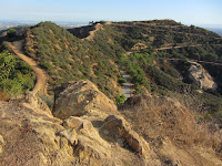
So up I climb. Foot steps have been cut into the granite making the climb quite doable. It’s a fun hands-and-feet scamper (maybe not suitable for novices or the faint of heart) and in 10 minutes I reach Hogback Trail. What beautiful vistas...from Glendale to Downtown L.A. to Hollywood to Pales Verde Peninsula...and my friends: Glendale Peak, Beacon Hill, and Mt. Hollywood. There is a cool breeze. Clouds loom over the San Gabriels. I continue northwest on Hogback Trail. It is steep but my “Mt. Baldy legs” climb well. The clouds cast blotchy shadows. I’m enjoying the sun and the bird’s-eye view of the park’s east end. Soon more friends come into view to the north and northwest: Bee Rock, “Baby Bell,” and Mt. Bell.
4:07 - “Hogback Peak”...as I call it. I’m soaking in the beauty of the rugged park and vast human sprawl beyond. I have a nice view of the route I came up. Keep pressing on and soon I reach Dante’s View and the junction. The rain freshened up the garden and I am tempted to just sit and enjoy it, but I press on continuing west.
4:23 - Four-point junction north of Mt. Hollywood (#33). More friends come into view to the west: Mt. Chapel, Mt. Lee, and Cahuenga Peak. I upload a photo to Facebook. I decide to head north to Mt. Bell, my most-climbed peak in Griffith Park. Walk along the ridge and enjoy expansive scenery. The late afternoon sun illuminates Bee Rock against a background of dark green. I take the route straight up the south ridge of “Baby Bell,” as I call it, and arrive at the summit at 4:42. I still wonder what the story is behind the octagon cement structure. I follow the path down the northwest ridge and in a few minutes arrive at the main trail and in another 50 yards to the Bell/Baby Bell saddle. Now I scramble up the narrow path to Mt. Bell. It’s odd to see bare-foot human foot prints.
4:54 - Mt. Bell (1582’). Surrounded by 20 millions people, I enjoy solitude on this splendid peak. The late afternoon sun casts a warm light on the surrounding hills. Mt. Lee to the west stands in silhouette. Upload another photo to Facebook. I’d like to linger but I must be back to the car by 6:00. Leave Mt. Bell at 5:12 and retrace my steps. I skirt “Baby Bell” along its north and east flanks and soon head south along the ridge. Pass the four-point junction (#33) and head to Mt. Hollywood. Lot’s of picturesque images to capture.
5:29 - Mt. Hollywood (1625’)—the crown of Griffith Park. There are always people here. Clouds loom. Griffith Observatory stands regally to the south with the downtown skyline rising as an island in the vast human sprawl. The iconic Hollywood sign adorns Mt. Lee to the west. The air is cool now. I say goodbye to Mt. Hollywood at 5:35 and head straight down the path steeply descending the south ridge (the route I climbed on my last visit to this summit). Soon reach the five-point junction at Charlie Turner Trail and continue straight south. In minutes I say farewell to my last view of the Hollywood sign and swing east into Vermont Canyon. The narrow path is a nice contrast to the wide dirt roads. A crowd is swelling at the Greek Theater below. The sun still sits on the crest of the west ridge. Near the canyon bottom a chain-link fence restricts access to the Bird Sanctuary which was badly burned in the May 2007 fire.
5:58 - Vermont Canyon Road. Lots of activity for the Furthur concert. Now the 10-minute walk back to the car.
Epilog - What a splendid hike! Griffith Park is such a treasure for Angelinos. Everything was so fresh from the rain. Clouds, sun, breeze, chaparral aromas, beautiful scenery, some solitude, good exercise, and exploring a new path—all contributed to a thoroughly enjoyable outing.
See Hiking Griffith Park at Dan's Hiking Pages
(includes links to my other blog posts for hiking in Griffith Park)
See blog posts from previous hikes in Griffith Park:
NEXT > Burbank Peak, Cahuenga Peak, Mt. Lee - December 30, 2011
PREVIOUS > Mt. Lee and More in Griffith Park Hike - March 9, 2011 (Mt. Hollywood, Mt. Chapel, Mt. Lee, Cahuenga Peak via Griffith Observatory)
I leave my office in Echo Park at 3:00 and head for Griffith Park. My plan was to begin at the Bird Sanctuary in Vermont Canyon, but a Furthur concert at the Greek Theater created traffic and parking chaos. So plan B was to begin at the Vermont Tennis Courts on Commonwealth Canyon Drive.
3:30 PM - Begin walking north through the tennis courts on the wide dirt road into the unnamed canyon (bordered by Vermont Canyon on the west and Aberdeen Canyon on the east). The sun feels good. I love the chaparral aroma after a rain. My pace is fast. I see walkers on the trails above. Pass the junction of Riverside Trail and keep heading north, now on a narrow path. Hogback Ridge looms ahead. In a few minutes the nice path ends and a steep use trail cuts right and climbs the east canyon wall. I’ve been here once before and purposed to come back and hike that route.
So up I climb. Foot steps have been cut into the granite making the climb quite doable. It’s a fun hands-and-feet scamper (maybe not suitable for novices or the faint of heart) and in 10 minutes I reach Hogback Trail. What beautiful vistas...from Glendale to Downtown L.A. to Hollywood to Pales Verde Peninsula...and my friends: Glendale Peak, Beacon Hill, and Mt. Hollywood. There is a cool breeze. Clouds loom over the San Gabriels. I continue northwest on Hogback Trail. It is steep but my “Mt. Baldy legs” climb well. The clouds cast blotchy shadows. I’m enjoying the sun and the bird’s-eye view of the park’s east end. Soon more friends come into view to the north and northwest: Bee Rock, “Baby Bell,” and Mt. Bell.
4:07 - “Hogback Peak”...as I call it. I’m soaking in the beauty of the rugged park and vast human sprawl beyond. I have a nice view of the route I came up. Keep pressing on and soon I reach Dante’s View and the junction. The rain freshened up the garden and I am tempted to just sit and enjoy it, but I press on continuing west.
4:23 - Four-point junction north of Mt. Hollywood (#33). More friends come into view to the west: Mt. Chapel, Mt. Lee, and Cahuenga Peak. I upload a photo to Facebook. I decide to head north to Mt. Bell, my most-climbed peak in Griffith Park. Walk along the ridge and enjoy expansive scenery. The late afternoon sun illuminates Bee Rock against a background of dark green. I take the route straight up the south ridge of “Baby Bell,” as I call it, and arrive at the summit at 4:42. I still wonder what the story is behind the octagon cement structure. I follow the path down the northwest ridge and in a few minutes arrive at the main trail and in another 50 yards to the Bell/Baby Bell saddle. Now I scramble up the narrow path to Mt. Bell. It’s odd to see bare-foot human foot prints.
4:54 - Mt. Bell (1582’). Surrounded by 20 millions people, I enjoy solitude on this splendid peak. The late afternoon sun casts a warm light on the surrounding hills. Mt. Lee to the west stands in silhouette. Upload another photo to Facebook. I’d like to linger but I must be back to the car by 6:00. Leave Mt. Bell at 5:12 and retrace my steps. I skirt “Baby Bell” along its north and east flanks and soon head south along the ridge. Pass the four-point junction (#33) and head to Mt. Hollywood. Lot’s of picturesque images to capture.
5:29 - Mt. Hollywood (1625’)—the crown of Griffith Park. There are always people here. Clouds loom. Griffith Observatory stands regally to the south with the downtown skyline rising as an island in the vast human sprawl. The iconic Hollywood sign adorns Mt. Lee to the west. The air is cool now. I say goodbye to Mt. Hollywood at 5:35 and head straight down the path steeply descending the south ridge (the route I climbed on my last visit to this summit). Soon reach the five-point junction at Charlie Turner Trail and continue straight south. In minutes I say farewell to my last view of the Hollywood sign and swing east into Vermont Canyon. The narrow path is a nice contrast to the wide dirt roads. A crowd is swelling at the Greek Theater below. The sun still sits on the crest of the west ridge. Near the canyon bottom a chain-link fence restricts access to the Bird Sanctuary which was badly burned in the May 2007 fire.
5:58 - Vermont Canyon Road. Lots of activity for the Furthur concert. Now the 10-minute walk back to the car.
Epilog - What a splendid hike! Griffith Park is such a treasure for Angelinos. Everything was so fresh from the rain. Clouds, sun, breeze, chaparral aromas, beautiful scenery, some solitude, good exercise, and exploring a new path—all contributed to a thoroughly enjoyable outing.
See Hiking Griffith Park at Dan's Hiking Pages
(includes links to my other blog posts for hiking in Griffith Park)
See blog posts from previous hikes in Griffith Park:
- Mt. Bell via North Trail Hike - July 8, 2010
- Griffith Park Six Peaks Hike - August 5, 2010
- Mt. Hollywood, Mt. Bell Hike - 10-10-10
- Mt. Lee and More in Griffith Park Hike - March 9, 2011
NEXT > Burbank Peak, Cahuenga Peak, Mt. Lee - December 30, 2011
PREVIOUS > Mt. Lee and More in Griffith Park Hike - March 9, 2011 (Mt. Hollywood, Mt. Chapel, Mt. Lee, Cahuenga Peak via Griffith Observatory)
Saturday, October 1, 2011
Day with the San Gabriel Mountains Trailbuilders - Oct. 1, 2011
A day working with the San Gabriel Mountains Trailbuilders is always satisfying. It’s been a while since I’ve been out with them, so I figured it was time for some trail work. The project for the day was Windy Gap Trail. When I hiked the trail in July I counted 19 deadfalls, so I was eager to help clear them.
8:00 AM - Leave from the San Gabriel Canyon Gateway Center in Azusa and head up Hwy 39 to Rincon Fire Station to load the equipment. There are 10 of us today: Ben, Bron, Brian, Bob, Jeanette, Kimberly, Greg, Lou, Tom, and me. With equipment loaded, we continue the drive up to Chrystal Lake basin. Normally when the Trailbuilders work on Windy Gap Trail, we drive up the Hawkins truck trail to where Windy Gap Trail crosses it a second time. The first task of the day is to remove several large trees that have fallen on the road blocking vehicle accesses to the trail. While driving up the road we encounter a new deadfall blocking our route. We attack it with vigor and soon we are back in the vehicles on our way.
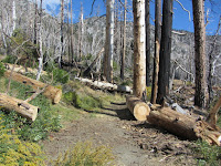
10:25 - Arrive at the work site. The jumble of large trees piled on the road is daunting. But we go work. The Crystal Lake basin was incinerated by the 2002 Curve Fire, destroying a mature forest, reducing it to dead sticks reaching into the deep blue sky. The Trailbuilders remove tons of trees from the trails every year, but more keep falling.
The weather is great today. In spit of the horrible destruction from the fire, there is still a beauty here. We are surrounded on three sides by soaring ridges 1,000 feet above with dramatic slopes falling into the basin. Wildflowers around us add a splash of color.
We finish clearing the first big tree and break for lunch. We sit in the shade. There’s always good conversation. Back to the deadfalls, everyone works hard and there’s a real camaraderie among the seasoned veterans and the newcomers alike.
We make excellent progress and nearly complete the task of clearing the road. We had hoped to have started on removing dead trees from Windy Gap Trail, but they will have to wait until next time. Wrap up at about 3:00 and head back down the mountain.
Epilog - It almost seems odd that arduous physical toil is enjoyable. But there is a sense of satisfaction in a job well done. And as a hiker I always value the opportunity to give back to the sport. If you would like to serve those who love the outdoors, come out and spend a day with the San Gabriel Mountains Trailbuilders. It’s a great group forks and everyone is welcome. Workdays are on the first, third, and fifth Saturdays of each month. Visit the San Gabriel Mountains Trailbuilders website to learn more.
See Windy Gap Trail hike description at Dan’s Hiking Pages
Subscribe to:
Posts (Atom)