Saturday, December 17, 2016

Joshua Tree - Negro Hill and Desert Queen Mine - Dec. 17, 2016

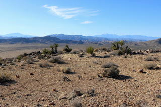
Panorama east toward Desert Queen Mine from the summit of Negro Hill, Joshua Tree National Park

It’s the holidays and time for hiking in Joshua Tree National Park (JTNP)! Since my daughter moved to Twentynine Palms in 2014, Christmastime and Easter have become de facto opportunities for me to hike JT. And last month I had the occasion to drive out to 29 to culminate the Thanksgiving weekend.

With my time constraints for this hike, I needed a hike that would be close to 29, so I began looking at hikes along the Park Boulevard area. Shall I do a peak, nature trail, oasis, mine? Part of me wants to keep visiting the marquee tourist sites just to cross them off my list, but part of me wants to adventure off the beaten path and bag peaks. Perusing through my three books, a write-up for Desert Queen Mine and Wash caught my attention (Best Easy Day Hikes in Joshua Tree National Park by Polly and Bill Cunningham). A visit to the largest and longest operating mine in the park seemed good, and if I add the wash it would be a nice 4 miles outs and back. But then as I was looking at the map, I saw Negro Hill (4875’) nearby. Hmmm. So I did some more sleuthing and found a hike description for it in On Foot in Joshua Tree National Park by Patty Furbush: Cross county, 1.5 miles round trip, 439 feet in elevation gain, 360 degree panorama. I chucked at the route description. This is it in its entirety: “Route: Negro Hill is the obvious hill located a short distance west of the backcountry board. Head west up any likely slope.” That’s my kind of hike! And I can add that to my mine visit and get the best of two worlds: a marquee site and off the beaten path.

National Park Service Oasis Visitor Center on Utah Trail, Twentynine Palms, near the north entrance to Joshua Tree National Park
My wife and I intended to leave our house in Azusa by 8 a.m. on Saturday, but my hydration reservoir leaked all over my packed pack. Urrg! So with handling that mess and some other delays, we didn’t leave until 9:15. We arrive at my daughter’s house in 29 at 11:22. After unloading our bags and a brief visit, I say bye to my wife and daughter and off I go. I stop by the Oasis Visitor Center on Utah Trail, take some pictures of plants in their garden, and chat with a ranger. He says no one has ever asked him about hiking to Negro Hill. What can I say? I’m not normal.

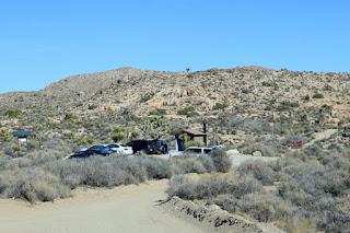
Nearing the Pine City Backcountry Board parking area and trailhead for Negro Hill and Desert Queen Mine, Joshua Tree National Park
I leave the visitor center at 12:32 and drive into the park. I’m glad there is no line at the entry station. This may be my last hike with my annual pass which expires this month. I always love the amazing scenery as I drive. I pass the trailheads for Split Rock (hiked on 4-3-15) and Crown Prince Lookout (hiked 12-20-15). Soon my excitement builds as I spot Negro Hill in the distance. I reach the intersection of Geology Tour Road (south) and Desert Queen Mine Road (north). I turn north (right) onto the dirt road and drive 1.4 miles to the Pine City Backcountry Board parking area. I arrive at 12:57. There are 10 cars in the small lot. A party of backpackers is gearing up. The temperature is 43 degrees but the reality of how cold that is doesn’t hit me until I get out of the car. It takes me a while to boot up and repack my pack after letting it dry on the drive. Gosh it’s cold. I decide to skip the fleece as my top layer and go directly to my jacket, something this fair-weather hiker rarely wears while hiking.

View west toward Negro Hill, Joshua Tree National Park
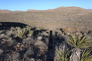
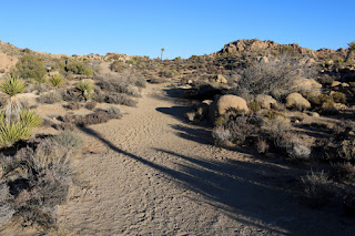
1:21 PM - Begin hike to Negro Hill. I head west on the road I came in on and immediately veer right (northwest) into a wash. Negro Hill stands as a rounded lump rising from the desert floor before me. Course sand crunches beneath my feet. In about 3 minutes I veer left from the wash and take a route heading to the hill. A few footprints indicate that others have been here. I’m careful as I know that many of these plants are poised to inflict pain upon me. The cloudless sky is a stark contrast to my hike to Mastodon Peak hike last month when the clouds created a gorgeous sky and picturesque shadows across the desert landscape. A cold wind nips at my face and hands. As I approach the base of the mountain, the grade gets steeper. I weave my way up the slope looking for the best footing and dodging hostile plants. Views slowly open up. The cold wind is coming from the north so I tend to stay on the south side of the broad ridgeline. The cluster of cars at the increasingly distant trailhead diminishes in size.

Rabbit on the east flank of Negro Hill, Joshua Tree National Park
I’m startled by movement near a yucca tree about 10 feet in front of me. I stop and notice a large rabbit seeming to use the shade of the plant to hide himself. His ears are laid flat back and he crouches close to the ground. I move a little closer to get a better picture and anticipate he’ll bound off. But he holds his ground. I chat with him for a minute then decide to walk a wide circle around him. He doesn’t move and I bid him farewell as I continue up the mountainside.

View east toward Desert Queen Mine from the flank of Negro Hill, Joshua Tree National Park
Up ahead an outcropping of darker colored rocks impedes a direct line. I veer to the left and find a good route that takes me to a flat saddle-like hip behind the rock. I arrive there at 1:43, and according the aerial, I’m about half way to the summit from the trailhead, but the real climbing is ahead. I continue mostly to the south of the broad ridge tending to take a snaking zigzag route. For the most part the footing is decent but requires careful steps. To the southwest, Ryan Mountain comes into view; View southwest toward Ryan Mountain from the flank of Negro Hill, Joshua Tree National Park it was my first peak in JT, which I hiked on 1-3-15. I’m enjoying the amazing “viewshed” (new word for me. I read it in the park’s Fall Guide and I really like it). I’ve not seen a single bloom of anything yet, but I am stopping occasionally to admire small cacti, which seem to get lost in the sea of tan desolation. I’m pleased that I recognize the hedgehog cactus (Echinocereus engelmannii) Hedgehog cactus (Echinocereus engelmannii) on the flank of Negro Hill, Joshua Tree National Park and the foxtail cactus (Escobaria vivipara) Foxtail cactus (Escobaria vivipara) on the flank of Negro Hill, Joshua Tree National Park which were two of the plants I photographed at the visitor center. I’m slowly gaining a familiarity with desert flora.

View north toward Queen Mountain from the east flank of Negro Hill, Joshua Tree National Park
As I curve over to the north flank of the broad ridge, I get a good view of Queen Mountain (5680’). I’ve been eager to become more familiar with it so I can recognize its profile from various locations. I’m hoping to climb it in the spring. Back over toward the south I see the black mass of Malapai Hill (4223’) rising from the floor of Queen Valley. I first became familiar with it with climbing Ryan Mountain. I’m really enjoying the amazing desert scenery. View east toward the Pine City Backcountry Board parking area and Desert Queen Mine from the east flank of Negro Hill, Joshua Tree National Park

View west toward the Wonderland of Rocks along the western edge of Queen Valley from the southern edge of the broad summit area of Negro Hill, Joshua Tree National Park
Up ahead I see what appears to be a summit, but judging from the topo map, I suspect it is just the leading edge of the summit area with the actual summit beyond. I arrive there and find it to be so. Wow, what a panorama! The viewshed (there’s that new word again) west lies before me. The peaks of San Jacinto and San Gorgonio, the two highest massifs in southern California, outline the distant horizon. The Wonderland of Rocks forms a craggy jumble along the western edge of Queen Valley. The broad summit area bends north and a gentle-five minute walk takes me to the highpoint. View north toward the summit of Negro Hill with Queen Mountain in the distance, Joshua Tree National Park

Panorama south toward Queen Valley from the summit of Negro Hill (4875’), Joshua Tree National Park

2:04 - Negro Hill (4875’). Splendid peak! Sprawling desert fills a 360-degree panorama. It’s cold and windy but the warm sun feels good. I review the maps and enjoy identifying various landmarks in the distance. Topo map at summit of Negro Hill (4875’), Joshua Tree National Park My 250mm telephoto lens helps bring things closer. View west toward the Wonderland of Rocks and distant San Gorgonio Mountain from the summit of Negro Hill (4875’), Joshua Tree National Park Zoomed-in view west toward the distant San Gorgonio Mountain from the summit of Negro Hill (4875’), Joshua Tree National Park Queen Mountain dominates the skyline to the immediate north. View north toward Queen Mountain from the summit of Negro Hill (4875’), Joshua Tree National Park I’m scoping out the Desert Queen Mine site to the east and pondering my visit as part 2 of today’s outing. Zoomed-in view east toward Desert Queen Mine from summit of Negro Hill (4875’), Joshua Tree National Park I have a bit to eat and soak in the beauty around me.

View east toward the Pine City Backcountry Board parking area and Desert Queen Mine from the east flank of Negro Hill, Joshua Tree National Park
2:39 - Leave summit. I meander around the west and south sections of the summit area just checking things out. An outcropping on the southern edge provides unobstructed views of the southern panorama. I finally decide to put on my gloves. I retrace my steps down the mountainside. The Desert Queen Mine area dominates my view in front of me. I guard my step as going downhill is dicier than going up.

View northeast toward the Pine City area from the east flank of Negro Hill, Joshua Tree National Park
I arrive at the outcropping hip at 3:06 and decide to veer northeast around it to take a little different route. It’s colder in the shade and I’m eager to remerge into the sun. Six minutes delivers me to the base of the mountain and warm sun. I bear southeast and generally follow a wash. View southeast across open desert toward the Pine City Backcountry Board parking area, Joshua Tree National Park Gangly Joshua trees accent the desolate landscape. When I reach the main wash I started on, I continue past it a couple more minutes to intersect the north-south trail to Pine City. I turn right (south). Off to my right I admire my new friend, Negro Hill, rising from the desert floor. Up ahead the parking lot comes into view. View south from Pine City Trail toward the Pine City Backcountry Board parking area, Joshua Tree National Park

3:29 - Trailhead (Pine City Backcountry Board parking area). Wow, that was a fun little excursion, good for 1.5 miles round trip with 440 feet in elevation gain. There are nine cars in the lot (including mine). Sunset is at 4:46 today, so I’ll see how much of Desert Queen Mine I can explore before dark.

Walking east on Desert Queen Mine Trail, Joshua Tree National Park
3:30 - Begin hike to Desert Queen Mine. I head east on the well-beaten path. I didn’t take time to review the trail description but I know that the first part is to follow this trail a quarter mile to the mine overlook and interpretive sign. The trail climbs at a slight grade. I’m beginning to enjoy the warm lighting of the golden hour. Occasionally I look behind me at Negro Hill rising from the desert floor. That was a fun conquest. To my right, views of a rocky canyon open up.

Structure ruins from Desert Queen Mine, Joshua Tree National Park
3:36 - Reach a spur path that heads south about 75 yards to a stone building ruins. I decide to check it out. I’m thankful that the Park Service lets these kinds of historic artifacts stand. The crude stone and mortar structure gives a glimpse into the mining days. A doorway on the south wall remains in tack with a timber header. The doorway is only about five feet tall so either the miners were really short or didn’t mind stooping over to enter. Structure ruins from Desert Queen Mine, Joshua Tree National Park From here I have a better view south into the rugged canyon and I can see a trail winding deep into the canyon. A trail continues down into the canyon from the ruins and I wonder how the network of routes tie together. Before leaving the ruins, I climb a little knob abutting the east side of the ruins for a better look at the surrounding topography. To the north, the hills are more gentle and dotted with tailings (the rock debris that is excavated from a mine shaft). Back on the main trail, another two minutes delivers me to my first planned destination.

View southeast from Desert Queen Mine overlook, Joshua Tree National Park
3:44 - Desert Queen Mine Overlook. Perched on the rounded eastern rim of this canyon, I am treated to a good view into the chasm and can see several tunnel openings and tailing mounds across the canyon. View southeast from Desert Queen Mine overlook, Joshua Tree National Park An interpretive sign narrates an overview of the mine’s colorful past. Gold was discovered here in 1894 and the mine operated until 1961 as one of the most productive mines in the area. It was entered into the National Register of Historic Places in 1976. A large metal cylinder stands a few feet away from the sign. A use path leaves the site heading south into the canyon. I remember the trail guide says to retrace my steps back to a junction for a trail that circles around descending into the canyon. But I’m losing daylight so I decide to see where this use path takes me. It’s well traveled so it should get me to the bottom ok, right?

View east across the canyon toward a tunnel and tailings at Desert Queen Mine, Joshua Tree National Park
I head south into the canyon. The path is a little steep and dicey in places but not bad. Down I go. I get increasing better views of the tunnels and tailings across the canyon, but deep shadows created by the setting sun make poor lighting for pictures. At the bottom of the canyon, the trail drops steeply, but I negotiate it without incident. I’m at the foot of a giant mound of granite tailings from a shaft on the west facing canyon wall. I climb the steep path next to the tailings to reach the mouth of my first tunnel. It was hewn out at about a 45 degree angle into the ground. A steal grate has been installed over the tunnel to keep people out…which is a good thing…falling into it would definitely be bad. I toss a rock through and opening at the edge of the grate and listen to it carom off the walls as it disappears into the deep abyss.

Looking northeast toward tailings from a horizontal mine shaft at Desert Queen Mine, Joshua Tree National Park
I climb the steep path to the left of the shaft to an abandoned mine road about 50 feet above. Some old mining equipment begs to be photographed. Abandoned mine equipment at Desert Queen Mine, Joshua Tree National Park Far below, a group of seven hikers walk the canyon bottom on their way back. I turn left (northeast) on the narrow road and step into welcome sun. I pass another grated tunnel below me. Giant rock formations to my right bask in the warm light of the golden hour. Up head is another huge tailing mound. As I arrive at its origin, a horizontal tunnel greets me. Horizontal tunnel entrance, Desert Queen Mine, Joshua Tree National Park It’s not blocked so I eagerly step inside. About 15 feet in, steel bars block further access. Small gauge train rails still run along the floor, absent of their wooden ties. It’s amazing to think about the rugged miners who bore these shafts through sheer rock and spent their careers laboring deep in bowels of these desolate rocky masses.

Covered mine shafts along the east canyon rim, Desert Queen Mine, Joshua Tree National Park
I continue along the old mine road 100 yards to check out several more grated tunnels along the canyon rim. I’m enjoying the sense of exploration. The lateness of the day is persistently on my mind as I would dread to get stranded out here in freezing nighttime temperatures. I decide to scramble up to the plateaued area above the shafts to poke around the huge outcropping glowing in the soon-setting sun. View north from an outcropping along the east canyon rim, Desert Queen Mine, Joshua Tree National Park I find another grated tunnel, this one vertical. I’m gambling on there being another route down from here. I circle around a giant boulder Giant boulder along the east canyon rim, Desert Queen Mine, Joshua Tree National Park and discover a draw that heads back to the mine road. It’s a fun climb down some large rocks and a minute later I’m back on the beaten path near the mining equipment were I came up.

Heading south along the narrow roadbed to the canyon bottom, Desert Queen Mine, Joshua Tree National Park
I decide to take the established trail back so I follow the narrow dirt roadbed south to the canyon bottom. The route crosses the sandy wash and begins to climb westward out of the canyon. I’m in full shade now but generating enough body heat to be comfortable. I’m really enjoying the rugged scenery. Across the canyon I get a final view of where I was exploring. Looking northeast across the canyon toward where I was exploring, Desert Queen Mine, Joshua Tree National Park Soon a path cuts right (north) and I suspect it is the use trail coming down from the structure ruins. I take that route and in about 3 minutes I arrive at the structure ruins. It’s is satisfying to see how a network of trails comes together.

Heading west on Desert Queen Mine Trail for the final few minutes of my hike, Joshua Tree National Park
4:42 - I turn left (west) on main trail. The sun has set behind distant mountains. There is beauty and serenity as dusk falls over the desert landscape. Mount San Jacinto stands silhouetted on the distant western horizon against a cloudless sky. A couple hundred yards to the north, a group of five-seems to be having fun throwing rocks. My pace is causal as I savor the last minutes of a splendid outing. About 3 minutes shy of the trailhead, I pass a junction of a well-traveled path heading south. I had not noticed it earlier, but I assume it is the main path that the trail guides note as the route circling around to the mine site. I feel a sense of satisfaction as I approach the trailhead. Heading west on Desert Queen Mine Trail approaching the Pine City Backcountry Board parking area and trailhead, Joshua Tree National Park

4:48 - End hike. My mine excursion was good for 1.5 miles round trip with 320 feet in elevation gain. The whole outing was good for 3 total miles with 760 total elevation gain. There are 5 cars (including mine) and it’s 36 degrees. The total step count on my Fitbit for the two parts of my hike is 10,374 (5,494 for Negro Hill and 4,880 for Desert Queen Mine). Now I head back to the house to get ready for a 7:00 concert in Joshua Tree.

Dan Simpson in the mouth of a horizontal mine shaft, Desert Queen Mine, Joshua Tree National Park
Epilog - Another thoroughly rewarding outing in JTNP! I love this amazing place. And what a fitting hike to celebrate the 100-year anniversary of the National Park Service! It’s nice to check off another tourist site as well as conquer another peak. As in some of my JTNP adventures, I had almost total solitude. Even with nine hikes in JT under my belt now, I still feel like a novice and outsider in this surreal desert wonderland. icon

hiking icon  See Joshua Tree hikes at Dan's Hiking Pages

PREVIOUS > Joshua Tree - Crown Prince Lookout - December 20, 2015

Thursday, June 30, 2016

Van Tassel Fire Road Post-Burn Hike - June 30, 2016

View west over Duarte toward the Fish Fire shortly after it started on Monday, June 21, 2016 – Photo NWS Los Angeles
Monday morning, June 20, a huge plume of smoke began to billow into the sky above Duarte and Azusa. By day’s end, the fast-moving wildfire consumed nearly 3,400 acres of Fish and Van Tassel canyons all the way to Fish Canyon Falls, Mount Bliss, and beyond. I was staying in L.A. for four days of meetings and began to see pictures of the inferno pop up on my smart phone. Heart wrenching! But with the consuming demands of my job that week, I had hardly a moment to think about the fire or look at the news.

Road closure in Duarte neighbor due to the Fish Fire June 23, 2016
When I got home on Thursday evening, June 23 and saw the mountains and began to see the fire reports and news stories, I was numb. At about 7 p.m. I drove over to nearby Duarte to see what I could see. Encanto Parkway was blocked off so I meandered through the residential streets a little further west and north, but sheriff deputies had the streets near the mountainside closed off. I headed east on Royal Oaks then north on Melcanyon Road and arrived at the intersection of Brookridge at the base of the mountainside. The burn area loomed above me. I was surprised that there were no deputies or signs restricting access.

Fish Fire damage along the access drive adjacent to Opal Canyon Road, Duarte, June 23, 2016 Fish Fire damage along the access drive adjacent to Opal Canyon Road, Duarte, June 23, 2016
Fish Fire damage along the access trail to Van Tassel Fire Road, Duarte, June 23, 2016 Fish Fire damage at the junction of the access trail and Van Tassel Fire Road, June 23, 2016
View southeast toward Duarte from Van Tassel Fire Road, June 23, 2016 View southeast toward Duarte from Van Tassel Fire Road, June 23, 2016
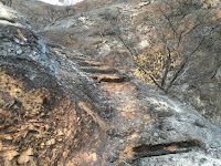
So I got out of my car and began to walk north up the access drive adjacent to Opal Canyon Road. The driveway leads to a water tank and an access trail to Van Tassel Fire Road. The charred scene was heartbreaking. At the water tank I transitioned to the path and began walking through what days earlier was thick, mature chaparral. Acrid smell filled the air. There was nothing but ash and blackened sticks. It was a strange and eerie scene. I was too numb to cry. I had no intent to hike that evening, and as I climbed the ashy path I had no idea how far I’d go. But curiosity drew me upward. I was snapping pictures but was mindful of a low battery. When I reached Van Tassel Fire Road I decided to continue climbing. Occasionally a firefighting helicopter flew overhead. I was surrounded by lifeless moonscape. I monitored the time and daylight because I didn’t want to be coming down in the dark. At 8:21 I reached a hairpin curve with good views south and decided this would be my turn around point. I retraced my steps down the road as dusk turned to night. Ambient light was sufficient as I carefully negotiated my way down the access trail and arrived back at the car at 9:00. I knew I needed to return soon.


Closure sign at Fish Canyon Trail trailhead after the Fish Fire, Azusa, June 30, 2016
A week later, on Thursday evening, June 30, I decided an after-work hike up Van Tassel Fire Road would be good. This time I would be more equipped to hike. I took the 10-minute drive to the Vulcan entrance on Fish Canyon Road to see the new banner they posted on Wednesday announcing that Fish Canyon Trail is temporarily closed. Then I drove over to the stables at the head of Van Tassel Fire Road. There were no closure notices so I was free to walk up the road. Fish Fire damage at the beginning of Van Tassel Fire Road in Van Tassel Canyon, Azusa, June 30, 2016

Fish Fire damage along Van Tassel Fire Road with Van Tassel Ridge in the background, Azusa, June 30, 2016
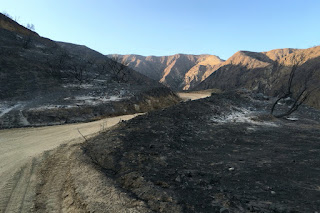
6:48 PM - Begin hike. The sun still rests on the Van Tassel Ridge high above me on the west. It’s amazing that the equestrian center was spared in the mouth of the canyon with scoured earth on three sides. I walk up the steep road surrounded by blackened scenery. The smell of burnt vegetation is still strong. I look north up narrow Van Tassel Canyon and ponder the possibility of exploring it now that it’s vegetation free. Soon the east end of the San Gabriel Valley lies before me illuminated by the late-day sun. View southeast toward the San Gabriel River from Van Tassel Fire Road surrounded by damage from the Fish Fire, Azusa, June 30, 2016 The barren, ashy landscape is surreal. There is almost a beauty to it in a Tim Burton kind of way. The only life is a fresh anthill.

Fish Fire damage along Van Tassel Fire Road with Van Tassel Ridge in the background, Azusa, June 30, 2016
The road has had a lot of traffic since I was here a week ago…no doubt firefighting vehicles. There is a fresh set of small tennis shoe prints. I leave a trail of footprints in the soft dirt. Higher and higher I climb surrounded by moonscape with blackened sticks. Fish Fire damage along Van Tassel Fire Road with Van Tassel Ridge in the background, Azusa, June 30, 2016 A lone blossom stalk of a yucca juts into the sky, strangely untouched by the fire. View southeast toward the San Gabriel River from Van Tassel Fire Road surrounded by damage from the Fish Fire, Azusa, June 30, 2016 As I round the outward bend by the first water tank, the pinkish-red Phos-Chek fire retardant covers the ground. Tons of it was dropped by aircraft during the first day of the fire. DC-10 Supertanker drops Flos-Chek to fight the Fish Fire, June 20, 2016, Los Angeles Times, Photo by Tim Berger The top of the water tank is now Phos-Chek red. View southeast from Van Tassel Fire Road toward a water tank covered with pinkish-red Phos-Chek fire retardant dropped fighting the Fish Fire on June 20, 2016 Typically much of my attention while hiking is on the plant life and photographing flowers. It’s so bizarre to walk through a lifeless moonscape. The last of the day’s sun lingers on distant Mount Baldy and neighboring peaks to the east. Huge power towers stand gangly against the azure sky. Power tower along Van Tassel Fire Road above Duarte, June 30, 2016

View west at dusk toward Monrovia from Van Tassel Fire Road above Duarte, June 30, 2016
7:43 - Heading west I pass through the open vehicle gate (it’s usually locked). I’m hoping to get line-of-sight to the 8:08 sunset, but soon see that the sun has dipped behind Mount Harvard. The line of Phos-Chek around me didn’t keep the fire from consuming the foothills to my west. The road cuts back east and I continue up. Dusk settles over my view east and the blackened landscape. View southeast toward Azusa from Van Tassel Fire Road above Duarte surrounded by damage from the Fish Fire, June 30, 2016 The scene is haunting. I should be overwhelmed with sadness over the loss of the rich chaparral that blanketed these slopes. But I feel at peace…kind of a melancholy contentment.

Heading north on Van Tassel Fire Road above Duarte surrounded by damage from the Fish Fire, June 30, 2016
For my destination I had in mind going to at least the power tower retaining wall up ahead. Since I was here last in August 2011, Edison has been working on the towers. I had assumed they were building additional ones, but I don’t see any new ones. I reflect on the many times I’ve climbed this road. It’s so familiar, yet now so different.

7:57 - Power towers, but there is no more retaining wall. View south along Van Tassel Fire Road above Duarte from the site of the now-gone retaining wall, June 30, 2016 The last sunlight sits upon Mount Baldy. I decide to continue up a little more. Deep in the canyons below some trees may have survived the inferno. I pass through a section of road that was previously lined with beautiful pines. Heading northwest along Van Tassel Fire Road above Duarte surrounded by damage from the Fish Fire, June 30, 2016 They are dead now.

View southwest toward Monrovia from Van Tassel Fire Road near water tank 14 (about half way to Mount Bliss), June 30, 2016
8:11 - Water tank 14 (about half way to Mount Bliss). View northwest toward water tank 14 (about half way to Mount Bliss) on Van Tassel Fire Road surrounded by damage from the Fish Fire, June 30, 2016 I now have a view southwest over the San Gabriel Valley as dusk falls and lights begin to twinkle. An orange band of haze outlines the horizon. It’s peaceful here. I linger for a few minutes and soak in the beauty of nightfall. At 8:15 I head down. View southeast toward Azusa on Van Tassel Fire Road surrounded by damage from the Fish Fire, June 30, 2016 I’m tempted to tangent up a slope to achieve a summit, but I decide to not trample bare earth by going off trail. As I reach the power towers, I scramble up to the tower on the high point to enjoy the vistas. It’s almost dark now and the human sprawl is a blanket of lights. The ambient light is sufficient for my steps. The temperature is quite pleasant.

View southeast along Van Tassel Fire Road toward Azusa and the east end of the San Gabriel Valley, June 30, 2016
8:58 - Pass through the open vehicle gate. The power towers have a strange beauty to them. I text a photo to my wife letting her know where I am. The dampness of evening intensifies the smell of charred landscape. I finally get out a light at 9:10 to aid my steps and at 9:15 I reach the bend where I ended my walk last week. It’s peaceful here. Occasionally the stillness is broken by rocks tumbling down the bare slopes. Crickets are chirping in the canyon below…the sounds of life amidst scoured earth. The bray of horses signals that I’m nearing the end. A tarantula crosses the road.

9:56 - End hike. My feet are filthy from miles of dusty road. Good for 4.4 miles round trip, 1,540 feet in elevation gain, and 13,969 steps on my Fitbit (normally it’s about 2,000 steps per miles walking; this turned out to be 3,174 steps per mile…so really short steps!).

Burnt shrub along Van Tassel Fire Road as night falls on the east end of the San Gabriel Valley, June 30, 2016
Epilog - What an interesting and fulfilling hike. Sad, serene, stirring, surreal. It’s sobering to experience the devastating results of a ferocious inferno. More than 4,200 acres of scorched earth. I’ve hiked this road many times since it is one of my nearby scrappy hikes. So sad to see it gone. The 2014 Colby Fire incinerated more than 1,700 acres of mountainside above Glendora and Azusa, laying waste the scenery around Colby Trail and Garcia Trail (which is still closed). Now the Fish Fire has destroyed the hikes to nearby Fish Canyon Falls and Mount Bliss. My four favorite scrappy hikes…reduced to moonscape. But I shall continue to hike and find beauty wherever I tread. icon

See Mt. Bliss hike description at Dan's Hiking Pages
 
CameraSee Mt. Bliss hike photo album - 8-14-11