Three months ago to the day, I began April with a hike to Beacon Hill in Griffith Park. I so enjoyed my hike that I followed it with four more hikes in Griffith Park through mid May. In so doing, I completed most of the main trails in the park. But I knew that there were some trails on the north side I still need to explore.
On Thursday, July 8, I had an early morning meeting at work in L.A., so that afforded me the chance to hit the trail in Griffith Park for a late afternoon hike. I leave my office in Echo Park at 3:30 and head to Griffith. I had pre-scouted the trailhead weeks earlier, so I know exactly where to park.
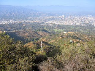
4:05 p.m. - Start hike from Mineral Wells Picnic Area at northeast corner of the Griffith Park. The trail climbs southwest up a canyon toward a water tank. The sun had finally come out, having been hidden by “June Gloom” most of the day. Temps are in the low 70s. The brown hillsides are a stark contrast to the green hikes I had in the spring. As I emerge out of the canyon, views east toward Glendale open up, but muted by the haze. I now see the cluster of trees marking Amir’s Garden, my first destination. As I approach, a pleasant fragrance catches my attention.
4:16 - Amir’s Garden - What a delightful oasis! I had read about it in several trail guides and online, but it exceeds my expectations. I wander around the labyrinth of trails and admire the amazing assortment of plants. Would be a great place to bring a book and just set a spell. I see Beacon Hill to the distant south. I want to stay longer but I must be heading on.
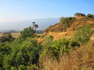
4:35 - Leave Amir’s Garden and continue west on the dirt road heading up a ridge. I hear voices of boys playing at Griffith Park Boy’s Camp in the canyon below to the south. Across the canyon I see Bill Eckert Trail where I had hiked down on April 16 after my first visit to Bee Rock and Mt. Bell. Up ahead to the southwest, Mt. Bell stands at the head of the canyon calling me up. Pass a water tank and turn left. To my right is Toyon Canyon Restoration Project—which is a fancy way of saying they intend to mask the remains of a huge garbage dump. Pass water tank 112. The trail now transitions to the north face just below the ridge. Pass the junction to Toyon Trail as views open up toward Mt. Chapel and Cahuenga Peak to the west. The map labels this section as Mt. Hollywood Trail [that label was removed on the 2014 map, implying that that section is a continuation of North Trail]. Reemerge onto the ridge with a view of the road up ahead. It’s breezy and cool.
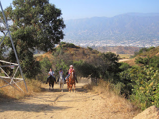
5:08 - Junction with Vista Del Valle Drive. Large power tower marks the spot. A group of horseback riders passes. Looks fun. A foursome of noisy ladies follows. Turn left (east) onto the paved road and immediately veer right unto the trail. In 5 minutes I reach another junction. Now I’m nearing familiar territory. Below me east in the canyon is the trail I ascended previously to Mt. Bell. I decide to forge ahead another minute to intersect the junction (39) of my pervious hike. I turn back and veer left (west) and ascend steeply across the north face of Mt. Bell. Sun feels good.
5:31 - Junction. west of Mt. Bell. Now I’m back on familiar ground. Clouds and haze mute the view south toward Hollywood. Turn left (east) and immediately find a use path that I had not seen before. Hmmm, how could I have missed it in my several times past this location? Let’s give it a try. Veer left and begin my final assault on Mt. Bell. The first section is pretty decent. I climb up some rocks and veer left. Past some more rocks and the number of paths multiply (I’ll resist using “labyrinth” for a second time in this write up). As I get closer to the summit the route gets brushier. I may not have picked the best way.
5:43 - Mt. Bell (1582’). That was an adventure. Scratchy and dirty now with burs in my socks. I really like this summit, now having climbed it this year three times from three different routes. It’s much more of a hikers’ peak than Mt. Hollywood. The views are muted by the haze today and it’s cool and breezy. Can see Amir’s Garden far below. Have a snack, takes some pics, and call home. Leave the summit at 6:00 and head down the west ridge again, trying to find a better route. Much better this time, but had to crawl over some large rocks.
6:11 - Junction west of Mt. Bell. Instead of turning right (north) and retracing my steps, I continue straight. Now I am on a trail I’ve hiked before, but only for about 3 minutes. I reach the paved road. Directly across is the trail to Mt. Chapel. I curve with the road to the right and in a half minute reach a “Y” in the road. I bear right (northeast). Pick up the pace of a light jog (I think I’m ready to go home now).
6:21 - Junction with power tower (5:08 location). Turn left (north) unto Mt. Hollywood Trail [North Trail] (unsigned) and retrace my steps down the ridge. I love the warm light this time of day for taking pictures. I continue at a jogging pace.
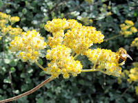
6:44 - Amir’s Garden. Much different light now, so I take more pics. I shall come here again, maybe spend a couple hours just photographing plants. Continue on my way. Leave the sun and disappear into the shade of the canyon.
6:55 - End hike.
Epilog - Another thoroughly enjoyable hike in Griffith Park. The cool weather (65 degrees now) certainly is unseasonal for July, but the brown grass and weeds indeed reveal the season. I often wonder what our chaparral would have looked like before the Europeans introduced all these invasive non-native grasses. According to Hileman’s map, it appears that I hiked a total of about 4 miles. Seems longer. What a nice way to spend a summer evening after work!
(includes links to my other blog posts for hiking in Griffith Park)
NEXT > Griffith Park Six Peaks Hike - August 5, 2010 (Bee Rock, Mt. Chapel, Mt. Bell, Mt. Hollywood, Glendale Peak, Beacon Hill via Old Zoo Park)
PREVIOUS > Brush Canyon to Mt. Bell and Bronson Caves - May 6, 2010


Dear Dan,
ReplyDeleteI just wanted to let you know how much I enjoy your blog and your website. I'm a hiker too! I also work right next to Echo Park. Do you know of any quick hikes in Elysian Park?
Jennifer :)
Hi Jennifer, nice to meet you! I enjoyed my visit to your blog. I've not hiked Elysian Park yet. Griffith is just too compelling! :-)
ReplyDelete