 See Smith Mountain Via Upper Bear Creek Trail Description on Dan's Hiking Pages
In June 2003 I discovered the San Gabriel Mountains Trailbuilders. What a great find that was. I had gone to the Forest Service office in Glendora to find out when the Crystal Lake area would be reopened (it had been incinerated by the Curve Fire a year earlier). The gal told me that it was still closed and that they had no idea when it would be reopened (it's still closed at this time, Nov. 2010!!). She told me that there was a group called the San Gabriel Mountains Trailbuilders who are working on the trials at Crystal Lake. Hmmm, the back door in! So I showed to work with the SGMTBs on Saturday, June 21, 2003. My ulterior motive was to see the Crystal Lake area. But I so thoroughly enjoyed the trailbuilding experience that I became a regular volunteer with organization. They are a great group of men and women who volunteer their time to work on trails, primarily in the San Gabriel River watershed. The regular work days are the first, third and fifth Saturday of each month.
Fast forward to November 2010, it had been awhile since I had been out with the Trailbuilders, so I decided to hit the trail with them. Our project for the day is routine trail maintenance on Upper Bear Creek Trail, which climbs three gentle miles from Hwy 39 in the San Gabriel Canyon to Smith Saddle (4260' est.). Joining us would be some scouts and adults from Troop 501 in La Canada.
 I arrive at the San Gabriel Canyon Gateway Center in Azusa a little before 8:00 a.m., the regular meeting location. We pile into cars and head up into San Gabriel Canyon on Hwy 39. At 8:20 we arrive at the Rincon Fire Station to load the equipment. Trailbuilder Bron Draganov gives a brief overview of the day. We load up and continue up Hwy. 39 and arrive at the trailhead at 8:50. Bron presents a safety briefing and explains some fundamentals of trailbuilding. We split up into two groups. One would hike up the trail about 2.5 miles and work their way back. The other would start near the lower end and work their way up.
 Armed with McLeods, mattocks, loppers, and leather gloves, we begin hiking up the trail at 9:03. I am with the first group, which consists of three trailbuilders, three scouts, the scoutmaster, and scout grand mother. The weather is nice and everything is greening up nicely from our recent rains. This area was incinerated in the 2002 Curve Fire, but it has rebounded well. The storms the following year significantly damaged the trail, completely washing out some sections. In late 2005 the Forest Service hired a trail contractor to repair the trail. And the San Gabriel Mountain Trailbuilders has worked a lot on this trail over the years. Today, the trail is in good condition except for some plants intruding into the path in places and the need for some general tread work.
 Our pace is little slow. Pass the one-mile maker at 9:37. Not much in bloom. The sycamore and poison oak are beginning to display fall colors. Clouds are drifting in overhead with some chance of rain late afternoon or evening. Pass the two-mile marker at 10:16. The pointed summit of Smith Mountain looms to our southwest. At 10:22 we arrive at our destination, a rock face which had required some dynamite work a couple years ago to restore the trail. I proceeded onto Smith Saddle while the others began trial work heading down. I do some light work as I hike.
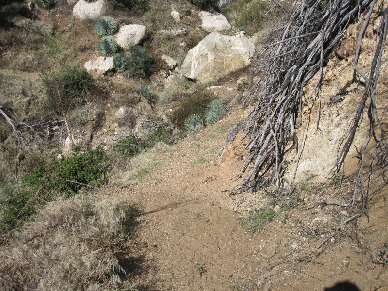 At 10:49 I come to section of trial which is worthy of concerted effort. I go to work removing dead branches which were hanging into the trail. Next I removed some rocks and debris, flatten the birm on the outside edge, remove some plants in the trail, and regrade the dread. An hour of work makes big difference...feels good. I continue up the trail and shortly encounter a deer hunter. He is waiting for his three friends who are coming down the trail. They've not bagged anything yet and tomorrow is the last day of hunting season. I continue up the trail, pass the three hunters, and at arrive at Smith Saddle at 12:11.
 It's cool and breezy now. I was here on July 18, and like at that time, the summit of Smith Mountain calls to me but I must stay on task. Take some pics, have lunch, and leave the saddle at 12:38. Aside from snapping some pics of a few plants, I proceed directly down the trail and meet with the rest of the group at 1:25. We continue to remove plants from the trail and rework tread. The cool weather is welcome. At 2:00 we stop work and begin our homeward decent. We traverse sections of trial that have been nicely worked by the other group. We arrive at the trailhead at 2:44, 15 minutes before the designated rendezvous time. We stash our tools back in the truck, say our good-byes and hit road.
A good day on the trail. It's always hard work but very rewarding. And it's always good to have Boy Scouts working us. Why not come out some Saturday and experience trial work for yourself?

Visit the San Gabriel Mountains Trailbuilders website
Read my Smith Saddle Blog - July 18, 2010
See Smith Mountain Via Upper Bear Creek Trail Description on Dan's Hiking Pages
:


