On Hwy 62 (29 Palms Hwy) about half way between Joshua Tree and Twentynine Palms, I turn south on Indian Cove Road. In about a mile I pull into the ranger station to see if there is anything helpful. The ranger was out but I picked up a campground map. Back on the road I continue south for another couple miles (past the junction for the group campground) to the campground. At the intersection, I turn right (west, toward campsites 40-101) and navigate my way to the trailhead for Indian Cove Nature Trail. There are just two cars here, which is a big difference from my last two hikes. My route will follow the first portion of the nature trail. I can see cone-shaped Mount Mel due west.
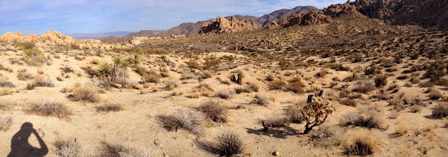
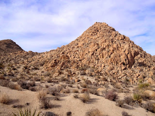
11:46 - Begin hike heading west on the nature trail. It’s a brisk 51 degrees but I’m comfortable in my t-shirt. I snap pics of the interpretive signs along the way. At about 0.15 mile, the trail drops into a wash and begins to curve back to the north and east. At this point (just past the packrat sign), my route veers left, leaves the nature trail, and begins to head west in the broad wash. There are many footprints in the soft sand. I don’t have line of sight to Mount Mel from here as it is now hidden behind an outcropping. The jumbles of huge rocks are surreal. The wash gets narrower and soon I regain sight of my peak. It kind of looks like a giant candy kiss covered with nuts.
12:14 - I reach a drainage that runs north separating Mount Mel from the huge jumble of boulders to its east. I’m really enjoying the rugged scenery and solitude. My first target is the saddle on the south flank of Mount Mel. The amount of footprints in the sand has thinned out considerably, but route finding is pretty easy. The massive pile of rocks called Mount Mel begins to look daunting.
12:26 - Saddle. Ok, that was the easy part…now for a crazy climb. I pause to study the mountainside and look for the best line. I’m feeling intimidated by the sheer mass of huge boulders. I run the timing in my mind: I have to be back at the house by 2:00, which means back to the trailhead by 1:45, which means climb this peak and back to this saddle by 1:15, which means I have about 45 minutes to climb up and down this monster. Is that doable? Is it safe? In my planning, I had grossly underestimated the demands of this ascent. I decide to at least test it.
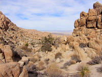
I follow a sandy path for about 50 yards to the start my first set of boulders. I successfully conquer the first big obstacle to find me staring at the next one. And it does not look safe. Wow, this could take a while. And these boulders look smooth from a distance, but their surface is incredibly course
I stand on a massive boulder and must make a decision. I break out singing the chorus from Kenny Rogers, “You gotta know when to hold ‘em, know when to fold ‘em, know when to walk away, know when to run.” I hate failing to summit, but good judgment says it’s time to walk away. Bagging this peak will have to wait for another day. My feelings are mixed. I feel good about my decision to abort the ascent, but also feel sad. Rarely do I fail to complete a hiking objective. But as a solo hiker, I always weigh the risks and use wisdom to keep from triggering a search and rescue operation. And I told the family I’d be home by 2:00, so I need to keep my word.
I climb back down to the saddle and decide to explore west a little. I descend the draw a couple hundred yards to the edge of the canyon along the west flank of Mount Mel. I can see a couple portions of Boy Scout Trail far below. In my pre-hike research, I saw a trip report on Peakbagger that shows a GPS track connecting this point with Boy Scout Trail. I don’t see an obvious route but the terrain looks possible to navigate, howbeit, rough, with about 300 feet in elevation change.
I arrive back at the saddle at 1:05 and begin my descent. For the most part I retrace my steps but in some spots I improve my route. I Iook back over my shoulder a few times at the boulder pile called Mount Mel. I reflect on the bizarre and amazing features of this desert landscape. In some ways it seems peaceful and welcoming. But in reality, behind its serene façade is a hostile and treacherous environment with little forgiveness and mercy toward its human visitors. Virtually every plant is armed to inflict pain.

Walking down the broad wash, I climb the steep bank on the right to get a better perspective. I follow the route down and arrive at the nature trail in the wash at 1:35 and veer left to continue along the trail. I enjoy the signs and learn about desert willow, desert almond, lizards, and bighorn sheep. I leave the trail and walk across the desert back to my car.
1:45 - End hike. It’s 56 degrees and there are no cars in the lot.
Epilog - What a pleasant hike to conclude my first set of adventures in Joshua Tree National Park. And it was nice having solitude compared to the other two hikes amidst a throng of park guests. I was treated to beautiful weather, stunning landscape, fascinating plants, and the fun of some cross-country travel. The summit of Mount Mel eluded me today, but I am growing to respect the unique challenges of desert hiking. I am eager to return.
NEXT > Joshua Tree - Warren Point & Panorama Loop - April 4, 2015
PREVIOUS > Joshua Tree - Ryan Mountain - January 3, 2015


Great post!
ReplyDeleteThanks, Jennifer. JT is proving to be a great place to hike.
DeleteWe climbed the peak this weekend with a group of boy scouts. We went up from the south which was a longer climb but more exciting. We came down on the west side to the saddle. Great echo from the peak.
ReplyDelete