
It’s great to start the new year with a hike. The theme of today’s Rose Parade in Pasadena is “Find Your Adventure,” so rather than sitting passively and watching the parade, I went to find an adventure. Standing predominantly over Azusa near the mouth of the San Gabriel Canyon, Summit 2843 is one of my favorite local peaks. I’ve climbed it a half dozen times and each outing is unique. Today’s plan is to climb it from a route I’ve not hiked before: straight up the steep east ridge. I’ve looked at it from various vantage points and studied the maps and aerials, and I’ve seen that others have used the route (at least partially) and posted the GPS tracks to Peakbagger.com. From the aerials, it’s evident that there is a clearly defined route, but it’s quite steep. So I’m psyched up for an earnest climb.
It’s winter and the night-time temps have been in the 30s and 40s, and day-time temps in the 50s and 60s. So I’m geared up for some brisk weather.
I arrive at the trailhead for Silver Fish Fire Road (2N28) adjacent to Morris Reservoir on Hwy 39 in San Gabriel Canyon. II don’t display an Adventure Pass since I understand that the courts have ruled that the Forest Service can require the pass only for areas where there are guest amenities, like restroom and tables. But the rules are still confusing and in dispute, and of course the FS is as clear as mud on the issue. There is a pick-up truck parked here. It’s 51 degrees.

9:45 AM - Begin hike. I skirt the locked vehicle gate for 2N28 and begin my adventure up the old Silver Fish Fire Road. Almost immediately I reach my junction. The road takes a shape right (north) but I veer left and follow the path up the ravine passing the check dam on its left. As many times as I’ve hiked here, this is my first time on this route. The corrugated “steps” of the metal barrier assist me over it. The path climbs steeply and within a minute bends left and follows the bed of what appears to be a long-abandoned dirt road, softened by decades of natural forces. In another minute I step into the sun and the route splits. To the left heads downhill, so I veer right. Views of Morris Reservoir and Dam open up. The path turns right (southwest) and I can see the concrete water tank high above me on the ridge.

It’s steep and a little brushy in places. A California everlasting greets me with its creamy white flowers as the first plant in bloom today. In a few minutes I reach the ascending/descending hogback ridge where I’ll be spending the rest of my climb. The route veers right onto the ridge. After the first steep scramble I reach a water district benchmark.

I’m treated with expanding views of the lower San Gabriel Canyon blanketed with thick, scruffy chaparral.

It’s quite peaceful aside from vehicle noise on Hwy 39 below. The path is steep and I take my time. The warm sun feels good.
10:13 - Water tank. I’m warming up so I shed my long-sleeved shirt. I linger few minutes and look around. Up I climb. The San Gabriels high county comes into view. There’s not much snow yet this year. Add a few occurrences of the weeds mustard and filaree to the blooming list. I look up and am intrigued to see huge circles of sky writing in the southwest sky.

It’s fading and difficult to read (later on the news I learned they were messages blasting Donald Trump: “America is Great! Trump is Disgusting,” “Anybody but Trump” and “Iowans Dump Trump”…I’ll let the political blogs opine on that).
Soon the route veers left to leave the ridgeline for a stretch. In a few minutes I reach a section that is dreadfully steep and loose.

I carefully place each step. A slip would have dire consequences. It takes me about six minutes to safely negotiate this section. This was actually too unsafe for my comfort zone as a solo hiker, but there was no way around it. Having poles would have really helped. I decide that I’m not going to return via this route; there are too many steep sections and descending would be tedious and risky, particularly without poles. Another four minutes and one more steep section bring me to the old road.

11:00 - First occurrence of 2N28. It’s overgrown and does not appear to have any foot traffic in either direction. To the right would be a short walk to highpoint 2214’ on the topo map, but it’s blocked by a pile of cut brush. My route continues steeply up the bank about 20 feet to achieve a gentle ridgeline which parallels the old road below it on the left. It’s nice to have a couple minutes of nearly level walking before my final steep section to the top. I reach a small saddle where the upper section of 2N28 reaches this ridgeline. Access to the old road is blocked by thick brush but an access path connects to it just past the saddle. This was the route taken by couple hikers who posted
GPS tracks on Peakbagger.com for trips to Silver Mountain (I really don’t know why they would take that route rather than the standard route I describe in
my Summit 2843 trail guide).
I continue to climb. To the northeast, Mt. Baldy and the San Gabriels high country from Ontario Peak to Baden-Powell come into view. In spite of the steepness,

I’m enjoying the fresh air, sunshine, rugged scenery, and solitude…sure is different from fighting the masses in Pasadena on this New Year’s Day. Vehicle noise from Hwy 39 is virtually silent now. There are fresh deer tracks. I’m surprised to find frost in the shade. I’m eager as I near the top.

12:00 - Upper ridgeline (2720’). Ok, I’ve now joined the standard route coming from the north…back on familiar territory. It’s fun to explore different routes. A nearly leafless elderberry tree sports some new leaves and blossoms. That’s the thing about SoCal, we do have seasons, but they are somewhat subtle and plants can be found behaving uncharacteristic to the seasons. But it is definitely winter with crisp air, frost, leafless trees and shrubs, dead grasses, rusty buckwheat, and virtually nothing in bloom. And I don’t have to worry about rattlesnakes!
I meander up the broad ridge and soak in the expansive scenery. On the upper ridge, buckwheat encroaches into the route; I’m glad I’m wearing long pants. I reflect on my various hikes up this ridge since my first ascent in May 2004 with my buddy Drew (Gosh, I didn’t even think about hiking it in 2014 to celebrate 10 years! Maybe I need to plan 20-year anniversary hikes this year to Mt. Lowe, Hoegees Trail Camp, and Switzer Falls).
12:20 - Summit 2843. Wow, here again for my seventh ascent. I love this peak. It’s my mountain looking down on my home in Azusa. Oh yes, there’s my house down there…nestled behind some trees.

The 360-degree panorama is stellar. The mighty San Gabriels fill the northern panorama.

The vast human habitation of the L.A. Basin sprawls the southern panorama, muted somewhat by haze.
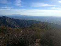
Catalina Island stretches along the distant horizon. The weather is fantastic for New Year’s Day. I take pictures, post to Facebook, and have a bite to eat.
1:20 - Leave summit and retrace my steps down the broad ridge. I’m enjoying the warm sunshine, blue skies, and splendid scenery. At 1:30 I pass the junction to the route I ascended, but I continue down main ridge for a loop. In another 13 minutes I reach the junction of the standard ridge route from the east. Rather than descending that route, I continue north down the old firebreak. It’s been some years since I’ve taken this route so I’d like to check out its condition. The path is reasonably easy to follow through the brush (mostly California buckwheat). It’s pretty steep but the soil is soft providing for decent footing. There are several big patches of frost in the deep shade. I suspect that portions of this steep, north-facing slope get no direct sun in the winter months.

2:03 - Saddle. The ridge in front of me climbs north 0.7 mile and 1,035 vertical feet to Silver Mountain (3385’). The old fire road (2N28) crosses the saddle north into Roberts Canyon, but it has long been abandoned and reclaimed by nature.
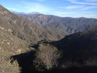
Water Canyon lies below my feet to the east. After a few minutes of taking pictures and scoping things out, I turn hard right and head southeast on the old fire road. It’s in good shape and my walk is pleasant. There’s lots of frost in the deep shade. Single occurrences of bush sunflower, bush monkey flower, and golden yarrow add yellow highlight to the winter landscape. Behind me Silver Mountain rises sharply into the blue sky.

2:18 - Junction to the ascending/descending ridge. This will be my route down but I continue along the road to do some scouting. The old road continues to be in good shape. I follow it for about six minutes to a point where I can see the gentle ridgeline and saddle where I ascended this morning. The route looks clear all the way over there. I turn back and reach the ascending/descending ridge at 2:32. I turn right (east) and begin my descent. The first section is steep but then it mellows out. My pace is comfortable and I enjoy the expansive views and warm sunshine. Across San Gabriel Canyon is see Glendora Mountain and reflect on my hike two months ago.

2:48 - Lower occurrence of 2N28. To the right (south) the road disappears into impassability. Straight ahead the ridge continues down. But I turn left (north) to follow the old road into Water Canyon for my return route. Immediately I step into the shade and figure that I’ll probably not be in direct sun for the rest of my outing. I enjoy sauntering along the old road as it contours in an out of canyon tributaries. It’s brisk and wintery and the grass is wet. Single occurrences of California fuchsia and cliff aster defy the season. At 3:07 I reach the hairpin where the route begins its eastward descent along the north-facing slopes of Water Canyon. Shortly I pass the rock face that should be a showy 12-foot waterfall during our upcoming El Niño rains.
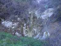
A little further along I reach the section that was washed out in the 2005 storms. A narrow path climbs up and over the slide. It has deteriorated some since I last hiked it 11 months ago. The footing is loose and a slip would be grave. I negotiate it without incident. I continue along. Across San Gabriel Canyon to the east, the golden-hour sun saturates the mountainside.
3:37 - Reach junction to the ascending/descending ridge route. I round the outward bend and get a shot of the sun disappearing behind the ridge I climbed this morning. As I contour into the tributary canyon, the temperature drops dramatically. Morris Reservoir looks serein. I stroll along savoring the last minutes of a rewarding day.
3:47 - End hike. The car thermometer reads 48 degrees.
Epilog - What a pleasant hike! Fresh air, blue skies, comfortable temperatures, sunshine, rugged scenery, solitude, healthy exercise, a new adventure, and a beloved peak...a great way to begin the new year. Life is good.

 See Summit 2843 hike description on Dan’s Hiking Pages
PREVIOUS > Summit 2843 via San Gabriel Canyon Hike - Feb. 21, 2015
See Summit 2843 hike description on Dan’s Hiking Pages
PREVIOUS > Summit 2843 via San Gabriel Canyon Hike - Feb. 21, 2015


 It’s steep and a little brushy in places. A California everlasting greets me with its creamy white flowers as the first plant in bloom today. In a few minutes I reach the ascending/descending hogback ridge where I’ll be spending the rest of my climb. The route veers right onto the ridge. After the first steep scramble I reach a water district benchmark.
 I’m treated with expanding views of the lower San Gabriel Canyon blanketed with thick, scruffy chaparral.
 It’s quite peaceful aside from vehicle noise on Hwy 39 below. The path is steep and I take my time. The warm sun feels good.
 It’s fading and difficult to read (later on the news I learned they were messages blasting Donald Trump: “America is Great! Trump is Disgusting,” “Anybody but Trump” and “Iowans Dump Trump”…I’ll let the political blogs opine on that).
 I carefully place each step. A slip would have dire consequences. It takes me about six minutes to safely negotiate this section. This was actually too unsafe for my comfort zone as a solo hiker, but there was no way around it. Having poles would have really helped. I decide that I’m not going to return via this route; there are too many steep sections and descending would be tedious and risky, particularly without poles. Another four minutes and one more steep section bring me to the old road.

 I’m enjoying the fresh air, sunshine, rugged scenery, and solitude…sure is different from fighting the masses in Pasadena on this New Year’s Day. Vehicle noise from Hwy 39 is virtually silent now. There are fresh deer tracks. I’m surprised to find frost in the shade. I’m eager as I near the top.


 The 360-degree panorama is stellar. The mighty San Gabriels fill the northern panorama.
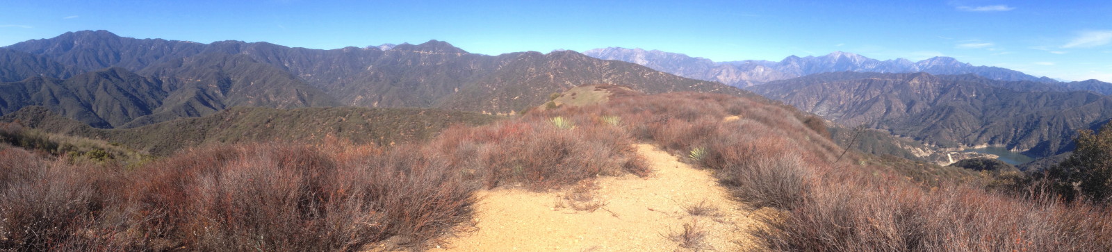 The vast human habitation of the L.A. Basin sprawls the southern panorama, muted somewhat by haze.
 Catalina Island stretches along the distant horizon. The weather is fantastic for New Year’s Day. I take pictures, post to Facebook, and have a bite to eat.

 Water Canyon lies below my feet to the east. After a few minutes of taking pictures and scoping things out, I turn hard right and head southeast on the old fire road. It’s in good shape and my walk is pleasant. There’s lots of frost in the deep shade. Single occurrences of bush sunflower, bush monkey flower, and golden yarrow add yellow highlight to the winter landscape. Behind me Silver Mountain rises sharply into the blue sky.

 A little further along I reach the section that was washed out in the 2005 storms. A narrow path climbs up and over the slide. It has deteriorated some since I last hiked it 11 months ago. The footing is loose and a slip would be grave. I negotiate it without incident. I continue along. Across San Gabriel Canyon to the east, the golden-hour sun saturates the mountainside.


