Saturday, October 25, 2014

Fish Canyon Falls Hike - October 25, 2014

Fish Creek in autumn as seen from Fish Canyon Trail, Angeles National Forest
See Fish Canyon Falls Hike Description at Dan's Hiking Pages

With the opening of the new access trail to Fish Canyon in June, I’m still getting used to the idea that I can hike to Fish Canyon Falls any day I want. Since June, however, there has been no compelling reason to actually want to visit Fish Canyon with its bone dry creek and parched vegetation. It’s about minding the seasons. But I’ve not been hiking in a month and needed to log something for October. As I laid in bed on Friday night, I pondered the local scrappy hikes that might be possible, but none really appealed to me and Fish Canyon didn’t cross my mind. When I awoke at 6 a.m., Fish Canyon popped into my thinking. So I got up and looked through my hike log. I figured if I’d never hiked it in October, that would be my hike. I saw that I’ve visited Fish Canyon Falls in every month except October and December! Bingo! I guess it’s off to hike rather than back to bed.

Front gate at Vulcan Materials and entrance to the Fish Canyon trailhead
After a ten-minute drive from my home in Azusa, I arrive at the Vulcan Materials gate a couple minutes before the 7 a.m. opening time. Two cars are waiting. The guard opens the gate a minute early and we drive in. I am the first one to hit the trail.

On Fish Canyon access trail in Vulcan Materials’ Azusa Rock quarry
7:00 AM - Begin hike. It’s cloudy but not too cool. There’s a slightly warm breeze. My pace is earnest as I walk along the dedicated corridor through the massive quarry with its silent equipment. It’s still kind of foreign to me that I’m legally walking through Vulcan’s quarry. View south on Fish Canyon access trail through Vulcan Materials’ Azusa Rock quarry The sun, slipping underneath the clouds, begins to alight on Van Tassel Ridge. The rising sun alights on Van Tassel Ridge as seen from Fish Canyon access trail through Vulcan Materials’ Azusa Rock quarry

Heading north on Fish Canyon Trail en route to Fish Canyon Falls above Azusa
7:14 - Reach the bridge and begin my walk on the trail. The creek is bone dry, as it was in June. Weedy, dead grasses line the trail. The vegetation is parched. Even the cacti are thirsty. Prickle pear cactus on Fish Canyon Trail en route to Fish Canyon Falls I was hoping to experience some fall colors, but the hues are muted. Many of the deciduous trees and poison oak have already lost most of their leaves. One month into autumn, these deciduous trees stand bare, as seen from Fish Canyon Trail en route to Fish Canyon Falls The tree of heaven jungle is starting to turn yellow. Evergreen trees and shrubs—like bay, oak, toyon, laurel sumac, sugar bush—provide an array of green. There is virtually nothing in bloom.

Dan Simpson at Darlin’ Donna Falls on Fish Canyon Trail en route to Fish Canyon Falls
Soon I’m greeted by one of my daughter’s former teachers as he jogs up the trail. Shortly after, a couple male voices disturb the tranquility. I find that I’m not able to outpace them, so I just stop and let them by. Their voices soon disappear up canyon. There is some water in portions of the creek far below. I take a side jaunt to Darlin’ Donna Falls and am pleasantly surprised that it is still flowing. I don’t understand the hydrological dynamics where such a tiny watershed can produce a year-around stream when the large watershed of upper Fish Creek is dry.

Crossing the main creek on Fish Canyon Trail en route to Fish Canyon Falls
I reach the main creek and it is bone dry. As I climb the canyon’s east wall, I’m enjoying the rugged scenery. Descending north on the east wall of Fish Canyon en route to Fish Canyon Falls It’s peaceful here. The clouds still provide welcome cover. As I approach the falls, the only sound is the voices of the two guys.

8:25 - Fish Canyon Falls. The falls and pool are completely dry. Fish Canyon Falls, dry as a bone on October 25, 2014 The lower pool still has some water. Fish Canyon Falls lower pool on October 25, 2014 Soon the two guys leave and I have the falls all to myself. It’s an unusual scene for here: no water, no people...just an eerie silence. But I’m enjoying the solitude. I have so many memories of this place.

Fish Canyon Falls, Angeles National Forest, March 22, 2014
3-22-14 - Fish Canyon Falls
Fish Canyon Falls, dry as a bone on October 25, 2014
10-25-14 - Fish Canyon Falls
The End of an Era - On March 22, 2014, I took a farewell tour of my beloved Fish Canyon anticipating that after the new access trail was completed, the pristine beauty of the canyon would be in jeopardy. I anticipated that since anyone will be able to hike to Fish Canyon Falls 365 days a year, all the reprobates who have horribly vandalize places like Eaton Canyon, Hermit Falls, and Bonita Falls, will be able to invade our pristine canyon and turn it into a hell hole. I am very sad today that the Fish Canyon hell hole is starting to become a reality. Fish Canyon Falls, dry as a bone on October 25, 2014 Unless the feds put some teeth into the new national monument status and launch an aggressive effort to protect and restore Fish Canyon, we can probably cross it off our lists as a place we would want to visit.

Riparian habitat in Fish Canyon along Fish Canyon Trail in autumn Big-leaf maple leaf along Fish Canyon Trail in autumn
Dried wild cucumber fruit along Fish Canyon Trail in autumn View north on Fish Canyon Trail in autumn, Angeles National Forest
Morning sun filters through coast live oaks on Fish Canyon Trail in autumn Tree of heaven along Fish Canyon Trail in autumn, Angeles National Forest
9:05 - Leave the falls. My pace is slow as I soak in the rugged beauty. I try not to dwell on the crimes of vandalism. I can’t help but to think that any efforts I take in reporting the destruction to the forest service will fall on deaf ears and impotence.

After crossing the creek, I encounter my first direct sun. I’m snapping pictures along the way trying to capture the nuances of the canyon, from sweeping mountainsides to the spines on dried wild cucumber fruit. Even in drought conditions, chaparral and riparian plant communities demonstrate resilient beauty. A hiker passes me heading to the falls, and shortly later, three more pass. The sun illuminates the yellowing tree of heaven leaves.

As I get near the end of the trail, I remind myself that there is no shuttle waiting to drive me through the quarry…I’ll have to walk the 0.7 mile back to the parking lot.

View of east wall along Fish Canyon access trail in Vulcan Materials’ Azusa Rock quarry
10:23 - Cross the bridge and begin my walk on the access trail. Two hikers head to the falls. The sun is bright and warm now. Steep quarry walls soar above me. Another hiker heads to the falls. I have encountered only eight people in five parties over the entire three and a half hours of the hike. That’s a minuscule number compared to the pre-access-trail days when there could be hundreds on a free-shuttle access day. And to think I was all by myself at Fish Canyon Falls today...on a fair-weather Saturday!

10:50 - End hike. It’s 75 degrees and there are four cars in the lot (including mine).

White alder on Fish Canyon Trail
Epilog - What a pleasant outing! I love Fish Canyon. And now I’ve hiked it during every month of the year except for December. But more than half of my dozens of visits were during March, April, and May…the very best time to experience the canyon. I’m sad that thoughtless criminals are stealing the beauty of these iconic falls. I guess we will see if being a national monument means anything. icon

Facebook icon Like Fish Canyon Falls Facebook Page

See Fish Canyon Falls Hike Description at Dan's Hiking Pages (including a link list for my other blog posts for Fish Canyon)

NEXT > Fish Canyon Falls Trail Restoration - January 17, 2015
PREVIOUS > Fish Canyon Falls - A New Era - June 21, 2014

Sunday, September 28, 2014

South Hills Alosta Loop Hike - September 28, 2014

View north from South Hills toward Glendora and the San Gabriel Mountains
Jutting up as an Island in southern Glendora bordering the I-210 Freeway, South Hills Wilderness Park hosts a network of fire roads and narrow paths offering pleasant strolls for local folks to get some exercise. It’s remarkable that as an avid hiker living in nearby Azusa for nearly 25 years, I’ve never hiked South Hills. Of course I’ve known of South Hills and have pondered exploring them, but I guess that when I get time to hike, I head to more appealing destinations, like the San Gabriels. But all that changed today.

Alosta Canyon trailhead, South Hills Wilderness Park, Glendora
I had spent Saturday at the celebrating-50-years-of-wilderness event in Claremont, so Sunday was going to be day to relax. But a backed-up sewer line has a way of arresting one’s total attention. After returning the rooter machine to The Home Depot rentals in Glendora, I decided to explore from a South Hills trailhead. Turning south on Elwood Avenue from Route 66, I found the trailhead for Alosta Canyon Trail at the entrance of Hidden Ranch Estates. The City of Glendora has done a nice job with trail signs and the Rotary Club has placed a little blue box on the sign post with maps. I took a map and figured I now had this trailhead scoped out for a future hike. But then I decided to walk up the trail for a minute or two just to get a feel for it. Yeah right, like I could stop myself.

Heading south on Alosta Canyon Trail, South Hills Wilderness Park, Glendora
2:50 – Begin hike with no intent to actually hike. I stroll south on the wide dirt road and within a minute arrive at a locked vehicle gate. I check the map and see that this Alosta Canyon Trail proceeds 0.6 mile to a ridge junction. That’s doable so I continue. Majestic live oaks and sycamores grace the route. Dead grass and wilting vegetation beg for rain. Pleasant temps and gentle breeze are fitting for the first weekend of autumn. Soon I pass a junction for East View North Fork Trail on the right, and shortly after, Alosta Canyon South Fork Trail on the left. The road bends west as it gently ascends the canyon. Poison oak begins to sport its fall colors. Nothing is in bloom. I’m really enjoying myself. The road bends south for its final pitch to the ridge.

View west from the junction of South Hills Trail and Alosta Canyon Trail
3:02 - Ridge and South Hills Trail junction. This is a good vantage point and is at the heart of the range. Across the road views open up toward the vast suburban sprawl to the south. The freeway noise is now ever present. Scattered clouds provide interesting lighting. This was to be my turn around point. But how can I stop now?! There is a 1212-foot summit 0.5 mile to the east that is calling to me. But first I shall to turn right and check out North Spur Trail 50 yards to the west. Its high point offers some nice views east and north. I had pondered descending this route as a loop to reconnect with Alosta Canyon, but the summit draws me higher. After a few minutes here I return to the junction and continue east.

View east toward Summit 1212 from South Hills Trail, Glendora
South Hills Trail is a wide dirt road running along the backbone of these hills (labeled South Hills Motorway on Google maps). Shortly I pass the junction for Bonny Cove East Trail on the right and in another minute reach a power tower. I now have a view east to my summit destination. I’m loving the beautiful weather, scattered clouds, and pleasant breeze. I’m really surprised that I’ve encountered no one else on the trails. I would have suspected that a trail system like this would have scads of users on a lovely weekend. I’m enjoying the varied vistas as I saunter along the undulating route. An expansive sea of prickly pear cactus on the south slope looks thirsty. Soon I reach a fork near Summit 1212. The map shows only the route branching left but I veer right and in a couple minutes reach another power tower. The route turns into a narrow path as it bends around the south face of the summit and then snakes through a patch of cactus heading to the top.

View southeast from Summit 1212, South Hills Wilderness Park, Glendora
3:37 - Summit 1212. This is nice. It’s kind of like Azusa Peak but surrounded by city. The summit is wide and clear with pretty decent views as I move around. Some oaks block the northern panorama. There are four L.A. County survey control benchmarks. A two-foot pile of small rocks (known as a “cairn”) accents the summit. I add three rocks to it. A wide path leaving the summit east circles north and intersects South Hills Trail just below the summit (not shown on the map). The patchy clouds cast a patchwork of shadows over the surrounding human sprawl and nearby mountains. This would be a great place in the winter or early spring when everything is green and snow blankets the majestic San Gabriels. I’ve looked at these hills for years from the freeway and surface streets, but it’s such a different perspective to be on top on them.

View west from below Summit 1212, South Hills Wilderness Park, Glendora
3:53 - Leave the summit heading west. I saw a path leave the road earlier so I decide to see if it is a good route. It’s not. I crawl down the steep bank to the road and head north. I turn right at the junction and in about 50 yards reach the signed junction for Alosta Canyon South Fork Trail. This will be my return route. But first, I notice a fork which cuts right (southeast) around the summit and obviously the connector for the route I saw leaving the summit east. So climb up it for a one-minute walk back to the summit. This is clearly the most efficient route to the top. I exit the summit this time straight north through oak to climb down a narrow route back to the road. It works well. I’ve now tried all four paths to the peak.

View north from Alosta Canyon South Fork Trail, South Hills Wilderness Park, Glendora
4:08 - Start my decent on Alosta Canyon South Fork Trail. This narrow path zigzags northwest down the sheer canyon slope. It’s pretty steep with loose footing in places, but free from brush and quite doable. It would be a real huff and puff to climb. I carefully pick my way down the narrow trail. The map depicts only two of the dozen switchbacks the 0.4-mile trail negotiates. As I reach the canyon bottom, the trail passes beneath a canopy of oaks and returns me to Alosta Canyon Trail to complete the loop. Now back on the wide dirt road, I saunter the final 0.3 mile to the trailhead.

4:35 - Finish hike.

View southeast from below Summit 1212, South Hills Wilderness Park, Glendora
Epilog - What an enjoyable hour and 45 minutes! I’ve finally hiked South Hills. Sometimes spontaneity can offer a real treat. It’s amazing to me that I encountered no one! How can it be that that such a nice trial amidst a huge population center on a gorgeous autumn weekend has no users? Back before Garcia Trail closed in January 2014, there would be hundreds of trail users on a typical weekend day. Why aren’t some of them over here? But I’m thankful for the solitude, particularly since I’m dressed only in a ragged pair of jeans and a scrappy old t-shirt. I had no idea that when I dressed to clean out my sewer line this morning, I’d be hiking in these clothes. And by the way, even though I did not have the 10 essentials with me nor did I tell anyone where I was going, I did have a map, a compass (on my iPhone), and a phone…three of the most essential essentials. icon

Trail Guide
South Hills Wilderness Park trail map, Glendora
I plan to post a detailed trail guide on Dan’s Hiking Pages after I’ve explored the other routes and trailheads. Meanwhile you can download the map and it will be most sufficient for you to craft any number of hikes piecing together various options. The loop hike I describe above from Elwood Avenue trailhead to Summit 1212 is 1.8 miles (not including my extra 0.2 mile of exploring) with about 450 feet in elevation gain.

Season: November - May
This hike is best done in the winter or early spring when the hills are green, the temperatures are pleasant, and the air is clear. The winter offers delightful views of the glistening snow-capped high country. The spring offers an array of wildflowers. Early in the summer the “June gloom” (marine layer, coastal fog) can make nice walking conditions but also can greatly obscure your views. There is little shade en route, so this hike could be dreadful on a hot summer day: smog, haze, heat, blistering sun, brown hillsides. If you go in the summer, try daybreak or early evening. See Seasons of the San Gabriels for a detailed description of minding the seasons.

Boot Icon Other Glendora hikes featured on Dan’s Hiking Pages:

Saturday, September 27, 2014

Celebrating 50 Years of Wilderness - September 27, 2014

Rancho Santa Ana Botanic Garden

On September 3, 1964, in a nearly unanimous vote, Congress passed the Wilderness Act, landmark legislation that permanently protects some of the most natural and undisturbed places in America. Our nation’s leaders formally acknowledged the immediate and lasting benefits of wild places to the human spirit and fabric of our nation.

The Wilderness Act reads in part, “...it is hereby declared to be the policy of the Congress to secure for the American people of present and future generations the benefits of an enduring resource of wilderness. For this purpose there is hereby established a National Wilderness Preservation System to be composed of federally owned areas designated by Congress as ‘wilderness areas’, and these shall be administered for the use and enjoyment of the American people in such manner as will leave them unimpaired for future use as wilderness.” (Read the Wilderness Act on wilderness.net)

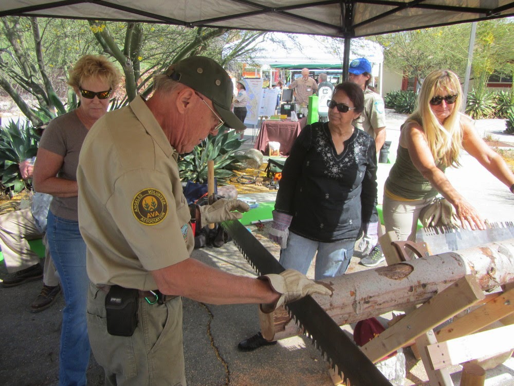
On Saturday, September 27, a 50-year anniversary event was held at Rancho Santa Ana Botanic Garden in Claremont, in partnership with the California Wilderness Coalition, Angeles National Forest, the Bureau of Land Management, Joshua Tree National Park, San Bernardino National Forest, and others. The Wilderness Fair included live music, partner booths, food trucks, Leave No Trace Traveling Trainers, and more. Walk for the Wild was a designated route through the botanic garden with interactive stations along the way sponsored by Leave No Trace.

I first enjoyed the booths and music then took the Walk for the Wild. After visiting the interactive stations, I meandered through the rest of the native plant gardens enjoying the hundreds of acres of natural beauty. It was a good day.

Below is a pictorial display of celebrating 50 years of wilderness.

Celebrating 50 Years of Wilderness Celebrating 50 Years of Wilderness
Celebrating 50 Years of Wilderness Celebrating 50 Years of Wilderness Celebrating 50 Years of Wilderness
Celebrating 50 Years of Wilderness Celebrating 50 Years of Wilderness
Celebrating 50 Years of Wilderness Celebrating 50 Years of Wilderness Celebrating 50 Years of Wilderness

When the Wilderness Act was passed in 1964, 54 areas (9.1 million acres) in 13 states were designated as wilderness. This law established these areas as part of the National Wilderness Preservation System. Since 1964, the NWPS has grown almost every year and now includes 758 areas (109.5 million acres) in 44 states and Puerto Rico.

We have five wilderness areas in the Angeles National Forest totaling
more than 130,000 acres:
Cucamonga | Magic Mountain | Pleasant View Ridge
San Gabriel | Sheep Mountain icon
http://www.fs.usda.gov/attmain/angeles/specialplaces


Walk for the Wild

Walk for the Wild t-shirts Walk for the Wild guide Walk for the Wild map
Walk for the Wild, Rancho Santa Ana Botanic Garden Walk for the Wild, Rancho Santa Ana Botanic Garden
Walk for the Wild, Rancho Santa Ana Botanic Garden Walk for the Wild, Rancho Santa Ana Botanic Garden Walk for the Wild, Rancho Santa Ana Botanic Garden
Walk for the Wild, Rancho Santa Ana Botanic Garden Walk for the Wild, Rancho Santa Ana Botanic Garden


Cactus, Rancho Santa Ana Botanic Garden Joshua tree, Yucca brevifolia, Century Plant Family Desert agave, Agave deserti, Century Plant Family (Agavaceae), Rancho Santa Ana Botanic Garden
Torrey pine, Pinus torreyana subsp. torreyana, Pine Family (Pinaceae), Rancho Santa Ana Botanic Garden Torrey pine, Pinus torreyana subsp. torreyana, Pine Family (Pinaceae), Rancho Santa Ana Botanic Garden
Toyon, Heteromeles arbutifolia, Rosaceae (Rose Family), Rancho Santa Ana Botanic Garden Toyon, Heteromeles arbutifolia, Rosaceae (Rose Family), Rancho Santa Ana Botanic Garden
Oak, Rancho Santa Ana Botanic Garden Flower, Rancho Santa Ana Botanic Garden Pacific madrone, Arbutus menziesii, Heath Family (Ericaceae), Rancho Santa Ana Botanic Garden
Big-leaf maple, Acer macrophyllum, Soapberry Family (Sapindaceae), Rancho Santa Ana Botanic Garden Big-leaf maple, Acer macrophyllum, Soapberry Family (Sapindaceae), Rancho Santa Ana Botanic Garden
Box elder, Acer negundo, Soapberry Family (Sapindaceae), Rancho Santa Ana Botanic Garden Box elder, Acer negundo, Soapberry Family (Sapindaceae), Rancho Santa Ana Botanic Garden Box elder, Acer negundo, Soapberry Family (Sapindaceae), Rancho Santa Ana Botanic Garden
California sycamore, Platanus racemosa, Plane-tree Family (Plantanaceae), Rancho Santa Ana Botanic Garden California sycamore, Platanus racemosa, Plane-tree Family (Plantanaceae), Rancho Santa Ana Botanic Garden
White alder, Alnus rhombifolia, Birth Family (Betulaceae), Rancho Santa Ana Botanic Garden White alder, Alnus rhombifolia, Birth Family (Betulaceae), Rancho Santa Ana Botanic Garden White alder, Alnus rhombifolia, Birth Family (Betulaceae), Rancho Santa Ana Botanic Garden
Rancho Santa Ana Botanic Garden gift shop Rancho Santa Ana Botanic Garden gift shop
Visit the website for Rancho Santa Ana Botanic Garden

See my blog post for my visit to Rancho Santa Ana Botanic Garden - April 23, 2011, including photos and captions of 18 plants

Plants See Plants and Wildflowers in the San Gabriel Mountains at Dan's Hiking Pages