 Visit Dan’s Hiking Pages
For several years I’ve been on the email list for the Hundred Peaks Section of the Sierra Club Angeles Chapter and have contemplated going on a hike with them sometime. Finally, everything came into alignment and I decided that this would be the hike. I emailed the hike leader, Peter Doggett, and he was quick to respond with answers to my questions. The hike was one of two hikes summiting Mt. Wilson that day to rendezvous at the top to celebrate the accomplishment of hike leader Ted Lubeshkoff in having led Sierra Club hikes to all the peaks on the HPS Peak List—284 peaks! That is an amazing accomplishment! And to think that I have climbed to only 33 of them!
 I arise bright and early and head to the rideshare location in La Canada for the 6:45 a.m. meeting time. The group gathers. There are seven of us: Peter and his wife Ignacia (the hike leaders), Larry, Brook, Asher, and the two newcomers, David, and me. We climb into four cars (I ride with David) and head up Angeles Crest Highway and arrive at the top of Mt. Wilson at 7:23. It’s really cold and foggy...very wintery. We leave two cars there and shuttle back to Red Box junction in the other two cars. It’s quite cold and I’m eager to hit trail and get my blood flowing. But one of the things about hiking with a group is that you have to wait for everyone to get ready.
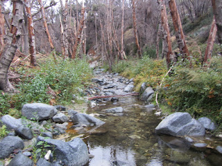
 7:52 AM - Start hike. We climb down the rock stairs and begin our descent on Gabrielino Trail east into West Fork San Gabriel River. It starts off in open chaparral and soon becomes woodsy. Evidence of the September 2009 Station Fire abounds. The golden leaves of bigleaf maple, sycamore, and poison oak paint a picture of autumn. The fog of low clouds obscures visibility. My hands are cold but putting on gloves makes it too hard to use the camera. We cross the growing creek several times and I consider how this little trickle will become the roaring San Gabriel River miles down canyon.
Along the trail someone has attached orange plastic ribbons to trees and bushes to mark the route. I suspect that it was done by trail run organizers. It’s really a visual blight and I am angered by the practice. I remove most of them as I hike along and plan to petition to the Forest Service to crack down on such littering of our trails.
 There are occurrences of poodle-dog bush (Turricula parryi), a poisonous plant with similar behavior to poison oak. It grows abundantly following a fire. Our leaders make sure everyone is alert to it, probably for the sake of David and I, since the others are veteran “HPSers.” In fact, over the course of the hike, I’m amazed to learn that between the five HPS veterans, they’ve accumulated many thousands of peak accents.
8:09 - Cross Rincon Red Box Road. There is a real beauty to the setting. The creek volume increases. We pass several charming cabins. Many of the trees have no leaves and I remind myself that it’s not because it’s approaching winter, but because they were killed by the Station Fire. At 8:49 we pass the junction of Valley Forge Trail, which ascends south to Mt. Wilson Road. We veer left and meet a trail maintenance crew from a local Scout troop.
 8:53 - Valley Forge Trail Camp (2.3 miles from the start). What a pleasant setting! Perhaps the autumn leaves and the freshness after the rain add to its beauty. We take a short potty break. Peter had explained that the trail section that connects from here to Kenyon Devore Trail is overrun with poodle-dog bush, so we are taking a detour along Rincon-Redbox Road to West Fork Trail Camp and then doubling back, adding 2.2 miles to the trip. We transition to dirt road now. It’s not as nice as a trail, but the scenery is still splendid. Clouds obscure the mountain slopes above. The creek—now starting to look more like a river—crosses the road at several points. We cross gingerly. At 9:29 we reach the signed junction to Kenyon Devore Trail (2.7 miles to Mt. Wilson). Our leader tells us that that route has vanished. We continue on the road. Fire damage is more prevalent here.
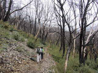
 9:44 - West Fork Trail Camp (4.5 miles from the start). This is also a splendid setting and very inviting. We stop for a little break. We have now descended 1,580 feet and from here we begin our 4.5-mile climb, ascending 2,660 feet. Ignacia now takes the lead. The pace is brisk, faster than my preference. Soon we transition from a beautiful forest to a horrible scene of massive fire damage. A mature forest has been reduced to blackened sticks. I want to cry. I lament over the politics, bureaucracy, and misguided policies which allowed the Station Fire to consume one third of the Angeles National Forest.
 A mountain biker passes us heading downhill. One minute later a man and women come down the trail. They came via Gabrielino Trail, using the section we avoided because of the poodle-dog bush. Hmmm.
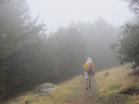
 10:27 - Gabrielino Trail junction. Take a brief break. Asher now takes the lead. His pace is a little more moderate, but still the climb seems relentless. We ascend Strayns Canyon beyond the major fire damage. The forest is quite pretty here. Golden leaves continue to provide a pleasing splash of color. Dense fog hangs on the mountainsides. This trail is beautifully designed. Big-cone Douglas-fir reach tall into the sky. I so wish we could just stop for a moment to enjoy the beauty. But the goal is to reach at the summit by noon to rendezvous with the others and celebrate with Ted. So we press on.
  11:53 - Junction about 100 yards shy of Mt. Wilson Road. Peter, Ignacia, Brook and I veer left and continue along the trail en route to the summit snack bar. The others head up to the road, retrieve the cars, and park them closer to the snack bar. It’s cold and visibility is limited to a few hundred feet. Peter leads at a fast pace.
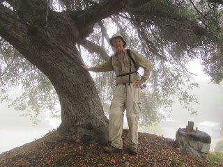
 12:06 - Mt. Wilson (5710’), arrive at the snack bar parking lot. We’re done! I think this is my first hike ever where I’ve had a car waiting at top of the mountain. We walk up to the snack bar. Asher and I walk over to the high spot about 50 yards east for a summit photo. We join the other group in a picnic area. There are about 25 of us and a dog. A table of food is inviting. We stand around and eat. It’s really cold. I put on my fleece, scarf, and beanie, but leave my hands bare to eat. Ted makes a heartfelt speech. I finally put on my gloves but my frigid fingers are already aching. The warm car feels so good! We drive away at 1:04, pick up the other cars at Red Box, and head down the mountain.
 Epilog - What an interesting hike. Hiking with a group certainly has its pros and cons. On the upside, it’s nice meeting some good folks and enjoying their company. And having a car shuttle is a real plus. On the other hand, in hiking with a group, one gives up some solitude and the freedom to choose a comfortable pace and to soak in the beauty. One of my concerns coming into the hike was pace. These peak baggers are in great shape and are known for racing to the summits. I had the lungs and legs to keep up, but I am definitely a sauntering guy who loves to stop and smell the roses. And in fairness, the objective of this hike was to celebrate with Ted Lubeshkoff, so it was necessary to drive a pace to arrive on time. But I probably would have skipped the 2.2-mile detour and pressed through the poodle-dog bush.
I’m grateful for the opportunity to experience a portion of the San Gabriels that I’ve not hiked. In spite of the horrible fire damage, there is still of plenty of beauty in the upper West Fork and north slopes of Mt. Wilson to provide a most satisfying outing. Hiking in frigid weather with foreboding clouds is a sobering reminder of the crucial importance to exercise vigilance in wintertime hiking. It’s easy to understand how hikers die on mountains like Mt. Baldy (nearly double the elevation of Mt. Wilson).
 My hat's off to Ted Lubeshkoff for his accomplishment and my appreciation to Peter and Ignacia for leading us to the celebration.
 Visit Hundred Peaks Section of the Sierra Club Angeles Chapter
Visit Dan’s Hiking Pages
Looks like a really cool hike. My friend Linda and I took my dog up to the Eaton Canyon Falls last week on a great hike. I saw a few signs for tails that said they went to Mt. Wilson from Eaton Canyon.
ReplyDeleteKay
Yes, Kay, lots of routes to Mt. Wilson.
ReplyDeleteWas in Eaton Canyon today. They had signs warning of poodle dog bush down on the valley floor, too. I don't ever remember seeing it down there, but I guess it's sort of a general awareness message. Everyone knows about poison oak, but poodle dog bush? Never even heard of it until Dan commented on my blog last July.
ReplyDeleteTrail runners use orange ribbon to mark trail races or training runs. The races are permitted and the marking of the trail is sanctioned. In fact it can cause runners to get lost when ribbons are removed which can be dangerous. Trail runners are required to sweep their runs and clear the markers after an event.
ReplyDeleteThank you, Jeff. That is a reasonable practice and quite acceptable. Most of the flags I removed were weathered, indicating that they had been there for some time.
Delete"Along the trail someone has attached orange plastic ribbons to trees and bushes to mark the route. I suspect that it was done by trail run organizers. It’s really a visual blight and I am angered by the practice. I remove most of them as I hike along and plan to petition to the Forest Service to crack down on such littering of our trails." "Angered"?!!! That's not "littering". That's also for safety to help other hikers stay on the maintained trails so that they don't have to wander off the trails during certain times of the year when the trail could be obscured. Next time, please leave them there. You're not the Trail Manager!!!
ReplyDelete