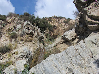
See San Gabriel Peak Hike Report January 6, 2006 at Dan’s Hiking Pages
An extraordinarily beautiful day following Thanksgiving and a day off work was the perfect occasion to hit the trail. And my hike to Mt. Wilson last week piqued my interesting in returning to the area. I had several goals in mind. One was to bag Mt. Deception, a peak that is not labeled on the USGS topo map or Tom Harrison map, but is on the Sierra Club Hundred Peaks list. I also wanted to hike the JPL trail, which I’ve not done before. And I wanted to get a feel for the extent of the Station Fire damage. Finally if I had time left over, I’d drive up the road and bag Occidental Peak.
Leave my house in Azusa at about 8:35 and head east on the 210. My eyes are drawn to Mt. Wilson and its neighboring peaks. As I wind along Angeles Crest Highway I stop several times to take some pictures. Turn right on Mt. Wilson Road and drive the half mile to the junction (2N52). Up the road about 80 yards on the left is the where the trail starts. A yellow sign warns of potential hazards in the burned area. It’s a brisk 51 degrees and I’m eager to hit the trail.
9:45 AM - Begin hike (4750’). The trail zigzags up a draw and begins to meander south up the broad ridge under a canopy of mature oaks. I’m delighted that this area was not destroyed by the fire. The trial is beautifully built with a comfortable grade. My pace is moderate as I enjoy the splendid setting. Views toward the eastern high country open up. Manzanita is thick and green. The trial passes near the road in several spots. Patches of snow linger in the deep shade.
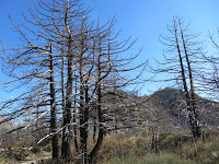
10:34 - Road (5750’) (1.3 miles from the start). A signpost marks the trail. A metal plaque indicates JPL 88. Now for a stroll up the road traversing the east flank of Mt. Disappointment. The warm sun feels good. As I approach the junction, blackened trees announce the entry into the fire zone. Reach a junction and am rewarded with striking views into Bear Canyon. Take a hard right to proceed up the steep road to the summit.
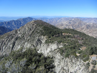
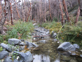
10:52 - Mt. Disappointment (5994’) (1.9 miles from the start). The array of structures makes for a less then ideal peak experience, but a fine rock out cropping on the southwest edge of the summit provides a nice place to sit and take in the views. Mt. Deception stands prominent below to the west and invites me to conquer it. Massive fire damage dominates the landscape, for miles. I’m grieved by the senseless destruction of one third of the Angeles National Forest which could have been avoided if not for the politics, bureaucracy, and misguided policies.
I sit on the rocks, have some food, upload a photo to FB, and attempt to call home. The weather is fantastic. The solitude is an amazing contrast to the crowds swarming the stores on this Black Friday. The downtown L.A. skyline pokes above the haze blanketing the human sprawl. Closer south, Mt. Markham and Mt. Lowe bring memories of my most excellent adventure in January 2006. Well, I’d like to linger longer but San Gabriel Peak calls me higher. I leave the summit at 11:30 and take a cross-country shortcut southeast down the ravine to the road. Works well.
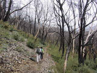
11:37 - Junction - Meet a gentleman named Dennis. Chat for a few minutes. He is heading to San Gabriel Peak too so we walk together. Leave the road and transition onto a trail dropping to a saddle where it passes the trail coming up from Markham Saddle. We begin our ascent. The fire damage is heartbreaking. What used to be a mature forest blanketing these slopes is now nothing but black sticks and the invasive poodle-dog bush (Turricula parryi). It’s a poisonous plant with similar behavior to poison oak and grows abundantly following a fire. We zigzag up the mountain in full sun. As the trail rounds to the shaded north slopes, patches of snow remind us that we indeed have seasons in SoCal (learn more about Seasons of the San Gabriels). Much of the forest to our immediate east was spared by the fire. I am always a huge fan of the gallant firefighters who battle the blaze on the front lines.
12:13 - San Gabriel Peak (6161’). The summit offers an amazing 360-degree panorama. It’s easy to see why this peak was a strategic location for a fire lookout tower, which stood here from 1928 to 1937. The last time I was here the views were partially obscured by dense vegetation. Not any more. Dennis and I linger on the summit and enjoy good conversation and the beauty of the day. I upload a photo to FB. There’s not a peak register to be found. We leave the summit at 1:01.
We pass a hiker heading to the top. I’m still numb over the horrific fire damage. This used to be such a magnificent forest. We pass another hiker. He has some clippers and is trimming poodle-dog bush along the way. Arrive back at the road at 1:26. It’s cool in the shade. We reach the trail junction and say our good-byes as Dennis heads down the trail and I head west down the road. Careful steps safely get me past a shaded stretch of road covered by ice. At a hairpin turn, I take a shortcut by descending off trail and hit the road again in a few minutes. It worked well. At 1:50 I reach a saddle where the road turns north and a climbers’ path heads west up the ridge toward Mt. Deception. The route looks steep and brushy, but Hundred Peakers do it, so we’ll see. Begin the climb. The route is actually pretty decent and free of brush, and untouched by the fire. It is steep but not unreasonable. After 8 minutes I reach the ridge and the route mellows out. Shortly I transition into the land of the incinerated with blackened vegetation and abundant poodle-dog bush. After passing a “false” summit the ridge bends northwest and in a few more minutes I pass through some brush and arrive at the summit.
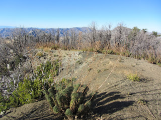
2:13 - Mt. Deception (5796’) - My biggest thought is why is this peak on the Hundred Peaks list? It’s really not a summit I’d write home about. There is a good view west into Bear Canyon , but the other views are mostly obscured by brush, burned as it is. I proceed down the ridge a little more to a spot with better views northwest. I pull up a rock, sit down, and eat the third course of my lunch. It’s peaceful here, even with the sound of vehicles 1,200 feet below on Angeles Crest Highway. I try to upload a pic to FB but the signal is not strong enough. I wander back up to the summit and find the peak register, placed here by Mars Bonfire on August 13, 2011. Only 17 people have signed it, with 9 of those in one party.
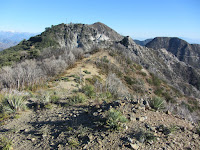
I leave the summit at 2:44 and begin to realize that maybe I’ve not left enough time in my day to drive over and climb Occidental Peak. We’ll see. I retrace my steps. When I get to the section that drops steeply east, I decide to turn left (north) and descend via another ridge. In studying the aerials before hand, I observed a clear route that looks like it may work well. Down I go. It gets pretty steep but the soil is soft and easy to descend. I would not want to climb this way. The route works fine and I reach the road at 2:56.
My pace now is relaxed. It’s nice to be back in unburned territory with living trees and green vegetation. The shade is cool. I’m pretty much resigned that Occidental is out. At 3:12 I leave the road and get back on the trail and enjoy a pleasant stroll through dense manzanita and oak. A man passes me heading up—only the forth person I’ve seen all day. As I approach the trailhead, I’m a little surprised that I’m here already.
3:31 - End hike. It’s a brisk 47 degrees.
I jump into the car and head to Mt. Wilson. When I get to the trailhead for Occidental Peak, I impulsively decide to give it a try. It’s supposed to be one mile to the peak, and I figure I can do that in a half hour and be back to the car by sunset at 5:00. I make it past the communications installation and helipad, but the route becomes rough and somewhat indistinct. I hack through it for awhile but finally I realize that there is no way I can safely make it to the summit and back before dark. As Kenny Rodgers says, “You gotta know when to hold ‘em, know when fold ‘em.” And it’s definitely time to fold ‘em. The peak will always be here for another day...but there is no guarantee that the beautiful mature forest will still be blanketing its slopes.
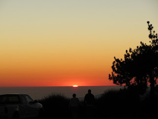
Epilog - Splendid day of hiking! The weather was absolutely perfect. Enjoyed good company with Dennis for a bit. Had lots of solitude and appreciated going my pace and soaking in the experience. The horrific damage from the Station Fire was somewhat depressing. I don’t know if it would be better to have not experienced the wonderful forest before that fire so that I don’t have a frame of reference to compare it to, or to have experienced the pre-fire forest and have good memories of its beauty. Maybe it’s a moot point since I did experience the forest before it was destroyed and value the memories. However, as I sit here looking at photos from my hike to San Gabriel Peak in 2006, I find myself getting angered that the bureaucrats didn’t allow for the firefighters to hit the fire hard enough and fast enough in its infancy. Oh well, if you enjoy black sticks and poodle-dog bush, head to the Station Fire burn area...there are millions of them!
See San Gabriel Peak Hike Report January 6, 2006 at Dan’s Hiking Pages
Friday, November 25, 2011
Saturday, November 19, 2011
Mt. Wilson via Kenyon Devore Trail - November 19, 2011
Visit Dan’s Hiking Pages
For several years I’ve been on the email list for the Hundred Peaks Section of the Sierra Club Angeles Chapter and have contemplated going on a hike with them sometime. Finally, everything came into alignment and I decided that this would be the hike. I emailed the hike leader, Peter Doggett, and he was quick to respond with answers to my questions. The hike was one of two hikes summiting Mt. Wilson that day to rendezvous at the top to celebrate the accomplishment of hike leader Ted Lubeshkoff in having led Sierra Club hikes to all the peaks on the HPS Peak List—284 peaks! That is an amazing accomplishment! And to think that I have climbed to only 33 of them!
I arise bright and early and head to the rideshare location in La Canada for the 6:45 a.m. meeting time. The group gathers. There are seven of us: Peter and his wife Ignacia (the hike leaders), Larry, Brook, Asher, and the two newcomers, David, and me. We climb into four cars (I ride with David) and head up Angeles Crest Highway and arrive at the top of Mt. Wilson at 7:23. It’s really cold and foggy...very wintery. We leave two cars there and shuttle back to Red Box junction in the other two cars. It’s quite cold and I’m eager to hit trail and get my blood flowing. But one of the things about hiking with a group is that you have to wait for everyone to get ready.
7:52 AM - Start hike. We climb down the rock stairs and begin our descent on Gabrielino Trail east into West Fork San Gabriel River. It starts off in open chaparral and soon becomes woodsy. Evidence of the September 2009 Station Fire abounds. The golden leaves of bigleaf maple, sycamore, and poison oak paint a picture of autumn. The fog of low clouds obscures visibility. My hands are cold but putting on gloves makes it too hard to use the camera. We cross the growing creek several times and I consider how this little trickle will become the roaring San Gabriel River miles down canyon.
Along the trail someone has attached orange plastic ribbons to trees and bushes to mark the route. I suspect that it was done by trail run organizers. It’s really a visual blight and I am angered by the practice. I remove most of them as I hike along and plan to petition to the Forest Service to crack down on such littering of our trails.
There are occurrences of poodle-dog bush (Turricula parryi), a poisonous plant with similar behavior to poison oak. It grows abundantly following a fire. Our leaders make sure everyone is alert to it, probably for the sake of David and I, since the others are veteran “HPSers.” In fact, over the course of the hike, I’m amazed to learn that between the five HPS veterans, they’ve accumulated many thousands of peak accents.
8:09 - Cross Rincon Red Box Road. There is a real beauty to the setting. The creek volume increases. We pass several charming cabins. Many of the trees have no leaves and I remind myself that it’s not because it’s approaching winter, but because they were killed by the Station Fire. At 8:49 we pass the junction of Valley Forge Trail, which ascends south to Mt. Wilson Road. We veer left and meet a trail maintenance crew from a local Scout troop.
8:53 - Valley Forge Trail Camp (2.3 miles from the start). What a pleasant setting! Perhaps the autumn leaves and the freshness after the rain add to its beauty. We take a short potty break. Peter had explained that the trail section that connects from here to Kenyon Devore Trail is overrun with poodle-dog bush, so we are taking a detour along Rincon-Redbox Road to West Fork Trail Camp and then doubling back, adding 2.2 miles to the trip. We transition to dirt road now. It’s not as nice as a trail, but the scenery is still splendid. Clouds obscure the mountain slopes above. The creek—now starting to look more like a river—crosses the road at several points. We cross gingerly. At 9:29 we reach the signed junction to Kenyon Devore Trail (2.7 miles to Mt. Wilson). Our leader tells us that that route has vanished. We continue on the road. Fire damage is more prevalent here.
9:44 - West Fork Trail Camp (4.5 miles from the start). This is also a splendid setting and very inviting. We stop for a little break. We have now descended 1,580 feet and from here we begin our 4.5-mile climb, ascending 2,660 feet. Ignacia now takes the lead. The pace is brisk, faster than my preference. Soon we transition from a beautiful forest to a horrible scene of massive fire damage. A mature forest has been reduced to blackened sticks. I want to cry. I lament over the politics, bureaucracy, and misguided policies which allowed the Station Fire to consume one third of the Angeles National Forest.
A mountain biker passes us heading downhill. One minute later a man and women come down the trail. They came via Gabrielino Trail, using the section we avoided because of the poodle-dog bush. Hmmm.
10:27 - Gabrielino Trail junction. Take a brief break. Asher now takes the lead. His pace is a little more moderate, but still the climb seems relentless. We ascend Strayns Canyon beyond the major fire damage. The forest is quite pretty here. Golden leaves continue to provide a pleasing splash of color. Dense fog hangs on the mountainsides. This trail is beautifully designed. Big-cone Douglas-fir reach tall into the sky. I so wish we could just stop for a moment to enjoy the beauty. But the goal is to reach at the summit by noon to rendezvous with the others and celebrate with Ted. So we press on.
11:53 - Junction about 100 yards shy of Mt. Wilson Road. Peter, Ignacia, Brook and I veer left and continue along the trail en route to the summit snack bar. The others head up to the road, retrieve the cars, and park them closer to the snack bar. It’s cold and visibility is limited to a few hundred feet. Peter leads at a fast pace.
12:06 - Mt. Wilson (5710’), arrive at the snack bar parking lot. We’re done! I think this is my first hike ever where I’ve had a car waiting at top of the mountain. We walk up to the snack bar. Asher and I walk over to the high spot about 50 yards east for a summit photo. We join the other group in a picnic area. There are about 25 of us and a dog. A table of food is inviting. We stand around and eat. It’s really cold. I put on my fleece, scarf, and beanie, but leave my hands bare to eat. Ted makes a heartfelt speech. I finally put on my gloves but my frigid fingers are already aching. The warm car feels so good! We drive away at 1:04, pick up the other cars at Red Box, and head down the mountain.
Epilog - What an interesting hike. Hiking with a group certainly has its pros and cons. On the upside, it’s nice meeting some good folks and enjoying their company. And having a car shuttle is a real plus. On the other hand, in hiking with a group, one gives up some solitude and the freedom to choose a comfortable pace and to soak in the beauty. One of my concerns coming into the hike was pace. These peak baggers are in great shape and are known for racing to the summits. I had the lungs and legs to keep up, but I am definitely a sauntering guy who loves to stop and smell the roses. And in fairness, the objective of this hike was to celebrate with Ted Lubeshkoff, so it was necessary to drive a pace to arrive on time. But I probably would have skipped the 2.2-mile detour and pressed through the poodle-dog bush.
I’m grateful for the opportunity to experience a portion of the San Gabriels that I’ve not hiked. In spite of the horrible fire damage, there is still of plenty of beauty in the upper West Fork and north slopes of Mt. Wilson to provide a most satisfying outing. Hiking in frigid weather with foreboding clouds is a sobering reminder of the crucial importance to exercise vigilance in wintertime hiking. It’s easy to understand how hikers die on mountains like Mt. Baldy (nearly double the elevation of Mt. Wilson).
My hat's off to Ted Lubeshkoff for his accomplishment and my appreciation to Peter and Ignacia for leading us to the celebration.
Visit Hundred Peaks Section of the Sierra Club Angeles Chapter
Visit Dan’s Hiking Pages
For several years I’ve been on the email list for the Hundred Peaks Section of the Sierra Club Angeles Chapter and have contemplated going on a hike with them sometime. Finally, everything came into alignment and I decided that this would be the hike. I emailed the hike leader, Peter Doggett, and he was quick to respond with answers to my questions. The hike was one of two hikes summiting Mt. Wilson that day to rendezvous at the top to celebrate the accomplishment of hike leader Ted Lubeshkoff in having led Sierra Club hikes to all the peaks on the HPS Peak List—284 peaks! That is an amazing accomplishment! And to think that I have climbed to only 33 of them!
I arise bright and early and head to the rideshare location in La Canada for the 6:45 a.m. meeting time. The group gathers. There are seven of us: Peter and his wife Ignacia (the hike leaders), Larry, Brook, Asher, and the two newcomers, David, and me. We climb into four cars (I ride with David) and head up Angeles Crest Highway and arrive at the top of Mt. Wilson at 7:23. It’s really cold and foggy...very wintery. We leave two cars there and shuttle back to Red Box junction in the other two cars. It’s quite cold and I’m eager to hit trail and get my blood flowing. But one of the things about hiking with a group is that you have to wait for everyone to get ready.
7:52 AM - Start hike. We climb down the rock stairs and begin our descent on Gabrielino Trail east into West Fork San Gabriel River. It starts off in open chaparral and soon becomes woodsy. Evidence of the September 2009 Station Fire abounds. The golden leaves of bigleaf maple, sycamore, and poison oak paint a picture of autumn. The fog of low clouds obscures visibility. My hands are cold but putting on gloves makes it too hard to use the camera. We cross the growing creek several times and I consider how this little trickle will become the roaring San Gabriel River miles down canyon.
Along the trail someone has attached orange plastic ribbons to trees and bushes to mark the route. I suspect that it was done by trail run organizers. It’s really a visual blight and I am angered by the practice. I remove most of them as I hike along and plan to petition to the Forest Service to crack down on such littering of our trails.
There are occurrences of poodle-dog bush (Turricula parryi), a poisonous plant with similar behavior to poison oak. It grows abundantly following a fire. Our leaders make sure everyone is alert to it, probably for the sake of David and I, since the others are veteran “HPSers.” In fact, over the course of the hike, I’m amazed to learn that between the five HPS veterans, they’ve accumulated many thousands of peak accents.
8:09 - Cross Rincon Red Box Road. There is a real beauty to the setting. The creek volume increases. We pass several charming cabins. Many of the trees have no leaves and I remind myself that it’s not because it’s approaching winter, but because they were killed by the Station Fire. At 8:49 we pass the junction of Valley Forge Trail, which ascends south to Mt. Wilson Road. We veer left and meet a trail maintenance crew from a local Scout troop.
8:53 - Valley Forge Trail Camp (2.3 miles from the start). What a pleasant setting! Perhaps the autumn leaves and the freshness after the rain add to its beauty. We take a short potty break. Peter had explained that the trail section that connects from here to Kenyon Devore Trail is overrun with poodle-dog bush, so we are taking a detour along Rincon-Redbox Road to West Fork Trail Camp and then doubling back, adding 2.2 miles to the trip. We transition to dirt road now. It’s not as nice as a trail, but the scenery is still splendid. Clouds obscure the mountain slopes above. The creek—now starting to look more like a river—crosses the road at several points. We cross gingerly. At 9:29 we reach the signed junction to Kenyon Devore Trail (2.7 miles to Mt. Wilson). Our leader tells us that that route has vanished. We continue on the road. Fire damage is more prevalent here.
9:44 - West Fork Trail Camp (4.5 miles from the start). This is also a splendid setting and very inviting. We stop for a little break. We have now descended 1,580 feet and from here we begin our 4.5-mile climb, ascending 2,660 feet. Ignacia now takes the lead. The pace is brisk, faster than my preference. Soon we transition from a beautiful forest to a horrible scene of massive fire damage. A mature forest has been reduced to blackened sticks. I want to cry. I lament over the politics, bureaucracy, and misguided policies which allowed the Station Fire to consume one third of the Angeles National Forest.
A mountain biker passes us heading downhill. One minute later a man and women come down the trail. They came via Gabrielino Trail, using the section we avoided because of the poodle-dog bush. Hmmm.
10:27 - Gabrielino Trail junction. Take a brief break. Asher now takes the lead. His pace is a little more moderate, but still the climb seems relentless. We ascend Strayns Canyon beyond the major fire damage. The forest is quite pretty here. Golden leaves continue to provide a pleasing splash of color. Dense fog hangs on the mountainsides. This trail is beautifully designed. Big-cone Douglas-fir reach tall into the sky. I so wish we could just stop for a moment to enjoy the beauty. But the goal is to reach at the summit by noon to rendezvous with the others and celebrate with Ted. So we press on.
11:53 - Junction about 100 yards shy of Mt. Wilson Road. Peter, Ignacia, Brook and I veer left and continue along the trail en route to the summit snack bar. The others head up to the road, retrieve the cars, and park them closer to the snack bar. It’s cold and visibility is limited to a few hundred feet. Peter leads at a fast pace.
12:06 - Mt. Wilson (5710’), arrive at the snack bar parking lot. We’re done! I think this is my first hike ever where I’ve had a car waiting at top of the mountain. We walk up to the snack bar. Asher and I walk over to the high spot about 50 yards east for a summit photo. We join the other group in a picnic area. There are about 25 of us and a dog. A table of food is inviting. We stand around and eat. It’s really cold. I put on my fleece, scarf, and beanie, but leave my hands bare to eat. Ted makes a heartfelt speech. I finally put on my gloves but my frigid fingers are already aching. The warm car feels so good! We drive away at 1:04, pick up the other cars at Red Box, and head down the mountain.
Epilog - What an interesting hike. Hiking with a group certainly has its pros and cons. On the upside, it’s nice meeting some good folks and enjoying their company. And having a car shuttle is a real plus. On the other hand, in hiking with a group, one gives up some solitude and the freedom to choose a comfortable pace and to soak in the beauty. One of my concerns coming into the hike was pace. These peak baggers are in great shape and are known for racing to the summits. I had the lungs and legs to keep up, but I am definitely a sauntering guy who loves to stop and smell the roses. And in fairness, the objective of this hike was to celebrate with Ted Lubeshkoff, so it was necessary to drive a pace to arrive on time. But I probably would have skipped the 2.2-mile detour and pressed through the poodle-dog bush.
I’m grateful for the opportunity to experience a portion of the San Gabriels that I’ve not hiked. In spite of the horrible fire damage, there is still of plenty of beauty in the upper West Fork and north slopes of Mt. Wilson to provide a most satisfying outing. Hiking in frigid weather with foreboding clouds is a sobering reminder of the crucial importance to exercise vigilance in wintertime hiking. It’s easy to understand how hikers die on mountains like Mt. Baldy (nearly double the elevation of Mt. Wilson).
My hat's off to Ted Lubeshkoff for his accomplishment and my appreciation to Peter and Ignacia for leading us to the celebration.
Visit Hundred Peaks Section of the Sierra Club Angeles Chapter
Visit Dan’s Hiking Pages
Saturday, November 5, 2011
Rubio Canyon Hikes - November 5, 2011
See Rubio Canyon Hike Description on Dan’s Hiking Pages
An email from the Arroyos & Foothills Conservancy (AFC) announcing a docent-led hike by Paul Ayers piqued my interest. It read: “Join local trails expert and railroad historian Paul Ayers on a strenuous loop deep into Rubio Canyon, along recently restored trails.” I had been exchanging emails with Paul for years related to various Rubio Canyon issues, so I thought it would be fun to do some hiking in Rubio with the expert. As it ended up, the hike wasn’t “deep into Rubio Canyon,” but only up the mountainside at the mouth of the canyon. So before the day would end, I ended up doing a second hike, and this time it was deep into the canyon.
A sunny and nice Saturday sandwiched between a rainy Friday and Sunday turned out to be ideal for hiking. I arose Saturday morning and headed to Altadena for the hike beginning 9:00. There were seven of us who met at the intersection of Loma Alta Drive and Camp Huntington Drive, just east of the bridge crossing Rubio creek.
Hike One: Historic Trail Loop
9:17 AM - Begin hike: Historic Trail Loop. The air is brisk and everything is fresh from yesterday’s rain. We head up canyon and a shortly transition to the old SCE Tractor Road (built in 1926) heading east past the covered reservoir. Paul and other volunteers have been working at restoring the route. It’s still a little rough but passable. Paul points out things along the way. Views out over the human sprawl are hazy. The sun feels good. There were recent efforts to remove the invasive, non-native fountain grass.
9:51 - Reach a gap in the ridge marking the boundary between AFC property and Angeles National Forest. We continue east along the along the brushy trail on the steep mountainside. Shortly we double back and continue our climb.
10:12 - Arrive at the junction of Lone Tree Trail just below the power towers. We climb the few steps to the towers for a good view into Rubio Canyon. Paul points out various landmarks. We have a great view across the canyon toward the old incline tram bed heading to Echo Mt. We leave at 10:31 and begin our descent on the old Lower Lone Tree Trail (1888), which was been recently roughed out in the early stages of restoration. It’s quite steep. At 11:04 we reach the junction of the SCE trail near the covered reservoir and retrace our steps back to the start.
11:09 - Finish Hike. A very pleasant outing. Good company. About 3 miles round trip with 800 feet in elevation gain. Paul was good docent providing lots of interesting information. Most everyone leaves and Kevin, Marilynne, and I linger and talk. I mention that I’m still up for more hiking. So Kevin suggests hiking up Rubio Canyon to Leontine Falls. Sounds good to me. We’ll do it. Say goodbye to Marilynne, get into our cars, and drive the few blocks to the trailhead at the intersection of Rubio Vista Road and Pleasantridge Road.
Hike Two: Rubio Canyon to Leontine Falls
11:46 - Begin hike. We pass between the two houses and head northwest on the old trolley rail bed (Rubio-Right of-Way Trail). We can look across the canyon and see the trail we were on earlier. Kevin has lived in the area all his life and has hiked all over these mountains. He shares lot of interesting tidbits. The trail is in good condition. Fluffy white clouds garnish the blue sky to the north.
11:57 - Reach the old Rubio Pavilion foundation and reflect on times past. Climb down to the creek bed and begin to follow it upstream. There is no water flowing, which is a huge contrast from when I was here in March and had to navigate dicey creek crossings.
12:17 - Ribbon Rock/Moss Grotto Falls. Water is flower over the falls, but it’s not gushing as in the spring. It’s still beautiful, though. We linger and enjoy the splendid setting. So far, we have had the canyon all to ourselves. At 12:37 we head up the ravine on the right (east). In about 100 yards we pass the beginning of the path that leads to the base of Grand Chasm Falls, but we continue about 100 yards more to the route that cuts left and will take us higher. A fig tree marks the spot. The path is rough and steep but not precarious. A narrow view opens to the civilization beyond the canyon. As we wade through the invasive fountain grass we debate the impacts of non-native plants.
12:52 - Outcropping with views into chasm below. Dramatic topography! We scramble over the rocks to the Thalehaha Falls Overlook to view one of the most dramatic waterfalls in the San Gabriels, deep in the canyon below. We hear voices down there. A bee stings me in the neck...ouch! After soaking in the beauty, we leave at 1:13 and continue north up the ridge. The path is still rough and steep but not too precarious. It’s a little brushy in places but the efforts of those who have trimmed make the route doable. We get a glimpse below of a group (5 men) in the canyon above Thalehaha Falls. It looks like they are equipped for canyoneering.
1:35 - Reach the ridge overlooking Leontine Falls. The falls are only partially in view from this point, but the scenery is breathtaking. Now comes the adventure. The route cuts back northeast toward the falls and drops precipitously 120 feet to the canyon bottom. It’s perilously steep. Ropes attached to trees make the descent doable. I have to admit, it’s a little scary, and definitely not for the faint of heart. Kevin has been here recently so serves as a good guide as he leads the way down. Gloves would have been good.
1:52 - Reach the canyon bottom below Leontine Falls. Wow, that was a trip. We cross the creek and make our way up the rocks and along the bare rock canyon wall toward the falls. It’s really dicey and a misstep could result in a top story on the evening news. Kevin’s experience proves helpful in getting through safely.
2:01 - Arrive at the base of Leontine Falls. What a splendid scene! Water is flowing down the sheer rock face. We can see only to the top of this bottom tier, maybe 50 feet. Two more tiers are above that. This sylvan sanctuary is free from litter and graffiti...no doubt, the arduous adventure getting here deters the yahoos and idiots. We sit on a rock next to the pool, chat, and enjoy the tranquil setting. Finally we carefully negotiate our way back to the start of our climb out.
2:38 - Begin our climb up the incredibly steep slope, hand over hand on the ropes. This is not hiking! Actually, the climb was not as bad as I anticipated and it takes us only 10 minutes to reach the ridge. Gray clouds creep in over the southland staging themselves for tomorrow’s forecasted rain. We retrace our steps back to the Thalehaha overlook, over the outcropping, through the fountain grass, and arrive at the ravine at 3:21. We continue to retrace our steps back past Ribbon Rock/Moss Grotto Falls and take more photos in the changing light. It is still curios to me that we are the only ones on the trail in such a beautiful location on such an ideal hiking day.
As we pass over the locations where Bay Arbor Falls and Maidenhair Falls stood previously before being buried, Kevin reflects on the changes in this canyon over the 40 years he’s hike here. At 3:47 we reach the pavilion site. Kevin asks if we would want to return by hiking down the canyon bottom. I am a little reluctant because I know such routes can become quite brushy and riddled with obstructions and surprises, and it was getting pretty late in the day. But he assures me that he had hiked it just two weeks ago and it is a quite doable route. So I agreed to the added adventure.
3:58 - Leave the pavilion site and head down stream. It’s quite beautiful. Had to carefully dodge some poison oak, but it wasn’t bad. Lots of white alder and mule fat. Bigleaf maple sports its fall colors. There is some water in several pools, but certainly this route would be a completely different scene when the creek is full and flowing. I’m thoroughly enjoying our ramble down this delightful canyon. At 4:41 we reach the junction of Camp Huntington Trail and in another 100 yards intersect the trail we were on with the group this morning, to complete the connection. We double back to Camp Huntington Trail and climb back to the main trail on the rail bed (the climb took about 8 minutes). I love the warm lighting this time of day. We linger a bit. A young man and women pass us coming down...the only people we directly encountered for the entire hike. We walk up the trial a short distance to get some views up canyon to where we were earlier, then head down.
5:18 - End hike.
Epilog - What a thoroughly enjoyable day! Two hikes. Good company. Historic Rubio Canyon always offers a splendid experience. I reflect on the diversity of the San Gabriels. Just last week I was climbing 9,500-foot peaks in spectacular high county (which now has snow) and this week I’m rambling through the rich chaparral and canyons of the front range. I suspect that the front range will now be my primary hiking venue until the snow melts in the late spring.
Arroyos & Foothills Conservancy (AFC) - Much of Rubio Canyon, including the land that the hike to the falls passes through, has been preserved by the AFC, a local nonprofit land trust. Visit their website for lots of helpful and interesting information about trail restoration, volunteer opportunities, docent-lead hikes, events, news, history, membership, and how to make tax-deductible contributions to their important work.
See blog posts from other hikes in Rubio Canyon:
- Plants in Bailey and Rubio Canyons - March 27, 2011
- Echo Mt. and Rubio Canyon Hike - December 27, 2010
See Rubio Canyon Hike Description on Dan’s Hiking Pages
Subscribe to:
Posts (Atom)