Visit Dan's Hiking Pages
See Verdugo Mountains South Hike
What a splendid hike conquering a peak in a local mountain range I’ve not visited before! I’ve had my eyes on the Verdugo Mountains for years. But with my focus on the San Gabriels and Griffith Park, I’ve just not had a chance to explore the Verdugos. A couple years ago I bought the Verdugo Mountains Trail Map by Tom Harrison. In preparing for this hike I quickly perused some of the hike descriptions from
Jerry Schad and
John McKinney, but I decided to craft my own hike. My objective was Verdugo Peak. In looking at the map I saw a red-dashed line from Wildwood Canyon climbing 1.7 miles to the range backbone. And then a fire road traversing the ridge about one mile to the summit. It looked like the ideal hike for my first foray into the Verdugos.
With time off from work I was eyeballing the weather to select the best day. Recent rain and wind have brought clear skies, brisk temperatures, and green hillsides. I leave the house at 10:50 and head to Burbank. I exit to Olive Avenue from the I-5 and navigate my way to Wildwood Canyon Park. The map shows four different trailheads accessing the main trail. I choose the second, 0.3 mile up the road from the park entrance. A stone gateway frames the beginning of the trail.
11:40 - Begin hike. The well-traveled trail starts gently but quickly wastes no time in steeply climbing above the oaks and sycamores. Actually, I’m a little surprised over how steep the trail is; it certainly defies normal trailbuilding conventions. Within three minutes, views open up toward the range backbone high above along with its array of communications antennas. One of those sites is my destination. I shall find which one soon.
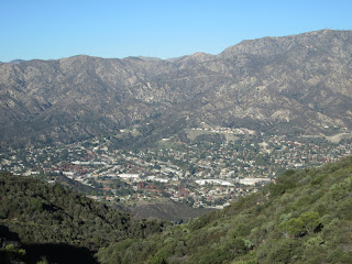
Six minutes delivers me to the junction with the main trail, 0.2 miles from the start. I take a hard right. The trail bends around and starts climbing the ridge. Wooden steps and guard rails give the sense that the trail is for urbanites rather than hikers. As the trail climbs higher, Burbank and the San Fernando Valley sprawl behind me to the west, muted by a slight haze. The mountains of Griffith Park, about six miles from here, look small. Downtown L.A., about 12 miles away, looks a little like the Emerald City from Oz.

Surrounding me, rugged mountains covered with rich chaparral remind me of hiking the front range of the San Gabriels. There is nothing in bloom. Fresh green grass provides a nice contrast to the brown summertime. The route is in full sun, which would be punishing on a hot day. Passing a large knob on the ridge, the trail dips and intersects the trail climbing up from the third trailhead. In another 0.2 mile I reach the junction with the trail coming from the forth trailhead. A stone pedestal hosts a map. A sign for Vital Link Trail announces the trail rules. The map shows the elevation as 1,860 feet, which tops the highest point in Griffith Park…Cahuenga Peak (1820’). Before me is another 1,200 feet of climbing.

Before continuing up, I proceed straight on the access trail and walk about 75 yards to a large flat area with a picnic table. Back at the junction, I turn right and continue to climb the ridge. The trail snakes its way up. It’s quite steep, out steeping Garcia Trail and rivaling Register Ridge to Mt. Baldy. In spite of being a cool, nearly-winter day, I’m sweeting as I plod up the ridge. I’m sure the trail builders had noble intent in constructing the guardrails and wood steps, but I find them to be an eyesore and probably unnecessary, particularly the guardrails. I suspect that those who built them had expertise in park management but were clueless about hiking trails. The steepness and myriad of steps kind of reminds me of climbing
Koko Crater in Oahu
A flat section gives a brief reprieve from the relentless climb. After another steep section, I arrive at a trail split and meet a family of three, who descended from the left fork. After chatting, I continue left. In ten minutes I reach the junction where the right split rejoins. After another 15 minutes of trudging up the steep ridge, I take a 15 minute nutrition break. I then keep climbing and another 15 minutes delivers me to the top.
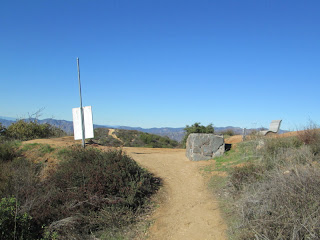
1:27 - Road junction. Views open to San Gabriels to the north and northeast. A cool breeze feels good. A sign and map mark the spot. A wooden maker placed by Gordon Greer in 2012 as an Eagle Scout project shows mileage at 3.2 mi and 2943’ elevation (the Harrison Map shows the elevation as 2940’). I don’t know what the mileage is referring to. Perhaps it’s the trail from Stough Canyon (which the Harrison map shows 3.0 miles to here). To the left the road descends 0.1 mile to a junction then cuts back south to continue along the backbone. I decide to turn right and climb the road about 50 yards to a communication installation, which tops the ridge I’ve been ascending for the last hour and 45 minutes.
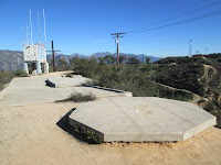
A little further along this ridgeline is a water collection slab and a small communications structure. A half mile south as the crow flies stands Verdugo Peak, my destination. Climbing up here I suspected that there would be a route continuing south to meet the road. And there is. A four-minute descent on a use path delivers me to the road. Before me is a canyon which the map identifies as Warden’s Grove. There are a lot of pine trees and I wonder what the backstory is. Later I read in John McKinney that it was planted by the Los Angeles County Department of Forestry in the 1930s. The department’s fire wardens patrolled the Verdugos until 1953 when the agency was combined with the Los Angeles County Fire Department. McKinney mentions fire damage, which may explain why most of the trees are young.

I follow the fire road southward passed Warden’s Grove and Plantation Lateral. It feels good to stretch my legs and walk at a decent pace. I’m enjoying the sweeping views, blue sky, pleasant breeze, and the wonderful fragrance of chaparral freshened by recent rains. A puddle still has ice in it. I pass to the right of large communication array with several towers. It’s perched on an unnamed summit that has a much more striking profile than Verdugo Peak. To the west I look right down into the upper reaches of Wildwood Canyon and see the ridge route I ascended bordering the north of the canyon. Shortly I pass a junction with a road coming from the east. My road bends west around another communications site and then back toward the highest summit in the Verdugos.
2:09 - Verdugo Peak (3,126’). A cinderblock building surrounded by a barbed-wire topped chain link fence tops the summit. There are no towering antennas here; just five telephone poles surround the site. I follow the path along the fence to the west side of the facility. A bench provides a splendid spot to sit and enjoy the amazing panorama of human sprawl. The late afternoon sun gleams on the Pacific Ocean. The mountains of Griffith Park appear as a line of mere bumps. A brown haze mutes the horizon. I see jet traffic at Burbank Airport. It’s peaceful here. I linger and soak in the scenery.
I leave the summit at 2:30. I take a shortcut past the communication faculty below the summit and then take a use path paralleling the road to the junction. I retrace my steps along the road. When I reach the use path junction of my first summit, I continue down the road as it skirts the summit to the east. The deep shade is cool. At 2:58 I reach the junction of the road coming up from the north. I bear left, pass another Eagle Scout mile maker (3.0 mi. / 2890’ El.), and make the short ascent back to Vital Link Trail junction. I sit on the handsome bench dedicated to the memory of Willie Mann (if I have interpreted the cursive writing correctly). It’s nice to relax in comfort before my steep descent.

3:18 - Begin my descent on Vital Link Trail. It’s easier than going up, although, I watch my footing carefully so that my feet don’t slip out from under me on the steep trail tread. When I get to the alternate route junction, I turn left to try it out. It’s a much gentler grade and the best choice for going up and down. The warm light of late afternoon makes it nice for pictures. I reach the upper trail access junction (with the map and sign) at 4:02. The map shows that between here and the top is 1.0 mile, but 44 minutes coming down, that’s a long mile. As I pass the next junction I consider heading down that route but decide to press ahead to stay in the sun and to explore the knob on the ridge below.

As I approach the knob I veer right unto the spur trail which takes me three minutes to the top, an elevation of 1800+ feet. This is a nice perch. A couple benches offer a spot to enjoy the view. Two young olive trees have been planted on the summit. I never can understand our need to plant non-native plants in our native ecosystems. And of course as these trees grow they will spoil the 360-degree panorama. I linger a few minutes. Back on the main trail I continue down and arrive at the junction, turn hard left and descend into the cool shadows of Wildwood Canyon.
4:38 - Done. The thermometer reads 50 degrees. Since I usually don’t hike on a weekday, I neglected to anticipate the horrible rush-hour traffic heading home.
Epilog - What a pleasant outing and great way to spend the last day of autumn. I was treated to fantastic weather, superb views, rugged scenery, and a fair amount of solitude. The climb was steeper than I had anticipated (the one mile from the upper junction to the backbone gained 1080 feet per mile!), but a trail is more enjoyable than a fire road. I covered about 5.6 miles with about 1,800 feet in elevation gain (including some rollercoaster action on top). It’s great to explore a new mountain range and bag a new peak. Even though hiking in the Verdugos is mostly on fire roads, I’m definitely enticed to return.
 Trail Notes:
Books: Jerry Schad
Trail Notes:
Books: Jerry Schad presents three hikes in the Verdugos but does not cover the route out of Wildwood Canyon.
John McKinney presents five hikes in the Verdugos; he covers this present hike with only two sentences as the descending portion of a loop hike out of Stough Canyon.
Peak Name: Verdugo Peak is not named on the USGS topo map nor is it listed on the
USGS Board on Geographical Names. It is listed as “Verdugo Peak” by Schad, McKinney, and the Harrison map.
Peckbagger.com lists it as “Verdugo Mountain.”
See my blog post for Verdugo Mountains South Hike - August 29, 2013
Visit Dan's Hiking Pages

 See Summit 2843 hike description on Dan's Hiking Pages


 As the photographer’s “golden hour” sets in, I am eager to capture the scenery in a different light. A pair of red-trail hawks soar and swoop.
 At 4:20 I cross the upper occurrence of the fire road and at 4:36 the second. I pause to photograph a lone occurrence of everlasting in bloom, about the only herbaceous plant I’ve seen in bloom all day. I take intermittent pics of Mt. Baldy and Morris Dam in the warm light of the setting sun as I try to capture the perfect shot. At 4:50 I begin my climb down the steep section. I admit that I’ve had a little angst in anticipating the pain-inflicting possibilities of feet sliding from under me. Thankfully I negotiate the slippery slope without incident and arrive back at the fire road in nine minutes.


