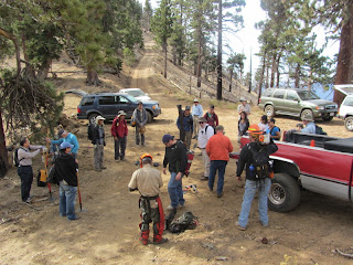
8:03 AM - Leave from the San Gabriel Canyon Gateway Center in Azusa and drive up Highway 39 to Rincon Fire Station to load the equipment. There are 22 of us today, including some students from Mt. San Antonio Collage. We load up the equipment: shovels, McLeods, pick-mattoxes, loppers, rock bars, chainsaws, etc. After the drive up to Crystal Lake Campground, we stop at Deer Flats and transfer those in cars to the high-clearance trucks and SUVs.
9:30 - Begin our drive up South Mt. Hawkins Road in a caravan of six. I’m in the second vehicle. The road is really rough even though it had been recently graded. We stop occasionally and I clear large rocks from the road, which the super high-clearance truck in front of us had no problems with. We stop briefly at the saddle. Our leader, Ben White, tells us to continue the drive up the South Mt. Hawkins so that the group can experience the site of the historic fire lookout. This is a rare opportunity to be here in vehicles.
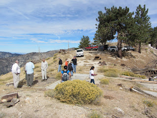
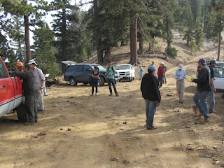
10:27 - South Mount Hawkins (7783’). Everyone piles out of the vehicles and lingers about the site enjoying the panorama. The views of surrounding mountains are pretty good today while the lowlands are shrouded with a layer of clouds. I reflect on my experience being here last month watching the Williams Fire grow. We leave the summit at 10:41 and head back to the saddle as the staging area for our work. Ben leads a safety meeting on the use of tools and guidelines for a safe day.
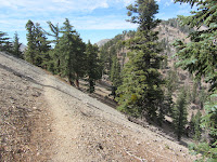
11:11 - Begin hike heading north up the road toward the trail. In a few minutes we reach a gentle saddle just north of a helespot clearing. This is the beginning of Hawkins Ridge Trail and our first task for the day: clearing a large deadfall that blocks the trail. The chainsaw gang attacks the tree while volunteers with McLeods and shovels begin to give definition to the faint path. Trail veterans give instructions to the new comers.
I hike ahead with Alan to where the trail vanishes in a meadow-like area. We carefully scan the area for traces of the old trail and use orange ribbons to flag the route for the hand crews to follow. I can see why I could not find the trail last month since it disappears into a jumble of fallen trees. Alan, a veteran trail boss, flags the original route through a couple hundred yards of the woody obstacles. The route arrives at a clear spot on the ridge offering views west. We take a break for lunch.
From here the route would have cut back northeast taking a tangent across the broad, undulating ridge. We can’t find any semblance of the trail. Alan forges ahead and locates the clear trail that picks up on the southeast flank of Sadie Hawkins. Between that point and the clearing where we had lunch, we crisscross back and forth but still are unable to identify the old trail. Alan flags a route that seems to reasonably match his recollections of the trail from his helping build it years ago. I head back down to see how the rest of the crew is doing.
The group has arrived at the jumble of trees. The three chain sawyers had leaped-frogged their way to here clearing the deadfalls while the other volunteers graded a fine trail. We now have a discussion as to whether we should reroute the trail above the tons of tree trunks and branches, or if we should carve our way through them. Since the FS policy is to always maintain the original trail route whenever possible, we decide to cut through the fallen forest. I wander back down the trial further to join the rest of the crew and assist in reestablishing a route.
I then head back up the trail past the jumble to the upper work section. I am pleased to find that the volunteers had roughed out the route we had blazed and a clear path is now established for hikers. Ben tells us that we’ve got six minutes before heading back at 2:30. I walk along the new route to where it joins the established trail which traverses along the east flank of Sadie Hawkins. In my hike last month I had gone up the ridge to the summit and so did not tread on this section of trail. I’m a little sad about that since it’s hard to write a reliable trail description without having hiked the whole trail. So I press on ahead and figure I can catch up with the others who were heading down.
The trail is in great shape as it gently ascends north along the eastern slope of the summit. It’s remarkable how nicely a well-built trail in certain conditions holds up without maintenance. I’m feeling a little angst because I would hate to have the whole group be waiting for me back at the vehicles, but on the other hand, I’d kick myself if I didn’t take the opportunity to explore further only to find the others lingering before heading down. I press on. I reach a point at which the trail begins its descent to the saddle north of Sadie Hawkins. I’m satisfied with having a visual of that couple hundred yards of trail, so I turn west and head straight up the steep, barren slope to the summit. When I achieve the top I find that I am north of Sadie Hawkins summit and near the point at which the use path drops steeply north to the saddle. I turn south, walk through a slight dip and climb the final steep pitch.
2:37 - Sadie Hawkins (8047’). A month ago I had no idea I’d be standing here again so soon. This time the southern sky is not filled with billowing smoke. I don’t linger as I leave the summit and head south on a route that looks like it was cleared by a dozer many years ago. Soon I veer left, climb down a steep section, and rejoin the newly reestablished trail. When I arrive at what used to be a jumble of timber, I am quite surprised to find that the chainsaw gang had made huge progress and the route was nearly clear except for about three last deadfalls. And I am happy to see the three sawyers still here getting ready to leave. So I won’t be the last one off the mountain! I proceed down on a beautifully restored trail. I’m greatly satisfied that the crew was able to accomplish so much today. I catch up with Ben at the point near the beginning of the trail and we walk down together as the sawyers catch up.
3:08 - Arrive back at the vehicles. An ice chest full of cold Gatorade and bottled water is welcome by all. We load the tools and begin the bumpy, 4.7-mile ride down the road to Deer Flats and then continue down. At Rincon Fire Station we unload the tools and call it a day.
Epilog - What an excellent day! I am so pleased that we were able to reestablish the missing section of this splendid Hawkins Ridge Trail. The crew worked hard and the weather was perfect. And for the group to visit the ruins of the historic South Hawkins Fire Lookout was a real treat. We encountered only one party of two hikers today who were coming down the ridge, having started from Hwy 2. Since the distances to hike here are long, this trail naturally won’t get a large amount of foot traffic. But it is one of the finest trails in the San Gabriels and offers the intrepid hiker a wonderful high-country experience. If you want to enjoy some rewarding work, come out and spend a day with the San Gabriel Mountains Trailbuilders. Workdays are on the first, third, and fifth Saturdays of each month. Visit the San Gabriel Mountains Trailbuilders website to learn more.
See Hawkins Ridge Hike - September 2-3, 2012 at Dan’s Hiking Blog
See Windy Gap Trail hike description at Dan’s Hiking Pages


