See Jones Peak Hike Description at Dan's Hiking Pages
Jones Peak holds a special place and for me. It was the first summit I climbed in the San Gabriel Mountains. Every day in my drive to and from work on the 1-210 Foothill Freeway, I could see the trail zig zagging up the mountain to the pointed peak towering over Sierra Madre. So on April 15, 1995, my son and I climbed the 3.3 miles to the top of 3375-foot Jones Peak. Ten days later I bought John Robinson’s Trail of the Angeles and so started my love for hiking in the San Gabriels. As I start my twentieth year of hiking the Angeles, it’s fitting to revisit Jones Peak. And I can add Hastings Peak to it and be able to check off another summit from the Sierra Club Lower Peaks list to end the year. The hike is about 9 miles round trip with 3,000 feet in elevation gain.
I leave the house at 11:20, which is unusually late for me to go hiking. But the morning was cold and I was having a hard time motivating myself to get going. I navigate my way to Bailey Canyon Park in Sierra Madre. There are about 10 cars in the parking lot. The air is brisk but I figure I’ll be fine in my t-shirt once I get going.
11:50 - Begin Hike. I follow the paved service road past the flood control basin and begin my walk into nature. It’s been six years since I’ve hiked to Jones Peak and I’m a little excited. Recent rain has brought life to plants and grass. I love the freshness from yesterday’s rain. A remnant or golden leaves hang onto the sycamores as they go dormant for the winter (yes, SoCal has seasons!). In five minutes I pass the bridge to Live Oak Nature Trail, and in another four minutes pass the junction to Bailey Canyon Falls.
Now I begin the earnest climb. The tiny white flowers of wild cucumber are about the only thing in bloom.
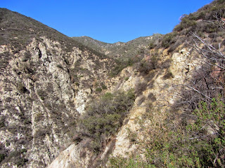
Soon views begin to open up of the San Gabriel Valley and beyond. Haze mutes the horizon. To the north up canyon, Hastings Peak stands regally inviting me to climb it. I love the aroma of the chaparral. Lots of switchbacks keep me walking in all directions. Trail volunteers have been busy building steps and retaining fences. The warm sun feels good. As always on this trail, I encounter other hikers coming and going, but it doesn’t feel crowded.
12:24 - MacCloud Saddle, 1.0 mile from the start. The canyon walls get steeper and more rugged. Sugar bush sports its pink bud clusters.
I’m really enjoying the beauty of the canyon. A blimp floats above Pasadena. Being December 31, it does not escape me that thousands of Rose Parade viewers are heading to Pasadena to find their spots along Colorado Boulevard. I’ve done that many times with family and friends over the years. But tonight I’ll enjoy a warm bed and tomorrow I’ll watch the parade on TV while blogging about my hiking adventures.
1:09 - Cabin foundation, 2.2 miles from the start. I sit on the stone wall and have a snack. Since the last time I was here, a bronze plaque has been mounted on the wall.
It reads, “George’s Cabin” and I’m amused by the story. I’ll let you hike here to read it for yourself. Another man arrives to check out the foundations. Strangely, he is not familiar with the well-known story alluded to on the plaque and the spoof is lost to him.
I leave the foundation at 1:22 and continue climbing. The trail gets steeper in this section and I’m getting a good workout. I enjoy the richly textured chaparral, fresh air, and blue skies. There virtually no shade on the trail and the warm sun is welcome on this brisk winter day (this trail can be punishing in full sun of summer…I know!). Through the distant haze, I can see the sun glistening off the Pacific Ocean.
As the trail bends around the backside of Jones Peak, I encounter a small patch of snow in the cold shade (yes, it’s winter in SoCal!).
2:10 - Jones saddle, nearly 3.3 miles from the start. I now have a view east toward snow-covered Ontario Peak. It’s cold in the shade and I’m eager to climb the steep pitch south to the summit and warm sunshine. Gosh, this is steep.
2:16 - Jones Peak (3375’), 3.3 miles from the start. It’s sunny but a breeze is chilling. I put on my long-sleeved shirt. A couple other guys are here. The one guy who I met at the foundation is just leaving. I enjoy chatting with Jonas, who is a volunteer with the distinguished Sierra Madre Search and Rescue. Jonas is carrying a full pack with equipment; today is a condition hike for him, just to stay in shape. I always so appreciate the huge sacrifice these dedicated volunteers make. I hope and pray I never need their service.
Jonas leaves the peak heading south down firebreak.
As I’m snapping pictures, the wind kicks up and I’m amazed how quickly the weather goes from comfortable to frigid. Man it’s cold! I’m first impulse is to hightail it down the mountain and skip Hastings Peak. I leave the summit at 2:44 and arrive at the saddle in four minutes. Amazingly, it’s not cold anymore! I quickly get a change of heart and decided to continue. After a sandwich and putting on my gloves, I proceed north climbing the steep trail. The warm sun feels good and there is little wind.
3:01 - Hastings Ridge junction. To the right is the crossover trail descending north into Little Santa Anita Canyon to intersect Mount Wilson Trail. I turn left and head west up the board ridge. It’s a good path with great views. Nearby Mount Harvard and Mount Wilson dominate the northwest skyline. Ahead, Hastings Peak stands prominently on this ridgeline. I have striking views south into Bailey Canyon and ponder how high I’ve climbed.
3:14 - Highpoint 3724. I’ve been here once before on a hot summer day in July 2004 coming up from Little Santa Anita. On that hike was the first I heard about Hasting Peak, having seen it mentioned on the sign at the junction. I didn’t know if it was this peak or the next one up the ridge (and it didn’t show on the map), so I stopped here and went back because the hike was getting long on hot. So Hastings Peak has been on my hit list for 10 years.
I continue west along the undulating ridge enjoying the views and feeling excitement about bagging a listed peak to end the year. I also contemplate the reality that it will be dark before I complete this hike…oh no, I just remembered that Bailey Canyon Park closes at sunset…will my car be locked in?! Dang! Oh well, I guess I’ll face that situation later. For now, I continue to the peak. At 3:25 I reach the base of the final pitch to the summit. It’s quite steep now. I encounter more small patches of snow.
3:34 - Hastings Peak (4000+’) - I’m here! Great 360 panorama. At least 25 named peaks in the San Gabriels can be seen from here on the northern panorama.
The San Gabriel Valley sprawls out in the southern panorama, muted by haze. The survey maker indicates that it was placed in 1940. I’d love to sit up here for an hour in more clear weather on a warmer day just soaking in the views. But it’s cold and getting dark soon so my visit is brief. I leave the peak at 3:46.
I retrace my steps down the ridge at a good clip. The sun feels good. I reach highpoint 3724 at 4:05, the junction at 4:15, and Jones saddle at 4:22. I move my headlamp from the pack to my pocket. The soon-setting sun casts a golden glow on the surrounding chaparral. As I descend lower into the canyon and the sun drops lower to the horizon, I’m hoping to have line of sight to see the last sunset of 2014. At 4:54 I get my last shot of the sunset. I pass the cabin foundation at 5:02.
The city beyond the v-shaped canyon is turning into a blanket of twinkling lights. I try to call the Sierra Madre PD to let them know my car is in the parking lot at Bailey Canyon Park and to see if I can keep it from getting locked in, but I’m not getting reception.
I resist using my headlamp for as long as I can since I prefer ambient light. As I’m negotiating a switchback my peripheral vision spots what appears to be a small back animal near my feet. It startles me, then I realize it is my shadow being cast by the moon. At 5:21 I finally get my call through to the police dispatcher and she says she’ll alert the officer on patrol. I finally switch on my headlamp on at 5:39. Even with light, walking in the dark is slow. I’m enjoying the beauty of nightfall. Temperature wise, I’m still comfortable without my third layer.
6:17 - End hike. I am elated that the parking lot gate has not been closed and there is no ticket on my car. It’s 44 degrees.
Epilog - What an enjoyable hike to end the year! Superb trail, rich chaparral, freshness after the rain, warm sun, blue sky, splendid views, a familiar peak and new peak, and great exercise. What a blessing to live next to such amazing mountain range and be able to hike.
See Jones Peak Hike Description at Dan's Hiking Pages
See Plants in Bailey and Rubio Canyons, Dan's Hiking Blog
- March 27, 2011
Wednesday, December 31, 2014
Monday, December 29, 2014
Joshua Tree - 49 Palms Oasis - December 29, 2014
The wild and strange topography of Joshua Tree National Park is an amazing treasure of natural beauty. As a lifelong SoCal resident and avid hiker, I’m almost embarrassed to admit, that before now, I’ve never been to JTNP. With my daughter’s recent move to Twentynine Palms, I now have an ideal gateway to explore “The Park,” as locals call it.
Joshua Tree National Park encompasses more than 800,000 acres and straddles the boundary between the Mojave and Sonoran deserts in Southern California. The park consists of six mountain ranges with ten peaks higher the 5,000 feet. Its surreal landscape with towering rock formations, jumbles of boulders, and gangly Joshua Trees, has been described as Seussian, resembling the fanciful illustrations of children’s author Dr. Seuss. JPNP is located about 120 miles east of Los Angeles and about 12 northeast of Palm Springs. Interstate 10 runs along the southern boundary, Highway 62 borders the west and north, and Highway 77 borders the east.
I chose Fortynine Palms Oasis for my first hike in JTNP. It isn’t too far from my daughter’s home, fit nicely within the limited time I had on our short stay, and is highlighted in park literature as a feature attraction. As a Christmas gift, my daughter gave me the book, Joshua Tree: The Complete Guide by James Kaiser. It’s beautifully done and I began to devour it immediately. His hike description for 49 Palms Oasis is compelling and armed me for the hike.
On Hwy 62 (29 Palms Hwy), I drive west from Twentynine Palms a few minutes to Canyon Road (1.75 miles east of Indian Cove Road). It’s easy to miss but the small animal hospital on the corner helps as a landmark. I turn left (south) and drive through open desert 1.7 miles to the trailhead at the base of the mountains. There are about 10 cars in the paved parking lot. Trailhead amenities include informational signage, a pit toilet, and a split-rail fence creating a funnel into the trail. I’m eager to hike.
9:04 AM - Begin hike. It’s a brisk 46 degrees and I’m wearing a heavy flannel shirt. The trail immediately begins to climb south and southeast through the barren landscape and massive rock outcroppings. Views of Twentynine Palms and the expansive desert to the south open up. The warm sun feels good as I weave in and out of patchy shade created by the slopes and the sun low in the sky following its winter path. The trail grade is comfortable and my pace is relaxed as I enjoy the strange beauty of the desert.
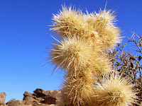
It’s going to take some work to learn the flora of the high desert. I can identify a few plants, like jumping cholla, barrel cactus, Joshua tree, and the ubiquitous creosote bush, but many of the other plants are foreign to me. Everything is so different from my local San Gabriel Mountains with its thick chaparral, woodsy riparian corridors, oak woodlands, and majestic conifer forests.
The trail angles southeast and I reach a hip of a ridge at 9:17. I now have views into 49 Palms Canyon and the ragged, rocky ridgelines beyond. The trail doubles back and ascends south. I shed my flannel shirt as I climb in the open sun. I’m really enjoying myself. The trail reaches another hip offering more views into the canyon hundreds of feet below. From the topography, I don’t see how the canyon bottom will rise to meet the current trajectory of the trail. In fact, I now see what appear to be palm trees peeking out far below. Kaiser’s trail guide lists an elevation change of 360 feet. I had interpreted that to be total gain. But since I’ve climbed that amount already and the rest of the hike is downhill from here, I guess I’ll be doubling that gain with my return trip. I’m generally not fond of upside down hikes. Later when rereading Kaiser’s description, I see he does mention descending toward the oasis. He should have put it in the Trial Info box so that readers quickly and easily see that the total elevation gain is 660 feet.
From here the trail ascends slightly for a couple more minutes then starts its descent into the canyon (9:27). The rugged, barren landscape is eerily beautiful. As a trailbuilder, I admire the various sets of rock steps along the trail. A solo hiker passes me…my first encounter for the hike. I snap pics of a few plants for further investigation. A party of three passes me climbing out. Soon I emerge to my first full view of the oasis below, nestled in morning shade.
9:54 - Fortynine Palms Oasis. It’s cool in the shade and I put on my flannel shirt. The destination is not particularly impressive to me. Signs read, “Sensitive Biological Area, Please Stay on Designated Trails.” There are others lingering near the lower end of the palm grove, so I climb to the upper end to look around. I make no attempt to count the palm trees to verify if there are 49, but in looking at the pictures later, I see the number of trees generously exceeds 49. I climb around the boulders exploring. Small ponds of water don’t look inviting to drink but the trees seem to enjoy the hydration amidst a desolate landscape. Park guests are coming and going. As one who prefers destinations of peaks and waterfalls, my attention is drawn to the rocky crags high above as I ponder their climbablity. And throughout the hike I’ve pondered if there is a reasonable alternate route to get here coming up the canyon. From my observations on the ground and in studying the topo map and Google Earth, it looks like a route is possible starting near Encelia Road behind Stater Bros. It certainly would not be a hike that the Park Service would promote to tourists, but as an adventurer, I am lured to it.
10:22 - Leave oasis and immediately step into the warm sun and shed my flannel shirt. The trail is busy now with lots of hikers coming and going. Some are carrying their jackets and sweatshirts. I’m rarely out of earshot of others during the entire return trip. I’m working up a sweat in these mid 50s temps. I can’t imagine hiking here on a summer mid-day. At 10:43, I reach the highpoint hip and begin my descent. A vast desert sprawls out to the north with patches of human habitation. I can see the massive Twentynine Palms Marine base bordering the mountains across the basin. I’ve heard that it is the largest military base in the U.S.
10:56 - I reach the next hip before my final descent and take a short side jaunt to a craggy outcropping. It provides an ideal perch to capture the sweeping panorama to the north.
A pyramid-shaped peak near the trailhead far below calls me to climb it...on another day. My descent is entirely in the sun now and I enjoy the fascinating tan scenery.
11:18 - End hike. There are 24 cars in the parking lot on this Monday morning and it’s 56 degrees.
Epilog - What a pleasant outing for my first hike in Joshua Tree National Park. The cool weather was most agreeable. Warm sun, amazing landscape, sweeping panoramas, splendid trail, intriguing plants, interesting destination. This short 3-mile round-trip hike with 660 feet in total elevation gain was an ideal introduction to hiking in this amazing desert place. I am eager to return for my next adventure in JTNP.
See Joshua Tree hikes at Dan's Hiking Pages
NEXT > Joshua Tree - Ryan Mountain - January 3, 2015
Joshua Tree National Park encompasses more than 800,000 acres and straddles the boundary between the Mojave and Sonoran deserts in Southern California. The park consists of six mountain ranges with ten peaks higher the 5,000 feet. Its surreal landscape with towering rock formations, jumbles of boulders, and gangly Joshua Trees, has been described as Seussian, resembling the fanciful illustrations of children’s author Dr. Seuss. JPNP is located about 120 miles east of Los Angeles and about 12 northeast of Palm Springs. Interstate 10 runs along the southern boundary, Highway 62 borders the west and north, and Highway 77 borders the east.
I chose Fortynine Palms Oasis for my first hike in JTNP. It isn’t too far from my daughter’s home, fit nicely within the limited time I had on our short stay, and is highlighted in park literature as a feature attraction. As a Christmas gift, my daughter gave me the book, Joshua Tree: The Complete Guide by James Kaiser. It’s beautifully done and I began to devour it immediately. His hike description for 49 Palms Oasis is compelling and armed me for the hike.
On Hwy 62 (29 Palms Hwy), I drive west from Twentynine Palms a few minutes to Canyon Road (1.75 miles east of Indian Cove Road). It’s easy to miss but the small animal hospital on the corner helps as a landmark. I turn left (south) and drive through open desert 1.7 miles to the trailhead at the base of the mountains. There are about 10 cars in the paved parking lot. Trailhead amenities include informational signage, a pit toilet, and a split-rail fence creating a funnel into the trail. I’m eager to hike.
9:04 AM - Begin hike. It’s a brisk 46 degrees and I’m wearing a heavy flannel shirt. The trail immediately begins to climb south and southeast through the barren landscape and massive rock outcroppings. Views of Twentynine Palms and the expansive desert to the south open up. The warm sun feels good as I weave in and out of patchy shade created by the slopes and the sun low in the sky following its winter path. The trail grade is comfortable and my pace is relaxed as I enjoy the strange beauty of the desert.
The trail angles southeast and I reach a hip of a ridge at 9:17. I now have views into 49 Palms Canyon and the ragged, rocky ridgelines beyond. The trail doubles back and ascends south. I shed my flannel shirt as I climb in the open sun. I’m really enjoying myself. The trail reaches another hip offering more views into the canyon hundreds of feet below. From the topography, I don’t see how the canyon bottom will rise to meet the current trajectory of the trail. In fact, I now see what appear to be palm trees peeking out far below. Kaiser’s trail guide lists an elevation change of 360 feet. I had interpreted that to be total gain. But since I’ve climbed that amount already and the rest of the hike is downhill from here, I guess I’ll be doubling that gain with my return trip. I’m generally not fond of upside down hikes. Later when rereading Kaiser’s description, I see he does mention descending toward the oasis. He should have put it in the Trial Info box so that readers quickly and easily see that the total elevation gain is 660 feet.
From here the trail ascends slightly for a couple more minutes then starts its descent into the canyon (9:27). The rugged, barren landscape is eerily beautiful. As a trailbuilder, I admire the various sets of rock steps along the trail. A solo hiker passes me…my first encounter for the hike. I snap pics of a few plants for further investigation. A party of three passes me climbing out. Soon I emerge to my first full view of the oasis below, nestled in morning shade.
9:54 - Fortynine Palms Oasis. It’s cool in the shade and I put on my flannel shirt. The destination is not particularly impressive to me. Signs read, “Sensitive Biological Area, Please Stay on Designated Trails.” There are others lingering near the lower end of the palm grove, so I climb to the upper end to look around. I make no attempt to count the palm trees to verify if there are 49, but in looking at the pictures later, I see the number of trees generously exceeds 49. I climb around the boulders exploring. Small ponds of water don’t look inviting to drink but the trees seem to enjoy the hydration amidst a desolate landscape. Park guests are coming and going. As one who prefers destinations of peaks and waterfalls, my attention is drawn to the rocky crags high above as I ponder their climbablity. And throughout the hike I’ve pondered if there is a reasonable alternate route to get here coming up the canyon. From my observations on the ground and in studying the topo map and Google Earth, it looks like a route is possible starting near Encelia Road behind Stater Bros. It certainly would not be a hike that the Park Service would promote to tourists, but as an adventurer, I am lured to it.
10:22 - Leave oasis and immediately step into the warm sun and shed my flannel shirt. The trail is busy now with lots of hikers coming and going. Some are carrying their jackets and sweatshirts. I’m rarely out of earshot of others during the entire return trip. I’m working up a sweat in these mid 50s temps. I can’t imagine hiking here on a summer mid-day. At 10:43, I reach the highpoint hip and begin my descent. A vast desert sprawls out to the north with patches of human habitation. I can see the massive Twentynine Palms Marine base bordering the mountains across the basin. I’ve heard that it is the largest military base in the U.S.
10:56 - I reach the next hip before my final descent and take a short side jaunt to a craggy outcropping. It provides an ideal perch to capture the sweeping panorama to the north.
A pyramid-shaped peak near the trailhead far below calls me to climb it...on another day. My descent is entirely in the sun now and I enjoy the fascinating tan scenery.
11:18 - End hike. There are 24 cars in the parking lot on this Monday morning and it’s 56 degrees.
Epilog - What a pleasant outing for my first hike in Joshua Tree National Park. The cool weather was most agreeable. Warm sun, amazing landscape, sweeping panoramas, splendid trail, intriguing plants, interesting destination. This short 3-mile round-trip hike with 660 feet in total elevation gain was an ideal introduction to hiking in this amazing desert place. I am eager to return for my next adventure in JTNP.
Be Prepared and Aware After the hike as I took a closer look at the trail map on the kiosk, I saw that it does show an elevation profile climbing the first half of this 1.5-mile trail, and descending the second half. And the text states that it “first climbs 350 feet and then descends 300 feet to the oasis.” That’s good to know, particularly for inexperienced trial users. It’s noteworthy that the kiosk sign also states in red, “Last year there were five helicopter rescues and eight carryouts from the 49 Palms Oasis Trail. Only one was because of injury. The remainder were due to medical conditions such as asthma, diabetes, or heart trouble.” |
See Joshua Tree hikes at Dan's Hiking Pages
NEXT > Joshua Tree - Ryan Mountain - January 3, 2015
Saturday, November 8, 2014
Hiking in Billings, Montana - November 4-8, 2014
Big Sky Country exceeded my expectations! Several short excursions into the surrounds of Billings, Montana provided an enjoyable taste of an outdoors that is distinctly different from my local San Gabriel Mountains. My son and family moved to Billings in July and so my wife and I were eager to visit them in their new setting. Hiking was not necessary part of the plan for the week, but opportunities to hit the trail are always on my radar. And after all, the slogan for Billings is “Montana’s Trailhead.”
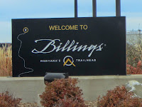
And the weather was amazingly cooperative. Usually by November, Billings can be snowy, but this was the warmest autumn since the 1930s. Our daytime highs ranged from the mid-50s to the mid-60s...temperatures that are quit manageable for this SoCal native.
Here are some highlights of my four outdoor excursions.
Wild Bill Lake - Tuesday, November 4
My son wanted to treat the family to a road trip that featured a noteworthy local destination, so he took us to Red Lodge. This small community is 60 miles west of Billings and is the gateway to the Beartooth Mountains. It has an old town feel with interesting shops and restaurants and lots of old-west history. After we arrive at the Visitor Center we decide that Wild Bill Lake will be a fun place for family. A 10-minute drive up West Fork Road delivers us to the Wild Bill Lake Picnic Area in the Custer National Forest, at an elevation of about 6,800 feet.
Wild Bill Lake was built by William “Wild Bill” Kurtzer as a commercial recreation enterprise in 1902. It was stocked with whitefish, had rental boats, and featured a concrete dance platform. Today a pleasant trial of about a half mile circles the lake and hosts several fishing decks.
Cloudy skies and 48 degrees are strong motivators to down our “picnic” lunch quickly and hit the trail. Our party of three young children and four adults start our “hike” at 1:56. A dense pine forest surrounds us and a ridgeline accented with a massive outcropping rises 865 feet above us. The small lake is covered with a thin sheet of ice. We have fun tossing pebbles and watching them skip across the ice. Our walking and tossing helps warm us up. From a fishing deck on a peninsula, we are intrigued to see the fish swimming in the frigid water below the ice. Soon the sun peeks out on a few occasions. We saunter around the lake thoroughly enjoying the rugged scenery. We finish the hike at 2:56, one hour from the start. What a delightful outing!
Back in downtown Red Lodge we stroll along the sidewalk and poke in various shops. Our day ends with a yummy meal at Bogart’s Restaurant.
Four Dances Natural Area - Wednesday, November 5
Today my son had pressing responsibilities at work and the ladies planned an outing with the kids to Target and Costco. It was the perfect opportunity for me to go hiking. I decided on Four Dances Natural Area, which is up on the bluffs in southeastern part of Billings. In 1999, the BLM acquired 765 acres of undeveloped open space to preserve as public land. According to the trailhead sign, “The property is native sagebrush/grassland, ponderosa pine in the rocky outcrop area near the river cliffs, and Yellowstone River cottonwood riparian.”
From Billings, I head east on I-90, cross the Yellowstone River and turn off on exit 452. I turn right on Highway 87 and almost immediately turn right unto Coburn Road. A short 0.7 mile brings me to the first trailhead and a path that leads to the old cabin site of Will James (1892-1942), cowboy, cattle rustler, author, artist, and stuntman. Back in the car, another 0.7 mile brings me to the turnoff for the next trailhead, where I turn right and drive the short dirt road to the parking lot. A nice kiosk presents a map and some information.
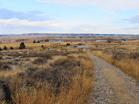
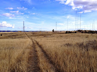
11:50 AM - Begin hike. The path heads west as it gently ascends the rolling grassland. Temps are in the low 50s but the warm sun makes it pleasant. The view of undulating yellow prairie dotted with islands of trees stretches to the horizon. The expansive landscape is wonderful. The path bends left into a slight draw and rises to a junction.
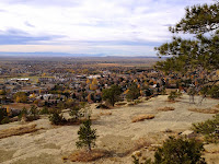
11:56 - Four-way junction. The map shows it as a T-bone junction, so I’m not sure which route isn’t shown. The sign points right (east) for the River Access and straight for the Scenic Overlook View Area. I go straight and in about 100 yards reach the crest with a partial view northwest toward downtown Billings. The path heads north and south and I choose south. Another couple hundred yards brings me to the overlook area with benches and interpretive signs. The scenery is grand with striking views of the surrounding rimrocks, the river, and the city. I climb down to an outcropping and enjoy a breathtaking perch.
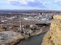
Back up on top, I follow the path southeast through the sprawling grassland about 100 yards from the edge. I don’t know what this tall, dry grass is, but it fits the description of “amber waves of grain.” Then there are the “spacious skies.” The big blue sky is accented with an assortment of fluffy and wispy clouds. I’m intrigued that as far as I can see, the horizon encircles me 360 degrees. This is truly “big sky country.” Nothing in SoCal really compares to this (and visa versa).
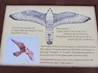
Occasionally a side path heads over to a nice bench placed strategically near the rim. There are five of them spaced out over about a half mile. I sample each bench and enjoy the varied vistas. The mighty Yellowstone River glistens in the afternoon sun. I’m captivated with the expansive scenery and huge sky. A majestic raptor soars overhead (it may be a peregrine falcon that is described on the interpretive sign). The sandstone cliffs remind me of cowboy movies. This is simply grand!
1:16 - Reach my furthest point south. The path continues ahead to an array of antennas, and beyond would be Coburn Road. I turn back, exploring more of the cliffs en route. I don’t think I’m afraid of heights, but I do get tingly feet when I’m close to the edge. Strong breezes increase the angst of standing near the precipice. The cliffs are tiered, but finding a route down to the middle level will have to wait for another trip.
2:14 - Back at the scenic overlook. I venture west down a short path to another dramatic perch on the sandstone cliffs. I add a face to a circle of rocks.
The biggest city in Montana spreads out before me. I can almost touch the river 560 feet below me.
The scenery is stunning. And no one is here…I get it all for myself! I guess that shouldn’t surprise me. There are times while hiking in my beloved San Gabriels Mountains surrounded by a population of 15 million, I enjoy amazing solitude.
I wander back up to the scenic overlook area and retrace my steps north to the junction, then continue north toward a communication antenna. It’s fun to look back across the chasm to the cliff were I was a few minutes ago. Past the antenna I gently descend to another vantage point and enjoy some more splendid views and dramatic scenery. The breeze is cool.
2:53 - Head back. Past the antenna I veer left and take a narrow path east to interest the “River Access” route. I turn right and two minutes delivers me to the four-way junction. My pace is slow as I retrace my steps back to the trailhead savoring the beauty of this special place.
3:05 - End hike. It’s a pleasant 61 degrees. An easy walk of probably 2.5 miles can barely be considered a hike, but what a thoroughly enjoyable outing! Exceeded my expectations.
Zimmerman Park and the Northern Rimrocks - Thursday, November 6
My wife and I have the morning free before rendezvousing with my son’s family later on, so we decide to do some sight seeing. Minutes from our accommodations we drive up Zimmerman Trail. This windy road heads north in a small canyon to the top of the rim overlooking Billings. The road was built by brothers Joseph and Frank Zimmerman in 1891 as a means for Joseph to move his sheep back and forth from his homestead below to the spring on top of the rimrocks. In 1938, the Rotary, Kiwanis, and Lions clubs, and a campaign committee, donated the $750 required to purchase the tract of land (Zimmerman Park) and the right-of-way for the road to the top. These properties were subsequently deeded to Yellowstone County.
At the top of Zimmerman Trail we turn left on Hwy 3 and in quarter mile turn left into the parking lot. Zimmerman is similar to Four Dances with grassland on top and ponderosa pine (the state tree of Montana) adorning the rocky cliffs. There is an extensive web of trails providing miles of possibilities.
10:48 - Begin our walk on the paved path about 80 yards to an informational sign surrounded by grassland. The attractive kiosk provides a brief history of the Zimmerman brothers and their settling of the area. We walk another 200 yards south to the rim. Wow, this is dramatic scenery!, We wander around and soak in the varied views and topography dominated by steep cliffs, huge boulders, pine trees, and the west end of Billings spreading out below us. The stiff breeze is cold so my wife is eager to leave. We stroll back on a different route before retracing our steps to the kiosk and then to the parking lot.
11:24 - End walk.
What a splendid natural park! This truly is a jewel in the billings park system being just minutes away from residential areas and offering hikers, bikers, joggers, and dog walkers a superb venue to enjoy the outdoors.
Unfortunately there is no restroom, so we jump in the car and drive east along the rim about seven minutes to the cute little “international” airport to use the facilities. Imagine driving to an airport just to use a restroom. Back at home I don’t even like driving to LAX to catch a plane!
After our potty break we visit the Yellowstone County Museum, which is there at the airport. It’s small but has an impressive collection of fine displays and artifacts featuring local history.
We then we drive across the highway to the parking area along the rim. I wander around and enjoy some splendid views and dramatic scenery.
Across the valley I get a good look at Four Dances where I was yesterday. Downtown Billings is pretty flat with only three modest high-rises (20 floors tops) attempting to provide a skyline. I climb down to a massive block perched on the side of the cliff. A 14-inch fissure separates it from the main rimrock. I can’t help but to ponder the scene if this bad boy decided to tumble town upon the houses below. (Later I found a news clip showing that these house-size boulders do indeed fall). I’m intrigued by the rimrocks and can see how this fascinating topography could provide the adventurer with many outings of exploration.
Riverfront Park - Saturday, November 8
Our week in Billings is coming to an end as we will board a plane late this afternoon. I decide I have time for one final jaunt in sampling the varied outdoor offerings of this city. It’s a brisk 39 degrees and I need to clear ice from the car windows. I pull out at 8:05 for the 8-minute drive to where South Billings Blvd. crosses the Yellowstone River. Before turning into the park, I drive across the bridge to get a view of the river from above. As a SoCal guy, the concept of a big flowing river fascinates me. The river is at least 100 yards wide and flowing briskly.
Back in the car I re-cross the bridge and turn right into Riverfront Park. I first drive through the park past Lake Josephine to a small parking area near Cochran Pond about 0.7 mile. There are two cars parked here. A sign with a map gives me the overview of the park. It’s peaceful here and the frigid air and leafless trees punctuate the changing seasons. An interpretive sign tells about Joseph Cochran who settled here in 1877 as the first white settler near present-day Billings. A couple joggers pass by.
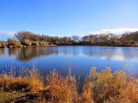
I drive back to Lake Josephine and park near the east end. A man in a kayak glides across the sparking blue lake. A pair of nosey geese flies overhead. I cross the small footbridge
that spans the channel that connects Lake Josephine and Cochran Pond, and head south on the paved path. Some shrubs still have a remnant of amber leafs amidst the leafless trees and yellow grass. My botanical skills are so narrow to plant communities of SoCal, I recognize nothing here by name. Just past Beaver Pond I veer left unto a narrow dirt path and continue south toward the river. I’m really enjoying the brisk air and the autumn beauty. The sound of the river grows. There are fresh deer tracks in the sand. Off trail now, I pick my way to the riverbank.
8:59 - Yellowstone River. What a splendid scene! There is so much beauty here. I think I officially love Montana. The river is wide and wild. There is a whitewater section in the middle where the river flows around a sandbar.
I video myself putting my hand into the icy water to experience the river (can one say he or she has been to the river without actually touching it?). I imagine that this riverbank scene would not be much different than how Lewis and Clark experienced it in July 1806 (aside from leafless autumn trees and the nearby bridge with traffic noise). I explore around a little. Leaves crunch beneath my feet…oh, I recognize these, they look like Fremont cottonwood (checking an online guide after getting home, I found that the tree is probably plains cottonwood, Populus deltoides).
There’s a network of paths so I take a different route back to the paved trail and retrace my way back.
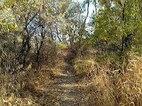
9:32 - Fishing walk. It’s 42 degrees. What a thoroughly pleasant outing! I’m so glad I decided to roll out of bed and venture into the cold for a last foray into the splendid outdoor spaces that grace this city. I am, however, a little puzzled. There are 105,000 people living in this city; I would think that more of them would be out walking or jogging in a beautiful park like this on a Saturday morning.
Epilog - From a glassy mountain lake, to golden prairie and towering rimrocks, to serene ponds and a roaring river, my samplings of some natural treasures that surround the Billings area were thoroughly rewarding. And I didn’t mention playing disc golf at Diamond X Disc Golf Course at Phipps Park on Monday. It’s the most amazing and challenging disc golf course I’ve ever experienced. We played only six holes, but it was so fun climbing around the base of the rimrocks searching for the tees, the holes, and our discs! It was definitely more of a hike than disc golf. I am eager to go back and conquer the beast.
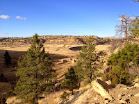
I really can see how Billings, Montana could be a suitable home for hikers. And the Beartooth Mountains are only an hour away, and they provide 12,000-foot peaks for one’s climbing pleasure! I look forward to my next trip to Big Sky County, or AKA, The Last Best Place.
See Dan's Hiking Pages
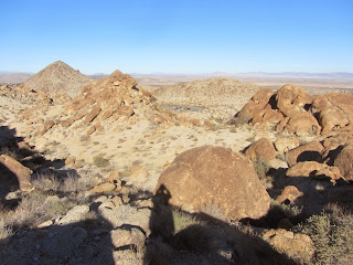
Here are some highlights of my four outdoor excursions.
Wild Bill Lake - Tuesday, November 4
My son wanted to treat the family to a road trip that featured a noteworthy local destination, so he took us to Red Lodge. This small community is 60 miles west of Billings and is the gateway to the Beartooth Mountains. It has an old town feel with interesting shops and restaurants and lots of old-west history. After we arrive at the Visitor Center we decide that Wild Bill Lake will be a fun place for family. A 10-minute drive up West Fork Road delivers us to the Wild Bill Lake Picnic Area in the Custer National Forest, at an elevation of about 6,800 feet.
Wild Bill Lake was built by William “Wild Bill” Kurtzer as a commercial recreation enterprise in 1902. It was stocked with whitefish, had rental boats, and featured a concrete dance platform. Today a pleasant trial of about a half mile circles the lake and hosts several fishing decks.
Cloudy skies and 48 degrees are strong motivators to down our “picnic” lunch quickly and hit the trail. Our party of three young children and four adults start our “hike” at 1:56. A dense pine forest surrounds us and a ridgeline accented with a massive outcropping rises 865 feet above us. The small lake is covered with a thin sheet of ice. We have fun tossing pebbles and watching them skip across the ice. Our walking and tossing helps warm us up. From a fishing deck on a peninsula, we are intrigued to see the fish swimming in the frigid water below the ice. Soon the sun peeks out on a few occasions. We saunter around the lake thoroughly enjoying the rugged scenery. We finish the hike at 2:56, one hour from the start. What a delightful outing!
Back in downtown Red Lodge we stroll along the sidewalk and poke in various shops. Our day ends with a yummy meal at Bogart’s Restaurant.
Four Dances Natural Area - Wednesday, November 5
Today my son had pressing responsibilities at work and the ladies planned an outing with the kids to Target and Costco. It was the perfect opportunity for me to go hiking. I decided on Four Dances Natural Area, which is up on the bluffs in southeastern part of Billings. In 1999, the BLM acquired 765 acres of undeveloped open space to preserve as public land. According to the trailhead sign, “The property is native sagebrush/grassland, ponderosa pine in the rocky outcrop area near the river cliffs, and Yellowstone River cottonwood riparian.”
From Billings, I head east on I-90, cross the Yellowstone River and turn off on exit 452. I turn right on Highway 87 and almost immediately turn right unto Coburn Road. A short 0.7 mile brings me to the first trailhead and a path that leads to the old cabin site of Will James (1892-1942), cowboy, cattle rustler, author, artist, and stuntman. Back in the car, another 0.7 mile brings me to the turnoff for the next trailhead, where I turn right and drive the short dirt road to the parking lot. A nice kiosk presents a map and some information.
11:50 AM - Begin hike. The path heads west as it gently ascends the rolling grassland. Temps are in the low 50s but the warm sun makes it pleasant. The view of undulating yellow prairie dotted with islands of trees stretches to the horizon. The expansive landscape is wonderful. The path bends left into a slight draw and rises to a junction.
11:56 - Four-way junction. The map shows it as a T-bone junction, so I’m not sure which route isn’t shown. The sign points right (east) for the River Access and straight for the Scenic Overlook View Area. I go straight and in about 100 yards reach the crest with a partial view northwest toward downtown Billings. The path heads north and south and I choose south. Another couple hundred yards brings me to the overlook area with benches and interpretive signs. The scenery is grand with striking views of the surrounding rimrocks, the river, and the city. I climb down to an outcropping and enjoy a breathtaking perch.
Back up on top, I follow the path southeast through the sprawling grassland about 100 yards from the edge. I don’t know what this tall, dry grass is, but it fits the description of “amber waves of grain.” Then there are the “spacious skies.” The big blue sky is accented with an assortment of fluffy and wispy clouds. I’m intrigued that as far as I can see, the horizon encircles me 360 degrees. This is truly “big sky country.” Nothing in SoCal really compares to this (and visa versa).
Occasionally a side path heads over to a nice bench placed strategically near the rim. There are five of them spaced out over about a half mile. I sample each bench and enjoy the varied vistas. The mighty Yellowstone River glistens in the afternoon sun. I’m captivated with the expansive scenery and huge sky. A majestic raptor soars overhead (it may be a peregrine falcon that is described on the interpretive sign). The sandstone cliffs remind me of cowboy movies. This is simply grand!
1:16 - Reach my furthest point south. The path continues ahead to an array of antennas, and beyond would be Coburn Road. I turn back, exploring more of the cliffs en route. I don’t think I’m afraid of heights, but I do get tingly feet when I’m close to the edge. Strong breezes increase the angst of standing near the precipice. The cliffs are tiered, but finding a route down to the middle level will have to wait for another trip.
I wander back up to the scenic overlook area and retrace my steps north to the junction, then continue north toward a communication antenna. It’s fun to look back across the chasm to the cliff were I was a few minutes ago. Past the antenna I gently descend to another vantage point and enjoy some more splendid views and dramatic scenery. The breeze is cool.
2:53 - Head back. Past the antenna I veer left and take a narrow path east to interest the “River Access” route. I turn right and two minutes delivers me to the four-way junction. My pace is slow as I retrace my steps back to the trailhead savoring the beauty of this special place.
3:05 - End hike. It’s a pleasant 61 degrees. An easy walk of probably 2.5 miles can barely be considered a hike, but what a thoroughly enjoyable outing! Exceeded my expectations.
Zimmerman Park and the Northern Rimrocks - Thursday, November 6
My wife and I have the morning free before rendezvousing with my son’s family later on, so we decide to do some sight seeing. Minutes from our accommodations we drive up Zimmerman Trail. This windy road heads north in a small canyon to the top of the rim overlooking Billings. The road was built by brothers Joseph and Frank Zimmerman in 1891 as a means for Joseph to move his sheep back and forth from his homestead below to the spring on top of the rimrocks. In 1938, the Rotary, Kiwanis, and Lions clubs, and a campaign committee, donated the $750 required to purchase the tract of land (Zimmerman Park) and the right-of-way for the road to the top. These properties were subsequently deeded to Yellowstone County.
At the top of Zimmerman Trail we turn left on Hwy 3 and in quarter mile turn left into the parking lot. Zimmerman is similar to Four Dances with grassland on top and ponderosa pine (the state tree of Montana) adorning the rocky cliffs. There is an extensive web of trails providing miles of possibilities.
10:48 - Begin our walk on the paved path about 80 yards to an informational sign surrounded by grassland. The attractive kiosk provides a brief history of the Zimmerman brothers and their settling of the area. We walk another 200 yards south to the rim. Wow, this is dramatic scenery!, We wander around and soak in the varied views and topography dominated by steep cliffs, huge boulders, pine trees, and the west end of Billings spreading out below us. The stiff breeze is cold so my wife is eager to leave. We stroll back on a different route before retracing our steps to the kiosk and then to the parking lot.
Unfortunately there is no restroom, so we jump in the car and drive east along the rim about seven minutes to the cute little “international” airport to use the facilities. Imagine driving to an airport just to use a restroom. Back at home I don’t even like driving to LAX to catch a plane!
After our potty break we visit the Yellowstone County Museum, which is there at the airport. It’s small but has an impressive collection of fine displays and artifacts featuring local history.
We then we drive across the highway to the parking area along the rim. I wander around and enjoy some splendid views and dramatic scenery.
Across the valley I get a good look at Four Dances where I was yesterday. Downtown Billings is pretty flat with only three modest high-rises (20 floors tops) attempting to provide a skyline. I climb down to a massive block perched on the side of the cliff. A 14-inch fissure separates it from the main rimrock. I can’t help but to ponder the scene if this bad boy decided to tumble town upon the houses below. (Later I found a news clip showing that these house-size boulders do indeed fall). I’m intrigued by the rimrocks and can see how this fascinating topography could provide the adventurer with many outings of exploration.
Riverfront Park - Saturday, November 8
Our week in Billings is coming to an end as we will board a plane late this afternoon. I decide I have time for one final jaunt in sampling the varied outdoor offerings of this city. It’s a brisk 39 degrees and I need to clear ice from the car windows. I pull out at 8:05 for the 8-minute drive to where South Billings Blvd. crosses the Yellowstone River. Before turning into the park, I drive across the bridge to get a view of the river from above. As a SoCal guy, the concept of a big flowing river fascinates me. The river is at least 100 yards wide and flowing briskly.
Back in the car I re-cross the bridge and turn right into Riverfront Park. I first drive through the park past Lake Josephine to a small parking area near Cochran Pond about 0.7 mile. There are two cars parked here. A sign with a map gives me the overview of the park. It’s peaceful here and the frigid air and leafless trees punctuate the changing seasons. An interpretive sign tells about Joseph Cochran who settled here in 1877 as the first white settler near present-day Billings. A couple joggers pass by.
There’s a network of paths so I take a different route back to the paved trail and retrace my way back.
9:32 - Fishing walk. It’s 42 degrees. What a thoroughly pleasant outing! I’m so glad I decided to roll out of bed and venture into the cold for a last foray into the splendid outdoor spaces that grace this city. I am, however, a little puzzled. There are 105,000 people living in this city; I would think that more of them would be out walking or jogging in a beautiful park like this on a Saturday morning.
Epilog - From a glassy mountain lake, to golden prairie and towering rimrocks, to serene ponds and a roaring river, my samplings of some natural treasures that surround the Billings area were thoroughly rewarding. And I didn’t mention playing disc golf at Diamond X Disc Golf Course at Phipps Park on Monday. It’s the most amazing and challenging disc golf course I’ve ever experienced. We played only six holes, but it was so fun climbing around the base of the rimrocks searching for the tees, the holes, and our discs! It was definitely more of a hike than disc golf. I am eager to go back and conquer the beast.
I really can see how Billings, Montana could be a suitable home for hikers. And the Beartooth Mountains are only an hour away, and they provide 12,000-foot peaks for one’s climbing pleasure! I look forward to my next trip to Big Sky County, or AKA, The Last Best Place.
See Dan's Hiking Pages