See Icehouse Canyon Hike Description at Dan’s Hiking Pages
Summer is a great time for hiking in the San Gabriels high country, and Icehouse Canyon offers some of the grandest scenery in our mountains. I decided to do an overnighter to test out a new backpack. It’s a Camelbak that I got for Christmas and is bigger than my regular day pack but smaller than my regular backpacking pack. A night at Cedar Glen trail camp seemed ideal, 2.5 miles up the trail.
Leave the house about 5:00 p.m. and arrive at the Icehouse Canyon parking lot in about 40 minutes. There are many of cars but I find a parking place near the front.
5:45 p.m. - Start the hike. It’s 85 degrees but there is some shade and the sun is at my back. Lots of people on the trail, which is usual on a weekend. The creek runs briskly and provides a relaxing soundtrack. I love the beauty of this canyon.
6:13 - Chapman Trial junction. This is my route. The trail has a nice grade as it utilizes a number of switchbacks to climb a tributary canyon on the north. I was here in October 2009 with the San Gabriel Mountain Trailbuilders doing trail maintenance. The expanding views of the canyon and surrounding peaks and ridges are breathtaking. I can see Icehouse Saddle in the distant east, my destination for tomorrow morning. The narrow trail is in good condition. I leave the tall trees and traverse through a thick blanket of shrubs. I can see the bench where Cedar Glen trail camp sits high on the slope in front of me. I cross the creek and encounter a man hiking down from Timber Mountain—my first human contact on this trail.
7:08 - Arrive at Cedar Glen trail camp. There is one lone tent. I immediately climb to the high spot along the west edge of the camp. Have a line-of-sight view to Baldy Village, but no cell reception. I was hoping to see the sunset from here, but the sun has disappeared beyond the massive ridge that defines the north side of Icehouse Canyon. I wander down to the campsite and have nice visit with a man and his eight-year-old daughter who are camping for the night. I set up my camp at the south end of the site. No tent—traveling light. Lot of mosquitoes. Dinner: PB&J. The warm, orange glow of the late-day sun sits on Ontario Ridge. Back to the high spot, through the narrow gap in the mountains, I watch dusk turn to night over the distant urban sprawl many miles and a world away. Bats flitter around. A near full moon rises. Gentle breeze feels good. Quite solitude. It doesn’t get any better than this! Retire at about 9:30.
5:30 a.m., Sunday, July 25 - Arise. Breakfast: PB&J. Pack camp and hit trail at 6:05. The warm, orange glow of sunrise sits on Ontario Ridge. I’ve not been on this section of trail before. Amazing scenery and gets better as I hike. Light not good for pictures yet. In about 12 minutes the trails rounds a hip and emerges high on the north slope of Icehouse Canyon. A sign marks the entrance to Cucamonga Wilderness. Icehouse Saddle is in view about a mile and a half mile away as the crow flies, but about two and a half miles of hiking. The pristine, rugged beauty of this canyon is stunning. Shire drop-offs may cause someone with acrophobia to have some anxiety. These sun-drenched slopes would get hot on a sunny day. I traverse through three large, rock-strewn washes draining the south slopes of Telegraph Peak. This trail far exceeds my expectationshas to be one of the finest trails in the San Gabriels. I get glimpses of Icehouse Canyon Trail hundreds of feet below. Encounter two men coming down the trail training for Whitney.
7:40 - Trail junction with Icehouse Canyon Trail. Now back on familiar tread. Sign indicates 0.6 mile to the saddle. I pick up my pace. The topography gets more gentle and park-like. Sun now beaming through trees and landing in spots around me.
7:58 - Arrive at Icehouse Saddle (7580’). This is a beautiful setting. I’ve been here several times before and it is always a splendid destination. A young man and two young ladies are packing up their campsite, having stayed there last night. I take pictures of the trial signs heading in multiple directions. More hikers pass through the saddle. Explore around looking for an off-trail route up the north ridge of Bighorn Peak. A bee flirts with me.
8:15 - Leave Icehouse Saddle with the goal to cover the 3.6 miles in two hours. Start with quick pace. Lot of hikers on the trail. Lighting better for pictures. This is amazing high country. Pass Chapman Trail junction at 8:34. I let a group of 10 backpackers pass as they are coming down from Kellys Camp. I chat with Frank and learn they are from an Orange County hiking club. I enjoy hearing about their outings. Reach Columbine Springs at 8:56. Meet Mitch with the OC group; he expressed appreciation for my hiking web pages. Linger for about 10 minutes and leave ahead of the group. Stream of hikers continues up the trail. When the trail reaches Telegraph Wash, it cuts left across the rocky bottom of Icehouse Canyon. The rocky trial impedes a good pace. In fact, the uneven trail surface riddled with rocks for much of the route to the trailhead makes for a tedious walk.
9:30 - Reach Cucamonga Wilderness boundary. Eight minutes later cross the creek to north bank. High, patchy clouds help keep the temps down and soften the lighting for pictures. Rustic cabins add some charm to the lower end of the canyon. So many hikers on the trail. Slipped on a rock step; Ouch!! Reach the Chapman Trail junction at 9:52. Ankle slowing me up some. Would be nice to back off the pace and enjoy a casual saunter in this special place, but it’s another Sunday where I need to have the car home for the wife at an appointed time. Nearing the trailhead, I stop to snap a pic of the conspicuous pointed peak that rises to the east of Bear Flat. I failed to reach it three weeks ago but have been on Google Earth since then scouting the topography. One of these day I shall prevail.
10:20 - Done, and on time. Get a wilderness permit (retroactive). I had called the Mt. Baldy Visitors Center the day before at about 3:35 to ask them to issue me a permit and pin it to the board, but I found they closed at 3:30. The passes are an important way for the Forest Service to track wilderness use.
Epilog: Another thoroughly enjoyable hike. My new pack performed well. Great weather. Lots of solitude on the Chapman Trial. A peaceful night under the stars and bright moon. Spectacular scenery. And a total of 8.6 miles with 2620 feet in elevation gain. So thankful for a healthy body, good feet and legs, safety, and the opportunity to experience such awesome high country.
See Icehouse Canyon Hike Description at Dan’s Hiking Pages
Sunday, July 25, 2010
Monday, July 19, 2010
Smith Saddle Hike - July 18, 2010
See Smith Mountain Via Upper Bear Creek Trail Description on Dan's Hiking Pages
Planning is good, but serendipity can bring pleasant surprises. Such was my hike on Upper Bear Creek Trail to Smith Saddle. Throughout the summer I try to hike once a week, even if it's just a "scrappy" hike (close to home on scraps of time craved out of a full schedule). With daytime temps hitting triple digits this weekend, a hike would need to be butt early. I went to bed on Saturday night with no specific hike picked out but with the plan that if I wake up in the 4:00 AM range, I'll go hiking. Well, I awoke at that hour but had a hard time dragging my butt out of bed. But I did and decided on Rincon-Red Box Road, just up Hwy 39 from my home in Azusa.
I arrive at the Rincon at 5:38 only to find it closed: "Fire Damaged Area." Oh, where now?! Sort though the inventory of trails in my mind. Well, maybe I'll wander up the West Fork. Drove by the trailhead but I just don't feel like walking along a paved road. Keep going up Hwy 39 and am pleasantly surprised that the locked gate that for years restricted access to the North Fork (and Crystal Lake) was open! Wow! I keep driving with the thoughts of Smith Saddle—a nice 6-mile round trip hike that would be ideal. Sure enough, the road was open all the way to the trailhead (but restricted beyond). I was a surprised to see eight cars parked there. Either their owners arose before 4 AM or perhaps they are backpacking in Bear Canyon.
6:00 AM - Start the hike ascending Upper Bear Creak Trail. It's 70 degrees and I plan to be done by 9:00, so I should be able to safely avoid the triple digit temps that are sizzling us this weekend. I love being on a narrow trail in contrast to the wide fire roads of Griffith Park, or even the one I had planned to hike this morning. This area was incinerated in the 2002 Curve Fire, but it has rebounded well. The storms the following year significantly damaged the trail, completely washing out some sections. In late 2005 the Forest Service hired a trail contractor to repair the trail. I hiked it in February 2006 with John Seals of the FS to survey the work. That was my first time on the trail and we hiked all the way to Bear Creek (11.2 miles r.t. with 2900 in elev. gain.). Today, the trail is in good condition except for the dead weeds intruding into the path in places. The San Gabriel Mountain Trailbuilders has worked a lot on this trail over the years.
I'm hiking along at a good pace. Not a lot in bloom. The California Buckwheat dominates the floral scene. After a few switchbacks, the trail crosses over a little ridge and enters the first of two primary canyons en route. At 6:22 I see the first traces of the sun landing on the outcrop just east of Smith Mountain.
6:26 - One-mile maker. Eleven minutes later I cross over into Lost Canyon. Not sure where it got its name. How do you loose a canyon?! A breeze feels good. The burned branches of scrub oak and manzanita accent the landscape. Lots of yucca in bloom. I hear water down below.
6:52 - Two-mile maker. Still at a pace of better than two miles an hour. The grade of the trail is quite gentle (climbs only 333 feet per mile). At 6:55 I step into the sunlightI feel like Dorothy stepping into full color in the Land of Oz. The brilliance of direct sunlight changes everything, particularly the photography. The trail crosses several places tucked into the wrinkles of the canyons hosting thriving oases of lush green plants and sycamores. At 6:57 I encounter a running spring. Weave in and out of the sun as I navigate the creases in topography. I'm startled by a snake racing across the trail directly in front of me.
7:20 - Smith Saddle (4260' - est.). Wow! To the west lies the rugged San Gabriel Wilderness, the pointed summit of Twin Peaks East Peak, and in the distance, Mt. Wilson and its neighboring peaks. Smith Mountain summit (5511) towers 800 feet above me to the south. It calls me to climb it, but I muster up self-discipline to resist. Must have the car home for the wife by 9:30. The trail continues past the "San Gabriel Wilderness" sign heading west into Bear Canyon. I linger for a few minutes and soak in the beauty and solitude of this place. Pull hat and sunglasses out of pack.
7:35 - Begin my return. I take a brisk pace to make up for my occasional stops to take pictures. Pass the 2-mile marker at 8:10 and the 1-mile maker at 8:38. Sun is getting warmer.
9:03 - Finish. The car thermometer reads 85 degrees. What an enjoyable hike this turned out to be. Certainly better than slogging up Rincon Red-Box Road. I'm glad I dragged myself out of bed this morning!
See Smith Mountain Via Upper Bear Creek Trail Description on Dan's Hiking Pages
 :
Friday, July 9, 2010
Mt. Bell via North Trail Hike - July 8, 2010
Three months ago to the day, I began April with a hike to Beacon Hill in Griffith Park. I so enjoyed my hike that I followed it with four more hikes in Griffith Park through mid May. In so doing, I completed most of the main trails in the park. But I knew that there were some trails on the north side I still need to explore.
On Thursday, July 8, I had an early morning meeting at work in L.A., so that afforded me the chance to hit the trail in Griffith Park for a late afternoon hike. I leave my office in Echo Park at 3:30 and head to Griffith. I had pre-scouted the trailhead weeks earlier, so I know exactly where to park.
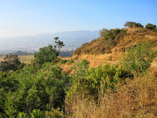
4:05 p.m. - Start hike from Mineral Wells Picnic Area at northeast corner of the Griffith Park. The trail climbs southwest up a canyon toward a water tank. The sun had finally come out, having been hidden by “June Gloom” most of the day. Temps are in the low 70s. The brown hillsides are a stark contrast to the green hikes I had in the spring. As I emerge out of the canyon, views east toward Glendale open up, but muted by the haze. I now see the cluster of trees marking Amir’s Garden, my first destination. As I approach, a pleasant fragrance catches my attention.
4:16 - Amir’s Garden - What a delightful oasis! I had read about it in several trail guides and online, but it exceeds my expectations. I wander around the labyrinth of trails and admire the amazing assortment of plants. Would be a great place to bring a book and just set a spell. I see Beacon Hill to the distant south. I want to stay longer but I must be heading on.
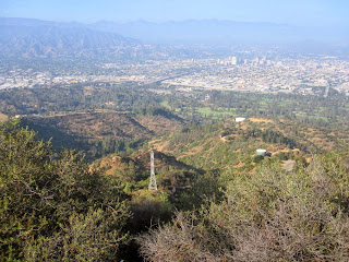
4:35 - Leave Amir’s Garden and continue west on the dirt road heading up a ridge. I hear voices of boys playing at Griffith Park Boy’s Camp in the canyon below to the south. Across the canyon I see Bill Eckert Trail where I had hiked down on April 16 after my first visit to Bee Rock and Mt. Bell. Up ahead to the southwest, Mt. Bell stands at the head of the canyon calling me up. Pass a water tank and turn left. To my right is Toyon Canyon Restoration Project—which is a fancy way of saying they intend to mask the remains of a huge garbage dump. Pass water tank 112. The trail now transitions to the north face just below the ridge. Pass the junction to Toyon Trail as views open up toward Mt. Chapel and Cahuenga Peak to the west. The map labels this section as Mt. Hollywood Trail [that label was removed on the 2014 map, implying that that section is a continuation of North Trail]. Reemerge onto the ridge with a view of the road up ahead. It’s breezy and cool.
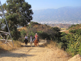
5:08 - Junction with Vista Del Valle Drive. Large power tower marks the spot. A group of horseback riders passes. Looks fun. A foursome of noisy ladies follows. Turn left (east) onto the paved road and immediately veer right unto the trail. In 5 minutes I reach another junction. Now I’m nearing familiar territory. Below me east in the canyon is the trail I ascended previously to Mt. Bell. I decide to forge ahead another minute to intersect the junction (39) of my pervious hike. I turn back and veer left (west) and ascend steeply across the north face of Mt. Bell. Sun feels good.
5:31 - Junction. west of Mt. Bell. Now I’m back on familiar ground. Clouds and haze mute the view south toward Hollywood. Turn left (east) and immediately find a use path that I had not seen before. Hmmm, how could I have missed it in my several times past this location? Let’s give it a try. Veer left and begin my final assault on Mt. Bell. The first section is pretty decent. I climb up some rocks and veer left. Past some more rocks and the number of paths multiply (I’ll resist using “labyrinth” for a second time in this write up). As I get closer to the summit the route gets brushier. I may not have picked the best way.
5:43 - Mt. Bell (1582’). That was an adventure. Scratchy and dirty now with burs in my socks. I really like this summit, now having climbed it this year three times from three different routes. It’s much more of a hikers’ peak than Mt. Hollywood. The views are muted by the haze today and it’s cool and breezy. Can see Amir’s Garden far below. Have a snack, takes some pics, and call home. Leave the summit at 6:00 and head down the west ridge again, trying to find a better route. Much better this time, but had to crawl over some large rocks.
6:11 - Junction west of Mt. Bell. Instead of turning right (north) and retracing my steps, I continue straight. Now I am on a trail I’ve hiked before, but only for about 3 minutes. I reach the paved road. Directly across is the trail to Mt. Chapel. I curve with the road to the right and in a half minute reach a “Y” in the road. I bear right (northeast). Pick up the pace of a light jog (I think I’m ready to go home now).
6:21 - Junction with power tower (5:08 location). Turn left (north) unto Mt. Hollywood Trail [North Trail] (unsigned) and retrace my steps down the ridge. I love the warm light this time of day for taking pictures. I continue at a jogging pace.
6:44 - Amir’s Garden. Much different light now, so I take more pics. I shall come here again, maybe spend a couple hours just photographing plants. Continue on my way. Leave the sun and disappear into the shade of the canyon.
6:55 - End hike.
Epilog - Another thoroughly enjoyable hike in Griffith Park. The cool weather (65 degrees now) certainly is unseasonal for July, but the brown grass and weeds indeed reveal the season. I often wonder what our chaparral would have looked like before the Europeans introduced all these invasive non-native grasses. According to Hileman’s map, it appears that I hiked a total of about 4 miles. Seems longer. What a nice way to spend a summer evening after work!
See Hiking Griffith Park at Dan's Hiking Pages
(includes links to my other blog posts for hiking in Griffith Park)
NEXT > Griffith Park Six Peaks Hike - August 5, 2010 (Bee Rock, Mt. Chapel, Mt. Bell, Mt. Hollywood, Glendale Peak, Beacon Hill via Old Zoo Park)
PREVIOUS > Ferndell to Griffith Observatory via Western Canyon - May 14, 2010 (Photo Album - Celebrating the Observatory 75 years)
PREVIOUS > Brush Canyon to Mt. Bell and Bronson Caves - May 6, 2010
Monday, July 5, 2010
Bear Flat Hike - July 4, 2010
See Bear Canyon Trail To Bear Flat Hike Description on Dan’s Hiking Pages
I decide to celebrate Independence Day by experiencing the freedom of the open trail. I choose Bear Flat above Baldy Village as my destination. It's been five years since I hiked it. The last time it was a 7.5-mile round trip to Bear Flat and beyond. This time is to be a shorter hike to Bear Flat and then explore the ridge to its immediate east.
I sleep in and leisure around before taking off. It is overcast but I know it will be sunny in the mountains. Find a parking space right near the trailhead and begin my hike at 10:55. As I walk up the paved road, I admire the cabins tucked away in this lovely canyon. The creek flows briskly. Dog walks down the road toward me. Not sure if he is friendly so I pick up a stick. He walks up to me, and to my surprise, he grabs the stick out of my hand and walks away with it in his mouth! Dog gone!
11:07 - Road ends and I cross the rustic bridge to the trail. A sign reads "Mt. Baldy Trail. Bear Flat 1.6 mi. Mt. Baldy Summit 6 mi." I stroll along at a leisurely pace soaking in the beautiful setting. There are two places where the trail emerges from the canyon to the mountainside to offer views southeast toward Ontario Ridge and south toward Baldy Village and beyond. Haze mutes the view, but still it is quite striking. Snap pics of flowers along the way. Thick canopy of oak, cedar, fir, pine, and bay provide abundant shade. As the creek and trail draw closer together, I know I am nearing my destination.
11:59 - Arrive at Bear Flat. The creek marks the south edge of the flat. Sign reads "Bear Flats." Oops, someone wrongly added an "s." Oh that Forest Service, bless their hearts. I ponder what natural forces caused this fern-covered bench. The massive ridge towers to my northwest. I meander across the flat toward the north edge looking for a route east to a ridgeline. I've come prepared for some bushwhacking, but the thick blanket of mountain white throne and the burned remains of manzanita pose a daunting barrier.
12:20 - I decide to continue ascending the trail north for a few minutes to get a view down toward Bear Flat to see if I can spot a route. The trail is steep and the sun is warm. The expanding views are breathtaking. I am aware that my time is limited because we are planning to drive to Orange County this afternoon for a July 4th party, but I can't seem to stop as I'm compelled to climb higher and higher. I wonder what year a fire consumed this mountainside. Blacked manzanita branches stick up from the new green growth. I have a good view of Bear Flat now, but still no route is apparent to the east ridge. Finally stop, take some pictures and turn around. Count 8 switchbacks (including the one where I stopped) heading down.
12:58 - Arrive back at Bear Flat and explore around. Met a father and his young son who camped the night there. They have not found a route heading east either. He mentioned they saw 2 rattlesnakes earlier. Good to know. Back at the stream an older couple relaxes and their dog sits in the middle of stream cooling himself. I follow the use path along the south edge of the creek which shortly ends under a huge oak tree. I continue foraging on and pass the location where the creek begins, flowing from out of the ground. I follow the dry creek bed for a few more minutes but realize that to reach the east ridge along this route would be more difficult and time consuming than I am prepared for today. I abort my attempt on the east ridge and head back to the trail.
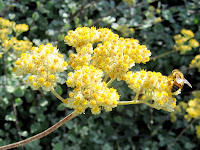
1:36 - Back to the main trail and begin my walk back. As I saunter along, I carefully scan the east slope to see if there are any routes to the ridge, but the steep, rugged mountainside offers no apparent options. Try to photograph butterflies on the California buckwheathard to capture. Took a spur path near cabin 41 to photograph a little water fall.
1:27 - Back to the beginning of the trail. Walk down the paved road to the car. Someone parked behind me making it difficult to maneuver out.
What a splendid hike! This has to be one of the very best short hikes in this area. Great way to spend the 4th of July. Now on to the party.
See Bear Canyon Trail To Bear Flat Hike Description on Dan’s Hiking Pages