Visit Dan's Hiking Pages
What a splendid hike in the San Gabriels’ high country! Mt. Williamson has long been on my list so finally the occasion arose to conquer it. My friend Ray and his
Hikemasters group had planned the hike and it worked out to join them.
At 8,214 feet, Mt. Williamson stands by itself north of the Angeles Crest Highway with commanding views over the heart of the San Gabriels and the vast Mojave Desert to the north. It lies within the Pleasant View Ridge Wilderness, which was newly established in 2009 to protect nearly 27,000 acres of pristine forest. Most of the hike travels along the Pacific Crest Trail, one of the quintessential footpaths in the San Gabriels.
We arrive at the trailhead several miles short of Islip Saddle and about 40 miles east of La Canada. Our plan is a loop hike starting on the west approach and ending on the east approach at Islip Saddle, so we staged a couple vehicles there.
8:53 - Begin hike (6700’). There are 8 of us and a dog. The weather is perfect. This section of the PCT heads north and east along the steep southwest slopes of Mt. Williamson through a mature forest. Ray likes this approach because the ascent is primarily in the morning shade. Soon views toward Mt. Williamson open up. It’s quite an impressive mass.
9:18 - Reach a jagged ridge with amazing views south into the heart of Bear Creek canyon and the rugged San Gabriel Wilderness. Cars and motorcycles whisk along the highway below. A car horn honks in the road tunnel shattering the tranquilly of the wilderness. A marine layer blankets the human sprawl beyond the mountains to the south. A series of switchbacks makes our ascent reasonable as we climb the steep mountainside. We cross huge scree slopes. The scent of staghorn lichen brings back childhood memories of building a model train set.

9:52 - Achieve Williamson’s south ridge and the junction to the summit climb. We linger for a few minutes and enjoy striking views east and south. I look across to Mt. Islip and think about standing on that summit six weeks ago and being drawn to this mountain. The PCT continues east descending toward Islip Saddle, but we turn north on the well-beaten path and are treated with views east and west. Lush green manzanita blankets the ground and sugar pine and white fir reach into the sky. A pleasant breeze feels good. For a few minutes the route is gentle until we reach the section where the climb gets serious. The path snakes up the steep ridge in a Lombard Street manner. The footing is loose. We patiently climb and in about 10 minutes we reach a splendid outcropping as the path mellows out. As we continue along the ridge, the scenery is gorgeous.
10:32 - Pleasant View Ridge. Wow, impressive view northeast to the desert. We turn right (southeast) and another minute brings us to the summit.
10:34 - Mt. Williamson (8214’), the official summit. The board, bald summit offers commanding views. We linger for a few minutes but the goal of the group is the next knob along the ridge (8244’), 0.3 mile northwest. Many consider that higher point to be the actual summit of Mt. Williamson, and indeed that’s where the summit registry is located. We backtrack a minute to the junction and continue along the ridge. There is some roller coaster action and in several spots the footing is loose and somewhat dicey. A sailplane soars by. I’m loving the beauty of this rugged high country. We make a final climb and a spur path cuts left to the reach the summit.
10:51 - Mt. Williamson (8244’), the middle summit. I walk around among the trees and rocks to admire the varying vistas. This is a superb peak. Ray serenades us on his ocarina. I flip through the peak registry and notice names of some HPSers I recognize. Mars Bonfire summited this peak for his 24th time on July 5! This is as far as our group will go today, so I decide to continue along the ridge to hit the third highpoint. Ray says to meet the group back at the junction by 12 p.m.
I leave at 11:11 and head northwest along the ridge. More of the same: Fir and sugar pine, manzanita and chinquapin, amazing scenery, craggy rock formations, blue sky, warm sun, pleasant breeze.
11:20 - Mt. Williamson (8248’), the northwest summit. The small, mostly bare summit provides great views, particularly northward toward the vast desert. From here the ridge steeply drops about 350 vertical feet to a saddle (7900’+) before climbing steeply to the next knob along the ridge (8160’+). Further northwest, Pallet Mt. and Will Thrall Peak stand as twin pyramids and call me to climb them. On the slope facing me to the northeast is debris from a plane wreck. Our ascending route can be seen to the south. Marine layer still hangs over the L.A Basin, so there is no hint of the massive human sprawl and the Pacific Ocean. I would enjoy hanging out here a lot longer, but the clock ticks. I leave the summit at 11:36.

I retrace my steps southeast along the ridge enjoying the scenery from the opposite direction. Stop to change my camera battery (after 254 pics and 7 videos). I arrive back at the middle summit (8244’) at 11:48. My friends have already left so I continue down the trail. As I hurry along I see no sign of them ahead. A lady passes me and I ask her if she saw my group and she says about half mile down the trail. That can’t be right. I arrive at the junction at 12:02, just two minutes late, and the group is not here. I continue down wondering why the group left me.

12:18 - PCT Junction. No one is here. I had really expected them to be here. I turn left (east) and begin my descent. Whenever I’m on the Pacific Crest Trail, I’m aware that this iconic path stretches all the way from Mexico to Canada. The dense blossoms of rabbit brush add a nice splash of yellow. The route descends a huge bowl with views east. Over my shoulder, the mass of Mt. Williamson looms above. The topography is breathtaking. I’m enjoying the solitude but wonder where my group is. Looking across to Mt. Islip, Throop Peak, Mt. Burnham, and Mt. Baden-Powell brings happy memories of most excellent adventures. I’ve still to conquer Mt. Lewis and Mt. Hawkins, so I’ve been eyeing them all day with hopes of hitting them this season. Soon the Islip Saddle trailhead can be seen on the highway far below.

As the trail bends southwest I’m intrigued by a pointed summit (7103’) at the bend of the highway; maybe next time I’ll hit it. A couple ladies pass me going up...the only humans I’ve encountered since the summit. The disparity in traffic distribution between marquee destinations like Baldy, Baden-Powell, and Icehouse, and less-visited peaks like Mt. Williamson is striking. And that’s fine by me; I like sitting on a superb peak all by myself! I pass a saddle offering a good view west and I begin my final southeast stretch toward the finish.
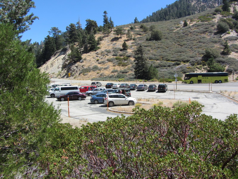
1:17 - Islip Saddle (6670’). Done. There are about 25 cars and a large bus in the parking lot. Obviously most of those hikers headed up toward Little Jimmy, Windy Gap, and Mt. Islip. I was eager as to why the group left me. Ray told me that the dog had gotten sick so they left early to get him back. Ok, I have the dog to thank for an hour and half of solitude!
Epilog - What great hike, one of the finest in the San Gabriels! Covered about 4.5 miles and 1,600 feet in elevation gain. Great weather, blue skies, pleasant breezes, magnificent topography, sweeping panoramas, mature forest, superb trail, good company, and a peak I’ve not visited before all made for a thoroughly enjoyable outing. This is definitely a destination worth repeating.
 Visit Dan's Hiking Pages